
Mitsumatarengedake
三俣蓮華岳
Toyama, Toyama · Elevation 2,841 m
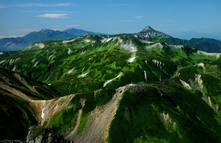
A 2,841 m peak in the Hida Mountains (Northern Japan Alps) standing on the tri-prefectural border of Toyama, Nagano, and Gifu. Its summit forms a watershed where the main ridges of the Tateyama, Ushiro-Tateyama, and Hotaka ranges meet, and lies within the Special Protection Zone of Chūbu-Sangaku National Park. Selected for the Japan 300 Famous Mountains and the Japan 100 High Mountains, it is most commonly approached from Mitsumata Sansō hut on the saddle to its north, with ridge routes continuing to Sugorokudake, Washibadake, and Kurobegorōdake.
Mitsumatarengedake at a glance
- Weather: The most settled day in the next 7 days is Sun, November 8: clear, gusts up to 8 m/s. Sat, Nov 7: strong wind (gusts up to 17 m/s).
- Route: The shortest is Mount Sugoroku, Mitsumatarenge, and Washiba Out-and-Back from Shinhotaka: about 20 h 39 min, 38.4 km, about 2,930 m of climbing.
Mitsumatarengedake weather (hourly, 14 days)
Sunrise today 06:14, sunset 16:53
| Tue, 11/3 | Wed, 11/4 | Thu, 11/5 | Fri, 11/6 | Sat, 11/7 | Sun, 11/8 | Mon, 11/9 | Tue, 11/10 | Wed, 11/11 | Thu, 11/12 | Fri, 11/13 | Sat, 11/14 | Sun, 11/15 | Mon, 11/16 | Tue, 11/17 | |||||||||||||||||||||||||||||||||||||||||||||||||||||||||||||||||||||||
|---|---|---|---|---|---|---|---|---|---|---|---|---|---|---|---|---|---|---|---|---|---|---|---|---|---|---|---|---|---|---|---|---|---|---|---|---|---|---|---|---|---|---|---|---|---|---|---|---|---|---|---|---|---|---|---|---|---|---|---|---|---|---|---|---|---|---|---|---|---|---|---|---|---|---|---|---|---|---|---|---|---|---|---|---|---|
| Japan time | 15 | 17 | 19 | 21 | 23 | 1 | 3 | 5 | 7 | 9 | 11 | 13 | 15 | 18 | 21 | 0 | 3 | 6 | 9 | 12 | 15 | 18 | 21 | 0 | 3 | 6 | 9 | 12 | 15 | 18 | 21 | 0 | 3 | 6 | 9 | 12 | 15 | 18 | 21 | 0 | 3 | 6 | 9 | 12 | 15 | 18 | 21 | 0 | 3 | 6 | 9 | 15 | 21 | 3 | 9 | 15 | 21 | 3 | 9 | 15 | 21 | 3 | 9 | 15 | 21 | 3 | 9 | 15 | 21 | 3 | 9 | 15 | 21 | 3 | 9 | 15 | 21 | 3 | 9 | 15 | 21 | 3 | 9 | 15 | |
  |   |  | | | | | | | |  | |   |   | |   | | |   | | | | | |   | | |   |   | |   | | | |   | | | |   | | |  | | | | |   | | | | |   | | | | | | | | | |  | | | | |   |   | | | | | | | | | | | | | | | | | ||
| Temperature | °C | 0° | -4° | -7° | -7° | -6° | -5° | -4° | -4° | -3° | 2° | 4° | 4° | 3° | 0° | 1° | 1° | 1° | 2° | 2° | 4° | 5° | 2° | 2° | 1° | 1° | 0° | 0° | 1° | 0° | -3° | -5° | -6° | -8° | -8° | -9° | -8° | -8° | -10° | -11° | -11° | -11° | -10° | -3° | -1° | -2° | -6° | -5° | -5° | -5° | -5° | -4° | -3° | -9° | -10° | -3° | -4° | -6° | -12° | -9° | -8° | -11° | -10° | -4° | -4° | -10° | -7° | -7° | -5° | -10° | -8° | -1° | -1° | -7° | -6° | 0° | -1° | 0° | -1° | 0° | -3° | -8° | -6° | -3° | -2° |
| Precipitation | mm | 2.3 | 9 | 8 | 6 | 0.7 | 0.4 | 3.5 | 3.1 | 1.2 | 0.9 | 0.1 | 0.5 | 0.4 | 1.5 | 1.6 | 1.9 | 1.9 | 0.8 | 0.3 | 0.1 | 0.1 | 0.7 | 0.8 | 0.1 | 0.6 | 2.9 | 7 | 4.0 | 0.5 | 1.1 | 3.1 | 0.2 | 0.9 | 10 | 9 | 5.0 | 2.3 | 1.0 | ||||||||||||||||||||||||||||||||||||||||||||||
| New snow | cm | <.1 | <.1 | <.1 | 0.2 | 1.3 | 1.6 | 1.8 | 1.8 | 0.8 | 0.3 | 0.1 | <.1 | <.1 | 0.1 | 0.6 | 0.6 | 0.1 | 0.5 | <.1 | 2.5 | 6.4 | 4.0 | 0.5 | 0.9 | 2.3 | 0.1 | <.1 | <.1 | 0.2 | 0.8 | ||||||||||||||||||||||||||||||||||||||||||||||||||||||
| Snow depth | cm | 0 | 0 | 0 | 0 | 0 | 0 | 0 | 0 | 0 | 0 | 0 | 0 | 0 | 0 | 0 | 0 | 0 | 0 | 0 | 0 | 0 | 0 | 0 | 0 | 0 | 0 | 0 | 0 | 0 | 0 | 0 | 1 | 2 | 3 | 5 | 5 | 5 | 5 | 5 | 5 | 5 | 5 | 5 | 4 | 4 | 4 | 4 | 4 | 5 | 5 | 5 | 5 | 5 | 5 | 4 | 4 | 6 | 11 | 14 | 14 | 13 | 13 | 13 | 12 | 12 | 12 | 14 | 13 | 13 | 13 | 13 | 12 | 11 | 11 | 11 | 9 | 8 | 5 | 4 | 3 | 3 | 3 | 3 | 3 |
| Wind | m/s | 2 | 0 | 0 | 0 | 0 | 1 | 1 | 1 | 1 | 2 | 3 | 3 | 3 | 1 | 2 | 0 | 1 | 1 | 1 | 3 | 3 | 1 | 1 | 1 | 1 | 3 | 3 | 4 | 4 | 4 | 4 | 5 | 4 | 5 | 5 | 5 | 3 | 3 | 2 | 1 | 1 | 1 | 1 | 2 | 0 | 1 | 1 | 1 | 2 | 1 | 1 | 1 | 1 | 1 | 2 | 4 | 2 | 7 | 4 | 3 | 2 | 0 | 2 | 1 | 1 | 2 | 3 | 2 | 1 | 1 | 1 | 1 | 1 | 1 | 2 | 1 | 4 | 2 | 3 | 4 | 2 | 0 | 1 | 2 |
| Wind gusts | m/s | 9 | 8 | 5 | 5 | 4 | 4 | 4 | 3 | 4 | 6 | 8 | 9 | 9 | 8 | 9 | 9 | 7 | 7 | 9 | 11 | 11 | 9 | 7 | 8 | 8 | 9 | 12 | 14 | 14 | 13 | 13 | 14 | 15 | 16 | 16 | 17 | 16 | 13 | 11 | 10 | 9 | 9 | 8 | 8 | 8 | 6 | 6 | 8 | 10 | 10 | 7 | 10 | 6 | 6 | 8 | 14 | 12 | 21 | 22 | 17 | 11 | 7 | 7 | 8 | 5 | 9 | 11 | 11 | 10 | 8 | 5 | 6 | 5 | 6 | 8 | 12 | 17 | 17 | 10 | 14 | 13 | 8 | 4 | 7 |
| Wind dir. | ↓ | ↓ | ↓ | ↓ | ↓ | ↓ | ↓ | ↓ | ↓ | ↓ | ↓ | ↓ | ↓ | ↓ | ↓ | ↓ | ↓ | ↓ | ↓ | ↓ | ↓ | ↓ | ↓ | ↓ | ↓ | ↓ | ↓ | ↓ | ↓ | ↓ | ↓ | ↓ | ↓ | ↓ | ↓ | ↓ | ↓ | ↓ | ↓ | ↓ | ↓ | ↓ | ↓ | ↓ | ↓ | ↓ | ↓ | ↓ | ↓ | ↓ | ↓ | ↓ | ↓ | ↓ | ↓ | ↓ | ↓ | ↓ | ↓ | ↓ | ↓ | ↓ | ↓ | ↓ | ↓ | ↓ | ↓ | ↓ | ↓ | ↓ | ↓ | ↓ | ↓ | ↓ | ↓ | ↓ | ↓ | ↓ | ↓ | ↓ | ↓ | ↓ | ↓ | ↓ | |
Mitsumatarengedake hiking routes
Hiking times are estimates calculated from the terrain.
Huts, campsites and lodging near Mitsumatarengedake
Mountain huts
- Mitsumatasanso 2026: open July 4–October 15 · reservation required
- Kurobegorogoya 2026: open July 10–October 15 · reservation required · sleeps 60
- Sugoroku Goya 2026: open July 10–October 20 · reservation required · sleeps 150
- 雲ノ平山荘 2026: open July 1–October 15 · reservation required · sleeps 60
- Suisho Hut 2026: open July 10–September 30 · reservation required · sleeps 38
Campsites
- 三俣蓮華岳テント場
- 黒部五郎キャンプ場
- 双六小屋テント場
- 雲ノ平キャンプ場
Lists that include Mitsumatarengedake
Japan's 300 Famous Mountains · Japan's 100 Highest Mountains · Koshinetsu 100 Famous Mountains · 100 Mountains of Hokuriku · Shinshu 100 Famous Mountains · 100 Mountains of Toyama · 100 Mountains of Gifu · Elevations of 1003 Mountains of Japan · 1000 Mountains of Japan
Mitsumatarengedake facts
- Elevation
- 2,841 m
- Location
- Toyama, Toyama
36.390020, 137.587731 - National Park
- 中部山岳国立公園
- Website
- mitsumatasanso.com
- Trail Map
- www.pref.toyama.jp (PDF)
- Access Information
- www.pref.toyama.jp
- Wikipedia
- ja.wikipedia.org