
Mt. Karasawa
涸沢岳
Takayama, Gifu / Matsumoto, Nagano · Elevation 3,110 m
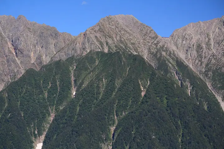
Mt. Karasawa (3,110 m) is one of the principal summits of the Hotaka Range in the southern North Alps, straddling the boundary of Matsumoto City in Nagano and Takayama City in Gifu within Chūbu-Sangaku National Park. It rises on the main ridge linking Mt. Oku-Hotaka—the highest peak of the range—with Mt. Kita-Hotaka, cradling on its eastern flank the famous glacial cirque of Karasawa. The Shiradashi Col directly below the summit is home to Hotaka-dake Sansō, the principal mountain hut for the Hotaka traverse, and most parties climb the peak as a way-point on the Oku-Hotaka–Kita-Hotaka traverse. It is counted among Japan's 100 High Mountains and the 3,000-Metre Peaks of Japan.
Mt. Karasawa at a glance
- Weather: The most settled day in the next 7 days is Wed, November 4: clear, gusts up to 8 m/s. Fri, Nov 6, Sat, Nov 7: strong wind (gusts up to 21 m/s).
- Route: The shortest is Kamikochi–Mount Mae-Hotaka–Mount Oku-Hotaka and Karasawa Circuit: about 15 h 28 min, 27.1 km, about 2,150 m of climbing.
Mt. Karasawa weather (hourly, 14 days)
Sunrise today 06:14, sunset 16:53
| Tue, 11/3 | Wed, 11/4 | Thu, 11/5 | Fri, 11/6 | Sat, 11/7 | Sun, 11/8 | Mon, 11/9 | Tue, 11/10 | Wed, 11/11 | Thu, 11/12 | Fri, 11/13 | Sat, 11/14 | Sun, 11/15 | Mon, 11/16 | Tue, 11/17 | |||||||||||||||||||||||||||||||||||||||||||||||||||||||||||||||||||||||
|---|---|---|---|---|---|---|---|---|---|---|---|---|---|---|---|---|---|---|---|---|---|---|---|---|---|---|---|---|---|---|---|---|---|---|---|---|---|---|---|---|---|---|---|---|---|---|---|---|---|---|---|---|---|---|---|---|---|---|---|---|---|---|---|---|---|---|---|---|---|---|---|---|---|---|---|---|---|---|---|---|---|---|---|---|---|
| Japan time | 15 | 17 | 19 | 21 | 23 | 1 | 3 | 5 | 7 | 9 | 11 | 13 | 15 | 18 | 21 | 0 | 3 | 6 | 9 | 12 | 15 | 18 | 21 | 0 | 3 | 6 | 9 | 12 | 15 | 18 | 21 | 0 | 3 | 6 | 9 | 12 | 15 | 18 | 21 | 0 | 3 | 6 | 9 | 12 | 15 | 18 | 21 | 0 | 3 | 6 | 9 | 15 | 21 | 3 | 9 | 15 | 21 | 3 | 9 | 15 | 21 | 3 | 9 | 15 | 21 | 3 | 9 | 15 | 21 | 3 | 9 | 15 | 21 | 3 | 9 | 15 | 21 | 3 | 9 | 15 | 21 | 3 | 9 | 15 | |
  |   |   | | | | | | | |  | |   |   | |   | | |   | | | | | | | |   | | | | |   | | |   | | | | | |  | | | | | | | | | |   | | | | | | | | |   | |  | | | | |   | | | | | | | | | | | | | |   | | | | ||
| Temperature | °C | -2° | -6° | -9° | -10° | -10° | -9° | -8° | -8° | -6° | -1° | 1° | 3° | 2° | -2° | -3° | -2° | -3° | -2° | 0° | 3° | 4° | -1° | -1° | -2° | -2° | -2° | -1° | 1° | -1° | -5° | -8° | -9° | -10° | -11° | -10° | -10° | -11° | -13° | -13° | -13° | -14° | -14° | -5° | -2° | -4° | -9° | -8° | -8° | -8° | -8° | -6° | -4° | -12° | -13° | -5° | -5° | -9° | -14° | -11° | -8° | -14° | -13° | -5° | -5° | -13° | -9° | -7° | -5° | -12° | -10° | -3° | -2° | -10° | -8° | -2° | -3° | -3° | -3° | -1° | -3° | -9° | -9° | -5° | -3° |
| Precipitation | mm | 3.2 | 10 | 9 | 5 | 0.5 | 0.2 | 1.9 | 2.7 | 0.6 | 0.7 | 0.2 | 0.2 | 0.2 | 0.6 | 0.8 | 0.7 | 0.5 | 0.1 | 0.3 | 0.3 | 0.3 | 3.2 | 5 | 2.0 | 0.2 | 1.0 | 0.7 | 8 | 9 | 2.8 | 0.7 | 0.2 | ||||||||||||||||||||||||||||||||||||||||||||||||||||
| New snow | cm | <.1 | 0.2 | 0.6 | 0.8 | 0.7 | 0.5 | 0.1 | <.1 | <.1 | <.1 | 0.2 | 0.3 | <.1 | 0.2 | <.1 | 3.0 | 4.7 | 2.0 | <.1 | 0.1 | 0.7 | <.1 | <.1 | 0.1 | ||||||||||||||||||||||||||||||||||||||||||||||||||||||||||||
| Snow depth | cm | 0 | 0 | 0 | 0 | 0 | 0 | 0 | 0 | 0 | 0 | 0 | 0 | 0 | 0 | 0 | 0 | 0 | 0 | 0 | 0 | 0 | 0 | 0 | 0 | 0 | 0 | 0 | 0 | 0 | 0 | 0 | <1 | <1 | 1 | 2 | 2 | 2 | 2 | 2 | 2 | 2 | 2 | 1 | 1 | 1 | 1 | 1 | 1 | 2 | 2 | 2 | 2 | 2 | 2 | 2 | 1 | 4 | 7 | 8 | 8 | 8 | 7 | 7 | 7 | 6 | 7 | 7 | 6 | 6 | 6 | 6 | 5 | 5 | 5 | 5 | 4 | 3 | 2 | <1 | <1 | <1 | <1 | <1 | <1 |
| Wind | m/s | 2 | 1 | 1 | 1 | 1 | 1 | 1 | 0 | 0 | 1 | 1 | 2 | 2 | 1 | 1 | 1 | 1 | 1 | 2 | 2 | 3 | 1 | 2 | 2 | 2 | 3 | 4 | 5 | 5 | 3 | 4 | 4 | 5 | 5 | 5 | 6 | 4 | 3 | 2 | 2 | 2 | 1 | 1 | 2 | 1 | 1 | 1 | 2 | 3 | 2 | 2 | 2 | 1 | 1 | 2 | 5 | 3 | 7 | 3 | 1 | 1 | 1 | 1 | 2 | 1 | 3 | 2 | 1 | 0 | 1 | 1 | 1 | 1 | 2 | 1 | 2 | 3 | 3 | 3 | 3 | 1 | 1 | 1 | 1 |
| Wind gusts | m/s | 9 | 9 | 6 | 6 | 6 | 6 | 5 | 5 | 4 | 5 | 7 | 8 | 8 | 8 | 6 | 6 | 6 | 6 | 10 | 10 | 12 | 12 | 8 | 10 | 11 | 11 | 14 | 18 | 18 | 17 | 15 | 17 | 18 | 19 | 19 | 21 | 20 | 16 | 13 | 12 | 11 | 11 | 9 | 9 | 9 | 7 | 7 | 9 | 12 | 12 | 10 | 13 | 8 | 5 | 7 | 17 | 15 | 24 | 26 | 15 | 7 | 5 | 7 | 11 | 9 | 13 | 12 | 10 | 7 | 5 | 5 | 7 | 6 | 9 | 9 | 14 | 14 | 17 | 14 | 17 | 13 | 6 | 5 | 7 |
| Wind dir. | ↓ | ↓ | ↓ | ↓ | ↓ | ↓ | ↓ | ↓ | ↓ | ↓ | ↓ | ↓ | ↓ | ↓ | ↓ | ↓ | ↓ | ↓ | ↓ | ↓ | ↓ | ↓ | ↓ | ↓ | ↓ | ↓ | ↓ | ↓ | ↓ | ↓ | ↓ | ↓ | ↓ | ↓ | ↓ | ↓ | ↓ | ↓ | ↓ | ↓ | ↓ | ↓ | ↓ | ↓ | ↓ | ↓ | ↓ | ↓ | ↓ | ↓ | ↓ | ↓ | ↓ | ↓ | ↓ | ↓ | ↓ | ↓ | ↓ | ↓ | ↓ | ↓ | ↓ | ↓ | ↓ | ↓ | ↓ | ↓ | ↓ | ↓ | ↓ | ↓ | ↓ | ↓ | ↓ | ↓ | ↓ | ↓ | ↓ | ↓ | ↓ | ↓ | ↓ | ↓ | |
Mt. Karasawa hiking routes
Hiking times are estimates calculated from the terrain.
Huts, campsites and lodging near Mt. Karasawa
Mountain huts
- Hotakadakesanso 2026: open April 27–November 3 · reservation required · sleeps 210
- Kitahodaka 2026: open April 28–November 3 · reservation required · sleeps 60
- Karasawagoya 2026: open April 27–November 3 · sleeps 80
- Karasawa Hutte 2026: open April 27–November 3 · reservation required · sleeps 140
- 滝谷避難小屋 temporarily closed
Campsites
- 北穂高岳南陵テント場
- Karasawa Tent Site
- 南岳小屋テント場
- 槍平小屋テン場
- Babadaira Camp Site
Lists that include Mt. Karasawa
Japan's 100 Highest Mountains · Japan's 3000 m Peaks · Shinshu Mountain Cards · Elevations of 1003 Mountains of Japan · 1000 Mountains of Japan
Mt. Karasawa facts
- Elevation
- 3,110 m
- Location
- Takayama, Gifu / Matsumoto, Nagano
36.296584, 137.646707 - National Park
- 中部山岳国立公園
- Website
- www.hotakadakesanso.com
- Trail Map
- karasawa-hyutte.com (PDF)
- Access Information
- www.hotakadakesanso.com
- Wikipedia
- ja.wikipedia.org