
Nishi-Hotakadake
西穂高岳
Takayama, Gifu · Elevation 2,909 m
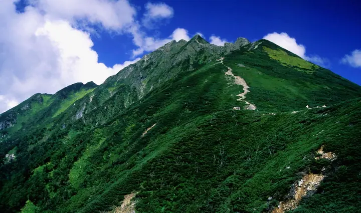
Nishi-Hotakadake rises to 2,908.59 m on the border between Matsumoto City in Nagano and Takayama City in Gifu, anchoring the south-western end of the Hotaka range in the core of Chūbu-Sangaku National Park. The Shin-Hotaka Ropeway lifts visitors to Nishi-Hotaka-guchi at 2,156 m, giving the peak unusually easy access for the Northern Alps, but the ridge from the Dokuhyō past Pyramid Peak to the main summit is a serious chain-and-rock route. The summit opens onto a broad panorama of Yari, Oku-Hotaka, Kasa, Norikura, and Kasumi, and the year-round Nishi-Hotaka Hut serves as a base for both summer and winter ascents. The peak features in Nihon Hyakkōzan, Hana no Hyakumeizan, and Gifu Hyakushūzan.
Nishi-Hotakadake at a glance
- Weather: The most settled day in the next 7 days is Wed, November 4: clear, gusts up to 8 m/s. Fri, Nov 6, Sat, Nov 7: strong wind (gusts up to 21 m/s).
- Route: The shortest is Mount Nishihotaka via Nishiho Maruyama and Doppyo from Nishihotakaguchi: about 5 h 42 min, 8.2 km, about 990 m of climbing.
Nishi-Hotakadake weather (hourly, 14 days)
Sunrise today 06:14, sunset 16:53
| Tue, 11/3 | Wed, 11/4 | Thu, 11/5 | Fri, 11/6 | Sat, 11/7 | Sun, 11/8 | Mon, 11/9 | Tue, 11/10 | Wed, 11/11 | Thu, 11/12 | Fri, 11/13 | Sat, 11/14 | Sun, 11/15 | Mon, 11/16 | Tue, 11/17 | |||||||||||||||||||||||||||||||||||||||||||||||||||||||||||||||||||||||
|---|---|---|---|---|---|---|---|---|---|---|---|---|---|---|---|---|---|---|---|---|---|---|---|---|---|---|---|---|---|---|---|---|---|---|---|---|---|---|---|---|---|---|---|---|---|---|---|---|---|---|---|---|---|---|---|---|---|---|---|---|---|---|---|---|---|---|---|---|---|---|---|---|---|---|---|---|---|---|---|---|---|---|---|---|---|
| Japan time | 15 | 17 | 19 | 21 | 23 | 1 | 3 | 5 | 7 | 9 | 11 | 13 | 15 | 18 | 21 | 0 | 3 | 6 | 9 | 12 | 15 | 18 | 21 | 0 | 3 | 6 | 9 | 12 | 15 | 18 | 21 | 0 | 3 | 6 | 9 | 12 | 15 | 18 | 21 | 0 | 3 | 6 | 9 | 12 | 15 | 18 | 21 | 0 | 3 | 6 | 9 | 15 | 21 | 3 | 9 | 15 | 21 | 3 | 9 | 15 | 21 | 3 | 9 | 15 | 21 | 3 | 9 | 15 | 21 | 3 | 9 | 15 | 21 | 3 | 9 | 15 | 21 | 3 | 9 | 15 | 21 | 3 | 9 | 15 | |
  |   |   | | | | | | | |  | |   |   | |   | | |   | | | | | | | |   | | | | |   | | |   | | | | | |  | | | | | | | | | |   | | | | | | | | |   | |  | | | | |   | | | | | | | | | | | | | |   | | | | ||
| Temperature | °C | -1° | -5° | -8° | -9° | -9° | -8° | -7° | -7° | -5° | 0° | 3° | 4° | 3° | -1° | -1° | -1° | -1° | -1° | 1° | 4° | 5° | 1° | 0° | 0° | 0° | 0° | 0° | 2° | 0° | -4° | -6° | -7° | -9° | -9° | -9° | -9° | -9° | -11° | -12° | -12° | -13° | -12° | -4° | -1° | -3° | -8° | -7° | -7° | -7° | -6° | -4° | -3° | -11° | -12° | -4° | -4° | -7° | -12° | -10° | -7° | -13° | -12° | -4° | -4° | -11° | -8° | -6° | -4° | -11° | -9° | -2° | -1° | -8° | -7° | -1° | -1° | -2° | -2° | 0° | -2° | -7° | -8° | -3° | -2° |
| Precipitation | mm | 3.2 | 10 | 9 | 5 | 0.5 | 0.2 | 1.9 | 2.7 | 0.6 | 0.7 | 0.2 | 0.2 | 0.2 | 0.6 | 0.8 | 0.7 | 0.5 | 0.1 | 0.3 | 0.3 | 0.3 | 3.2 | 5 | 2.0 | 0.2 | 1.0 | 0.7 | 8 | 9 | 2.8 | 0.7 | 0.2 | ||||||||||||||||||||||||||||||||||||||||||||||||||||
| New snow | cm | <.1 | 0.2 | 0.6 | 0.8 | 0.7 | 0.5 | 0.1 | <.1 | <.1 | <.1 | 0.2 | 0.3 | <.1 | 0.2 | <.1 | 3.0 | 4.7 | 2.0 | <.1 | 0.1 | 0.7 | <.1 | <.1 | 0.1 | ||||||||||||||||||||||||||||||||||||||||||||||||||||||||||||
| Snow depth | cm | 0 | 0 | 0 | 0 | 0 | 0 | 0 | 0 | 0 | 0 | 0 | 0 | 0 | 0 | 0 | 0 | 0 | 0 | 0 | 0 | 0 | 0 | 0 | 0 | 0 | 0 | 0 | 0 | 0 | 0 | 0 | <1 | <1 | 1 | 2 | 2 | 2 | 2 | 2 | 2 | 2 | 2 | 1 | 1 | 1 | 1 | 1 | 1 | 2 | 2 | 2 | 2 | 2 | 2 | 2 | 1 | 4 | 7 | 8 | 8 | 8 | 7 | 7 | 7 | 6 | 7 | 7 | 6 | 6 | 6 | 6 | 5 | 5 | 5 | 5 | 4 | 3 | 2 | <1 | <1 | <1 | <1 | <1 | <1 |
| Wind | m/s | 2 | 1 | 1 | 1 | 1 | 1 | 1 | 0 | 0 | 1 | 1 | 2 | 2 | 1 | 1 | 1 | 1 | 1 | 2 | 2 | 3 | 1 | 2 | 2 | 2 | 3 | 4 | 5 | 5 | 3 | 4 | 4 | 5 | 5 | 5 | 6 | 4 | 3 | 2 | 2 | 2 | 1 | 1 | 2 | 1 | 1 | 1 | 2 | 3 | 2 | 2 | 2 | 1 | 1 | 2 | 5 | 3 | 7 | 3 | 1 | 1 | 1 | 1 | 2 | 1 | 3 | 2 | 1 | 0 | 1 | 1 | 1 | 1 | 2 | 1 | 2 | 3 | 3 | 3 | 3 | 1 | 1 | 1 | 1 |
| Wind gusts | m/s | 9 | 9 | 6 | 6 | 6 | 6 | 5 | 5 | 4 | 5 | 7 | 8 | 8 | 8 | 6 | 6 | 6 | 6 | 10 | 10 | 12 | 12 | 8 | 10 | 11 | 11 | 14 | 18 | 18 | 17 | 15 | 17 | 18 | 19 | 19 | 21 | 20 | 16 | 13 | 12 | 11 | 11 | 9 | 9 | 9 | 7 | 7 | 9 | 12 | 12 | 10 | 13 | 8 | 5 | 7 | 17 | 15 | 24 | 26 | 15 | 7 | 5 | 7 | 11 | 9 | 13 | 12 | 10 | 7 | 5 | 5 | 7 | 6 | 9 | 9 | 14 | 14 | 17 | 14 | 17 | 13 | 6 | 5 | 7 |
| Wind dir. | ↓ | ↓ | ↓ | ↓ | ↓ | ↓ | ↓ | ↓ | ↓ | ↓ | ↓ | ↓ | ↓ | ↓ | ↓ | ↓ | ↓ | ↓ | ↓ | ↓ | ↓ | ↓ | ↓ | ↓ | ↓ | ↓ | ↓ | ↓ | ↓ | ↓ | ↓ | ↓ | ↓ | ↓ | ↓ | ↓ | ↓ | ↓ | ↓ | ↓ | ↓ | ↓ | ↓ | ↓ | ↓ | ↓ | ↓ | ↓ | ↓ | ↓ | ↓ | ↓ | ↓ | ↓ | ↓ | ↓ | ↓ | ↓ | ↓ | ↓ | ↓ | ↓ | ↓ | ↓ | ↓ | ↓ | ↓ | ↓ | ↓ | ↓ | ↓ | ↓ | ↓ | ↓ | ↓ | ↓ | ↓ | ↓ | ↓ | ↓ | ↓ | ↓ | ↓ | ↓ | |
Nishi-Hotakadake hiking routes
Hiking times are estimates calculated from the terrain.
Huts, campsites and lodging near Nishi-Hotakadake
Mountain huts
- Dakesawa Hut 2026: open April 27–November 3 · reservation required · sleeps 40
- Nishiho Hut 2026: open all year · reservation required · sleeps 180
- Hotakadakesanso 2026: open April 27–November 3 · reservation required · sleeps 210
- Shiraidezawa
- Karasawagoya 2026: open April 27–November 3 · sleeps 80
Campsites
- 西穂山荘テント場
- 北穂高岳南陵テント場
- Konashidaira Camping Retreat
- Karasawa Tent Site
- わさび平小屋テント場
Lodging
- Kamikochi Hotel Shirakabaso
- The Parklodge Kamikochi
- Kamikochi Alpen Hotel
- Kamikochi Nishi-ito-ya Mountain Lodge
- Gosenjaku Hotel Kamikochi
Lists that include Nishi-Hotakadake
100 Famous Mountains of Flowers · Japan's 100 Highest Mountains · 100 Mountains of Gifu · Shinshu Mountain Cards · Elevations of 1003 Mountains of Japan · 1000 Mountains of Japan
Nishi-Hotakadake facts
- Elevation
- 2,909 m
- Location
- Takayama, Gifu
36.279015, 137.629053 - National Park
- 中部山岳国立公園
- Website
- www.nishiho.com
- Trail Map
- www.pref.gifu.lg.jp (PDF)
- Access Information
- shinhotaka-ropeway.jp
- Wikipedia
- ja.wikipedia.org