
Mt. Toishiyama
砥石山
Sapporo, Hokkaido · Elevation 826 m
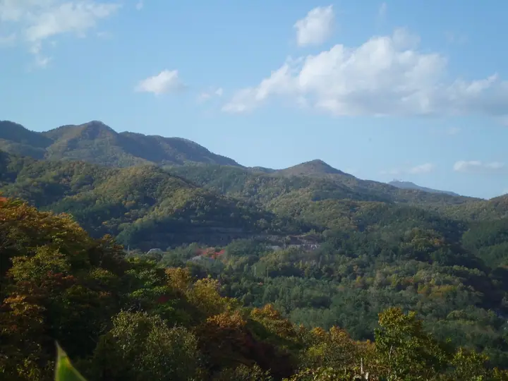
Mt. Toishiyama is an 826-meter peak on the boundary between Nishi-ku and Minami-ku in Sapporo, forming the high point of the city's Nakanosawa–Kobayashi Pass–Genpachi-zawa Nature Trail (about 15 km with three trailheads). Its name derives from former whetstone (toishi) quarrying near the summit. Known for spring wildflowers such as Diphylleia grayi and Anemone flaccida, it is a popular nearby peak for Sapporo residents and is included in the Sapporo 50 Peaks list.
Mt. Toishiyama at a glance
- Weather: The most settled day in the next 7 days is Thu, November 5: clear, gusts up to 7 m/s. Sat, Nov 7, Sun, Nov 8: strong wind (gusts up to 19 m/s).
- Route: The shortest is Mount Toishi and Sankakuyama from Nakanosawa: about 5 h 13 min, 8.2 km, about 770 m of climbing.
Mt. Toishiyama weather (hourly, 14 days)
Sunrise today 06:11, sunset 16:26
| Tue, 11/3 | Wed, 11/4 | Thu, 11/5 | Fri, 11/6 | Sat, 11/7 | Sun, 11/8 | Mon, 11/9 | Tue, 11/10 | Wed, 11/11 | Thu, 11/12 | Fri, 11/13 | Sat, 11/14 | Sun, 11/15 | Mon, 11/16 | Tue, 11/17 | |||||||||||||||||||||||||||||||||||||||||||||||||||||||||||||||||||||||
|---|---|---|---|---|---|---|---|---|---|---|---|---|---|---|---|---|---|---|---|---|---|---|---|---|---|---|---|---|---|---|---|---|---|---|---|---|---|---|---|---|---|---|---|---|---|---|---|---|---|---|---|---|---|---|---|---|---|---|---|---|---|---|---|---|---|---|---|---|---|---|---|---|---|---|---|---|---|---|---|---|---|---|---|---|---|
| Japan time | 15 | 17 | 19 | 21 | 23 | 1 | 3 | 5 | 7 | 9 | 11 | 13 | 15 | 18 | 21 | 0 | 3 | 6 | 9 | 12 | 15 | 18 | 21 | 0 | 3 | 6 | 9 | 12 | 15 | 18 | 21 | 0 | 3 | 6 | 9 | 12 | 15 | 18 | 21 | 0 | 3 | 6 | 9 | 12 | 15 | 18 | 21 | 0 | 3 | 6 | 9 | 15 | 21 | 3 | 9 | 15 | 21 | 3 | 9 | 15 | 21 | 3 | 9 | 15 | 21 | 3 | 9 | 15 | 21 | 3 | 9 | 15 | 21 | 3 | 9 | 15 | 21 | 3 | 9 | 15 | 21 | 3 | 9 | 15 | |
  |   | |   |   |   |   | |   | |  | | |  | | | | | | | |   | |   | |   | | |   | | | | | |   | | | | | | | | | | | | | | | | | |   | | | | | |   | | | | |   | | | | | | | | | | | | | | |   | | |  | | | ||
| Temperature | °C | 0° | -3° | -4° | -4° | -4° | -2° | -2° | -1° | -1° | 0° | 2° | 3° | 3° | -4° | -4° | -4° | -2° | -1° | 5° | 8° | 8° | 4° | 4° | 4° | 5° | 5° | 8° | 10° | 7° | 2° | -1° | -4° | -5° | -5° | -4° | -4° | -4° | -5° | -5° | -5° | -5° | -6° | -5° | -4° | -4° | -5° | -5° | -6° | -5° | -5° | -4° | -5° | -7° | -9° | -4° | -3° | -7° | -6° | -2° | -1° | -7° | -5° | -2° | -2° | -5° | -7° | -6° | -5° | -5° | -5° | -2° | 0° | -8° | -2° | 3° | 3° | 2° | 0° | -1° | -3° | -5° | -7° | -2° | -1° |
| Precipitation | mm | 0.5 | 2.2 | 1.2 | 0.1 | 2.6 | 1.7 | 1.6 | 0.4 | 0.3 | 0.1 | 0.4 | 0.5 | 0.7 | 0.8 | 1.1 | 0.8 | 1.3 | 1.0 | 1.0 | 1.2 | 1.2 | 1.2 | 0.9 | 0.5 | 0.3 | 0.1 | 1.1 | 1.2 | 0.2 | 0.3 | 0.2 | 0.3 | 0.7 | 0.6 | 0.2 | 0.1 | 0.5 | 0.6 | 3.3 | 1.7 | 0.3 | |||||||||||||||||||||||||||||||||||||||||||
| New snow | cm | <.1 | 0.5 | 2.1 | 0.8 | <.1 | <.1 | 0.4 | 0.5 | 0.7 | 0.8 | 1.1 | 0.8 | 1.3 | 1.0 | 1.0 | 1.2 | 1.2 | 1.2 | 0.9 | 0.5 | 0.3 | 0.1 | <.1 | <.1 | <.1 | <.1 | <.1 | 1.1 | 1.2 | 0.2 | 0.3 | <.1 | 0.2 | 0.3 | 0.7 | 0.6 | 0.3 | 0.9 | 0.3 | |||||||||||||||||||||||||||||||||||||||||||||
| Snow depth | cm | <1 | <1 | <1 | <1 | <1 | 2 | 2 | 2 | 2 | 2 | 2 | 2 | 2 | 2 | 2 | 2 | 2 | 1 | <1 | <1 | <1 | <1 | <1 | <1 | <1 | <1 | 0 | 0 | 0 | 0 | 0 | 0 | <1 | 1 | 1 | 2 | 3 | 3 | 4 | 4 | 5 | 5 | 6 | 6 | 7 | 7 | 7 | 7 | 7 | 7 | 6 | 6 | 6 | 6 | 6 | 6 | 6 | 6 | 7 | 7 | 7 | 7 | 7 | 7 | 7 | 7 | 7 | 7 | 7 | 8 | 7 | 7 | 7 | 7 | 6 | 4 | 3 | 2 | 2 | 2 | 2 | 2 | 2 | 2 |
| Wind | m/s | 5 | 3 | 2 | 2 | 2 | 3 | 2 | 4 | 4 | 4 | 1 | 0 | 0 | 2 | 3 | 3 | 3 | 3 | 2 | 2 | 1 | 1 | 2 | 2 | 2 | 2 | 3 | 4 | 4 | 3 | 4 | 4 | 5 | 5 | 6 | 7 | 5 | 6 | 7 | 7 | 8 | 7 | 6 | 6 | 4 | 4 | 3 | 1 | 1 | 0 | 3 | 3 | 1 | 2 | 1 | 2 | 0 | 1 | 1 | 2 | 2 | 2 | 1 | 3 | 0 | 1 | 5 | 3 | 2 | 2 | 0 | 0 | 2 | 3 | 2 | 2 | 2 | 1 | 3 | 5 | 4 | 2 | 1 | 1 |
| Wind gusts | m/s | 13 | 12 | 8 | 7 | 8 | 11 | 11 | 11 | 12 | 12 | 11 | 5 | 4 | 5 | 8 | 8 | 9 | 9 | 7 | 7 | 7 | 4 | 5 | 6 | 6 | 7 | 9 | 12 | 15 | 15 | 11 | 15 | 15 | 15 | 16 | 18 | 19 | 16 | 19 | 20 | 21 | 21 | 19 | 17 | 16 | 13 | 12 | 8 | 5 | 4 | 8 | 10 | 9 | 6 | 6 | 6 | 5 | 4 | 5 | 7 | 6 | 6 | 5 | 10 | 8 | 5 | 13 | 14 | 9 | 7 | 5 | 3 | 5 | 7 | 8 | 8 | 9 | 7 | 7 | 13 | 13 | 11 | 7 | 5 |
| Wind dir. | ↓ | ↓ | ↓ | ↓ | ↓ | ↓ | ↓ | ↓ | ↓ | ↓ | ↓ | ↓ | ↓ | ↓ | ↓ | ↓ | ↓ | ↓ | ↓ | ↓ | ↓ | ↓ | ↓ | ↓ | ↓ | ↓ | ↓ | ↓ | ↓ | ↓ | ↓ | ↓ | ↓ | ↓ | ↓ | ↓ | ↓ | ↓ | ↓ | ↓ | ↓ | ↓ | ↓ | ↓ | ↓ | ↓ | ↓ | ↓ | ↓ | ↓ | ↓ | ↓ | ↓ | ↓ | ↓ | ↓ | ↓ | ↓ | ↓ | ↓ | ↓ | ↓ | ↓ | ↓ | ↓ | ↓ | ↓ | ↓ | ↓ | ↓ | ↓ | ↓ | ↓ | ↓ | ↓ | ↓ | ↓ | ↓ | ↓ | ↓ | ↓ | ↓ | ↓ | ↓ | |
Mt. Toishiyama hiking routes
- Mount Toishi and Sankakuyama from Nakanosawa 8.2 km · Ascent 771 m 中ノ沢登山口
- Mount Toishi in Sapporo, Ridge Return from Kobayashi Pass over Sankakuyama 9.8 km · Ascent 860 m 小林峠登山口
Hiking times are estimates calculated from the terrain.
Huts, campsites and lodging near Mt. Toishiyama
Campsites
- 八剣山ワイナリー焚き火キャンプ場
- Redoor Sapporo
Lodging
- r230
- 小金湯温泉湯元旬の御宿;まつの湯
- まつの湯
- 湯元 小金湯
Lists that include Mt. Toishiyama
Mt. Toishiyama facts
- Elevation
- 826 m
- Location
- Sapporo, Hokkaido
42.997448, 141.258940 - Website
- www.city.sapporo.jp
- Trail Map
- www.city.sapporo.jp (PDF)
- Wikipedia
- ja.wikipedia.org