
Mt. Maruyama
円山
Sapporo, Hokkaido · Elevation 225 m
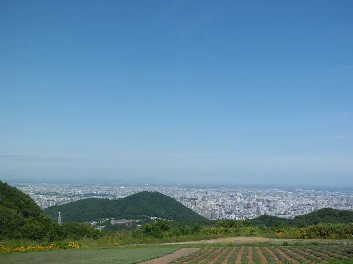
Mt. Maruyama is a 225-meter wooded hill of Quaternary andesite immediately west of central Sapporo in Chūō Ward, draped in the Maruyama Primeval Forest — designated a national natural monument in 1921 — and adjoining Maruyama Park and Sapporo Maruyama Zoo. The city's Maruyama Nature Trail offers two main routes to the summit: a roughly 1 km path lined with the 88 Kannon statues of a miniature pilgrimage and a shorter 0.7 km trail from the Zoo gate. It is included in the Sapporo 50 Peaks and the 1993 edition of the Hokkaido Hyakumeizan list.
Mt. Maruyama at a glance
- Weather: The most settled day in the next 7 days is Thu, November 5: clear, gusts up to 8 m/s.
- Route: The shortest is Mount Maruyama Return from Maruyama-Nishimachi, Sapporo: about 1 h 19 min, 2.6 km, about 170 m of climbing.
Mt. Maruyama weather (hourly, 14 days)
Sunrise today 06:11, sunset 16:26
| Tue, 11/3 | Wed, 11/4 | Thu, 11/5 | Fri, 11/6 | Sat, 11/7 | Sun, 11/8 | Mon, 11/9 | Tue, 11/10 | Wed, 11/11 | Thu, 11/12 | Fri, 11/13 | Sat, 11/14 | Sun, 11/15 | Mon, 11/16 | Tue, 11/17 | |||||||||||||||||||||||||||||||||||||||||||||||||||||||||||||||||||||||
|---|---|---|---|---|---|---|---|---|---|---|---|---|---|---|---|---|---|---|---|---|---|---|---|---|---|---|---|---|---|---|---|---|---|---|---|---|---|---|---|---|---|---|---|---|---|---|---|---|---|---|---|---|---|---|---|---|---|---|---|---|---|---|---|---|---|---|---|---|---|---|---|---|---|---|---|---|---|---|---|---|---|---|---|---|---|
| Japan time | 15 | 17 | 19 | 21 | 23 | 1 | 3 | 5 | 7 | 9 | 11 | 13 | 15 | 18 | 21 | 0 | 3 | 6 | 9 | 12 | 15 | 18 | 21 | 0 | 3 | 6 | 9 | 12 | 15 | 18 | 21 | 0 | 3 | 6 | 9 | 12 | 15 | 18 | 21 | 0 | 3 | 6 | 9 | 12 | 15 | 18 | 21 | 0 | 3 | 6 | 9 | 15 | 21 | 3 | 9 | 15 | 21 | 3 | 9 | 15 | 21 | 3 | 9 | 15 | 21 | 3 | 9 | 15 | 21 | 3 | 9 | 15 | 21 | 3 | 9 | 15 | 21 | 3 | 9 | 15 | 21 | 3 | 9 | 15 | |
  |  |   | |   |   |   | | | |  | | |  | | | | |   | | |   |   |   | |   | | |   | | | |   | |   |   | | |   | | | | | | | | | | | | | | | | | | | |   | | | |   | | | | | | | | | | | | | | | |   | | | | | | ||
| Temperature | °C | 6° | 3° | 2° | 1° | 1° | 0° | 1° | 1° | 3° | 5° | 6° | 7° | 7° | 2° | 0° | -1° | 1° | 1° | 8° | 12° | 13° | 9° | 8° | 8° | 8° | 9° | 12° | 15° | 13° | 7° | 4° | 2° | 0° | 0° | 0° | 1° | 1° | 0° | 0° | -1° | -1° | -1° | 0° | 2° | 1° | 1° | 0° | 0° | 0° | -1° | 1° | 1° | -1° | -4° | 0° | 2° | -2° | -2° | 1° | 4° | -1° | -2° | 2° | 4° | 0° | -2° | -1° | 0° | 0° | -1° | 1° | 4° | -4° | 0° | 6° | 9° | 6° | 5° | 4° | 2° | 0° | -1° | 2° | 4° |
| Precipitation | mm | 0.4 | 1.6 | 1.0 | 3.2 | 2.4 | 1.7 | 0.3 | 0.6 | 0.8 | 1.0 | 0.3 | 0.4 | 0.7 | 0.8 | 0.4 | 0.5 | 0.5 | 0.4 | 0.4 | 0.5 | 0.3 | 0.1 | 0.5 | 0.6 | 0.3 | 0.5 | 0.7 | 1.0 | 1.2 | 1.3 | 0.7 | 3.6 | 2.2 | 0.4 | ||||||||||||||||||||||||||||||||||||||||||||||||||
| New snow | cm | <.1 | 0.2 | 0.6 | 0.1 | <.1 | <.1 | 0.3 | 0.4 | 0.7 | 0.8 | 0.4 | 0.5 | 0.5 | 0.4 | 0.4 | 0.5 | 0.3 | 0.1 | <.1 | <.1 | <.1 | <.1 | 0.5 | 0.6 | <.1 | <.1 | 0.5 | 0.7 | 1.0 | 1.1 | 0.9 | <.1 | <.1 | <.1 | 0.3 | |||||||||||||||||||||||||||||||||||||||||||||||||
| Snow depth | cm | 0 | 0 | 0 | 0 | <1 | <1 | <1 | <1 | <1 | <1 | <1 | <1 | <1 | <1 | <1 | <1 | <1 | <1 | <1 | <1 | 0 | 0 | 0 | 0 | 0 | 0 | 0 | 0 | 0 | 0 | 0 | 0 | <1 | <1 | <1 | 1 | <1 | <1 | <1 | 1 | 2 | 2 | 2 | 1 | 1 | 1 | <1 | <1 | <1 | <1 | <1 | <1 | <1 | <1 | <1 | <1 | <1 | <1 | 1 | <1 | <1 | <1 | <1 | <1 | <1 | <1 | 1 | 1 | 2 | 2 | 2 | <1 | <1 | <1 | <1 | <1 | <1 | <1 | <1 | <1 | <1 | <1 | <1 | <1 |
| Wind | m/s | 4 | 2 | 1 | 2 | 2 | 0 | 1 | 2 | 4 | 5 | 2 | 1 | 2 | 1 | 1 | 2 | 2 | 2 | 2 | 3 | 2 | 2 | 1 | 1 | 2 | 3 | 3 | 3 | 1 | 1 | 1 | 1 | 1 | 2 | 2 | 4 | 3 | 4 | 6 | 5 | 6 | 5 | 4 | 5 | 4 | 3 | 2 | 1 | 0 | 1 | 1 | 3 | 1 | 1 | 0 | 3 | 1 | 1 | 2 | 3 | 2 | 1 | 1 | 3 | 1 | 2 | 6 | 4 | 3 | 1 | 1 | 1 | 2 | 2 | 3 | 2 | 2 | 1 | 4 | 5 | 5 | 3 | 2 | 1 |
| Wind gusts | m/s | 11 | 9 | 4 | 4 | 6 | 7 | 5 | 5 | 8 | 12 | 12 | 6 | 5 | 4 | 4 | 5 | 6 | 6 | 6 | 8 | 8 | 5 | 4 | 5 | 4 | 6 | 7 | 8 | 10 | 7 | 4 | 7 | 6 | 5 | 9 | 12 | 12 | 10 | 13 | 14 | 15 | 14 | 13 | 14 | 14 | 11 | 8 | 6 | 4 | 2 | 4 | 9 | 7 | 3 | 4 | 7 | 7 | 3 | 4 | 9 | 7 | 5 | 4 | 8 | 6 | 5 | 14 | 16 | 10 | 8 | 4 | 4 | 4 | 5 | 7 | 7 | 5 | 5 | 10 | 13 | 14 | 11 | 7 | 7 |
| Wind dir. | ↓ | ↓ | ↓ | ↓ | ↓ | ↓ | ↓ | ↓ | ↓ | ↓ | ↓ | ↓ | ↓ | ↓ | ↓ | ↓ | ↓ | ↓ | ↓ | ↓ | ↓ | ↓ | ↓ | ↓ | ↓ | ↓ | ↓ | ↓ | ↓ | ↓ | ↓ | ↓ | ↓ | ↓ | ↓ | ↓ | ↓ | ↓ | ↓ | ↓ | ↓ | ↓ | ↓ | ↓ | ↓ | ↓ | ↓ | ↓ | ↓ | ↓ | ↓ | ↓ | ↓ | ↓ | ↓ | ↓ | ↓ | ↓ | ↓ | ↓ | ↓ | ↓ | ↓ | ↓ | ↓ | ↓ | ↓ | ↓ | ↓ | ↓ | ↓ | ↓ | ↓ | ↓ | ↓ | ↓ | ↓ | ↓ | ↓ | ↓ | ↓ | ↓ | ↓ | ↓ | |
Mt. Maruyama hiking routes
- Mount Maruyama Return from Maruyama-Nishimachi, Sapporo 2.6 km · Ascent 173 m Maruyama Nishi-machi 2 (Bus stop)
- Maruyama Circuit via the 88-Temple and Zoo Trails 2.7 km · Ascent 206 m parking
- Mount Maruyama Loop via the Zoo and 88 Sacred Places Trails 4.9 km · Ascent 216 m Maruyama koen (Station), Odori nishi 25 (Bus stop), Maruyama Bus Terminal (Bus stop), Maruyama Bus Terminal (Bus station)
Hiking times are estimates calculated from the terrain.
Huts, campsites and lodging near Mt. Maruyama
Campsites
- Redoor Sapporo
Lodging
- Sapporo Maruyama Guesthouse Tsumuri-An
- HOTEL HAMILTON SAPPORO
- Asano Hotel
- Guest House On My Way
- Sapporo Prince Hotel
Lists that include Mt. Maruyama
Mt. Maruyama facts
- Elevation
- 225 m
- Location
- Sapporo, Hokkaido
43.047283, 141.316549 - Website
- visit.sapporo.travel
- Trail Map
- www.city.sapporo.jp (PDF)
- Wikipedia
- ja.wikipedia.org