
Mt. Sapporodake
札幌岳
Sapporo, Hokkaido · Elevation 1,293 m
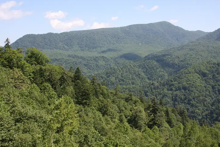
Mt. Sapporodake is a 1,293-meter volcano in Minami Ward, Sapporo City, Hokkaido — one of the older volcanic peaks of the Jozankei area within Shikotsu-Toya National Park. The mountain takes its name from the Toyohira River, whose source lies near the summit ("Sat-poro-pet" in Ainu, meaning "dry-large-river"). Two trails reach the top: the Toyotaki route from near Hakkenzan and the Reisuizawa route from the approach to Hoheikyo Dam, both popular as day hikes from the city. The peak appears in the Hokkaido Hyakumeizan and Sapporo 50 Peaks lists.
Mt. Sapporodake at a glance
- Weather: The most settled day in the next 7 days is Thu, November 5: clear, gusts up to 7 m/s. Sat, Nov 7, Sun, Nov 8: strong wind (gusts up to 19 m/s).
- Route: The shortest is Mount Sapporo Round Trip via the Hiyamizu Course: about 6 h 33 min, 11.0 km, about 870 m of climbing.
Mt. Sapporodake weather (hourly, 14 days)
Sunrise today 06:11, sunset 16:27
| Tue, 11/3 | Wed, 11/4 | Thu, 11/5 | Fri, 11/6 | Sat, 11/7 | Sun, 11/8 | Mon, 11/9 | Tue, 11/10 | Wed, 11/11 | Thu, 11/12 | Fri, 11/13 | Sat, 11/14 | Sun, 11/15 | Mon, 11/16 | Tue, 11/17 | |||||||||||||||||||||||||||||||||||||||||||||||||||||||||||||||||||||||
|---|---|---|---|---|---|---|---|---|---|---|---|---|---|---|---|---|---|---|---|---|---|---|---|---|---|---|---|---|---|---|---|---|---|---|---|---|---|---|---|---|---|---|---|---|---|---|---|---|---|---|---|---|---|---|---|---|---|---|---|---|---|---|---|---|---|---|---|---|---|---|---|---|---|---|---|---|---|---|---|---|---|---|---|---|---|
| Japan time | 15 | 17 | 19 | 21 | 23 | 1 | 3 | 5 | 7 | 9 | 11 | 13 | 15 | 18 | 21 | 0 | 3 | 6 | 9 | 12 | 15 | 18 | 21 | 0 | 3 | 6 | 9 | 12 | 15 | 18 | 21 | 0 | 3 | 6 | 9 | 12 | 15 | 18 | 21 | 0 | 3 | 6 | 9 | 12 | 15 | 18 | 21 | 0 | 3 | 6 | 9 | 15 | 21 | 3 | 9 | 15 | 21 | 3 | 9 | 15 | 21 | 3 | 9 | 15 | 21 | 3 | 9 | 15 | 21 | 3 | 9 | 15 | 21 | 3 | 9 | 15 | 21 | 3 | 9 | 15 | 21 | 3 | 9 | 15 | |
  |   | |   |   |   |   | |   | |  | | |  | | | | | | | |   | |   | |   | | |   | | | | | |   | | | | | | | | | | | | | | | | | |   | | | | | |   | | | | |   | | | | | | | | | | | | | | |   | | |  | | | ||
| Temperature | °C | -3° | -6° | -7° | -7° | -7° | -5° | -5° | -4° | -4° | -3° | -1° | 0° | 0° | -7° | -7° | -7° | -5° | -4° | 2° | 5° | 5° | 0° | 1° | 1° | 2° | 2° | 5° | 7° | 4° | -2° | -4° | -7° | -8° | -8° | -7° | -7° | -7° | -8° | -8° | -8° | -8° | -9° | -8° | -7° | -7° | -8° | -8° | -9° | -8° | -9° | -7° | -8° | -10° | -12° | -7° | -6° | -10° | -10° | -5° | -4° | -10° | -8° | -5° | -5° | -8° | -10° | -9° | -8° | -8° | -8° | -5° | -3° | -11° | -5° | 0° | 0° | -1° | -3° | -4° | -6° | -8° | -10° | -5° | -4° |
| Precipitation | mm | 0.5 | 2.2 | 1.2 | 0.1 | 2.6 | 1.7 | 1.6 | 0.4 | 0.3 | 0.1 | 0.4 | 0.5 | 0.7 | 0.8 | 1.1 | 0.8 | 1.3 | 1.0 | 1.0 | 1.2 | 1.2 | 1.2 | 0.9 | 0.5 | 0.3 | 0.1 | 1.1 | 1.2 | 0.2 | 0.3 | 0.2 | 0.3 | 0.7 | 0.6 | 0.2 | 0.1 | 0.5 | 0.6 | 3.3 | 1.7 | 0.3 | |||||||||||||||||||||||||||||||||||||||||||
| New snow | cm | <.1 | 0.5 | 2.1 | 0.8 | <.1 | <.1 | 0.4 | 0.5 | 0.7 | 0.8 | 1.1 | 0.8 | 1.3 | 1.0 | 1.0 | 1.2 | 1.2 | 1.2 | 0.9 | 0.5 | 0.3 | 0.1 | <.1 | <.1 | <.1 | <.1 | <.1 | 1.1 | 1.2 | 0.2 | 0.3 | <.1 | 0.2 | 0.3 | 0.7 | 0.6 | 0.3 | 0.9 | 0.3 | |||||||||||||||||||||||||||||||||||||||||||||
| Snow depth | cm | <1 | <1 | <1 | <1 | <1 | 2 | 2 | 2 | 2 | 2 | 2 | 2 | 2 | 2 | 2 | 2 | 2 | 1 | <1 | <1 | <1 | <1 | <1 | <1 | <1 | <1 | 0 | 0 | 0 | 0 | 0 | 0 | <1 | 1 | 1 | 2 | 3 | 3 | 4 | 4 | 5 | 5 | 6 | 6 | 7 | 7 | 7 | 7 | 7 | 7 | 6 | 6 | 6 | 6 | 6 | 6 | 6 | 6 | 7 | 7 | 7 | 7 | 7 | 7 | 7 | 7 | 7 | 7 | 7 | 8 | 7 | 7 | 7 | 7 | 6 | 4 | 3 | 2 | 2 | 2 | 2 | 2 | 2 | 2 |
| Wind | m/s | 5 | 3 | 2 | 2 | 2 | 3 | 2 | 4 | 4 | 4 | 1 | 0 | 0 | 2 | 3 | 3 | 3 | 3 | 2 | 2 | 1 | 1 | 2 | 2 | 2 | 2 | 3 | 4 | 4 | 3 | 4 | 4 | 5 | 5 | 6 | 7 | 5 | 6 | 7 | 7 | 8 | 7 | 6 | 6 | 4 | 4 | 3 | 1 | 1 | 0 | 3 | 3 | 1 | 2 | 1 | 2 | 0 | 1 | 1 | 2 | 2 | 2 | 1 | 3 | 0 | 1 | 5 | 3 | 2 | 2 | 0 | 0 | 2 | 3 | 2 | 2 | 2 | 1 | 3 | 5 | 4 | 2 | 1 | 1 |
| Wind gusts | m/s | 13 | 12 | 8 | 7 | 8 | 11 | 11 | 11 | 12 | 12 | 11 | 5 | 4 | 5 | 8 | 8 | 9 | 9 | 7 | 7 | 7 | 4 | 5 | 6 | 6 | 7 | 9 | 12 | 15 | 15 | 11 | 15 | 15 | 15 | 16 | 18 | 19 | 16 | 19 | 20 | 21 | 21 | 19 | 17 | 16 | 13 | 12 | 8 | 5 | 4 | 8 | 10 | 9 | 6 | 6 | 6 | 5 | 4 | 5 | 7 | 6 | 6 | 5 | 10 | 8 | 5 | 13 | 14 | 9 | 7 | 5 | 3 | 5 | 7 | 8 | 8 | 9 | 7 | 7 | 13 | 13 | 11 | 7 | 5 |
| Wind dir. | ↓ | ↓ | ↓ | ↓ | ↓ | ↓ | ↓ | ↓ | ↓ | ↓ | ↓ | ↓ | ↓ | ↓ | ↓ | ↓ | ↓ | ↓ | ↓ | ↓ | ↓ | ↓ | ↓ | ↓ | ↓ | ↓ | ↓ | ↓ | ↓ | ↓ | ↓ | ↓ | ↓ | ↓ | ↓ | ↓ | ↓ | ↓ | ↓ | ↓ | ↓ | ↓ | ↓ | ↓ | ↓ | ↓ | ↓ | ↓ | ↓ | ↓ | ↓ | ↓ | ↓ | ↓ | ↓ | ↓ | ↓ | ↓ | ↓ | ↓ | ↓ | ↓ | ↓ | ↓ | ↓ | ↓ | ↓ | ↓ | ↓ | ↓ | ↓ | ↓ | ↓ | ↓ | ↓ | ↓ | ↓ | ↓ | ↓ | ↓ | ↓ | ↓ | ↓ | ↓ | |
Mt. Sapporodake hiking routes
Hiking times are estimates calculated from the terrain.
Huts, campsites and lodging near Mt. Sapporodake
Mountain huts
Lists that include Mt. Sapporodake
Hokkaido 100 Famous Mountains · 50 Peaks of Sapporo · Elevations of 1003 Mountains of Japan · 1000 Mountains of Japan
Mt. Sapporodake facts
- Elevation
- 1,293 m
- Location
- Sapporo, Hokkaido
42.900219, 141.200554 - National Park
- 支笏洞爺国立公園
- Website
- www.city.sapporo.jp
- Trail Map
- jozankei.jp (PDF)
- Wikipedia
- ja.wikipedia.org