
Mt. Kotengudake
小天狗岳
Sapporo, Hokkaido · Elevation 765 m
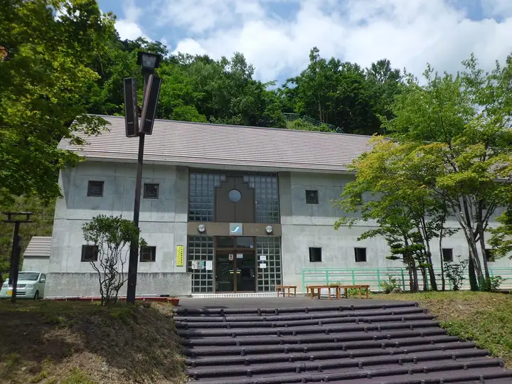
Mt. Kotengudake is a 764.7-meter rocky peak in the Jōzankei district of Minami Ward, Sapporo, Hokkaido, rising on the west shore of Lake Jōzan above the Jōzankei Dam. Its name ("Little Tengu") reflects its miniature resemblance to nearby Jōzankei Tengudake to the northwest. The trailhead lies past the dam museum at the downstream-park complex, which made access far easier once the dam and its park were completed. The mountain is included in the Sapporo 50 Peaks list.
Mt. Kotengudake at a glance
- Weather: The most settled day in the next 7 days is Tue, November 10: clear, gusts up to 6 m/s. Fri, Nov 6, Sat, Nov 7, Sun, Nov 8: strong wind (gusts up to 24 m/s).
Mt. Kotengudake weather (hourly, 14 days)
Sunrise today 06:13, sunset 16:25
| Tue, 11/3 | Wed, 11/4 | Thu, 11/5 | Fri, 11/6 | Sat, 11/7 | Sun, 11/8 | Mon, 11/9 | Tue, 11/10 | Wed, 11/11 | Thu, 11/12 | Fri, 11/13 | Sat, 11/14 | Sun, 11/15 | Mon, 11/16 | Tue, 11/17 | |||||||||||||||||||||||||||||||||||||||||||||||||||||||||||||||||||||||
|---|---|---|---|---|---|---|---|---|---|---|---|---|---|---|---|---|---|---|---|---|---|---|---|---|---|---|---|---|---|---|---|---|---|---|---|---|---|---|---|---|---|---|---|---|---|---|---|---|---|---|---|---|---|---|---|---|---|---|---|---|---|---|---|---|---|---|---|---|---|---|---|---|---|---|---|---|---|---|---|---|---|---|---|---|---|
| Japan time | 21 | 23 | 1 | 3 | 5 | 7 | 9 | 11 | 13 | 15 | 17 | 19 | 21 | 0 | 3 | 6 | 9 | 12 | 15 | 18 | 21 | 0 | 3 | 6 | 9 | 12 | 15 | 18 | 21 | 0 | 3 | 6 | 9 | 12 | 15 | 18 | 21 | 0 | 3 | 6 | 9 | 12 | 15 | 18 | 21 | 0 | 3 | 6 | 9 | 12 | 15 | 21 | 3 | 9 | 15 | 21 | 3 | 9 | 15 | 21 | 3 | 9 | 15 | 21 | 3 | 9 | 15 | 21 | 3 | 9 | 15 | 21 | 3 | 9 | 15 | 21 | 3 | 9 | 15 | 21 | 3 | 9 | 15 | 21 | |
  |   | | | |   |   |  | | |  | | | |   | | | | |   |   | | | |   |   | | | | | | |   | | | | | | | | | | | | | | | | | | | | | | |   | |   | | | | |   | | | | | |   | | | | | | | | |   | | |  | | | | ||
| Temperature | °C | -4° | -4° | -3° | -2° | -2° | -2° | -1° | 1° | 2° | 1° | -4° | -5° | -5° | -4° | -2° | -2° | 5° | 6° | 6° | 2° | 5° | 4° | 4° | 4° | 5° | 9° | 6° | 0° | -2° | -5° | -7° | -7° | -5° | -5° | -5° | -5° | -6° | -6° | -6° | -7° | -5° | -5° | -6° | -7° | -7° | -7° | -7° | -8° | -6° | -5° | -7° | -9° | -11° | -5° | -3° | -8° | -7° | -2° | -1° | -8° | -5° | -3° | -3° | -6° | -8° | -7° | -6° | -6° | -6° | -2° | 0° | -7° | -1° | 3° | 3° | 2° | 1° | -1° | -4° | -6° | -8° | -3° | -2° | -5° |
| Precipitation | mm | 0.6 | 0.7 | 2.7 | 1.0 | 0.1 | 0.1 | 1.7 | 1.3 | 4.8 | 6 | 0.5 | 0.5 | 0.6 | 0.3 | 0.7 | 0.9 | 1.0 | 1.5 | 1.5 | 1.3 | 0.9 | 0.7 | 0.6 | 0.6 | 0.5 | 0.6 | 0.3 | 0.2 | 0.1 | 0.3 | 0.2 | 1.3 | 1.2 | 0.4 | 0.7 | 0.3 | 0.3 | 0.6 | 0.4 | 0.4 | 0.3 | 0.9 | 1.3 | 3.5 | 2.0 | 0.5 | ||||||||||||||||||||||||||||||||||||||
| New snow | cm | 0.6 | 0.7 | 2.7 | 1.0 | 0.1 | 0.3 | 0.7 | 0.9 | 1.0 | 1.5 | 1.5 | 1.3 | 1.0 | 0.7 | 0.6 | 0.6 | 0.5 | 0.6 | 0.3 | 0.2 | <.1 | <.1 | <.1 | <.1 | <.1 | 0.3 | 0.2 | <.1 | <.1 | <.1 | 1.4 | 1.2 | 0.4 | 0.7 | <.1 | <.1 | 0.3 | 0.2 | 0.5 | 0.3 | 1.4 | 1.9 | 0.5 | |||||||||||||||||||||||||||||||||||||||||
| Snow depth | cm | <1 | 2 | 4 | 5 | 5 | 5 | 5 | 5 | 4 | 4 | 4 | 4 | 4 | 4 | 4 | 4 | 3 | 3 | 2 | 2 | 2 | <1 | <1 | <1 | 0 | 0 | 0 | 0 | 0 | <1 | 1 | 2 | 3 | 4 | 5 | 6 | 7 | 8 | 9 | 10 | 11 | 12 | 12 | 12 | 12 | 12 | 12 | 12 | 12 | 12 | 11 | 11 | 11 | 11 | 10 | 10 | 12 | 13 | 12 | 12 | 12 | 12 | 12 | 12 | 12 | 12 | 12 | 12 | 13 | 12 | 12 | 12 | 12 | 10 | 8 | 6 | 5 | 5 | 6 | 6 | 6 | 6 | 6 | 6 |
| Wind | m/s | 2 | 3 | 3 | 3 | 5 | 4 | 4 | 2 | 1 | 1 | 2 | 2 | 3 | 3 | 3 | 3 | 2 | 1 | 1 | 2 | 3 | 1 | 1 | 1 | 2 | 4 | 6 | 7 | 6 | 6 | 6 | 6 | 7 | 8 | 8 | 8 | 8 | 7 | 6 | 6 | 6 | 6 | 5 | 4 | 2 | 2 | 2 | 2 | 3 | 3 | 4 | 2 | 2 | 1 | 1 | 1 | 1 | 1 | 2 | 2 | 2 | 2 | 4 | 2 | 2 | 5 | 3 | 2 | 2 | 1 | 1 | 2 | 3 | 2 | 3 | 3 | 1 | 2 | 4 | 4 | 2 | 1 | 1 | 2 |
| Wind gusts | m/s | 9 | 10 | 11 | 11 | 13 | 14 | 14 | 12 | 6 | 5 | 5 | 6 | 7 | 8 | 9 | 9 | 7 | 6 | 5 | 5 | 7 | 8 | 5 | 4 | 5 | 10 | 16 | 19 | 18 | 18 | 17 | 16 | 20 | 23 | 24 | 24 | 23 | 21 | 19 | 16 | 16 | 17 | 17 | 14 | 11 | 8 | 7 | 6 | 8 | 10 | 11 | 11 | 6 | 6 | 5 | 4 | 4 | 5 | 7 | 5 | 6 | 6 | 13 | 11 | 6 | 13 | 14 | 9 | 7 | 5 | 5 | 6 | 8 | 10 | 9 | 11 | 8 | 7 | 12 | 12 | 10 | 8 | 6 | 5 |
| Wind dir. | ↓ | ↓ | ↓ | ↓ | ↓ | ↓ | ↓ | ↓ | ↓ | ↓ | ↓ | ↓ | ↓ | ↓ | ↓ | ↓ | ↓ | ↓ | ↓ | ↓ | ↓ | ↓ | ↓ | ↓ | ↓ | ↓ | ↓ | ↓ | ↓ | ↓ | ↓ | ↓ | ↓ | ↓ | ↓ | ↓ | ↓ | ↓ | ↓ | ↓ | ↓ | ↓ | ↓ | ↓ | ↓ | ↓ | ↓ | ↓ | ↓ | ↓ | ↓ | ↓ | ↓ | ↓ | ↓ | ↓ | ↓ | ↓ | ↓ | ↓ | ↓ | ↓ | ↓ | ↓ | ↓ | ↓ | ↓ | ↓ | ↓ | ↓ | ↓ | ↓ | ↓ | ↓ | ↓ | ↓ | ↓ | ↓ | ↓ | ↓ | ↓ | ↓ | ↓ | ↓ | |
Huts, campsites and lodging near Mt. Kotengudake
Campsites
- 晴好雨喜
Lodging
- Suizantei Club Jozankei
- HATAGOYA-Jōzankei Shōten
- Shiki Club Jozankei Prime
- Jozankei Daiichi Hotel Suizantei
- Jozankei View Hotel
Lists that include Mt. Kotengudake
Mt. Kotengudake facts
- Elevation
- 765 m
- Location
- Sapporo, Hokkaido
42.988855, 141.147081 - Website
- jozankei.jp
- Trail Map
- jozankei.jp (PDF)
- Wikipedia
- ja.wikipedia.org