
Mount Muine
無意根山
Kyogoku, Hokkaido · Elevation 1,464 m
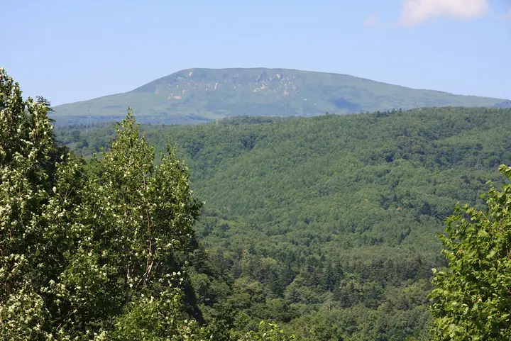
Mount Muine is a 1,464 m peak on the boundary between Sapporo (Jōzankei, Minami Ward), Kyōgoku Town, and Kimobetsu Town in Hokkaido — the second-highest summit within Sapporo City after Mount Yoichi. The name derives from the Ainu phrase 'mui-ne-shir' ('a basket-shaped mountain'). The mountain lies within Shikotsu-Tōya National Park and is climbed by the Usubetsu Course from the Jōzankei side and the Motoyama Course from the old Toyoha Mine area. It is counted among the Sapporo 50 Peaks and the 100 Famous Mountains of Hokkaido.
Mount Muine at a glance
- Weather: The most settled day in the next 7 days is Thu, November 5: clear, gusts up to 8 m/s. Wed, Nov 4, Fri, Nov 6, Sat, Nov 7, Sun, Nov 8: strong wind (gusts up to 21 m/s).
Mount Muine weather (hourly, 14 days)
Sunrise today 06:12, sunset 16:27
| Tue, 11/3 | Wed, 11/4 | Thu, 11/5 | Fri, 11/6 | Sat, 11/7 | Sun, 11/8 | Mon, 11/9 | Tue, 11/10 | Wed, 11/11 | Thu, 11/12 | Fri, 11/13 | Sat, 11/14 | Sun, 11/15 | Mon, 11/16 | Tue, 11/17 | |||||||||||||||||||||||||||||||||||||||||||||||||||||||||||||||||||||||
|---|---|---|---|---|---|---|---|---|---|---|---|---|---|---|---|---|---|---|---|---|---|---|---|---|---|---|---|---|---|---|---|---|---|---|---|---|---|---|---|---|---|---|---|---|---|---|---|---|---|---|---|---|---|---|---|---|---|---|---|---|---|---|---|---|---|---|---|---|---|---|---|---|---|---|---|---|---|---|---|---|---|---|---|---|---|
| Japan time | 15 | 17 | 19 | 21 | 23 | 1 | 3 | 5 | 7 | 9 | 11 | 13 | 15 | 18 | 21 | 0 | 3 | 6 | 9 | 12 | 15 | 18 | 21 | 0 | 3 | 6 | 9 | 12 | 15 | 18 | 21 | 0 | 3 | 6 | 9 | 12 | 15 | 18 | 21 | 0 | 3 | 6 | 9 | 12 | 15 | 18 | 21 | 0 | 3 | 6 | 9 | 15 | 21 | 3 | 9 | 15 | 21 | 3 | 9 | 15 | 21 | 3 | 9 | 15 | 21 | 3 | 9 | 15 | 21 | 3 | 9 | 15 | 21 | 3 | 9 | 15 | 21 | 3 | 9 | 15 | 21 | 3 | 9 | 15 | |
  |   |   | |   | | | |   | |   |  | |  | |   | | | | | | |   |   | | |   |   | | | | | | |   | | | | | | | | | | | | | | | | | | | |   | | | | |   | | | | | | | | | |   | | | | | | | | |   | | | | | | ||
| Temperature | °C | -5° | -7° | -7° | -7° | -7° | -5° | -5° | -5° | -5° | -4° | -3° | -2° | -3° | -8° | -7° | -6° | -5° | -4° | 2° | 4° | 3° | -1° | 0° | 1° | 2° | 2° | 4° | 5° | 2° | -3° | -6° | -9° | -9° | -10° | -9° | -8° | -9° | -9° | -9° | -10° | -10° | -10° | -9° | -8° | -8° | -9° | -9° | -9° | -9° | -10° | -9° | -9° | -12° | -13° | -9° | -7° | -11° | -10° | -5° | -5° | -10° | -8° | -6° | -6° | -9° | -11° | -10° | -9° | -9° | -9° | -5° | -4° | -9° | -4° | 0° | 0° | 0° | -1° | -4° | -7° | -10° | -12° | -6° | -6° |
| Precipitation | mm | 0.3 | 1.1 | 3.0 | 1.8 | 0.3 | 2.8 | 2.9 | 1.7 | 0.2 | 0.3 | 1.7 | 0.6 | 0.5 | 1.3 | 1.4 | 1.7 | 1.7 | 2.4 | 1.7 | 2.1 | 1.5 | 1.9 | 2.0 | 2.2 | 2.6 | 2.0 | 1.3 | 0.8 | 0.4 | 0.3 | 0.3 | 0.1 | 0.1 | 0.1 | 1.4 | 1.1 | 0.7 | 1.1 | 0.1 | 0.3 | 0.3 | 0.5 | 0.2 | 0.2 | 0.5 | 0.4 | 1.1 | 2.2 | 3.6 | 2.2 | 0.5 | |||||||||||||||||||||||||||||||||
| New snow | cm | <.1 | 0.3 | 1.1 | 3.0 | 1.8 | 0.2 | <.1 | 0.4 | 1.3 | 1.4 | 1.7 | 1.7 | 2.4 | 1.7 | 2.1 | 1.5 | 1.9 | 2.0 | 2.2 | 2.6 | 2.0 | 1.3 | 0.7 | 0.4 | 0.3 | 0.3 | 0.1 | <.1 | <.1 | <.1 | 0.1 | <.1 | 1.4 | 1.1 | 0.7 | 1.1 | 0.1 | <.1 | 0.3 | 0.2 | 0.4 | 0.2 | 2.1 | 2.2 | 0.5 | |||||||||||||||||||||||||||||||||||||||
| Snow depth | cm | 2 | 2 | 2 | 2 | 3 | 5 | 7 | 7 | 7 | 6 | 6 | 6 | 6 | 6 | 6 | 6 | 6 | 6 | 5 | 4 | 3 | 3 | 3 | 2 | 1 | 1 | <1 | 0 | 0 | 0 | 0 | <1 | 2 | 4 | 5 | 7 | 8 | 9 | 10 | 11 | 13 | 14 | 16 | 17 | 17 | 17 | 17 | 17 | 17 | 17 | 16 | 16 | 16 | 16 | 15 | 15 | 15 | 16 | 17 | 16 | 16 | 16 | 16 | 16 | 16 | 16 | 17 | 16 | 17 | 16 | 16 | 16 | 16 | 16 | 14 | 11 | 9 | 8 | 8 | 10 | 10 | 10 | 10 | 10 |
| Wind | m/s | 5 | 3 | 3 | 2 | 3 | 4 | 3 | 6 | 5 | 5 | 3 | 1 | 1 | 2 | 2 | 1 | 2 | 2 | 2 | 2 | 1 | 1 | 1 | 2 | 2 | 2 | 4 | 5 | 6 | 7 | 5 | 6 | 5 | 5 | 7 | 7 | 7 | 7 | 8 | 7 | 8 | 7 | 6 | 8 | 6 | 6 | 4 | 3 | 3 | 2 | 4 | 4 | 2 | 1 | 1 | 1 | 1 | 1 | 1 | 2 | 1 | 2 | 2 | 4 | 2 | 2 | 5 | 3 | 2 | 1 | 2 | 1 | 1 | 2 | 2 | 3 | 3 | 0 | 3 | 5 | 4 | 2 | 2 | 2 |
| Wind gusts | m/s | 15 | 14 | 9 | 9 | 10 | 13 | 13 | 16 | 16 | 16 | 13 | 9 | 6 | 6 | 7 | 7 | 9 | 8 | 7 | 8 | 6 | 4 | 6 | 7 | 9 | 9 | 12 | 13 | 19 | 20 | 18 | 20 | 18 | 16 | 21 | 21 | 21 | 19 | 21 | 21 | 20 | 20 | 19 | 21 | 21 | 17 | 15 | 12 | 9 | 8 | 11 | 13 | 12 | 6 | 5 | 5 | 6 | 5 | 5 | 7 | 6 | 6 | 6 | 14 | 12 | 8 | 14 | 14 | 10 | 8 | 6 | 6 | 5 | 8 | 10 | 9 | 10 | 9 | 8 | 13 | 14 | 11 | 8 | 7 |
| Wind dir. | ↓ | ↓ | ↓ | ↓ | ↓ | ↓ | ↓ | ↓ | ↓ | ↓ | ↓ | ↓ | ↓ | ↓ | ↓ | ↓ | ↓ | ↓ | ↓ | ↓ | ↓ | ↓ | ↓ | ↓ | ↓ | ↓ | ↓ | ↓ | ↓ | ↓ | ↓ | ↓ | ↓ | ↓ | ↓ | ↓ | ↓ | ↓ | ↓ | ↓ | ↓ | ↓ | ↓ | ↓ | ↓ | ↓ | ↓ | ↓ | ↓ | ↓ | ↓ | ↓ | ↓ | ↓ | ↓ | ↓ | ↓ | ↓ | ↓ | ↓ | ↓ | ↓ | ↓ | ↓ | ↓ | ↓ | ↓ | ↓ | ↓ | ↓ | ↓ | ↓ | ↓ | ↓ | ↓ | ↓ | ↓ | ↓ | ↓ | ↓ | ↓ | ↓ | ↓ | ↓ | |
Huts, campsites and lodging near Mount Muine
Mountain huts
Lists that include Mount Muine
Hokkaido 100 Famous Mountains · 50 Peaks of Sapporo · Elevations of 1003 Mountains of Japan · 1000 Mountains of Japan
Mount Muine facts
- Elevation
- 1,464 m
- Location
- Kyogoku, Hokkaido
42.930800, 141.040490 - National Park
- 支笏洞爺国立公園
- Website
- jozankei.jp
- Trail Map
- jozankei.jp (PDF)
- Access Information
- www.rinya.maff.go.jp
- Wikipedia
- ja.wikipedia.org