
Mt. Abeyama
阿部山
Sapporo, Hokkaido · Elevation 703 m
Mt. Abeyama is a 703-meter peak in the Heiwa district of Nishi Ward, Sapporo, Hokkaido, lying southwest of Heiwa Falls near the confluence of the Kotoni-Hassamu and Miyaginosawa rivers. The slopes hold the remains of the Sapporo Mine, where the Nakajima Trading Company extracted gold, silver, and copper from the late Meiji era until closure around 1936; stone structures from that period still line the riverbanks. No formal hiking trail exists, so the peak is climbed by Sapporo 50 Peaks enthusiasts via remnant snow or unmarked footpaths.
Mt. Abeyama at a glance
- Weather: The most settled day in the next 7 days is Thu, November 5: clear, gusts up to 7 m/s. Sat, Nov 7, Sun, Nov 8: strong wind (gusts up to 17 m/s).
Mt. Abeyama weather (hourly, 14 days)
Sunrise today 06:11, sunset 16:26
| Tue, 11/3 | Wed, 11/4 | Thu, 11/5 | Fri, 11/6 | Sat, 11/7 | Sun, 11/8 | Mon, 11/9 | Tue, 11/10 | Wed, 11/11 | Thu, 11/12 | Fri, 11/13 | Sat, 11/14 | Sun, 11/15 | Mon, 11/16 | Tue, 11/17 | |||||||||||||||||||||||||||||||||||||||||||||||||||||||||||||||||||||||
|---|---|---|---|---|---|---|---|---|---|---|---|---|---|---|---|---|---|---|---|---|---|---|---|---|---|---|---|---|---|---|---|---|---|---|---|---|---|---|---|---|---|---|---|---|---|---|---|---|---|---|---|---|---|---|---|---|---|---|---|---|---|---|---|---|---|---|---|---|---|---|---|---|---|---|---|---|---|---|---|---|---|---|---|---|---|
| Japan time | 15 | 17 | 19 | 21 | 23 | 1 | 3 | 5 | 7 | 9 | 11 | 13 | 15 | 18 | 21 | 0 | 3 | 6 | 9 | 12 | 15 | 18 | 21 | 0 | 3 | 6 | 9 | 12 | 15 | 18 | 21 | 0 | 3 | 6 | 9 | 12 | 15 | 18 | 21 | 0 | 3 | 6 | 9 | 12 | 15 | 18 | 21 | 0 | 3 | 6 | 9 | 15 | 21 | 3 | 9 | 15 | 21 | 3 | 9 | 15 | 21 | 3 | 9 | 15 | 21 | 3 | 9 | 15 | 21 | 3 | 9 | 15 | 21 | 3 | 9 | 15 | 21 | 3 | 9 | 15 | 21 | 3 | 9 | 15 | |
  |   | |   |   |   | | | | |  | | |  | | | | |   | | |   |   |   | |   | | |   | | | |   | |   | | | | | | | | | | | | | | | | |   | | | | | |   |   | | | | | | | | | | | | | | | |   | | | |   | | | | | | ||
| Temperature | °C | 2° | 0° | -2° | -2° | -2° | -2° | -1° | 0° | 0° | 2° | 3° | 5° | 4° | -2° | -3° | -3° | -2° | -1° | 6° | 10° | 10° | 5° | 5° | 5° | 6° | 6° | 10° | 12° | 10° | 4° | 1° | -1° | -3° | -3° | -3° | -2° | -2° | -3° | -3° | -4° | -4° | -4° | -3° | -2° | -2° | -3° | -3° | -3° | -4° | -4° | -2° | -2° | -4° | -8° | -2° | -1° | -4° | -5° | -1° | 1° | -4° | -4° | 0° | 0° | -3° | -4° | -4° | -3° | -3° | -4° | -1° | 1° | -6° | -1° | 4° | 6° | 3° | 2° | 1° | -1° | -3° | -4° | -1° | 1° |
| Precipitation | mm | 0.7 | 2.1 | 1.1 | 3.0 | 1.6 | 1.6 | 0.5 | 0.5 | 0.4 | 0.8 | 0.7 | 0.9 | 0.9 | 1.0 | 0.7 | 0.8 | 0.8 | 0.7 | 0.7 | 0.9 | 0.7 | 0.4 | 0.2 | 0.1 | 0.7 | 0.6 | 0.1 | 0.5 | 0.4 | 0.6 | 0.9 | 1.2 | 1.2 | 0.1 | 1.0 | 4.0 | 2.6 | 0.5 | ||||||||||||||||||||||||||||||||||||||||||||||
| New snow | cm | <.1 | 0.4 | 1.5 | 0.6 | <.1 | 0.5 | 0.7 | 0.9 | 0.9 | 1.0 | 0.7 | 0.8 | 0.8 | 0.7 | 0.7 | 0.9 | 0.7 | 0.4 | 0.2 | 0.1 | <.1 | <.1 | <.1 | 0.7 | 0.6 | 0.1 | 0.3 | 0.4 | 0.6 | 0.9 | 1.2 | 1.2 | 0.3 | 0.9 | 0.5 | <.1 | ||||||||||||||||||||||||||||||||||||||||||||||||
| Snow depth | cm | 0 | 0 | 0 | 0 | <1 | 1 | 1 | 1 | 1 | 1 | 1 | 1 | 1 | 1 | <1 | <1 | <1 | <1 | <1 | <1 | <1 | <1 | 0 | 0 | 0 | 0 | 0 | 0 | 0 | 0 | 0 | <1 | <1 | 1 | 2 | 2 | 2 | 2 | 3 | 4 | 4 | 4 | 4 | 4 | 5 | 5 | 4 | 4 | 4 | 4 | 4 | 4 | 4 | 4 | 4 | 3 | 3 | 4 | 4 | 4 | 3 | 3 | 3 | 3 | 3 | 3 | 4 | 4 | 5 | 6 | 6 | 4 | 4 | 4 | 4 | 2 | 1 | <1 | <1 | 1 | 1 | 1 | 1 | 1 |
| Wind | m/s | 4 | 2 | 2 | 1 | 2 | 1 | 2 | 3 | 4 | 4 | 2 | 1 | 1 | 1 | 2 | 2 | 2 | 2 | 2 | 2 | 1 | 1 | 2 | 1 | 1 | 2 | 2 | 2 | 3 | 1 | 2 | 3 | 3 | 4 | 5 | 5 | 4 | 5 | 6 | 6 | 7 | 6 | 4 | 5 | 4 | 4 | 3 | 1 | 1 | 1 | 2 | 3 | 2 | 2 | 1 | 2 | 1 | 1 | 1 | 3 | 2 | 2 | 1 | 3 | 1 | 2 | 6 | 4 | 3 | 1 | 0 | 1 | 2 | 2 | 2 | 1 | 1 | 2 | 4 | 5 | 5 | 2 | 2 | 1 |
| Wind gusts | m/s | 12 | 11 | 7 | 6 | 8 | 9 | 7 | 9 | 11 | 13 | 12 | 6 | 5 | 4 | 6 | 7 | 7 | 7 | 6 | 7 | 7 | 4 | 5 | 6 | 5 | 6 | 7 | 9 | 11 | 11 | 7 | 12 | 11 | 12 | 13 | 15 | 16 | 15 | 18 | 18 | 19 | 19 | 17 | 15 | 15 | 12 | 11 | 8 | 6 | 4 | 7 | 11 | 8 | 5 | 6 | 6 | 6 | 3 | 4 | 8 | 7 | 6 | 4 | 10 | 8 | 5 | 15 | 15 | 11 | 8 | 5 | 4 | 5 | 6 | 7 | 7 | 6 | 6 | 9 | 14 | 15 | 12 | 7 | 7 |
| Wind dir. | ↓ | ↓ | ↓ | ↓ | ↓ | ↓ | ↓ | ↓ | ↓ | ↓ | ↓ | ↓ | ↓ | ↓ | ↓ | ↓ | ↓ | ↓ | ↓ | ↓ | ↓ | ↓ | ↓ | ↓ | ↓ | ↓ | ↓ | ↓ | ↓ | ↓ | ↓ | ↓ | ↓ | ↓ | ↓ | ↓ | ↓ | ↓ | ↓ | ↓ | ↓ | ↓ | ↓ | ↓ | ↓ | ↓ | ↓ | ↓ | ↓ | ↓ | ↓ | ↓ | ↓ | ↓ | ↓ | ↓ | ↓ | ↓ | ↓ | ↓ | ↓ | ↓ | ↓ | ↓ | ↓ | ↓ | ↓ | ↓ | ↓ | ↓ | ↓ | ↓ | ↓ | ↓ | ↓ | ↓ | ↓ | ↓ | ↓ | ↓ | ↓ | ↓ | ↓ | ↓ | |
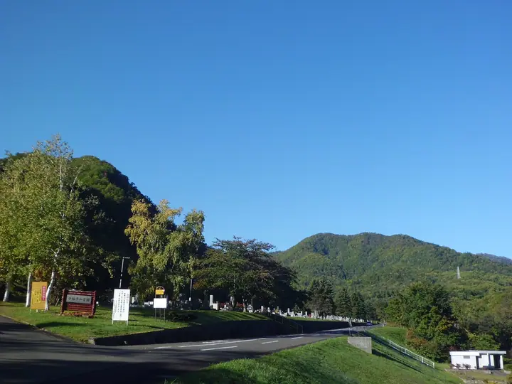
Huts, campsites and lodging near Mt. Abeyama
Mountain huts
Campsites
- コモレビヨリ
Lists that include Mt. Abeyama
Mt. Abeyama facts
- Elevation
- 703 m
- Location
- Sapporo, Hokkaido
43.047773, 141.202930 - Wikipedia
- ja.wikipedia.org