
Mount Soranuma
空沼岳
Sapporo, Hokkaido · Elevation 1,251 m
Mount Soranuma is a 1,250.8 m peak in Sapporo's Minami Ward, designated as a Class 1 Special Protection Zone within Shikotsu-Tōya National Park. Its name derives from the Sora-numa marsh on the south side; to the north lie the equally picturesque Manke-numa and Masarenu-numa marshes, with wetland-and-forest scenery that defines the route. The trailhead is about 40 minutes by car from central Sapporo, and the summit, reached in roughly three hours, opens onto a 360-degree panorama. Beloved year-round — wildflowers in summer, autumn foliage, and ski touring in winter — the peak appears in Hana no Hyakumeizan, Hokkaidō Hyakumeizan, and Sapporo 50.
Mount Soranuma at a glance
- Weather: The most settled day in the next 7 days is Thu, November 5: cloudy, gusts up to 9 m/s. Fri, Nov 6, Sat, Nov 7, Sun, Nov 8: strong wind (gusts up to 22 m/s).
- Route: The shortest is Mount Soranuma, Bankei Pond, and Mamisunuma Pond Out-and-Back: about 8 h 32 min, 14.9 km, about 950 m of climbing.
Mount Soranuma weather (hourly, 14 days)
Sunrise today 06:11, sunset 16:27
| Tue, 11/3 | Wed, 11/4 | Thu, 11/5 | Fri, 11/6 | Sat, 11/7 | Sun, 11/8 | Mon, 11/9 | Tue, 11/10 | Wed, 11/11 | Thu, 11/12 | Fri, 11/13 | Sat, 11/14 | Sun, 11/15 | Mon, 11/16 | Tue, 11/17 | |||||||||||||||||||||||||||||||||||||||||||||||||||||||||||||||||||||
|---|---|---|---|---|---|---|---|---|---|---|---|---|---|---|---|---|---|---|---|---|---|---|---|---|---|---|---|---|---|---|---|---|---|---|---|---|---|---|---|---|---|---|---|---|---|---|---|---|---|---|---|---|---|---|---|---|---|---|---|---|---|---|---|---|---|---|---|---|---|---|---|---|---|---|---|---|---|---|---|---|---|---|---|
| Japan time | 21 | 23 | 1 | 3 | 5 | 7 | 9 | 11 | 13 | 15 | 17 | 19 | 21 | 0 | 3 | 6 | 9 | 12 | 15 | 18 | 21 | 0 | 3 | 6 | 9 | 12 | 15 | 18 | 21 | 0 | 3 | 6 | 9 | 12 | 15 | 18 | 21 | 0 | 3 | 6 | 9 | 12 | 15 | 18 | 21 | 0 | 3 | 6 | 9 | 15 | 21 | 3 | 9 | 15 | 21 | 3 | 9 | 15 | 21 | 3 | 9 | 15 | 21 | 3 | 9 | 15 | 21 | 3 | 9 | 15 | 21 | 3 | 9 | 15 | 21 | 3 | 9 | 15 | 21 | 3 | 9 | 15 | |
  |   |   |   | |   |   |  | | |  | | |   | | | |   | |   | |   | |   |   | | | | | | | |   | | | | | | | | | | | | | | | | |   |   | | | | | |   | | | | | | | | | | |   | | | | | | | | |   | | |  | | | ||
| Temperature | °C | -4° | -3° | -3° | -2° | -2° | -2° | 0° | 1° | 2° | 1° | -3° | -4° | -4° | -3° | -1° | 0° | 5° | 6° | 6° | 3° | 4° | 5° | 5° | 5° | 7° | 9° | 6° | 0° | -2° | -5° | -6° | -7° | -5° | -5° | -5° | -6° | -6° | -6° | -6° | -6° | -5° | -5° | -5° | -6° | -6° | -6° | -6° | -6° | -5° | -5° | -8° | -9° | -5° | -4° | -7° | -7° | -3° | -1° | -7° | -5° | -2° | -3° | -6° | -8° | -7° | -6° | -6° | -5° | -2° | 0° | -7° | -2° | 2° | 3° | 2° | 0° | -1° | -3° | -6° | -7° | -3° | -2° |
| Precipitation | mm | 0.2 | 0.6 | 2.5 | 0.9 | 3.1 | 2.3 | 2.5 | 0.4 | 0.7 | 0.3 | 0.2 | 0.3 | 0.1 | 0.4 | 0.4 | 0.7 | 0.8 | 1.1 | 0.9 | 1.0 | 1.0 | 1.0 | 1.2 | 0.8 | 0.5 | 0.2 | 1.6 | 1.5 | 0.2 | 0.2 | 0.1 | 0.2 | 0.2 | 0.3 | 0.2 | 0.7 | 0.8 | 2.8 | 1.2 | 0.1 | ||||||||||||||||||||||||||||||||||||||||||
| New snow | cm | <.1 | 0.6 | 3.5 | 0.6 | <.1 | – | – | <.1 | 0.3 | 0.2 | 0.4 | 0.4 | 0.7 | 0.8 | 1.1 | 0.9 | 1.0 | 1.0 | 1.0 | 1.2 | 0.8 | 0.5 | 0.2 | <.1 | <.1 | <.1 | <.1 | <.1 | <.1 | 1.6 | 1.5 | 0.2 | 0.2 | <.1 | 0.1 | 0.2 | 0.2 | 0.5 | 0.7 | 0.1 | ||||||||||||||||||||||||||||||||||||||||||
| Snow depth | cm | <1 | <1 | 3 | 3 | 3 | 3 | 3 | 3 | 3 | 2 | 2 | 2 | 2 | 2 | 2 | 2 | 2 | 1 | 1 | <1 | <1 | <1 | <1 | <1 | 0 | 0 | 0 | 0 | 0 | 0 | <1 | <1 | <1 | 2 | 2 | 3 | 3 | 3 | 4 | 5 | 6 | 6 | 6 | 6 | 6 | 6 | 6 | 6 | 6 | 6 | 6 | 6 | 6 | 5 | 5 | 6 | 7 | 7 | 7 | 7 | 7 | 7 | 7 | 7 | 7 | 7 | 7 | 7 | 7 | 7 | 6 | 6 | 5 | 3 | 1 | 1 | 1 | 2 | 2 | 2 | 1 | 1 |
| Wind | m/s | 2 | 3 | 4 | 3 | 4 | 4 | 4 | 2 | 1 | 1 | 1 | 2 | 2 | 3 | 3 | 3 | 2 | 2 | 1 | 1 | 2 | 3 | 2 | 2 | 3 | 5 | 6 | 6 | 5 | 6 | 6 | 7 | 8 | 8 | 7 | 6 | 7 | 7 | 7 | 7 | 7 | 7 | 5 | 5 | 4 | 2 | 2 | 2 | 4 | 4 | 1 | 1 | 1 | 2 | 1 | 2 | 2 | 2 | 1 | 1 | 2 | 3 | 2 | 1 | 5 | 3 | 2 | 2 | 1 | 0 | 2 | 3 | 3 | 3 | 3 | 2 | 3 | 5 | 4 | 3 | 1 | 2 |
| Wind gusts | m/s | 10 | 10 | 13 | 14 | 14 | 14 | 13 | 12 | 6 | 5 | 5 | 7 | 8 | 8 | 9 | 9 | 9 | 8 | 7 | 5 | 6 | 9 | 9 | 8 | 9 | 14 | 17 | 19 | 16 | 19 | 19 | 19 | 21 | 22 | 22 | 19 | 21 | 21 | 22 | 22 | 20 | 21 | 20 | 17 | 15 | 11 | 7 | 8 | 11 | 11 | 11 | 6 | 5 | 8 | 7 | 7 | 6 | 7 | 6 | 5 | 7 | 12 | 10 | 6 | 13 | 13 | 9 | 8 | 5 | 5 | 6 | 9 | 11 | 11 | 12 | 9 | 7 | 14 | 14 | 12 | 9 | 7 |
| Wind dir. | ↓ | ↓ | ↓ | ↓ | ↓ | ↓ | ↓ | ↓ | ↓ | ↓ | ↓ | ↓ | ↓ | ↓ | ↓ | ↓ | ↓ | ↓ | ↓ | ↓ | ↓ | ↓ | ↓ | ↓ | ↓ | ↓ | ↓ | ↓ | ↓ | ↓ | ↓ | ↓ | ↓ | ↓ | ↓ | ↓ | ↓ | ↓ | ↓ | ↓ | ↓ | ↓ | ↓ | ↓ | ↓ | ↓ | ↓ | ↓ | ↓ | ↓ | ↓ | ↓ | ↓ | ↓ | ↓ | ↓ | ↓ | ↓ | ↓ | ↓ | ↓ | ↓ | ↓ | ↓ | ↓ | ↓ | ↓ | ↓ | ↓ | ↓ | ↓ | ↓ | ↓ | ↓ | ↓ | ↓ | ↓ | ↓ | ↓ | ↓ | ↓ | ↓ | |
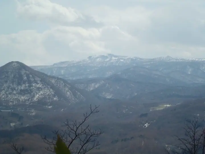
Mount Soranuma hiking routes
Hiking times are estimates calculated from the terrain.
Lists that include Mount Soranuma
100 Famous Mountains of Flowers · Hokkaido 100 Famous Mountains · 50 Peaks of Sapporo · Elevations of 1003 Mountains of Japan · 1000 Mountains of Japan
Mount Soranuma facts
- Elevation
- 1,251 m
- Location
- Sapporo, Hokkaido
42.864983, 141.253619 - National Park
- 支笏洞爺国立公園
- Website
- www.sapporo.travel
- Wikipedia
- ja.wikipedia.org