
Mt. Okuteineyama
奥手稲山
Sapporo, Hokkaido / Otaru, Hokkaido · Elevation 949 m
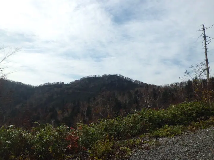
Mt. Okuteineyama is a 948.9-meter peak in the Yoichi Range, straddling the boundary between Teine and Minami wards of Sapporo, Hokkaido. The name ("deep Teine") reflects its position behind the better-known Mt. Teineyama. A mountain lodge built in 1930 about two kilometers south of the summit — originally run by Japanese National Railways and later by the Hokkaido University Mountaineering Club — made the peak a longtime favourite for ski mountaineering. It is one of the 50 peaks selected by Sapporo City in its "Sapporo 50 Mountains" canon.
Mt. Okuteineyama at a glance
- Weather: The most settled day in the next 7 days is Thu, November 5: clear, gusts up to 9 m/s. Sat, Nov 7, Sun, Nov 8: strong wind (gusts up to 21 m/s).
Mt. Okuteineyama weather (hourly, 14 days)
Sunrise today 06:12, sunset 16:27
| Tue, 11/3 | Wed, 11/4 | Thu, 11/5 | Fri, 11/6 | Sat, 11/7 | Sun, 11/8 | Mon, 11/9 | Tue, 11/10 | Wed, 11/11 | Thu, 11/12 | Fri, 11/13 | Sat, 11/14 | Sun, 11/15 | Mon, 11/16 | Tue, 11/17 | |||||||||||||||||||||||||||||||||||||||||||||||||||||||||||||||||||||||
|---|---|---|---|---|---|---|---|---|---|---|---|---|---|---|---|---|---|---|---|---|---|---|---|---|---|---|---|---|---|---|---|---|---|---|---|---|---|---|---|---|---|---|---|---|---|---|---|---|---|---|---|---|---|---|---|---|---|---|---|---|---|---|---|---|---|---|---|---|---|---|---|---|---|---|---|---|---|---|---|---|---|---|---|---|---|
| Japan time | 15 | 17 | 19 | 21 | 23 | 1 | 3 | 5 | 7 | 9 | 11 | 13 | 15 | 18 | 21 | 0 | 3 | 6 | 9 | 12 | 15 | 18 | 21 | 0 | 3 | 6 | 9 | 12 | 15 | 18 | 21 | 0 | 3 | 6 | 9 | 12 | 15 | 18 | 21 | 0 | 3 | 6 | 9 | 12 | 15 | 18 | 21 | 0 | 3 | 6 | 9 | 15 | 21 | 3 | 9 | 15 | 21 | 3 | 9 | 15 | 21 | 3 | 9 | 15 | 21 | 3 | 9 | 15 | 21 | 3 | 9 | 15 | 21 | 3 | 9 | 15 | 21 | 3 | 9 | 15 | 21 | 3 | 9 | 15 | |
  |   |   |   | |   | | | | |  | | |  | | | | | |   | |   | |   | |   |   |   | | |   | | | |   | | | | | | | | | | | | | |   | | |   | | | | | | |   | | | | | | | | | | | | | | | | | | | |   | | | | | | ||
| Temperature | °C | 0° | -2° | -3° | -4° | -3° | -3° | -1° | -1° | -1° | 0° | 1° | 2° | 2° | -4° | -3° | -3° | -1° | 0° | 5° | 9° | 8° | 3° | 3° | 4° | 5° | 5° | 8° | 10° | 7° | 2° | -1° | -4° | -5° | -5° | -5° | -4° | -4° | -5° | -5° | -6° | -6° | -6° | -5° | -4° | -4° | -5° | -5° | -6° | -6° | -6° | -5° | -5° | -7° | -10° | -4° | -3° | -6° | -6° | -2° | -1° | -5° | -4° | -1° | -2° | -4° | -6° | -6° | -5° | -4° | -4° | -1° | 1° | -6° | 0° | 4° | 4° | 2° | 2° | -1° | -3° | -5° | -7° | -2° | -1° |
| Precipitation | mm | 0.1 | 0.6 | 3.5 | 1.4 | 2.1 | 1.8 | 2.0 | 0.1 | 0.9 | 0.6 | 0.4 | 1.2 | 1.2 | 1.5 | 1.4 | 1.5 | 1.2 | 1.3 | 1.2 | 1.2 | 1.1 | 1.4 | 1.2 | 0.7 | 0.5 | 0.4 | 0.2 | 0.1 | 0.9 | 0.6 | 0.3 | 0.8 | 0.3 | 0.6 | 0.7 | 1.1 | 0.7 | 0.2 | 0.3 | 1.7 | 4.7 | 2.9 | 0.7 | |||||||||||||||||||||||||||||||||||||||||
| New snow | cm | <.1 | 0.1 | 0.6 | 3.5 | 1.4 | <.1 | <.1 | 0.3 | 1.2 | 1.2 | 1.5 | 1.4 | 1.5 | 1.1 | 1.3 | 1.2 | 1.2 | 1.1 | 1.4 | 1.2 | 0.7 | 0.5 | 0.4 | 0.1 | 0.1 | <.1 | <.1 | <.1 | <.1 | <.1 | <.1 | 0.9 | 0.6 | <.1 | 0.3 | 0.8 | <.1 | 0.3 | 0.6 | 0.7 | 1.1 | 0.7 | 1.1 | 2.6 | 0.7 | <.1 | ||||||||||||||||||||||||||||||||||||||
| Snow depth | cm | <1 | <1 | <1 | <1 | 1 | 3 | 4 | 4 | 4 | 4 | 3 | 3 | 3 | 3 | 3 | 3 | 3 | 2 | 2 | 1 | 1 | 1 | <1 | <1 | <1 | <1 | 0 | 0 | 0 | 0 | 0 | 1 | 2 | 2 | 3 | 4 | 5 | 5 | 6 | 7 | 8 | 9 | 9 | 9 | 10 | 10 | 10 | 10 | 9 | 9 | 9 | 9 | 9 | 9 | 9 | 8 | 8 | 9 | 9 | 9 | 9 | 9 | 9 | 9 | 9 | 9 | 10 | 10 | 11 | 11 | 11 | 10 | 10 | 10 | 9 | 6 | 4 | 2 | 3 | 4 | 5 | 5 | 5 | 4 |
| Wind | m/s | 5 | 3 | 3 | 2 | 3 | 3 | 3 | 4 | 5 | 4 | 2 | 1 | 1 | 2 | 3 | 4 | 4 | 3 | 2 | 2 | 1 | 2 | 2 | 2 | 2 | 3 | 3 | 3 | 5 | 5 | 4 | 5 | 5 | 6 | 7 | 7 | 6 | 7 | 7 | 7 | 8 | 7 | 5 | 6 | 4 | 5 | 4 | 2 | 2 | 2 | 4 | 4 | 2 | 3 | 1 | 1 | 0 | 1 | 1 | 2 | 2 | 2 | 1 | 4 | 2 | 2 | 5 | 4 | 3 | 2 | 1 | 1 | 3 | 3 | 2 | 2 | 2 | 2 | 3 | 5 | 5 | 3 | 2 | 2 |
| Wind gusts | m/s | 15 | 14 | 10 | 11 | 11 | 14 | 12 | 14 | 15 | 15 | 13 | 7 | 6 | 7 | 10 | 11 | 11 | 11 | 9 | 7 | 6 | 5 | 6 | 8 | 8 | 9 | 10 | 12 | 15 | 18 | 16 | 19 | 18 | 18 | 20 | 21 | 21 | 21 | 22 | 22 | 24 | 23 | 20 | 19 | 19 | 15 | 14 | 12 | 9 | 8 | 11 | 13 | 11 | 8 | 8 | 6 | 5 | 3 | 4 | 8 | 7 | 7 | 7 | 13 | 12 | 8 | 15 | 16 | 12 | 9 | 7 | 5 | 8 | 9 | 11 | 10 | 11 | 9 | 9 | 14 | 15 | 13 | 9 | 7 |
| Wind dir. | ↓ | ↓ | ↓ | ↓ | ↓ | ↓ | ↓ | ↓ | ↓ | ↓ | ↓ | ↓ | ↓ | ↓ | ↓ | ↓ | ↓ | ↓ | ↓ | ↓ | ↓ | ↓ | ↓ | ↓ | ↓ | ↓ | ↓ | ↓ | ↓ | ↓ | ↓ | ↓ | ↓ | ↓ | ↓ | ↓ | ↓ | ↓ | ↓ | ↓ | ↓ | ↓ | ↓ | ↓ | ↓ | ↓ | ↓ | ↓ | ↓ | ↓ | ↓ | ↓ | ↓ | ↓ | ↓ | ↓ | ↓ | ↓ | ↓ | ↓ | ↓ | ↓ | ↓ | ↓ | ↓ | ↓ | ↓ | ↓ | ↓ | ↓ | ↓ | ↓ | ↓ | ↓ | ↓ | ↓ | ↓ | ↓ | ↓ | ↓ | ↓ | ↓ | ↓ | ↓ | |
Huts, campsites and lodging near Mt. Okuteineyama
Mountain huts
Lists that include Mt. Okuteineyama
Mt. Okuteineyama facts
- Elevation
- 949 m
- Location
- Sapporo, Hokkaido / Otaru, Hokkaido
43.087390, 141.153175 - Wikipedia
- ja.wikipedia.org