
Mount Nokogiri
鋸岳
Hokuto, Yamanashi · Elevation 2,685 m
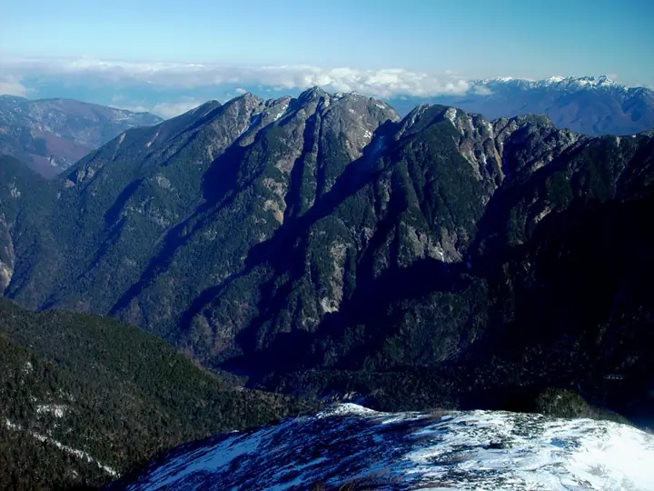
Mount Nokogiri is a 2,685 m peak with its summit in Hokuto City, Yamanashi Prefecture, along the border with Ina City, Nagano Prefecture, standing at the northern end of the Akaishi Range within Southern Alps National Park. The serrated ridge linking its First and Second High Points — sharp as a saw, hence the name — runs northwest of Kai-Komagatake and forms the drainage divide between the Fuji River system (the Kamanashi) and the Todai tributaries of the Tenryū. The mountain requires confident route-finding plus chain and rope work on exposed rock. The principal approaches are a long all-day climb from the Kamanashi forest-road gate on the Yamanashi side, and a traverse from Kai-Komagatake reached via Kitazawa Pass on the Nagano side, served by the Southern Alps forest-road bus operated by Ina City from Todai-guchi.
Mount Nokogiri at a glance
- Weather: The most settled day in the next 7 days is Sun, November 8: clear, gusts up to 9 m/s. Sat, Nov 7: strong wind (gusts up to 17 m/s).
- Route: The shortest is Mount Nokogiri First Summit Return via Yokodake Pass: about 14 h 10 min, 26.5 km, about 2,000 m of climbing.
Mount Nokogiri weather (hourly, 14 days)
Sunrise today 06:10, sunset 16:51
| Tue, 11/3 | Wed, 11/4 | Thu, 11/5 | Fri, 11/6 | Sat, 11/7 | Sun, 11/8 | Mon, 11/9 | Tue, 11/10 | Wed, 11/11 | Thu, 11/12 | Fri, 11/13 | Sat, 11/14 | Sun, 11/15 | Mon, 11/16 | Tue, 11/17 | |||||||||||||||||||||||||||||||||||||||||||||||||||||||||||||||||||||||
|---|---|---|---|---|---|---|---|---|---|---|---|---|---|---|---|---|---|---|---|---|---|---|---|---|---|---|---|---|---|---|---|---|---|---|---|---|---|---|---|---|---|---|---|---|---|---|---|---|---|---|---|---|---|---|---|---|---|---|---|---|---|---|---|---|---|---|---|---|---|---|---|---|---|---|---|---|---|---|---|---|---|---|---|---|---|
| Japan time | 15 | 17 | 19 | 21 | 23 | 1 | 3 | 5 | 7 | 9 | 11 | 13 | 15 | 18 | 21 | 0 | 3 | 6 | 9 | 12 | 15 | 18 | 21 | 0 | 3 | 6 | 9 | 12 | 15 | 18 | 21 | 0 | 3 | 6 | 9 | 12 | 15 | 18 | 21 | 0 | 3 | 6 | 9 | 12 | 15 | 18 | 21 | 0 | 3 | 6 | 9 | 15 | 21 | 3 | 9 | 15 | 21 | 3 | 9 | 15 | 21 | 3 | 9 | 15 | 21 | 3 | 9 | 15 | 21 | 3 | 9 | 15 | 21 | 3 | 9 | 15 | 21 | 3 | 9 | 15 | 21 | 3 | 9 | 15 | |
  |   | | |   | |  | | | | |   |   |   | | | | | | |   | | |  | |   | |  | | | | | |   | | | | | | | | | | | | | | | | | | |   |   | | | | |   | | |  | | | | | | | | | | | | | | | | | |   | | | | | ||
| Temperature | °C | 4° | -2° | -4° | -5° | -6° | -6° | -6° | -6° | -4° | 2° | 5° | 6° | 3° | 0° | 0° | 0° | 0° | 1° | 4° | 8° | 5° | 2° | 0° | 0° | 1° | 1° | 5° | 9° | 7° | -1° | -3° | -5° | -6° | -7° | -2° | 2° | 0° | -7° | -8° | -8° | -7° | -7° | 1° | 4° | 2° | -5° | -3° | -3° | -3° | -3° | 0° | 2° | -5° | -7° | -1° | 0° | -4° | -7° | -6° | -3° | -8° | -6° | -1° | 1° | -6° | -6° | -1° | 1° | -7° | -6° | 1° | 3° | -6° | -6° | 2° | 3° | 1° | 0° | 6° | 5° | -4° | -5° | 0° | 1° |
| Precipitation | mm | 0.4 | 0.1 | 5 | 10 | 6 | 1.6 | 0.4 | 0.2 | 0.1 | 8 | 14 | 0.1 | ||||||||||||||||||||||||||||||||||||||||||||||||||||||||||||||||||||||||
| New snow | cm | 0.1 | |||||||||||||||||||||||||||||||||||||||||||||||||||||||||||||||||||||||||||||||||||
| Snow depth | cm | 0 | 0 | 0 | 0 | 0 | 0 | 0 | 0 | 0 | 0 | 0 | 0 | 0 | 0 | 0 | 0 | 0 | 0 | 0 | 0 | 0 | 0 | 0 | 0 | 0 | 0 | 0 | 0 | 0 | 0 | 0 | 0 | 0 | 0 | 0 | 0 | 0 | 0 | 0 | 0 | 0 | 0 | 0 | 0 | 0 | 0 | 0 | 0 | 0 | 0 | 0 | 0 | 0 | 0 | 0 | 0 | 0 | 0 | 0 | 0 | 0 | 0 | 0 | 0 | 0 | 0 | 0 | 0 | 0 | 0 | 0 | 0 | 0 | 0 | 0 | 0 | 0 | 0 | 0 | 0 | 0 | 0 | 0 | 0 |
| Wind | m/s | 1 | 0 | 1 | 2 | 1 | 1 | 1 | 1 | 1 | 1 | 1 | 0 | 1 | 2 | 2 | 3 | 2 | 1 | 1 | 1 | 2 | 1 | 2 | 2 | 3 | 2 | 2 | 3 | 3 | 3 | 2 | 2 | 3 | 3 | 3 | 4 | 3 | 2 | 2 | 2 | 2 | 1 | 0 | 1 | 1 | 1 | 2 | 2 | 2 | 2 | 2 | 1 | 2 | 2 | 1 | 3 | 3 | 4 | 4 | 2 | 1 | 1 | 2 | 2 | 1 | 2 | 2 | 1 | 1 | 1 | 1 | 1 | 2 | 2 | 2 | 1 | 2 | 2 | 2 | 4 | 1 | 1 | 0 | 1 |
| Wind gusts | m/s | 8 | 7 | 8 | 9 | 9 | 9 | 9 | 8 | 8 | 7 | 7 | 6 | 6 | 10 | 11 | 13 | 16 | 14 | 8 | 9 | 13 | 12 | 11 | 12 | 15 | 15 | 13 | 14 | 14 | 14 | 15 | 15 | 16 | 15 | 16 | 17 | 17 | 13 | 12 | 11 | 11 | 10 | 9 | 8 | 9 | 8 | 11 | 13 | 13 | 13 | 13 | 14 | 8 | 10 | 11 | 14 | 14 | 19 | 20 | 18 | 12 | 8 | 10 | 13 | 11 | 9 | 11 | 11 | 8 | 7 | 7 | 8 | 9 | 11 | 11 | 14 | 16 | 19 | 15 | 15 | 14 | 8 | 6 | 8 |
| Wind dir. | ↓ | ↓ | ↓ | ↓ | ↓ | ↓ | ↓ | ↓ | ↓ | ↓ | ↓ | ↓ | ↓ | ↓ | ↓ | ↓ | ↓ | ↓ | ↓ | ↓ | ↓ | ↓ | ↓ | ↓ | ↓ | ↓ | ↓ | ↓ | ↓ | ↓ | ↓ | ↓ | ↓ | ↓ | ↓ | ↓ | ↓ | ↓ | ↓ | ↓ | ↓ | ↓ | ↓ | ↓ | ↓ | ↓ | ↓ | ↓ | ↓ | ↓ | ↓ | ↓ | ↓ | ↓ | ↓ | ↓ | ↓ | ↓ | ↓ | ↓ | ↓ | ↓ | ↓ | ↓ | ↓ | ↓ | ↓ | ↓ | ↓ | ↓ | ↓ | ↓ | ↓ | ↓ | ↓ | ↓ | ↓ | ↓ | ↓ | ↓ | ↓ | ↓ | ↓ | ↓ | |
Mount Nokogiri hiking routes
Hiking times are estimates calculated from the terrain.
Huts, campsites and lodging near Mount Nokogiri
Mountain huts
- 六合目小屋 unstaffed
- Shichijo Cabin Annex 2026: open all year · reservation required · sleeps 24
- Shichijo Cabin 2026: open all year · reservation required · sleeps 24
- 北沢峠こもれび山荘 2026: open April 25–November 3 · reservation required · sleeps 67
- Odairasanso 2026: open July 5–October 25 · reservation required · sleeps 50
Campsites
- 長衛小屋テント場
Lists that include Mount Nokogiri
Japan 200 Famous Mountains · Japan's 300 Famous Mountains · Japan's 100 Highest Mountains · Yamanashi 100 Famous Mountains · Shinshu 100 Famous Mountains · Shinshu Mountain Cards · Elevations of 1003 Mountains of Japan · 1000 Mountains of Japan
Mount Nokogiri facts
- Elevation
- 2,685 m
- Location
- Hokuto, Yamanashi
35.778994, 138.210078 - National Park
- 南アルプス国立公園
- Website
- www.yamanashi-kankou.jp
- Trail Map
- www.pref.yamanashi.jp (PDF)
- Access Information
- www.inacity.jp
- Wikipedia
- ja.wikipedia.org