
Mt. Hachibuseyama
鉢伏山
Okaya, Nagano · Elevation 1,929 m
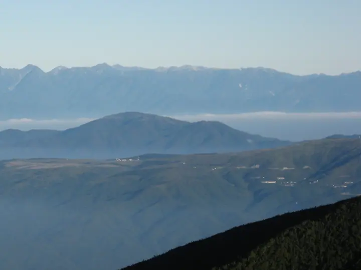
Hachibuse-yama (1,929 m) lies on the boundary of Matsumoto and Okaya cities in central Nagano Prefecture, the principal peak of the northern Chikuma range between Kirigamine and Takabocchi. It is included in the 300 Famous Mountains, the (New) 100 Famous Flower Mountains and the 100 Famous Mountains of Shinshū. The gentle inverted-bowl profile that gives the mountain its name supports a sweeping 360-degree summit view across the Northern, Central and Southern Alps to Mount Ontake, Mount Fuji and the Yatsugatake. From mid-June some 300,000 Japanese azaleas (rengetsutsuji) cover the upper slopes, drawing visitors to the open ridge.
Mt. Hachibuseyama at a glance
- Weather: The most settled day in the next 7 days is Wed, November 4: clear, gusts up to 5 m/s. Sat, Nov 7: strong wind (gusts up to 18 m/s).
- Route: The shortest is Mount Hachibuse Circuit from Gofukuji: about 6 h 43 min, 13.7 km, about 1,060 m of climbing.
Mt. Hachibuseyama weather (hourly, 14 days)
Sunrise today 06:12, sunset 16:51
| Tue, 11/3 | Wed, 11/4 | Thu, 11/5 | Fri, 11/6 | Sat, 11/7 | Sun, 11/8 | Mon, 11/9 | Tue, 11/10 | Wed, 11/11 | Thu, 11/12 | Fri, 11/13 | Sat, 11/14 | Sun, 11/15 | Mon, 11/16 | Tue, 11/17 | |||||||||||||||||||||||||||||||||||||||||||||||||||||||||||||||||||||||
|---|---|---|---|---|---|---|---|---|---|---|---|---|---|---|---|---|---|---|---|---|---|---|---|---|---|---|---|---|---|---|---|---|---|---|---|---|---|---|---|---|---|---|---|---|---|---|---|---|---|---|---|---|---|---|---|---|---|---|---|---|---|---|---|---|---|---|---|---|---|---|---|---|---|---|---|---|---|---|---|---|---|---|---|---|---|
| Japan time | 15 | 17 | 19 | 21 | 23 | 1 | 3 | 5 | 7 | 9 | 11 | 13 | 15 | 18 | 21 | 0 | 3 | 6 | 9 | 12 | 15 | 18 | 21 | 0 | 3 | 6 | 9 | 12 | 15 | 18 | 21 | 0 | 3 | 6 | 9 | 12 | 15 | 18 | 21 | 0 | 3 | 6 | 9 | 12 | 15 | 18 | 21 | 0 | 3 | 6 | 9 | 15 | 21 | 3 | 9 | 15 | 21 | 3 | 9 | 15 | 21 | 3 | 9 | 15 | 21 | 3 | 9 | 15 | 21 | 3 | 9 | 15 | 21 | 3 | 9 | 15 | 21 | 3 | 9 | 15 | 21 | 3 | 9 | 15 | |
  |   |  | | | | | | | |  | |   |   | |   | |   |   | |   | |   | | | | | | |  | | | | | | | | | | | | | | | | | | | | | | | | | | | |   |   | | |  | | | | | | | | | | | | | |   | | | |   | | | | | ||
| Temperature | °C | 6° | 3° | 0° | 0° | 0° | 0° | 0° | -1° | 0° | 4° | 8° | 10° | 10° | 5° | 5° | 3° | 3° | 3° | 6° | 9° | 10° | 7° | 6° | 5° | 5° | 5° | 10° | 13° | 11° | 5° | 3° | 2° | 1° | 0° | 3° | 5° | 3° | -2° | -4° | -5° | -5° | -5° | 1° | 5° | 3° | -1° | -1° | -1° | 0° | 0° | 6° | 5° | -1° | -2° | 4° | 6° | 1° | -2° | -1° | 1° | -4° | -5° | 1° | 6° | -3° | -2° | 1° | 1° | -4° | -5° | 1° | 9° | 0° | 0° | 5° | 8° | 5° | 5° | 9° | 6° | -1° | -4° | -1° | 5° |
| Precipitation | mm | 2.0 | 10 | 3.1 | 1.5 | 0.4 | 0.1 | 0.4 | 0.3 | 8 | 9 | 1.2 | 0.5 | ||||||||||||||||||||||||||||||||||||||||||||||||||||||||||||||||||||||||
| New snow | cm | <.1 | <.1 | ||||||||||||||||||||||||||||||||||||||||||||||||||||||||||||||||||||||||||||||||||
| Snow depth | cm | 0 | 0 | 0 | 0 | 0 | 0 | 0 | 0 | 0 | 0 | 0 | 0 | 0 | 0 | 0 | 0 | 0 | 0 | 0 | 0 | 0 | 0 | 0 | 0 | 0 | 0 | 0 | 0 | 0 | 0 | 0 | 0 | 0 | 0 | 0 | 0 | 0 | 0 | 0 | 0 | 0 | 0 | 0 | 0 | 0 | 0 | 0 | 0 | 0 | 0 | 0 | 0 | 0 | 0 | 0 | 0 | 0 | 0 | 0 | 0 | 0 | 0 | 0 | 0 | 0 | 0 | 0 | 0 | 0 | 0 | 0 | 0 | 0 | 0 | 0 | 0 | 0 | 0 | 0 | 0 | 0 | 0 | 0 | 0 |
| Wind | m/s | 3 | 2 | 2 | 1 | 1 | 1 | 1 | 1 | 1 | 1 | 1 | 1 | 1 | 1 | 1 | 2 | 1 | 0 | 0 | 1 | 2 | 2 | 2 | 2 | 3 | 2 | 3 | 4 | 4 | 2 | 2 | 3 | 3 | 4 | 5 | 6 | 5 | 1 | 2 | 2 | 2 | 2 | 2 | 2 | 3 | 2 | 1 | 1 | 1 | 1 | 1 | 3 | 2 | 1 | 1 | 5 | 3 | 4 | 1 | 4 | 1 | 1 | 2 | 1 | 1 | 2 | 2 | 3 | 1 | 0 | 1 | 2 | 2 | 3 | 3 | 4 | 3 | 3 | 3 | 3 | 3 | 2 | 1 | 2 |
| Wind gusts | m/s | 8 | 8 | 5 | 5 | 3 | 3 | 3 | 3 | 3 | 4 | 5 | 5 | 5 | 4 | 4 | 4 | 5 | 7 | 4 | 5 | 7 | 8 | 6 | 8 | 9 | 9 | 10 | 13 | 14 | 12 | 8 | 9 | 10 | 12 | 15 | 18 | 18 | 14 | 4 | 4 | 6 | 6 | 6 | 7 | 10 | 9 | 6 | 5 | 4 | 5 | 6 | 9 | 8 | 5 | 5 | 16 | 15 | 14 | 14 | 14 | 12 | 4 | 7 | 11 | 8 | 6 | 7 | 10 | 10 | 5 | 5 | 8 | 8 | 10 | 11 | 15 | 11 | 14 | 11 | 11 | 11 | 8 | 6 | 7 |
| Wind dir. | ↓ | ↓ | ↓ | ↓ | ↓ | ↓ | ↓ | ↓ | ↓ | ↓ | ↓ | ↓ | ↓ | ↓ | ↓ | ↓ | ↓ | ↓ | ↓ | ↓ | ↓ | ↓ | ↓ | ↓ | ↓ | ↓ | ↓ | ↓ | ↓ | ↓ | ↓ | ↓ | ↓ | ↓ | ↓ | ↓ | ↓ | ↓ | ↓ | ↓ | ↓ | ↓ | ↓ | ↓ | ↓ | ↓ | ↓ | ↓ | ↓ | ↓ | ↓ | ↓ | ↓ | ↓ | ↓ | ↓ | ↓ | ↓ | ↓ | ↓ | ↓ | ↓ | ↓ | ↓ | ↓ | ↓ | ↓ | ↓ | ↓ | ↓ | ↓ | ↓ | ↓ | ↓ | ↓ | ↓ | ↓ | ↓ | ↓ | ↓ | ↓ | ↓ | ↓ | ↓ | |
Mt. Hachibuseyama hiking routes
Hiking times are estimates calculated from the terrain.
Huts, campsites and lodging near Mt. Hachibuseyama
Mountain huts
Campsites
- Takabocchi Plateau Campground
Lodging
- 薬師平茜宿
Lists that include Mt. Hachibuseyama
Japan's 300 Famous Mountains · New 100 Famous Flower Mountains · Koshinetsu 100 Famous Mountains · Shinshu 100 Famous Mountains · Elevations of 1003 Mountains of Japan · 1000 Mountains of Japan
Mt. Hachibuseyama facts
- Elevation
- 1,929 m
- Location
- Okaya, Nagano
36.163037, 138.059167 - Website
- www.kanko-okaya.jp
- Trail Map
- www.city.matsumoto.nagano.jp (PDF)
- Access Information
- www.city.matsumoto.nagano.jp
- Wikipedia
- ja.wikipedia.org