
Mount Sanpo
三宝山
Kawakami, Nagano / Chichibu, Saitama · Elevation 2,483 m
Mount Sanpo (2,483.5 m) rises on the border of Chichibu (Saitama) and Kawakami (Minamisaku District, Nagano) and is the highest peak in Saitama Prefecture. It stands about 20 minutes north of Mount Kobushi-ga-take (a 100 Famous Mountain) along the main ridge of the Okuchichibu range, on the watershed dividing the Shinano, Ara and Chikuma rivers. The summit hosts a first-class triangulation point and lies within both Chichibu-Tama-Kai National Park and Kobushi UNESCO Biosphere Reserve.
Mount Sanpo at a glance
- Weather: The most settled day in the next 7 days is Sun, November 8: clear, gusts up to 6 m/s.
- Route: The shortest is Mount Kobushigatake and Mount Sanpo Loop from Mokidaira via the Chikuma River Source and Jumonji Pass: about 9 h 35 min, 15.3 km, about 1,380 m of climbing.
Mount Sanpo weather (hourly, 14 days)
Sunrise today 06:09, sunset 16:49
| Tue, 11/3 | Wed, 11/4 | Thu, 11/5 | Fri, 11/6 | Sat, 11/7 | Sun, 11/8 | Mon, 11/9 | Tue, 11/10 | Wed, 11/11 | Thu, 11/12 | Fri, 11/13 | Sat, 11/14 | Sun, 11/15 | Mon, 11/16 | Tue, 11/17 | |||||||||||||||||||||||||||||||||||||||||||||||||||||||||||||||||||||||
|---|---|---|---|---|---|---|---|---|---|---|---|---|---|---|---|---|---|---|---|---|---|---|---|---|---|---|---|---|---|---|---|---|---|---|---|---|---|---|---|---|---|---|---|---|---|---|---|---|---|---|---|---|---|---|---|---|---|---|---|---|---|---|---|---|---|---|---|---|---|---|---|---|---|---|---|---|---|---|---|---|---|---|---|---|---|
| Japan time | 21 | 23 | 1 | 3 | 5 | 7 | 9 | 11 | 13 | 15 | 17 | 19 | 21 | 0 | 3 | 6 | 9 | 12 | 15 | 18 | 21 | 0 | 3 | 6 | 9 | 12 | 15 | 18 | 21 | 0 | 3 | 6 | 9 | 12 | 15 | 18 | 21 | 0 | 3 | 6 | 9 | 12 | 15 | 18 | 21 | 0 | 3 | 6 | 9 | 12 | 15 | 21 | 3 | 9 | 15 | 21 | 3 | 9 | 15 | 21 | 3 | 9 | 15 | 21 | 3 | 9 | 15 | 21 | 3 | 9 | 15 | 21 | 3 | 9 | 15 | 21 | 3 | 9 | 15 | 21 | 3 | 9 | 15 | 21 | |
  | |   | | |   | | |   | | | | | | |   |   |   | |   | |  |   | |  | | | | | | | | | | | | | | | |   | | | | | | | | | | |   | |   |   | | |   | |   |  | | |   | | | | | | | | | | | | | | | | | | | | | ||
| Temperature | °C | -2° | -1° | -1° | -1° | -1° | -1° | 0° | 3° | 3° | 1° | 0° | -1° | -1° | 0° | 0° | 1° | 4° | 9° | 6° | 3° | 2° | 1° | 2° | 1° | 6° | 10° | 9° | 1° | -2° | -4° | -6° | -6° | 1° | 2° | 1° | -5° | -7° | -7° | -8° | -8° | 1° | 3° | 1° | -3° | -3° | -3° | -2° | -2° | 0° | 3° | 0° | -4° | -6° | -4° | -1° | -4° | -6° | -4° | -4° | -8° | -8° | -1° | 0° | -5° | -7° | -1° | 0° | -7° | -7° | 1° | 2° | -6° | -5° | 2° | 4° | 1° | 1° | 7° | 4° | -4° | -4° | -1° | 0° | -3° |
| Precipitation | mm | 0.5 | 0.4 | 0.1 | 0.2 | 0.2 | 0.7 | 2.0 | 8 | 9 | 6 | 0.5 | 0.1 | 0.6 | 0.1 | 0.3 | 0.6 | 0.2 | 0.6 | 1.2 | 1.6 | 6 | 2.9 | 0.5 | 0.2 | 0.2 | 6 | 9 | 0.3 | 0.4 | 0.1 | ||||||||||||||||||||||||||||||||||||||||||||||||||||||
| New snow | cm | 0.4 | 3.6 | 2.0 | <.1 | 0.2 | <.1 | ||||||||||||||||||||||||||||||||||||||||||||||||||||||||||||||||||||||||||||||
| Snow depth | cm | 0 | 0 | 0 | 0 | 0 | 0 | 0 | 0 | 0 | 0 | 0 | 0 | 0 | 0 | 0 | 0 | 0 | 0 | 0 | 0 | 0 | 0 | 0 | 0 | 0 | 0 | 0 | 0 | 0 | 0 | 0 | 0 | 0 | 0 | 0 | 0 | 0 | 0 | 0 | 0 | 0 | 0 | 0 | 0 | 0 | 0 | 0 | 0 | 0 | 0 | 0 | <1 | 3 | 4 | 2 | <1 | <1 | <1 | <1 | <1 | <1 | <1 | <1 | <1 | <1 | <1 | <1 | <1 | <1 | <1 | <1 | <1 | <1 | <1 | <1 | <1 | 0 | 0 | 0 | 0 | 0 | 0 | 0 | 0 |
| Wind | m/s | 0 | 0 | 0 | 0 | 0 | 1 | 1 | 2 | 2 | 2 | 2 | 2 | 2 | 2 | 0 | 0 | 1 | 1 | 1 | 1 | 2 | 2 | 3 | 2 | 2 | 3 | 2 | 2 | 2 | 2 | 3 | 3 | 3 | 3 | 3 | 2 | 1 | 1 | 1 | 1 | 0 | 1 | 2 | 1 | 1 | 1 | 1 | 1 | 1 | 0 | 2 | 1 | 0 | 1 | 1 | 1 | 4 | 8 | 6 | 3 | 1 | 0 | 1 | 0 | 2 | 4 | 2 | 2 | 1 | 1 | 1 | 1 | 1 | 2 | 1 | 2 | 2 | 2 | 4 | 3 | 1 | 0 | 1 | 1 |
| Wind gusts | m/s | 3 | 3 | 3 | 3 | 3 | 3 | 5 | 6 | 7 | 7 | 6 | 6 | 7 | 7 | 7 | 6 | 5 | 5 | 5 | 5 | 6 | 8 | 10 | 10 | 7 | 11 | 11 | 8 | 8 | 8 | 9 | 10 | 11 | 12 | 12 | 9 | 7 | 6 | 6 | 5 | 5 | 6 | 6 | 5 | 5 | 6 | 7 | 7 | 6 | 6 | 7 | 4 | 4 | 5 | 7 | 6 | 12 | 24 | 24 | 18 | 8 | 6 | 7 | 6 | 5 | 12 | 14 | 8 | 6 | 4 | 6 | 5 | 5 | 6 | 9 | 8 | 11 | 10 | 13 | 14 | 8 | 5 | 6 | 5 |
| Wind dir. | ↓ | ↓ | ↓ | ↓ | ↓ | ↓ | ↓ | ↓ | ↓ | ↓ | ↓ | ↓ | ↓ | ↓ | ↓ | ↓ | ↓ | ↓ | ↓ | ↓ | ↓ | ↓ | ↓ | ↓ | ↓ | ↓ | ↓ | ↓ | ↓ | ↓ | ↓ | ↓ | ↓ | ↓ | ↓ | ↓ | ↓ | ↓ | ↓ | ↓ | ↓ | ↓ | ↓ | ↓ | ↓ | ↓ | ↓ | ↓ | ↓ | ↓ | ↓ | ↓ | ↓ | ↓ | ↓ | ↓ | ↓ | ↓ | ↓ | ↓ | ↓ | ↓ | ↓ | ↓ | ↓ | ↓ | ↓ | ↓ | ↓ | ↓ | ↓ | ↓ | ↓ | ↓ | ↓ | ↓ | ↓ | ↓ | ↓ | ↓ | ↓ | ↓ | ↓ | ↓ | |
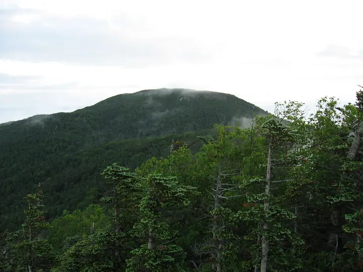
Mount Sanpo hiking routes
Hiking times are estimates calculated from the terrain.
Huts, campsites and lodging near Mount Sanpo
Mountain huts
Lists that include Mount Sanpo
Highest Peaks by Prefecture · 50 Mountains of Saitama Prefecture · Elevations of 1003 Mountains of Japan
Mount Sanpo facts
- Elevation
- 2,483 m
- Location
- Kawakami, Nagano / Chichibu, Saitama
35.917629, 138.727820 - National Park
- 秩父多摩甲斐国立公園
- Website
- www.vill.kawakami.nagano.jp
- Wikipedia
- ja.wikipedia.org