
Mount Kamihiruzen
上蒜山
Kurayoshi, Tottori · Elevation 1,202 m
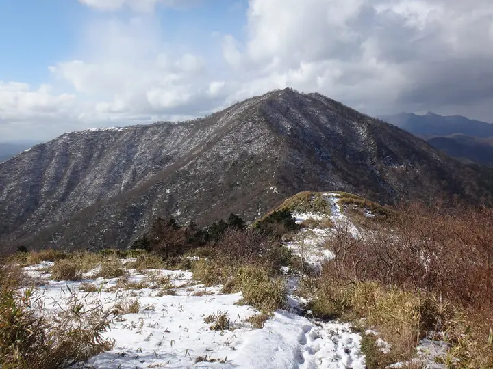
Mount Kamihiruzen is a 1202 m mountain on the border of Okayama and Tottori prefectures. A traverse leads from Shimohiruzen via Nakahiruzen to Kamihiruzen, which offers views of Daisen and Karasugasen. Beech woods near the ridge and hayfields and pastures on the slopes and foothills create a pastoral landscape. Dogtooth violets bloom along the traverse in May.
Mount Kamihiruzen at a glance
- Weather: The most settled day in the next 7 days is Wed, November 4: clear, gusts up to 8 m/s. Sat, Nov 7: strong wind (gusts up to 15 m/s).
- Route: The shortest is Shimo-Hiruzen to Kami-Hiruzen Three-Peak Ridge Traverse: about 7 h 20 min, 11.3 km, about 1,160 m of climbing.
Mount Kamihiruzen weather (hourly, 14 days)
Sunrise today 06:28, sunset 17:10
| Tue, 11/3 | Wed, 11/4 | Thu, 11/5 | Fri, 11/6 | Sat, 11/7 | Sun, 11/8 | Mon, 11/9 | Tue, 11/10 | Wed, 11/11 | Thu, 11/12 | Fri, 11/13 | Sat, 11/14 | Sun, 11/15 | Mon, 11/16 | Tue, 11/17 | |||||||||||||||||||||||||||||||||||||||||||||||||||||||||||||||||||||||
|---|---|---|---|---|---|---|---|---|---|---|---|---|---|---|---|---|---|---|---|---|---|---|---|---|---|---|---|---|---|---|---|---|---|---|---|---|---|---|---|---|---|---|---|---|---|---|---|---|---|---|---|---|---|---|---|---|---|---|---|---|---|---|---|---|---|---|---|---|---|---|---|---|---|---|---|---|---|---|---|---|---|---|---|---|---|
| Japan time | 21 | 23 | 1 | 3 | 5 | 7 | 9 | 11 | 13 | 15 | 17 | 19 | 21 | 0 | 3 | 6 | 9 | 12 | 15 | 18 | 21 | 0 | 3 | 6 | 9 | 12 | 15 | 18 | 21 | 0 | 3 | 6 | 9 | 12 | 15 | 18 | 21 | 0 | 3 | 6 | 9 | 12 | 15 | 18 | 21 | 0 | 3 | 6 | 9 | 12 | 15 | 21 | 3 | 9 | 15 | 21 | 3 | 9 | 15 | 21 | 3 | 9 | 15 | 21 | 3 | 9 | 15 | 21 | 3 | 9 | 15 | 21 | 3 | 9 | 15 | 21 | 3 | 9 | 15 | 21 | 3 | 9 | 15 | 21 | |
  |   | |   | |   | | |   | | | | |   | | |   |   | |   | | | | | |   | | | | | | |   | | | | | | | | | | | | | | | | | | |   | | | | | | | | | |  | | | | | | | | | | | | | | | | | | | | | | | ||
| Temperature | °C | 4° | 3° | 4° | 4° | 4° | 4° | 8° | 11° | 11° | 10° | 7° | 6° | 6° | 7° | 6° | 7° | 11° | 12° | 13° | 9° | 9° | 8° | 7° | 7° | 9° | 10° | 9° | 5° | 4° | 4° | 4° | 3° | 5° | 6° | 5° | 4° | 4° | 3° | 3° | 2° | 4° | 6° | 5° | 4° | 3° | 3° | 3° | 3° | 7° | 8° | 7° | 1° | 0° | 5° | 6° | 2° | 1° | 3° | 4° | 3° | 1° | 4° | 9° | 3° | 3° | 4° | 5° | 2° | 0° | 6° | 10° | 3° | 5° | 8° | 8° | 9° | 8° | 8° | 5° | 3° | 1° | 3° | 4° | 0° |
| Precipitation | mm | 0.3 | 0.2 | 0.3 | 0.2 | 1.8 | 6 | 3.4 | 0.1 | 1.4 | 0.5 | 0.8 | 0.3 | 0.4 | 0.4 | 0.3 | 0.6 | 2.2 | 0.7 | 1.7 | 0.7 | 1.7 | 0.9 | 1.2 | 3.9 | 1.0 | 6 | 18 | 0.8 | 8 | 14 | 10 | 0.5 | 0.1 | |||||||||||||||||||||||||||||||||||||||||||||||||||
| New snow | cm | ||||||||||||||||||||||||||||||||||||||||||||||||||||||||||||||||||||||||||||||||||||
| Snow depth | cm | 0 | 0 | 0 | 0 | 0 | 0 | 0 | 0 | 0 | 0 | 0 | 0 | 0 | 0 | 0 | 0 | 0 | 0 | 0 | 0 | 0 | 0 | 0 | 0 | 0 | 0 | 0 | 0 | 0 | 0 | 0 | 0 | 0 | 0 | 0 | 0 | 0 | 0 | 0 | 0 | 0 | 0 | 0 | 0 | 0 | 0 | 0 | 0 | 0 | 0 | 0 | 0 | 0 | 0 | 0 | 0 | 0 | 0 | 0 | 0 | 0 | 0 | 0 | 0 | 0 | 0 | 0 | 0 | 0 | 0 | 0 | 0 | 0 | 0 | 0 | 0 | 0 | 0 | 0 | 0 | 0 | 0 | 0 | 0 |
| Wind | m/s | 0 | 0 | 1 | 1 | 1 | 1 | 2 | 2 | 2 | 2 | 1 | 1 | 2 | 2 | 1 | 1 | 0 | 1 | 1 | 1 | 0 | 2 | 1 | 1 | 2 | 5 | 5 | 3 | 4 | 4 | 4 | 4 | 6 | 6 | 5 | 3 | 2 | 2 | 2 | 1 | 1 | 3 | 2 | 0 | 0 | 1 | 1 | 1 | 2 | 3 | 3 | 2 | 1 | 2 | 4 | 5 | 6 | 4 | 3 | 1 | 1 | 1 | 4 | 1 | 2 | 3 | 3 | 1 | 1 | 1 | 1 | 3 | 3 | 4 | 7 | 2 | 2 | 3 | 4 | 3 | 2 | 2 | 1 | 0 |
| Wind gusts | m/s | 2 | 3 | 3 | 3 | 3 | 3 | 5 | 8 | 7 | 7 | 6 | 3 | 5 | 6 | 6 | 4 | 3 | 5 | 6 | 5 | 9 | 7 | 6 | 7 | 9 | 14 | 13 | 12 | 11 | 11 | 11 | 12 | 15 | 15 | 15 | 13 | 9 | 7 | 6 | 4 | 4 | 7 | 8 | 5 | 3 | 3 | 4 | 4 | 7 | 10 | 10 | 8 | 5 | 8 | 13 | 13 | 17 | 14 | 11 | 9 | 4 | 5 | 10 | 10 | 7 | 9 | 10 | 9 | 4 | 4 | 6 | 7 | 9 | 11 | 18 | 18 | 10 | 9 | 11 | 11 | 8 | 6 | 6 | 4 |
| Wind dir. | ↓ | ↓ | ↓ | ↓ | ↓ | ↓ | ↓ | ↓ | ↓ | ↓ | ↓ | ↓ | ↓ | ↓ | ↓ | ↓ | ↓ | ↓ | ↓ | ↓ | ↓ | ↓ | ↓ | ↓ | ↓ | ↓ | ↓ | ↓ | ↓ | ↓ | ↓ | ↓ | ↓ | ↓ | ↓ | ↓ | ↓ | ↓ | ↓ | ↓ | ↓ | ↓ | ↓ | ↓ | ↓ | ↓ | ↓ | ↓ | ↓ | ↓ | ↓ | ↓ | ↓ | ↓ | ↓ | ↓ | ↓ | ↓ | ↓ | ↓ | ↓ | ↓ | ↓ | ↓ | ↓ | ↓ | ↓ | ↓ | ↓ | ↓ | ↓ | ↓ | ↓ | ↓ | ↓ | ↓ | ↓ | ↓ | ↓ | ↓ | ↓ | ↓ | ↓ | ↓ | |
Mount Kamihiruzen live cameras
Mount Kamihiruzen hiking routes
- Shimo-Hiruzen to Kami-Hiruzen Three-Peak Ridge Traverse 11.3 km · Ascent 1,159 m parking → 上蒜山登山口駐車場
Hiking times are estimates calculated from the terrain.
Huts, campsites and lodging near Mount Kamihiruzen
Mountain huts
- 中蒜山避難小屋
- だんだん村
Campsites
- ひるぜん塩釜キャンプ場
- 蒜山高原キャンプ場
- 中蒜山オートキャンプ場
Lodging
- ひるぜん塩釜キャンピングヴィレッジ
- 蒜山倶楽部 Nadja
Lists that include Mount Kamihiruzen
Japan 200 Famous Mountains · Japan's 300 Famous Mountains · New Japan 100 Famous Mountains · 100 Low Mountains of Japan · 100 Famous Hot Spring Mountains · Chugoku 100 Famous Mountains · Okayama Prefecture 100 Famous Mountains · Elevations of 1003 Mountains of Japan · 1000 Mountains of Japan
Mount Kamihiruzen facts
- Elevation
- 1,202 m
- Location
- Kurayoshi, Tottori
35.326689, 133.662382 - Website
- www.env.go.jp
- Wikipedia
- ja.wikipedia.org