
Mount Dainichi
大日岳
Tateyama, Toyama · Elevation 2,501 m
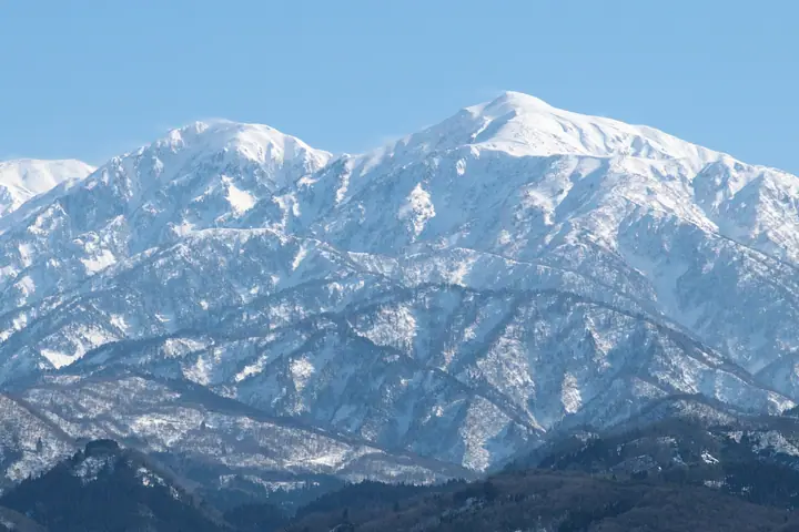
Mount Dainichi is a 2501-meter peak in Tateyama, Toyama Prefecture, on the Dainichi Ridge branching from the Tateyama Range of the Hida Mountains. A round-trip route starts at Shomyo parking area and passes Dainichidaira and Dainichi Hut. The mountain has a gently conical profile, with another route from Murodo via Raichozawa and Okudainichidake.
Mount Dainichi at a glance
- Weather: The most settled day in the next 7 days is Sun, November 8: clear, gusts up to 7 m/s. Fri, Nov 6, Sat, Nov 7: strong wind (gusts up to 17 m/s).
- Route: The shortest is Mount Dainichi Out-and-Back from the Dainichi Trailhead: about 9 h 43 min, 15.5 km, about 1,550 m of climbing.
Mount Dainichi weather (hourly, 14 days)
Sunrise today 06:14, sunset 16:52
| Tue, 11/3 | Wed, 11/4 | Thu, 11/5 | Fri, 11/6 | Sat, 11/7 | Sun, 11/8 | Mon, 11/9 | Tue, 11/10 | Wed, 11/11 | Thu, 11/12 | Fri, 11/13 | Sat, 11/14 | Sun, 11/15 | Mon, 11/16 | Tue, 11/17 | |||||||||||||||||||||||||||||||||||||||||||||||||||||||||||||||||||||||
|---|---|---|---|---|---|---|---|---|---|---|---|---|---|---|---|---|---|---|---|---|---|---|---|---|---|---|---|---|---|---|---|---|---|---|---|---|---|---|---|---|---|---|---|---|---|---|---|---|---|---|---|---|---|---|---|---|---|---|---|---|---|---|---|---|---|---|---|---|---|---|---|---|---|---|---|---|---|---|---|---|---|---|---|---|---|
| Japan time | 15 | 17 | 19 | 21 | 23 | 1 | 3 | 5 | 7 | 9 | 11 | 13 | 15 | 18 | 21 | 0 | 3 | 6 | 9 | 12 | 15 | 18 | 21 | 0 | 3 | 6 | 9 | 12 | 15 | 18 | 21 | 0 | 3 | 6 | 9 | 12 | 15 | 18 | 21 | 0 | 3 | 6 | 9 | 12 | 15 | 18 | 21 | 0 | 3 | 6 | 9 | 15 | 21 | 3 | 9 | 15 | 21 | 3 | 9 | 15 | 21 | 3 | 9 | 15 | 21 | 3 | 9 | 15 | 21 | 3 | 9 | 15 | 21 | 3 | 9 | 15 | 21 | 3 | 9 | 15 | 21 | 3 | 9 | 15 | |
  |  |   | | | | | | |  | | |   |   |   |   | | |   | | | | | | | | |   | |   | | | |   |   | | | | | | | | | | | |   | | | |   | | | | | | | | | | | | | | | |   |   |  | | | | | | | | | | | |   | | | | ||
| Temperature | °C | 0° | -5° | -7° | -7° | -7° | -7° | -7° | -6° | -5° | 2° | 4° | 5° | 4° | 0° | 1° | 1° | 1° | 2° | 3° | 5° | 6° | 3° | 2° | 3° | 2° | 1° | 1° | 1° | -1° | -3° | -5° | -6° | -7° | -8° | -8° | -7° | -8° | -9° | -10° | -11° | -13° | -11° | -4° | -3° | -3° | -6° | -6° | -5° | -5° | -4° | -3° | -3° | -12° | -12° | -1° | -2° | -5° | -11° | -9° | -8° | -9° | -12° | -4° | -4° | -11° | -6° | -7° | -5° | -11° | -11° | -1° | 0° | -9° | -7° | 1° | 1° | 1° | 1° | 0° | -4° | -8° | -10° | -4° | -3° |
| Precipitation | mm | 1.6 | 9 | 8 | 4.7 | 1.3 | 0.3 | 1.0 | 1.5 | 3.8 | 2.6 | 3.0 | 1.5 | 3.0 | 2.4 | 5 | 3.5 | 3.3 | 3.2 | 1.8 | 0.9 | 0.4 | 0.3 | 1.3 | 1.4 | 0.7 | 4.9 | 11 | 8 | 2.7 | 0.2 | 2.5 | 6 | 0.5 | 0.6 | 7 | 7 | 10 | 12 | 5 | |||||||||||||||||||||||||||||||||||||||||||||
| New snow | cm | <.1 | 0.4 | 3.9 | 2.6 | 2.8 | 2.7 | 1.7 | 0.8 | 0.3 | <.1 | <.1 | 0.3 | 1.1 | 1.1 | <.1 | 0.4 | 3.8 | 10 | 7.5 | 2.7 | 0.2 | 2.1 | 4.4 | 0.4 | 1.0 | 2.6 | ||||||||||||||||||||||||||||||||||||||||||||||||||||||||||
| Snow depth | cm | 0 | 0 | 0 | 0 | 0 | 0 | 0 | 0 | 0 | 0 | 0 | 0 | 0 | 0 | 0 | 0 | 0 | 0 | 0 | 0 | 0 | 0 | 0 | 0 | 0 | 0 | 0 | 0 | 0 | 0 | <1 | 3 | 5 | 7 | 9 | 10 | 10 | 10 | 10 | 10 | 10 | 9 | 9 | 9 | 8 | 8 | 8 | 8 | 10 | 10 | 10 | 9 | 9 | 9 | 9 | 8 | 11 | 18 | 24 | 25 | 24 | 23 | 23 | 22 | 21 | 23 | 26 | 25 | 25 | 25 | 24 | 23 | 22 | 22 | 22 | 20 | 18 | 15 | 13 | 12 | 13 | 13 | 13 | 12 |
| Wind | m/s | 1 | 0 | 1 | 1 | 1 | 1 | 1 | 1 | 1 | 0 | 1 | 2 | 1 | 1 | 1 | 0 | 1 | 1 | 2 | 3 | 2 | 0 | 1 | 1 | 1 | 3 | 3 | 3 | 4 | 4 | 4 | 4 | 4 | 4 | 4 | 4 | 3 | 2 | 1 | 1 | 1 | 1 | 0 | 2 | 0 | 1 | 1 | 1 | 1 | 1 | 1 | 0 | 1 | 1 | 1 | 4 | 3 | 7 | 3 | 2 | 1 | 0 | 1 | 1 | 1 | 1 | 2 | 1 | 1 | 0 | 0 | 1 | 1 | 2 | 2 | 3 | 4 | 2 | 1 | 3 | 1 | 0 | 1 | 1 |
| Wind gusts | m/s | 8 | 6 | 5 | 5 | 5 | 5 | 4 | 4 | 4 | 5 | 7 | 8 | 8 | 7 | 9 | 8 | 6 | 6 | 10 | 14 | 13 | 9 | 8 | 10 | 9 | 10 | 13 | 12 | 15 | 15 | 15 | 14 | 16 | 16 | 16 | 17 | 17 | 12 | 9 | 7 | 7 | 7 | 6 | 7 | 7 | 6 | 7 | 8 | 9 | 9 | 9 | 9 | 7 | 6 | 8 | 16 | 15 | 24 | 24 | 14 | 10 | 5 | 6 | 9 | 6 | 8 | 9 | 9 | 7 | 7 | 4 | 6 | 5 | 8 | 10 | 16 | 18 | 21 | 14 | 12 | 12 | 5 | 4 | 5 |
| Wind dir. | ↓ | ↓ | ↓ | ↓ | ↓ | ↓ | ↓ | ↓ | ↓ | ↓ | ↓ | ↓ | ↓ | ↓ | ↓ | ↓ | ↓ | ↓ | ↓ | ↓ | ↓ | ↓ | ↓ | ↓ | ↓ | ↓ | ↓ | ↓ | ↓ | ↓ | ↓ | ↓ | ↓ | ↓ | ↓ | ↓ | ↓ | ↓ | ↓ | ↓ | ↓ | ↓ | ↓ | ↓ | ↓ | ↓ | ↓ | ↓ | ↓ | ↓ | ↓ | ↓ | ↓ | ↓ | ↓ | ↓ | ↓ | ↓ | ↓ | ↓ | ↓ | ↓ | ↓ | ↓ | ↓ | ↓ | ↓ | ↓ | ↓ | ↓ | ↓ | ↓ | ↓ | ↓ | ↓ | ↓ | ↓ | ↓ | ↓ | ↓ | ↓ | ↓ | ↓ | ↓ | |
Mount Dainichi hiking routes
Hiking times are estimates calculated from the terrain.
Huts, campsites and lodging near Mount Dainichi
Mountain huts
- 大日小屋 reservation required
- 大日平山荘 2026: open July 18–October 11 · reservation required · sleeps 15
- Tengudaira Sanso 2026: open April 15–October 25 · reservation required
- 六甲学院立山ヒュッテ
- Tateyama-so 2026: open April 15–November 3 · reservation required · sleeps 89
Campsites
- Raicho-zawa Camping Site
Lodging
- Tatehama Kogen Hotel
- Midagahara Hotel
Lists that include Mount Dainichi
New 100 Famous Flower Mountains · 100 Mountains of Hokuriku · 100 Mountains of Toyama · Elevations of 1003 Mountains of Japan · 1000 Mountains of Japan
Mount Dainichi facts
- Elevation
- 2,501 m
- Location
- Tateyama, Toyama
36.599444, 137.549880 - Website
- www.pref.toyama.jp
- Trail Map
- www.pref.toyama.jp (PDF)
- Access Information
- www.info-toyama.com
- Wikipedia
- ja.wikipedia.org