
Mt. Shougigashirayama
将棊頭山
Kiso, Nagano · Elevation 2,730 m
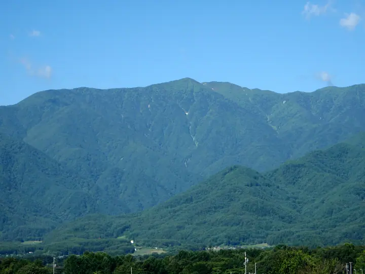
Mount Shōgigashira-yama (2,730 m) stands in the northern Central Alps (Kiso Range) on the borders of Ina, Kiso, and Miyada in Nagano Prefecture, on the main ridge leading to Mount Kiso-Komagatake. The Nishikoma-sansō hut sits just below its summit. The mountain is remembered for a 1913 school-climbing disaster that killed eleven and inspired Jirō Nitta's novel "Seishoku no Ishibumi," and it is counted among Japan's 100 Highest Mountains.
Mt. Shougigashirayama at a glance
- Weather: The most settled day in the next 7 days is Sun, November 8: clear, gusts up to 6 m/s. Sat, Nov 7: strong wind (gusts up to 16 m/s).
- Route: The shortest is Mount Shogigashira from Katsurakoba: about 10 h 30 min, 17.8 km, about 1,730 m of climbing.
Mt. Shougigashirayama weather (hourly, 14 days)
Sunrise today 06:12, sunset 16:53
| Tue, 11/3 | Wed, 11/4 | Thu, 11/5 | Fri, 11/6 | Sat, 11/7 | Sun, 11/8 | Mon, 11/9 | Tue, 11/10 | Wed, 11/11 | Thu, 11/12 | Fri, 11/13 | Sat, 11/14 | Sun, 11/15 | Mon, 11/16 | Tue, 11/17 | |||||||||||||||||||||||||||||||||||||||||||||||||||||||||||||||||||||||
|---|---|---|---|---|---|---|---|---|---|---|---|---|---|---|---|---|---|---|---|---|---|---|---|---|---|---|---|---|---|---|---|---|---|---|---|---|---|---|---|---|---|---|---|---|---|---|---|---|---|---|---|---|---|---|---|---|---|---|---|---|---|---|---|---|---|---|---|---|---|---|---|---|---|---|---|---|---|---|---|---|---|---|---|---|---|
| Japan time | 15 | 17 | 19 | 21 | 23 | 1 | 3 | 5 | 7 | 9 | 11 | 13 | 15 | 18 | 21 | 0 | 3 | 6 | 9 | 12 | 15 | 18 | 21 | 0 | 3 | 6 | 9 | 12 | 15 | 18 | 21 | 0 | 3 | 6 | 9 | 12 | 15 | 18 | 21 | 0 | 3 | 6 | 9 | 12 | 15 | 18 | 21 | 0 | 3 | 6 | 9 | 15 | 21 | 3 | 9 | 15 | 21 | 3 | 9 | 15 | 21 | 3 | 9 | 15 | 21 | 3 | 9 | 15 | 21 | 3 | 9 | 15 | 21 | 3 | 9 | 15 | 21 | 3 | 9 | 15 | 21 | 3 | 9 | 15 | |
  |   |  | | | | | | | | |   |   |   | |   | | |   | |   | |   | | |   |  | | | | | | | | | | |  | | | | | | | | | | | | | | | |   | | | |   |   | | | | | |  | | | | | | | | | | | | | |   | | | | | | ||
| Temperature | °C | 5° | 0° | -3° | -4° | -5° | -5° | -6° | -6° | -5° | 1° | 5° | 7° | 7° | 2° | 0° | -1° | -1° | -1° | 2° | 5° | 5° | 2° | 1° | 0° | 1° | 0° | 4° | 8° | 6° | 0° | -3° | -3° | -4° | -7° | -2° | -1° | -2° | -8° | -10° | -11° | -11° | -12° | -2° | 4° | 4° | -4° | -5° | -4° | -4° | -4° | 0° | 3° | -5° | -8° | 0° | 0° | -4° | -7° | -6° | -2° | -10° | -12° | -2° | 1° | -8° | -8° | -2° | 1° | -9° | -11° | -2° | 2° | -5° | -6° | 1° | 3° | 0° | -1° | 4° | 4° | -6° | -6° | -2° | 2° |
| Precipitation | mm | 3.3 | 15 | 2.0 | 1.5 | 0.2 | 0.4 | 0.2 | 0.2 | 0.2 | 0.1 | 15 | 13 | 0.2 | 0.6 | ||||||||||||||||||||||||||||||||||||||||||||||||||||||||||||||||||||||
| New snow | cm | <.1 | 0.1 | ||||||||||||||||||||||||||||||||||||||||||||||||||||||||||||||||||||||||||||||||||
| Snow depth | cm | 0 | 0 | 0 | 0 | 0 | 0 | 0 | 0 | 0 | 0 | 0 | 0 | 0 | 0 | 0 | 0 | 0 | 0 | 0 | 0 | 0 | 0 | 0 | 0 | 0 | 0 | 0 | 0 | 0 | 0 | 0 | 0 | 0 | 0 | 0 | 0 | 0 | 0 | 0 | 0 | 0 | 0 | 0 | 0 | 0 | 0 | 0 | 0 | 0 | 0 | 0 | 0 | 0 | 0 | 0 | 0 | 0 | 0 | 0 | 0 | 0 | 0 | 0 | 0 | 0 | 0 | 0 | 0 | 0 | 0 | 0 | 0 | 0 | 0 | 0 | 0 | 0 | 0 | 0 | 0 | 0 | 0 | 0 | 0 |
| Wind | m/s | 1 | 1 | 0 | 0 | 0 | 0 | 0 | 0 | 0 | 1 | 1 | 1 | 1 | 1 | 1 | 1 | 1 | 1 | 0 | 0 | 2 | 1 | 1 | 1 | 1 | 2 | 2 | 3 | 3 | 2 | 2 | 2 | 2 | 2 | 3 | 4 | 3 | 2 | 2 | 2 | 1 | 0 | 0 | 0 | 1 | 1 | 1 | 1 | 1 | 1 | 2 | 2 | 0 | 0 | 1 | 4 | 2 | 3 | 1 | 2 | 0 | 1 | 1 | 2 | 1 | 1 | 1 | 1 | 0 | 1 | 1 | 2 | 1 | 1 | 2 | 2 | 1 | 1 | 3 | 3 | 1 | 1 | 0 | 2 |
| Wind gusts | m/s | 8 | 7 | 5 | 4 | 5 | 5 | 4 | 4 | 4 | 5 | 5 | 7 | 7 | 6 | 6 | 6 | 10 | 9 | 7 | 6 | 10 | 10 | 9 | 9 | 12 | 12 | 9 | 13 | 14 | 13 | 11 | 11 | 11 | 11 | 14 | 16 | 16 | 13 | 9 | 9 | 9 | 8 | 6 | 6 | 6 | 5 | 7 | 9 | 10 | 10 | 11 | 12 | 7 | 5 | 9 | 16 | 14 | 16 | 17 | 13 | 10 | 5 | 8 | 12 | 9 | 8 | 9 | 9 | 8 | 5 | 5 | 9 | 8 | 9 | 10 | 15 | 15 | 14 | 12 | 13 | 12 | 6 | 4 | 10 |
| Wind dir. | ↓ | ↓ | ↓ | ↓ | ↓ | ↓ | ↓ | ↓ | ↓ | ↓ | ↓ | ↓ | ↓ | ↓ | ↓ | ↓ | ↓ | ↓ | ↓ | ↓ | ↓ | ↓ | ↓ | ↓ | ↓ | ↓ | ↓ | ↓ | ↓ | ↓ | ↓ | ↓ | ↓ | ↓ | ↓ | ↓ | ↓ | ↓ | ↓ | ↓ | ↓ | ↓ | ↓ | ↓ | ↓ | ↓ | ↓ | ↓ | ↓ | ↓ | ↓ | ↓ | ↓ | ↓ | ↓ | ↓ | ↓ | ↓ | ↓ | ↓ | ↓ | ↓ | ↓ | ↓ | ↓ | ↓ | ↓ | ↓ | ↓ | ↓ | ↓ | ↓ | ↓ | ↓ | ↓ | ↓ | ↓ | ↓ | ↓ | ↓ | ↓ | ↓ | ↓ | ||
Mt. Shougigashirayama hiking routes
Hiking times are estimates calculated from the terrain.
Huts, campsites and lodging near Mt. Shougigashirayama
Mountain huts
- Nishikoma-sanso 2026: open July 11–October 12 · reservation required · sleeps 28
- 大樽避難小屋 unstaffed · sleeps 10
- 伊勢滝避難小屋 unstaffed
- Choujou-Sansou 2026: open July 10–October 5 · reservation required · sleeps 50
- 頂上木曽小屋 2022: open July 1–October 15 · reservation required · sleeps 100
Campsites
- Sainokawara Camp Site
Lodging
- Hotel Senjojiki
Lists that include Mt. Shougigashirayama
Japan's 100 Highest Mountains · Elevations of 1003 Mountains of Japan · 1000 Mountains of Japan
Mt. Shougigashirayama facts
- Elevation
- 2,730 m
- Location
- Kiso, Nagano
35.806572, 137.827713 - National Park
- 中央アルプス国定公園
- Season Opens
- July 11
- Season Closes
- October 12
- Website
- www.inadanikankou.jp
- Access Information
- www.inadanikankou.jp
- Wikipedia
- ja.wikipedia.org