
Mount Saburyū
佐武流山
Yuzawa, Niigata · Elevation 2,192 m
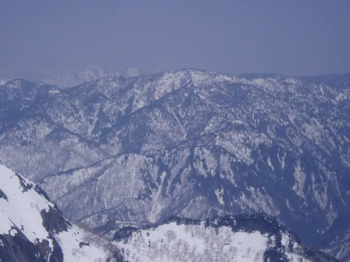
Mount Saburyū is a 2,192 m peak straddling Niigata Prefecture and Sakae Village in Shimominochi District, Nagano Prefecture, sitting on the ridge that extends southwest from Mount Naeba at the southern edge of Jōshin'etsu Kōgen National Park. The highest summit within Sakae Village, it long stood without a maintained trail until the village began clearing one in 1998, finally opening the route to the summit on 3 September 2000. It is listed in the Nihon Nihyaku Meizan, the Shinshū Hyakumeizan, and the Niigata 100 Meizan. The sole official ascent climbs from Doronoki-daira in the Akiyama-gō, traversing Warusa Peak, the Nishi-Akasawa headwaters, and Bōzu-daira — a long, rugged round trip of about ten hours suited to fit hikers. The summit commands an unobstructed 180° panorama over Mount Naeba and the Echigo ranges.
Mount Saburyū at a glance
- Weather: The most settled day in the next 7 days is Wed, November 4: clear, gusts up to 9 m/s. Sat, Nov 7: strong wind (gusts up to 19 m/s).
Mount Saburyū weather (hourly, 14 days)
Sunrise today 06:10, sunset 16:48
| Tue, 11/3 | Wed, 11/4 | Thu, 11/5 | Fri, 11/6 | Sat, 11/7 | Sun, 11/8 | Mon, 11/9 | Tue, 11/10 | Wed, 11/11 | Thu, 11/12 | Fri, 11/13 | Sat, 11/14 | Sun, 11/15 | Mon, 11/16 | Tue, 11/17 | |||||||||||||||||||||||||||||||||||||||||||||||||||||||||||||||||||||||
|---|---|---|---|---|---|---|---|---|---|---|---|---|---|---|---|---|---|---|---|---|---|---|---|---|---|---|---|---|---|---|---|---|---|---|---|---|---|---|---|---|---|---|---|---|---|---|---|---|---|---|---|---|---|---|---|---|---|---|---|---|---|---|---|---|---|---|---|---|---|---|---|---|---|---|---|---|---|---|---|---|---|---|---|---|---|
| Japan time | 15 | 17 | 19 | 21 | 23 | 1 | 3 | 5 | 7 | 9 | 11 | 13 | 15 | 18 | 21 | 0 | 3 | 6 | 9 | 12 | 15 | 18 | 21 | 0 | 3 | 6 | 9 | 12 | 15 | 18 | 21 | 0 | 3 | 6 | 9 | 12 | 15 | 18 | 21 | 0 | 3 | 6 | 9 | 12 | 15 | 18 | 21 | 0 | 3 | 6 | 9 | 15 | 21 | 3 | 9 | 15 | 21 | 3 | 9 | 15 | 21 | 3 | 9 | 15 | 21 | 3 | 9 | 15 | 21 | 3 | 9 | 15 | 21 | 3 | 9 | 15 | 21 | 3 | 9 | 15 | 21 | 3 | 9 | 15 | |
  |   |   |   |  | | | |  |   | | | | |   | | | |   |   | | | | | |   |   | |   | | |   | |   | |   | | | | | | |   | | | | | | | | | | | |   | | | | | | | | | | | | | | | | | |  | | | | |   | | | | | | | ||
| Temperature | °C | -1° | -4° | -6° | -6° | -5° | -5° | -5° | -4° | -2° | 2° | 4° | 5° | 3° | -1° | -1° | 0° | 0° | 2° | 4° | 9° | 8° | 3° | 4° | 3° | 2° | 1° | 6° | 8° | 6° | 1° | -1° | -3° | -4° | -6° | -5° | -3° | -5° | -7° | -7° | -7° | -7° | -7° | -5° | -4° | -5° | -7° | -6° | -5° | -5° | -4° | -1° | -2° | -5° | -4° | -3° | -2° | -4° | -5° | -6° | -6° | -6° | -6° | -3° | -2° | -7° | -5° | -5° | -6° | -6° | -9° | 0° | 1° | -6° | -4° | 2° | 2° | -1° | 1° | 4° | -1° | -6° | -7° | -2° | -1° |
| Precipitation | mm | 0.6 | 0.8 | 10 | 5 | 1.4 | 1.2 | 0.2 | 0.2 | 0.2 | 0.2 | 0.6 | 0.4 | 0.2 | 0.3 | 0.2 | 0.2 | 0.5 | 0.6 | 0.1 | 0.2 | 0.2 | 0.8 | 0.5 | 0.4 | 3.4 | 5 | 7 | 2.2 | 0.2 | 7 | 2.9 | 0.5 | 6 | 5 | 0.4 | 4.7 | 7 | 0.4 | ||||||||||||||||||||||||||||||||||||||||||||||
| New snow | cm | <.1 | 0.1 | 0.1 | 0.1 | 0.2 | 0.2 | 0.2 | <.1 | <.1 | <.1 | <.1 | <.1 | 0.5 | 0.5 | 0.1 | 0.1 | <.1 | 0.1 | 3.3 | 5.0 | 7.1 | 2.0 | 0.1 | <.1 | 6.9 | 2.8 | 0.4 | <.1 | 5.7 | 0.3 | ||||||||||||||||||||||||||||||||||||||||||||||||||||||
| Snow depth | cm | 0 | 0 | 0 | 0 | 0 | 0 | 0 | 0 | 0 | 0 | 0 | 0 | 0 | 0 | 0 | 0 | 0 | 0 | 0 | 0 | 0 | 0 | 0 | 0 | 0 | 0 | 0 | 0 | 0 | 0 | 0 | 0 | <1 | <1 | <1 | <1 | <1 | <1 | <1 | <1 | <1 | <1 | <1 | <1 | <1 | <1 | <1 | <1 | 1 | 1 | 1 | <1 | <1 | <1 | <1 | <1 | <1 | 3 | 6 | 10 | 11 | 11 | 11 | 9 | 9 | 9 | 14 | 15 | 15 | 14 | 14 | 12 | 12 | 12 | 12 | 9 | 9 | 6 | 5 | 3 | 6 | 6 | 6 | 5 |
| Wind | m/s | 2 | 2 | 2 | 1 | 1 | 0 | 1 | 1 | 0 | 2 | 2 | 3 | 3 | 3 | 4 | 4 | 3 | 3 | 2 | 1 | 0 | 1 | 1 | 1 | 1 | 2 | 2 | 2 | 3 | 2 | 3 | 3 | 3 | 3 | 4 | 5 | 4 | 4 | 3 | 3 | 4 | 4 | 3 | 3 | 3 | 1 | 1 | 1 | 1 | 1 | 2 | 1 | 1 | 1 | 3 | 3 | 2 | 4 | 9 | 7 | 4 | 3 | 1 | 1 | 0 | 2 | 3 | 5 | 4 | 2 | 0 | 0 | 1 | 1 | 1 | 1 | 2 | 2 | 2 | 6 | 4 | 3 | 1 | 1 |
| Wind gusts | m/s | 10 | 9 | 7 | 6 | 5 | 4 | 4 | 4 | 4 | 5 | 7 | 8 | 9 | 10 | 12 | 13 | 12 | 11 | 10 | 8 | 7 | 4 | 5 | 6 | 6 | 7 | 7 | 9 | 10 | 10 | 10 | 11 | 12 | 12 | 15 | 18 | 19 | 15 | 14 | 12 | 14 | 14 | 14 | 11 | 11 | 10 | 7 | 6 | 6 | 7 | 7 | 7 | 6 | 5 | 8 | 10 | 10 | 16 | 29 | 28 | 22 | 12 | 8 | 7 | 6 | 7 | 11 | 15 | 15 | 12 | 8 | 4 | 5 | 5 | 6 | 7 | 9 | 14 | 10 | 18 | 19 | 14 | 10 | 4 |
| Wind dir. | ↓ | ↓ | ↓ | ↓ | ↓ | ↓ | ↓ | ↓ | ↓ | ↓ | ↓ | ↓ | ↓ | ↓ | ↓ | ↓ | ↓ | ↓ | ↓ | ↓ | ↓ | ↓ | ↓ | ↓ | ↓ | ↓ | ↓ | ↓ | ↓ | ↓ | ↓ | ↓ | ↓ | ↓ | ↓ | ↓ | ↓ | ↓ | ↓ | ↓ | ↓ | ↓ | ↓ | ↓ | ↓ | ↓ | ↓ | ↓ | ↓ | ↓ | ↓ | ↓ | ↓ | ↓ | ↓ | ↓ | ↓ | ↓ | ↓ | ↓ | ↓ | ↓ | ↓ | ↓ | ↓ | ↓ | ↓ | ↓ | ↓ | ↓ | ↓ | ↓ | ↓ | ↓ | ↓ | ↓ | ↓ | ↓ | ↓ | ↓ | ↓ | ↓ | ↓ | ↓ | |
Huts, campsites and lodging near Mount Saburyū
Mountain huts
Lists that include Mount Saburyū
Japan 200 Famous Mountains · Japan's 300 Famous Mountains · Shinshu 100 Famous Mountains · Niigata 100 Famous Mountains · Elevations of 1003 Mountains of Japan · 1000 Mountains of Japan
Mount Saburyū facts
- Also known as
- さぶるやま
- Elevation
- 2,192 m
- Location
- Yuzawa, Niigata
36.772288, 138.670571 - National Park
- 上信越高原国立公園
- Website
- sakae-akiyamago.com
- Trail Map
- sakae-akiyamago.com (PDF)
- Wikipedia
- ja.wikipedia.org