
Mount Omoshiro
面白山
Sendai, Miyagi / Yamagata, Yamagata · Elevation 1,264 m
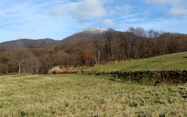
Mount Omoshiro (1,264 m) sits on the border of Sendai's Taihaku Ward (Miyagi) and Yamagata City, on the main spine of the Ōu Mountains, and forms the northern tip of Zao Quasi-National Park. The name — literally "white-faced mountain" — is said to derive from the snowy slopes that face Sendai in winter, and the peak is also called North Omoshiro to distinguish it from South Omoshiro 4 km to the south. The JR Senzan Line's Omoshiroyama-Kōgen station drops hikers directly at the trailhead, and the mountain is paired in popularity with the nearby Momijigawa Gorge. It is listed in the Yamagata Hyakumeizan and the Tōhoku Hyakumeizan.
Mount Omoshiro at a glance
- Weather: The most settled day in the next 7 days is Wed, November 4: clear, gusts up to 8 m/s. Fri, Nov 6, Sat, Nov 7, Sun, Nov 8: strong wind (gusts up to 23 m/s).
- Route: The shortest is Mount Omoshiroyama Return via Tendo Kogen and Misawayama: about 4 h 36 min, 7.6 km, about 620 m of climbing.
Mount Omoshiro weather (hourly, 14 days)
Sunrise today 06:05, sunset 16:38
| Tue, 11/3 | Wed, 11/4 | Thu, 11/5 | Fri, 11/6 | Sat, 11/7 | Sun, 11/8 | Mon, 11/9 | Tue, 11/10 | Wed, 11/11 | Thu, 11/12 | Fri, 11/13 | Sat, 11/14 | Sun, 11/15 | Mon, 11/16 | Tue, 11/17 | |||||||||||||||||||||||||||||||||||||||||||||||||||||||||||||||||||||||
|---|---|---|---|---|---|---|---|---|---|---|---|---|---|---|---|---|---|---|---|---|---|---|---|---|---|---|---|---|---|---|---|---|---|---|---|---|---|---|---|---|---|---|---|---|---|---|---|---|---|---|---|---|---|---|---|---|---|---|---|---|---|---|---|---|---|---|---|---|---|---|---|---|---|---|---|---|---|---|---|---|---|---|---|---|---|
| Japan time | 15 | 17 | 19 | 21 | 23 | 1 | 3 | 5 | 7 | 9 | 11 | 13 | 15 | 18 | 21 | 0 | 3 | 6 | 9 | 12 | 15 | 18 | 21 | 0 | 3 | 6 | 9 | 12 | 15 | 18 | 21 | 0 | 3 | 6 | 9 | 12 | 15 | 18 | 21 | 0 | 3 | 6 | 9 | 12 | 15 | 18 | 21 | 0 | 3 | 6 | 9 | 15 | 21 | 3 | 9 | 15 | 21 | 3 | 9 | 15 | 21 | 3 | 9 | 15 | 21 | 3 | 9 | 15 | 21 | 3 | 9 | 15 | 21 | 3 | 9 | 15 | 21 | 3 | 9 | 15 | 21 | 3 | 9 | 15 | |
 |  | | | | | | |   | | | | |   | |   |   | |   | | | | |   |   | |   |   |   | | | | | | |   |   |   |   | | | | | |   | | | | | | | | |   | | | | | | | | | | | | | | | | | | |  | | | | | | | | | | | | ||
| Temperature | °C | 5° | 2° | 1° | 0° | -1° | -1° | -1° | -1° | 1° | 5° | 7° | 8° | 8° | 3° | 4° | 4° | 4° | 5° | 7° | 7° | 8° | 7° | 7° | 7° | 6° | 6° | 9° | 10° | 10° | 6° | 4° | 1° | 0° | -1° | -1° | -1° | -1° | -2° | -2° | -1° | -1° | -1° | 0° | 2° | 1° | -1° | -1° | -1° | -1° | -2° | 1° | 1° | -3° | -5° | 1° | 1° | 1° | -1° | -1° | 3° | -2° | -1° | 1° | 2° | -1° | 0° | 0° | 0° | -2° | -3° | 1° | 4° | -3° | -2° | 6° | 9° | 5° | 3° | 6° | 4° | -3° | -3° | -1° | 2° |
| Precipitation | mm | 0.9 | 8 | 9 | 2.9 | 1.3 | 0.1 | 1.2 | 0.2 | 1.1 | 0.6 | 0.4 | 0.7 | 0.9 | 1.2 | 1.5 | 1.4 | 1.6 | 0.6 | 0.9 | 0.4 | 0.3 | 0.1 | 0.3 | 0.4 | 0.1 | 0.2 | 1.8 | 1.3 | 0.4 | 0.7 | 0.9 | 1.4 | 6 | 0.8 | 1.1 | 1.0 | ||||||||||||||||||||||||||||||||||||||||||||||||
| New snow | cm | <.1 | 0.2 | 0.9 | 0.1 | 0.3 | <.1 | <.1 | <.1 | <.1 | <.1 | ||||||||||||||||||||||||||||||||||||||||||||||||||||||||||||||||||||||||||
| Snow depth | cm | 0 | 0 | 0 | 0 | 0 | 0 | 0 | 0 | 0 | 0 | 0 | 0 | 0 | 0 | 0 | 0 | 0 | 0 | 0 | 0 | 0 | 0 | 0 | 0 | 0 | 0 | 0 | 0 | 0 | 0 | 0 | 0 | 0 | 0 | 0 | <1 | <1 | <1 | <1 | <1 | <1 | <1 | <1 | 0 | 0 | 0 | 0 | 0 | 0 | 0 | 0 | 0 | 0 | 0 | 0 | 0 | 0 | 0 | 0 | 0 | 0 | 0 | 0 | 0 | 0 | 0 | 0 | 0 | 0 | 0 | 0 | 0 | 0 | 0 | 0 | 0 | 0 | 0 | 0 | 0 | 0 | 0 | 0 | 0 |
| Wind | m/s | 6 | 4 | 3 | 2 | 0 | 0 | 1 | 1 | 1 | 3 | 2 | 2 | 1 | 2 | 3 | 4 | 2 | 2 | 2 | 1 | 1 | 0 | 0 | 1 | 2 | 2 | 4 | 8 | 8 | 6 | 6 | 6 | 6 | 6 | 6 | 8 | 7 | 8 | 8 | 9 | 9 | 8 | 7 | 9 | 9 | 5 | 4 | 4 | 2 | 1 | 2 | 3 | 1 | 1 | 1 | 6 | 3 | 4 | 5 | 6 | 2 | 3 | 3 | 4 | 1 | 1 | 6 | 8 | 4 | 2 | 2 | 2 | 0 | 0 | 1 | 1 | 1 | 2 | 2 | 7 | 7 | 5 | 3 | 2 |
| Wind gusts | m/s | 16 | 14 | 9 | 8 | 6 | 4 | 4 | 5 | 4 | 7 | 8 | 6 | 5 | 6 | 8 | 9 | 9 | 6 | 5 | 5 | 5 | 4 | 2 | 5 | 5 | 6 | 11 | 20 | 21 | 19 | 16 | 15 | 16 | 15 | 19 | 23 | 22 | 21 | 20 | 21 | 22 | 22 | 20 | 22 | 23 | 20 | 13 | 10 | 9 | 6 | 5 | 9 | 9 | 4 | 4 | 15 | 15 | 11 | 12 | 19 | 15 | 8 | 8 | 11 | 10 | 6 | 15 | 19 | 19 | 11 | 7 | 7 | 5 | 3 | 4 | 5 | 4 | 5 | 7 | 17 | 21 | 16 | 13 | 7 |
| Wind dir. | ↓ | ↓ | ↓ | ↓ | ↓ | ↓ | ↓ | ↓ | ↓ | ↓ | ↓ | ↓ | ↓ | ↓ | ↓ | ↓ | ↓ | ↓ | ↓ | ↓ | ↓ | ↓ | ↓ | ↓ | ↓ | ↓ | ↓ | ↓ | ↓ | ↓ | ↓ | ↓ | ↓ | ↓ | ↓ | ↓ | ↓ | ↓ | ↓ | ↓ | ↓ | ↓ | ↓ | ↓ | ↓ | ↓ | ↓ | ↓ | ↓ | ↓ | ↓ | ↓ | ↓ | ↓ | ↓ | ↓ | ↓ | ↓ | ↓ | ↓ | ↓ | ↓ | ↓ | ↓ | ↓ | ↓ | ↓ | ↓ | ↓ | ↓ | ↓ | ↓ | ↓ | ↓ | ↓ | ↓ | ↓ | ↓ | ↓ | ↓ | ↓ | ↓ | ↓ | ↓ | |
Mount Omoshiro hiking routes
Hiking times are estimates calculated from the terrain.
Huts, campsites and lodging near Mount Omoshiro
Lodging
- 藤花山荘
- こがね荘
Lists that include Mount Omoshiro
Tohoku 100 Famous Mountains · Yamagata 100 Famous Mountains · 1000 Mountains of Japan
Mount Omoshiro facts
- Also known as
- 北面白山
- Elevation
- 1,264 m
- Location
- Sendai, Miyagi / Yamagata, Yamagata
38.348661, 140.522373 - National Park
- 蔵王国定公園
- Website
- yamagatayama.com
- Wikipedia
- ja.wikipedia.org