
Mount Ōdanairi
大棚入山
Shiojiri, Nagano · Elevation 2,375 m
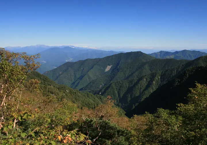
Mount Ōdanairi is a 2,375.21 m peak straddling Shiojiri City and Kiso Town in Nagano Prefecture, marking the northern terminus of the Central Alps (Kiso Range) main ridge and of Chūō-Alps Quasi-National Park. Its conical profile when viewed from the north has earned it the alternate name 烏帽子山 (Mount Eboshi); the summit holds a second-class triangulation point but is enclosed in conifers with no view, while the mountain itself is conspicuous from National Route 19. It is featured in the "Mountains over 2000 m" and Japan-2000m-peak survey lists.
Mount Ōdanairi at a glance
- Weather: The most settled day in the next 7 days is Sun, November 8: clear, gusts up to 6 m/s. Sat, Nov 7: strong wind (gusts up to 16 m/s).
Mount Ōdanairi weather (hourly, 14 days)
Sunrise today 06:12, sunset 16:53
| Tue, 11/3 | Wed, 11/4 | Thu, 11/5 | Fri, 11/6 | Sat, 11/7 | Sun, 11/8 | Mon, 11/9 | Tue, 11/10 | Wed, 11/11 | Thu, 11/12 | Fri, 11/13 | Sat, 11/14 | Sun, 11/15 | Mon, 11/16 | Tue, 11/17 | |||||||||||||||||||||||||||||||||||||||||||||||||||||||||||||||||||||||
|---|---|---|---|---|---|---|---|---|---|---|---|---|---|---|---|---|---|---|---|---|---|---|---|---|---|---|---|---|---|---|---|---|---|---|---|---|---|---|---|---|---|---|---|---|---|---|---|---|---|---|---|---|---|---|---|---|---|---|---|---|---|---|---|---|---|---|---|---|---|---|---|---|---|---|---|---|---|---|---|---|---|---|---|---|---|
| Japan time | 15 | 17 | 19 | 21 | 23 | 1 | 3 | 5 | 7 | 9 | 11 | 13 | 15 | 18 | 21 | 0 | 3 | 6 | 9 | 12 | 15 | 18 | 21 | 0 | 3 | 6 | 9 | 12 | 15 | 18 | 21 | 0 | 3 | 6 | 9 | 12 | 15 | 18 | 21 | 0 | 3 | 6 | 9 | 12 | 15 | 18 | 21 | 0 | 3 | 6 | 9 | 15 | 21 | 3 | 9 | 15 | 21 | 3 | 9 | 15 | 21 | 3 | 9 | 15 | 21 | 3 | 9 | 15 | 21 | 3 | 9 | 15 | 21 | 3 | 9 | 15 | 21 | 3 | 9 | 15 | 21 | 3 | 9 | 15 | |
  |   |  | | | | | | | | |   |   |   | |   | | |   | |   | |   | | |   |  | | | | | | | | | | |  | | | | | | | | | | | | | | | |   | | | |   |   | | | | | |  | | | | | | | | | | | | | |   | | | | | | ||
| Temperature | °C | 8° | 2° | 0° | -2° | -3° | -3° | -3° | -4° | -3° | 3° | 7° | 10° | 9° | 4° | 2° | 2° | 2° | 1° | 4° | 7° | 7° | 4° | 3° | 2° | 3° | 2° | 7° | 10° | 8° | 2° | 0° | -1° | -2° | -5° | 0° | 1° | 0° | -6° | -8° | -8° | -9° | -9° | 0° | 6° | 6° | -1° | -2° | -2° | -1° | -1° | 3° | 5° | -3° | -5° | 2° | 2° | -2° | -5° | -4° | 1° | -7° | -10° | 0° | 3° | -6° | -5° | 0° | 3° | -6° | -9° | 0° | 4° | -3° | -3° | 3° | 5° | 2° | 1° | 6° | 6° | -4° | -4° | 0° | 4° |
| Precipitation | mm | 3.3 | 15 | 2.0 | 1.5 | 0.2 | 0.4 | 0.2 | 0.2 | 0.2 | 0.1 | 15 | 13 | 0.2 | 0.6 | ||||||||||||||||||||||||||||||||||||||||||||||||||||||||||||||||||||||
| New snow | cm | <.1 | 0.1 | ||||||||||||||||||||||||||||||||||||||||||||||||||||||||||||||||||||||||||||||||||
| Snow depth | cm | 0 | 0 | 0 | 0 | 0 | 0 | 0 | 0 | 0 | 0 | 0 | 0 | 0 | 0 | 0 | 0 | 0 | 0 | 0 | 0 | 0 | 0 | 0 | 0 | 0 | 0 | 0 | 0 | 0 | 0 | 0 | 0 | 0 | 0 | 0 | 0 | 0 | 0 | 0 | 0 | 0 | 0 | 0 | 0 | 0 | 0 | 0 | 0 | 0 | 0 | 0 | 0 | 0 | 0 | 0 | 0 | 0 | 0 | 0 | 0 | 0 | 0 | 0 | 0 | 0 | 0 | 0 | 0 | 0 | 0 | 0 | 0 | 0 | 0 | 0 | 0 | 0 | 0 | 0 | 0 | 0 | 0 | 0 | 0 |
| Wind | m/s | 1 | 1 | 0 | 0 | 0 | 0 | 0 | 0 | 0 | 1 | 1 | 1 | 1 | 1 | 1 | 1 | 1 | 1 | 0 | 0 | 2 | 1 | 1 | 1 | 1 | 2 | 2 | 3 | 3 | 2 | 2 | 2 | 2 | 2 | 3 | 4 | 3 | 2 | 2 | 2 | 1 | 0 | 0 | 0 | 1 | 1 | 1 | 1 | 1 | 1 | 2 | 2 | 0 | 0 | 1 | 4 | 2 | 3 | 1 | 2 | 0 | 1 | 1 | 2 | 1 | 1 | 1 | 1 | 0 | 1 | 1 | 2 | 1 | 1 | 2 | 2 | 1 | 1 | 3 | 3 | 1 | 1 | 0 | 2 |
| Wind gusts | m/s | 8 | 7 | 5 | 4 | 5 | 5 | 4 | 4 | 4 | 5 | 5 | 7 | 7 | 6 | 6 | 6 | 10 | 9 | 7 | 6 | 10 | 10 | 9 | 9 | 12 | 12 | 9 | 13 | 14 | 13 | 11 | 11 | 11 | 11 | 14 | 16 | 16 | 13 | 9 | 9 | 9 | 8 | 6 | 6 | 6 | 5 | 7 | 9 | 10 | 10 | 11 | 12 | 7 | 5 | 9 | 16 | 14 | 16 | 17 | 13 | 10 | 5 | 8 | 12 | 9 | 8 | 9 | 9 | 8 | 5 | 5 | 9 | 8 | 9 | 10 | 15 | 15 | 14 | 12 | 13 | 12 | 6 | 4 | 10 |
| Wind dir. | ↓ | ↓ | ↓ | ↓ | ↓ | ↓ | ↓ | ↓ | ↓ | ↓ | ↓ | ↓ | ↓ | ↓ | ↓ | ↓ | ↓ | ↓ | ↓ | ↓ | ↓ | ↓ | ↓ | ↓ | ↓ | ↓ | ↓ | ↓ | ↓ | ↓ | ↓ | ↓ | ↓ | ↓ | ↓ | ↓ | ↓ | ↓ | ↓ | ↓ | ↓ | ↓ | ↓ | ↓ | ↓ | ↓ | ↓ | ↓ | ↓ | ↓ | ↓ | ↓ | ↓ | ↓ | ↓ | ↓ | ↓ | ↓ | ↓ | ↓ | ↓ | ↓ | ↓ | ↓ | ↓ | ↓ | ↓ | ↓ | ↓ | ↓ | ↓ | ↓ | ↓ | ↓ | ↓ | ↓ | ↓ | ↓ | ↓ | ↓ | ↓ | ↓ | ↓ | ||
Huts, campsites and lodging near Mount Ōdanairi
Mountain huts
- 大樽避難小屋 unstaffed · sleeps 10
- Nishikoma-sanso 2026: open July 11–October 12 · reservation required · sleeps 28
Campsites
- Kisokoma Reisui Park
Lists that include Mount Ōdanairi
Mount Ōdanairi facts
- Also known as
- 烏帽子山
- Elevation
- 2,375 m
- Location
- Shiojiri, Nagano
35.848091, 137.810129 - National Park
- 中央アルプス国定公園
- Wikipedia
- ja.wikipedia.org