
Mount Mitsuishi
三ッ石山
Hachimantai, Iwate / Shizukuishi, Iwate · Elevation 1,466 m
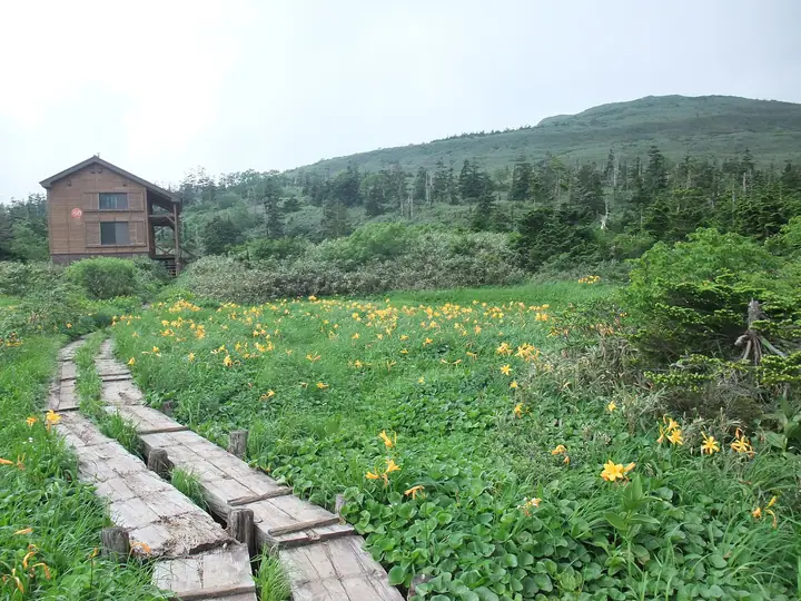
Mount Mitsuishi is a 1,466 m peak straddling Shizukuishi and Hachimantai in Iwate Prefecture, sitting midway along the Ura-Iwate traverse that links Mount Iwate to the Hachimantai plateau. Within Towada-Hachimantai National Park, its name refers to the three boulders crowning the summit that appear distinct from every direction. The mountainside is renowned for some of the most vivid autumn foliage in Tōhoku from mid-September to early October, and the peak appears in Tōhoku Hyakumeizan, Iwate Hyakumeizan and Onsen Hyakumeizan.
Mount Mitsuishi at a glance
- Weather: The most settled day in the next 7 days is Wed, November 4: clear, gusts up to 15 m/s. Fri, Nov 6, Sat, Nov 7, Sun, Nov 8: strong wind (gusts up to 26 m/s).
- Route: The shortest is Mount Mitsuishi Out-and-Back from the Mitsuishi Trailhead: about 4 h 1 min, 8.8 km, about 510 m of climbing.
Mount Mitsuishi weather (hourly, 14 days)
Sunrise today 06:07, sunset 16:34
| Tue, 11/3 | Wed, 11/4 | Thu, 11/5 | Fri, 11/6 | Sat, 11/7 | Sun, 11/8 | Mon, 11/9 | Tue, 11/10 | Wed, 11/11 | Thu, 11/12 | Fri, 11/13 | Sat, 11/14 | Sun, 11/15 | Mon, 11/16 | Tue, 11/17 | |||||||||||||||||||||||||||||||||||||||||||||||||||||||||||||||||||||||
|---|---|---|---|---|---|---|---|---|---|---|---|---|---|---|---|---|---|---|---|---|---|---|---|---|---|---|---|---|---|---|---|---|---|---|---|---|---|---|---|---|---|---|---|---|---|---|---|---|---|---|---|---|---|---|---|---|---|---|---|---|---|---|---|---|---|---|---|---|---|---|---|---|---|---|---|---|---|---|---|---|---|---|---|---|---|
| Japan time | 15 | 17 | 19 | 21 | 23 | 1 | 3 | 5 | 7 | 9 | 11 | 13 | 15 | 18 | 21 | 0 | 3 | 6 | 9 | 12 | 15 | 18 | 21 | 0 | 3 | 6 | 9 | 12 | 15 | 18 | 21 | 0 | 3 | 6 | 9 | 12 | 15 | 18 | 21 | 0 | 3 | 6 | 9 | 12 | 15 | 18 | 21 | 0 | 3 | 6 | 9 | 15 | 21 | 3 | 9 | 15 | 21 | 3 | 9 | 15 | 21 | 3 | 9 | 15 | 21 | 3 | 9 | 15 | 21 | 3 | 9 | 15 | 21 | 3 | 9 | 15 | 21 | 3 | 9 | 15 | 21 | 3 | 9 | 15 | |
  |   |   | |  |   | | | |  | | |   | | | | |   |   | | | | | | | | | | | |   | |   | |   | |   | | | | | | | |   | | |   | | | | | | | | | | | | | | | | | | | | | | | | |  | | | | | | |   | | | | | ||
| Temperature | °C | 1° | -2° | -2° | -3° | -3° | -3° | -2° | -1° | 1° | 3° | 5° | 5° | 4° | 0° | 1° | 0° | 1° | 3° | 5° | 6° | 6° | 5° | 6° | 6° | 5° | 6° | 7° | 7° | 5° | 1° | -2° | -4° | -4° | -5° | -5° | -4° | -5° | -6° | -6° | -6° | -6° | -6° | -4° | -3° | -4° | -5° | -5° | -6° | -6° | -7° | -3° | -4° | -6° | -8° | -4° | -1° | -3° | -2° | -3° | -3° | -6° | -7° | -2° | -2° | -2° | -3° | -4° | -4° | -8° | -9° | -2° | 0° | -6° | -6° | 3° | 3° | 1° | 1° | 3° | -2° | -7° | -8° | -3° | -3° |
| Precipitation | mm | 0.4 | 4.3 | 4.7 | 1.7 | 1.8 | 1.2 | 4.0 | 1.9 | 0.7 | 1.0 | 3.3 | 2.7 | 0.7 | 1.7 | 1.2 | 1.4 | 1.6 | 1.2 | 1.4 | 2.0 | 0.8 | 0.3 | 0.3 | 0.3 | 0.3 | 0.1 | 0.4 | 0.1 | 1.4 | 10 | 7 | 2.8 | 0.2 | 0.3 | 4.0 | 1.4 | 3.4 | 2.0 | 2.6 | 2.7 | ||||||||||||||||||||||||||||||||||||||||||||
| New snow | cm | <.1 | 0.5 | 0.8 | 1.3 | 1.6 | 1.2 | 1.5 | 2.0 | 0.8 | 0.3 | 0.3 | 0.3 | 0.3 | <.1 | <.1 | 0.1 | <.1 | 0.3 | 0.1 | 1.4 | 8.7 | 6.1 | 2.8 | <.1 | <.1 | 0.2 | 0.2 | 3.6 | <.1 | <.1 | <.1 | 1.0 | 2.6 | <.1 | ||||||||||||||||||||||||||||||||||||||||||||||||||
| Snow depth | cm | <1 | <1 | <1 | <1 | <1 | <1 | <1 | <1 | <1 | <1 | 0 | 0 | 0 | 0 | 0 | 0 | 0 | 0 | 0 | 0 | 0 | 0 | 0 | 0 | 0 | 0 | 0 | 0 | 0 | 0 | <1 | <1 | 2 | 3 | 3 | 4 | 5 | 6 | 6 | 6 | 6 | 6 | 6 | 6 | 6 | 6 | 6 | 5 | 5 | 5 | 5 | 5 | 5 | 5 | 5 | 5 | 6 | 12 | 15 | 16 | 16 | 16 | 16 | 14 | 14 | 17 | 17 | 17 | 16 | 16 | 16 | 15 | 15 | 15 | 15 | 13 | 12 | 11 | 10 | 9 | 10 | 10 | 10 | 10 |
| Wind | m/s | 6 | 4 | 4 | 4 | 3 | 3 | 4 | 4 | 5 | 5 | 4 | 4 | 2 | 0 | 1 | 2 | 2 | 2 | 2 | 1 | 1 | 1 | 1 | 2 | 2 | 2 | 2 | 6 | 6 | 6 | 7 | 7 | 6 | 6 | 6 | 7 | 6 | 8 | 7 | 7 | 7 | 7 | 8 | 9 | 7 | 6 | 5 | 4 | 4 | 1 | 3 | 3 | 1 | 1 | 1 | 3 | 5 | 1 | 4 | 3 | 2 | 2 | 4 | 3 | 2 | 1 | 3 | 5 | 2 | 2 | 2 | 2 | 1 | 0 | 1 | 1 | 2 | 1 | 1 | 3 | 5 | 3 | 3 | 2 |
| Wind gusts | m/s | 17 | 17 | 12 | 12 | 11 | 11 | 12 | 13 | 14 | 15 | 14 | 12 | 11 | 6 | 5 | 6 | 7 | 8 | 8 | 7 | 5 | 4 | 6 | 6 | 7 | 7 | 10 | 20 | 20 | 19 | 20 | 21 | 19 | 18 | 19 | 24 | 25 | 23 | 21 | 21 | 21 | 21 | 22 | 26 | 25 | 21 | 17 | 14 | 11 | 11 | 11 | 11 | 9 | 6 | 6 | 8 | 15 | 14 | 12 | 17 | 10 | 7 | 11 | 12 | 10 | 7 | 11 | 14 | 13 | 8 | 7 | 9 | 6 | 4 | 4 | 6 | 7 | 7 | 5 | 10 | 16 | 14 | 9 | 9 |
| Wind dir. | ↓ | ↓ | ↓ | ↓ | ↓ | ↓ | ↓ | ↓ | ↓ | ↓ | ↓ | ↓ | ↓ | ↓ | ↓ | ↓ | ↓ | ↓ | ↓ | ↓ | ↓ | ↓ | ↓ | ↓ | ↓ | ↓ | ↓ | ↓ | ↓ | ↓ | ↓ | ↓ | ↓ | ↓ | ↓ | ↓ | ↓ | ↓ | ↓ | ↓ | ↓ | ↓ | ↓ | ↓ | ↓ | ↓ | ↓ | ↓ | ↓ | ↓ | ↓ | ↓ | ↓ | ↓ | ↓ | ↓ | ↓ | ↓ | ↓ | ↓ | ↓ | ↓ | ↓ | ↓ | ↓ | ↓ | ↓ | ↓ | ↓ | ↓ | ↓ | ↓ | ↓ | ↓ | ↓ | ↓ | ↓ | ↓ | ↓ | ↓ | ↓ | ↓ | ↓ | ↓ | |
Mount Mitsuishi hiking routes
- Mount Mitsuishi Out-and-Back from the Mitsuishi Trailhead 8.8 km · Ascent 509 m 三ツ石山登山駐車場 (parking)
- Mitsuishiyama Loop via Gentagadake from Matsukawa Onsen 14.7 km · Ascent 998 m 松川温泉バス停 (Bus stop) (parking)
Hiking times are estimates calculated from the terrain.
Huts, campsites and lodging near Mount Mitsuishi
Mountain huts
Campsites
- 県営松川キャンプ場
Lodging
- 松川温泉 峡雲荘
- 松川温泉 松川荘
- Ryukanso
Lists that include Mount Mitsuishi
100 Famous Hot Spring Mountains · Tohoku 100 Famous Mountains · Iwate 100 Famous Mountains
Mount Mitsuishi facts
- Elevation
- 1,466 m
- Location
- Hachimantai, Iwate / Shizukuishi, Iwate
39.851211, 140.896520 - National Park
- 十和田八幡平国立公園
- Website
- shizukuishi-kanko.gr.jp
- Trail Map
- shizukuishi-kanko.gr.jp (PDF)
- Wikipedia
- ja.wikipedia.org