
Odake
大岳
Nagaoka, Niigata · Elevation 1,432 m
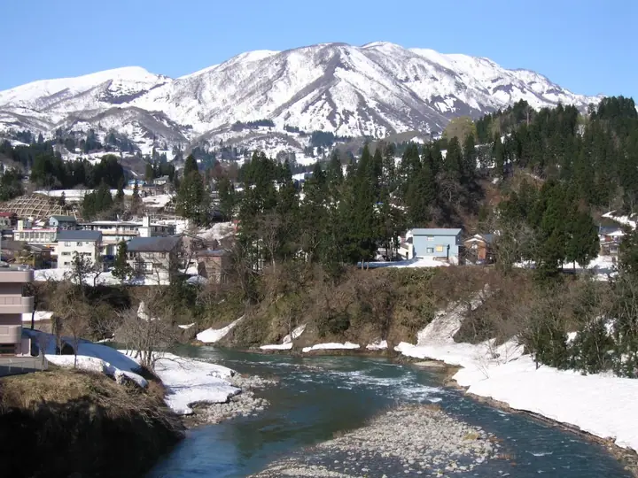
Odake is a 1,432-meter peak forming the western end of the three summits (Hakamadake, Seiundake, Odake) of Mount Sumon. Spanning Uonuma, Sanjo, and Nagaoka cities in Niigata, Mount Sumon is one of the 200 Famous Mountains of Japan; Odake is climbed via the Hokkyure and Oshirakawa courses and is known for its enormous snow cornices and lingering-snow scenery. The area lies within Echigo-Sanzan-Tadami Quasi-National Park.
Odake at a glance
- Weather: The most settled day in the next 7 days is Wed, November 4: clear, gusts up to 8 m/s. Fri, Nov 6, Sat, Nov 7: strong wind (gusts up to 22 m/s).
- Route: The shortest is Mount Sumon (Mount Hakama) Return from Hokkure via Mount Odake and Mount Seiun: about 6 h 27 min, 9.7 km, about 1,090 m of climbing.
Odake weather (hourly, 14 days)
Sunrise today 06:09, sunset 16:45
| Tue, 11/3 | Wed, 11/4 | Thu, 11/5 | Fri, 11/6 | Sat, 11/7 | Sun, 11/8 | Mon, 11/9 | Tue, 11/10 | Wed, 11/11 | Thu, 11/12 | Fri, 11/13 | Sat, 11/14 | Sun, 11/15 | Mon, 11/16 | Tue, 11/17 | |||||||||||||||||||||||||||||||||||||||||||||||||||||||||||||||||||||||
|---|---|---|---|---|---|---|---|---|---|---|---|---|---|---|---|---|---|---|---|---|---|---|---|---|---|---|---|---|---|---|---|---|---|---|---|---|---|---|---|---|---|---|---|---|---|---|---|---|---|---|---|---|---|---|---|---|---|---|---|---|---|---|---|---|---|---|---|---|---|---|---|---|---|---|---|---|---|---|---|---|---|---|---|---|---|
| Japan time | 15 | 17 | 19 | 21 | 23 | 1 | 3 | 5 | 7 | 9 | 11 | 13 | 15 | 18 | 21 | 0 | 3 | 6 | 9 | 12 | 15 | 18 | 21 | 0 | 3 | 6 | 9 | 12 | 15 | 18 | 21 | 0 | 3 | 6 | 9 | 12 | 15 | 18 | 21 | 0 | 3 | 6 | 9 | 12 | 15 | 18 | 21 | 0 | 3 | 6 | 9 | 15 | 21 | 3 | 9 | 15 | 21 | 3 | 9 | 15 | 21 | 3 | 9 | 15 | 21 | 3 | 9 | 15 | 21 | 3 | 9 | 15 | 21 | 3 | 9 | 15 | 21 | 3 | 9 | 15 | 21 | 3 | 9 | 15 | |
 |   |  | | | | | |   | | | | | |   | |   | |   |   | |   |   |   | | | | | | | | | | | |   | | |   | | | | | | | | | | | |   |   | |   | | | | | | | | | | | | | | | | | | |  | | |   | | | | | | | | | ||
| Temperature | °C | 5° | 1° | 0° | -2° | -3° | -2° | -1° | 0° | 1° | 5° | 8° | 9° | 9° | 4° | 3° | 4° | 3° | 3° | 5° | 7° | 10° | 6° | 7° | 7° | 5° | 6° | 7° | 7° | 6° | 4° | 2° | 1° | 0° | -1° | -1° | -1° | -1° | -2° | -2° | -2° | -2° | -2° | 0° | 2° | 0° | -1° | -1° | -2° | -2° | -2° | 1° | 1° | -1° | -5° | 2° | 8° | 1° | -3° | 0° | -1° | -1° | -2° | 1° | 2° | -2° | 0° | -1° | 0° | -2° | -2° | 2° | 4° | -2° | -2° | 7° | 8° | 3° | 3° | 5° | 2° | -2° | -3° | -1° | 1° |
| Precipitation | mm | 6 | 12 | 3.3 | 1.6 | 0.1 | 0.3 | 2.5 | 3.5 | 4.5 | 1.4 | 2.5 | 4.2 | 5 | 7 | 7 | 6 | 3.5 | 2.5 | 1.4 | 0.9 | 0.7 | 0.9 | 1.2 | 0.5 | 0.4 | 0.7 | 0.3 | 0.2 | 0.4 | 0.8 | 0.8 | 0.1 | 0.2 | 1.7 | 12 | 6 | 6 | 2.2 | 0.4 | 0.5 | 1.3 | 3.8 | 12 | 0.2 | 4.1 | 4.6 | 3.9 | 11 | 7 | 0.3 | ||||||||||||||||||||||||||||||||||
| New snow | cm | <.1 | <.1 | <.1 | 1.7 | 2.3 | 0.1 | ||||||||||||||||||||||||||||||||||||||||||||||||||||||||||||||||||||||||||||||
| Snow depth | cm | 0 | 0 | 0 | 0 | 0 | 0 | 0 | 0 | 0 | 0 | 0 | 0 | 0 | 0 | 0 | 0 | 0 | 0 | 0 | 0 | 0 | 0 | 0 | 0 | 0 | 0 | 0 | 0 | 0 | 0 | 0 | 0 | 0 | 0 | 0 | 0 | 0 | 0 | 0 | 0 | 0 | 0 | 0 | 0 | 0 | 0 | 0 | 0 | 0 | 0 | 0 | 0 | 0 | 0 | 0 | 0 | 0 | 1 | 2 | <1 | 0 | 0 | 0 | 0 | 0 | 0 | 0 | 0 | 0 | 0 | 0 | 0 | 0 | 0 | 0 | 0 | 0 | 0 | 0 | 0 | 0 | 0 | 0 | 0 |
| Wind | m/s | 3 | 1 | 0 | 1 | 1 | 1 | 1 | 0 | 0 | 1 | 2 | 2 | 3 | 3 | 3 | 4 | 3 | 3 | 3 | 2 | 1 | 1 | 2 | 0 | 1 | 3 | 5 | 5 | 5 | 5 | 5 | 3 | 4 | 4 | 5 | 6 | 6 | 5 | 5 | 4 | 5 | 3 | 4 | 5 | 3 | 1 | 1 | 1 | 1 | 2 | 1 | 3 | 1 | 1 | 2 | 2 | 3 | 2 | 3 | 5 | 2 | 1 | 2 | 3 | 1 | 3 | 4 | 4 | 1 | 0 | 1 | 2 | 1 | 1 | 1 | 1 | 3 | 3 | 2 | 6 | 4 | 1 | 1 | 2 |
| Wind gusts | m/s | 12 | 9 | 5 | 3 | 3 | 3 | 3 | 3 | 2 | 4 | 6 | 7 | 8 | 9 | 9 | 11 | 11 | 9 | 10 | 9 | 7 | 4 | 5 | 5 | 4 | 9 | 15 | 16 | 18 | 16 | 15 | 15 | 15 | 16 | 16 | 20 | 22 | 19 | 15 | 14 | 14 | 13 | 11 | 14 | 14 | 9 | 4 | 3 | 3 | 4 | 4 | 8 | 7 | 3 | 7 | 9 | 11 | 16 | 20 | 19 | 14 | 7 | 7 | 11 | 9 | 13 | 11 | 13 | 12 | 6 | 4 | 6 | 6 | 3 | 4 | 5 | 9 | 8 | 8 | 15 | 16 | 11 | 5 | 7 |
| Wind dir. | ↓ | ↓ | ↓ | ↓ | ↓ | ↓ | ↓ | ↓ | ↓ | ↓ | ↓ | ↓ | ↓ | ↓ | ↓ | ↓ | ↓ | ↓ | ↓ | ↓ | ↓ | ↓ | ↓ | ↓ | ↓ | ↓ | ↓ | ↓ | ↓ | ↓ | ↓ | ↓ | ↓ | ↓ | ↓ | ↓ | ↓ | ↓ | ↓ | ↓ | ↓ | ↓ | ↓ | ↓ | ↓ | ↓ | ↓ | ↓ | ↓ | ↓ | ↓ | ↓ | ↓ | ↓ | ↓ | ↓ | ↓ | ↓ | ↓ | ↓ | ↓ | ↓ | ↓ | ↓ | ↓ | ↓ | ↓ | ↓ | ↓ | ↓ | ↓ | ↓ | ↓ | ↓ | ↓ | ↓ | ↓ | ↓ | ↓ | ↓ | ↓ | ↓ | ↓ | ↓ | |
Odake hiking routes
- Mount Sumon (Mount Hakama) Return from Hokkure via Mount Odake and Mount Seiun 9.7 km · Ascent 1,087 m parking
- Mount Sumon, a Beech-forest Peak: Circuit from Futakuchi to the Highest Point Hakamadake and Down a Marshy Ridge 12.4 km · Ascent 1,212 m parking
Hiking times are estimates calculated from the terrain.
Huts, campsites and lodging near Odake
Mountain huts
Campsites
- 吉ヶ平山荘
Odake facts
- Also known as
- 守門大岳
- Elevation
- 1,432 m
- Location
- Nagaoka, Niigata
37.410089, 139.123274 - National Park
- 越後三山只見国定公園
- Website
- www.iine-uonuma.jp
- Wikipedia
- ja.wikipedia.org