
Mt. Yunomaru (North Peak)
湯ノ丸山 北峰
Ueda, Nagano / Tsumagoi, Gunma · Elevation 2,099 m
Yunomaruyama North Peak (2,099 m) is one of the twin summits of Mount Yunomaru, part of the Eboshi volcano group on the border between Tsumagoi Village in Gunma Prefecture and the cities of Tomi and Ueda in Nagano Prefecture, standing beside the slightly higher South Peak (2,101 m). The mountainside meadow of Tsutsuji-daira holds a colony of some 600,000 renge azaleas designated a National Natural Monument, and the peak is easily reached from Jizo Pass, making it a celebrated flower mountain. It lies within Joshin'etsu-kogen National Park and is listed in "350 Mountains Around Tokyo."
Mt. Yunomaru (North Peak) at a glance
- Weather: The most settled day in the next 7 days is Wed, November 4: clear, gusts up to 8 m/s. Sat, Nov 7: strong wind (gusts up to 17 m/s).
- Route: The shortest is Mount Yunomaru and Mount Eboshi Circuit from Jizō Pass: about 5 h 16 min, 9.2 km, about 660 m of climbing.
Mt. Yunomaru (North Peak) weather (hourly, 14 days)
Sunrise today 06:11, sunset 16:49
| Tue, 11/3 | Wed, 11/4 | Thu, 11/5 | Fri, 11/6 | Sat, 11/7 | Sun, 11/8 | Mon, 11/9 | Tue, 11/10 | Wed, 11/11 | Thu, 11/12 | Fri, 11/13 | Sat, 11/14 | Sun, 11/15 | Mon, 11/16 | Tue, 11/17 | |||||||||||||||||||||||||||||||||||||||||||||||||||||||||||||||||||||||
|---|---|---|---|---|---|---|---|---|---|---|---|---|---|---|---|---|---|---|---|---|---|---|---|---|---|---|---|---|---|---|---|---|---|---|---|---|---|---|---|---|---|---|---|---|---|---|---|---|---|---|---|---|---|---|---|---|---|---|---|---|---|---|---|---|---|---|---|---|---|---|---|---|---|---|---|---|---|---|---|---|---|---|---|---|---|
| Japan time | 15 | 17 | 19 | 21 | 23 | 1 | 3 | 5 | 7 | 9 | 11 | 13 | 15 | 18 | 21 | 0 | 3 | 6 | 9 | 12 | 15 | 18 | 21 | 0 | 3 | 6 | 9 | 12 | 15 | 18 | 21 | 0 | 3 | 6 | 9 | 12 | 15 | 18 | 21 | 0 | 3 | 6 | 9 | 12 | 15 | 18 | 21 | 0 | 3 | 6 | 9 | 15 | 21 | 3 | 9 | 15 | 21 | 3 | 9 | 15 | 21 | 3 | 9 | 15 | 21 | 3 | 9 | 15 | 21 | 3 | 9 | 15 | 21 | 3 | 9 | 15 | 21 | 3 | 9 | 15 | 21 | 3 | 9 | 15 | |
  |   | |   | | | | | | |  | |   |   | |   | | |   | | | | | | |   | | | | | | | | | | | | | | | | | | | | | | | | | | | | | | | |   |   | | | | | | | |   | | |  | | | | | |   | |   | | | | | | | ||
| Temperature | °C | 5° | 1° | -2° | -3° | -3° | -3° | -2° | -2° | -1° | 4° | 6° | 8° | 6° | 1° | 1° | 1° | 2° | 3° | 5° | 9° | 9° | 5° | 5° | 4° | 5° | 4° | 8° | 10° | 9° | 4° | 2° | 0° | -1° | -1° | 0° | 1° | 0° | -4° | -5° | -6° | -6° | -6° | -1° | 3° | 2° | -2° | -3° | -3° | -3° | -3° | 1° | 3° | -1° | -2° | 0° | 2° | -2° | -5° | -4° | -3° | -5° | -6° | 0° | 3° | -5° | -2° | -1° | -2° | -7° | -6° | 2° | 6° | -2° | -1° | 4° | 7° | 2° | 4° | 7° | 4° | -4° | -6° | 0° | 3° |
| Precipitation | mm | 0.7 | 9 | 3.8 | 1.7 | 1.0 | 0.2 | 0.7 | 1.2 | 0.3 | 1.9 | 1.8 | 1.6 | 0.1 | 0.1 | 7 | 6 | 0.3 | 0.1 | ||||||||||||||||||||||||||||||||||||||||||||||||||||||||||||||||||
| New snow | cm | <.1 | <.1 | <.1 | <.1 | <.1 | 1.8 | 1.8 | 1.5 | <.1 | <.1 | <.1 | |||||||||||||||||||||||||||||||||||||||||||||||||||||||||||||||||||||||||
| Snow depth | cm | 0 | 0 | 0 | 0 | 0 | 0 | 0 | 0 | 0 | 0 | 0 | 0 | 0 | 0 | 0 | 0 | 0 | 0 | 0 | 0 | 0 | 0 | 0 | 0 | 0 | 0 | 0 | 0 | 0 | 0 | 0 | 0 | 0 | 0 | 0 | 0 | 0 | 0 | 0 | 0 | 0 | 0 | 0 | 0 | 0 | 0 | 0 | 0 | 0 | 0 | 0 | 0 | 0 | 0 | 0 | 0 | 0 | <1 | 2 | 3 | 2 | 2 | 2 | 1 | 1 | 1 | 1 | <1 | <1 | <1 | <1 | <1 | <1 | <1 | <1 | <1 | 0 | 0 | 0 | 0 | 0 | 0 | 0 | 0 |
| Wind | m/s | 1 | 1 | 0 | 1 | 0 | 1 | 0 | 0 | 0 | 1 | 2 | 2 | 2 | 3 | 2 | 2 | 2 | 1 | 1 | 1 | 0 | 1 | 0 | 1 | 1 | 1 | 3 | 4 | 3 | 2 | 3 | 3 | 4 | 3 | 3 | 5 | 3 | 2 | 1 | 2 | 2 | 2 | 2 | 2 | 2 | 1 | 1 | 1 | 1 | 1 | 0 | 1 | 1 | 1 | 1 | 2 | 1 | 4 | 5 | 4 | 2 | 1 | 1 | 1 | 0 | 1 | 3 | 3 | 2 | 1 | 1 | 1 | 0 | 0 | 2 | 4 | 1 | 2 | 2 | 5 | 3 | 2 | 1 | 1 |
| Wind gusts | m/s | 7 | 6 | 4 | 4 | 4 | 3 | 3 | 3 | 3 | 5 | 7 | 8 | 8 | 8 | 8 | 9 | 9 | 8 | 7 | 6 | 7 | 5 | 5 | 6 | 8 | 8 | 10 | 14 | 12 | 10 | 10 | 11 | 14 | 15 | 15 | 17 | 16 | 13 | 10 | 10 | 10 | 10 | 9 | 9 | 9 | 7 | 6 | 6 | 6 | 7 | 7 | 8 | 5 | 3 | 5 | 8 | 8 | 15 | 26 | 23 | 18 | 10 | 7 | 8 | 6 | 8 | 11 | 14 | 13 | 9 | 7 | 6 | 5 | 5 | 7 | 13 | 12 | 13 | 12 | 17 | 18 | 14 | 8 | 6 |
| Wind dir. | ↓ | ↓ | ↓ | ↓ | ↓ | ↓ | ↓ | ↓ | ↓ | ↓ | ↓ | ↓ | ↓ | ↓ | ↓ | ↓ | ↓ | ↓ | ↓ | ↓ | ↓ | ↓ | ↓ | ↓ | ↓ | ↓ | ↓ | ↓ | ↓ | ↓ | ↓ | ↓ | ↓ | ↓ | ↓ | ↓ | ↓ | ↓ | ↓ | ↓ | ↓ | ↓ | ↓ | ↓ | ↓ | ↓ | ↓ | ↓ | ↓ | ↓ | ↓ | ↓ | ↓ | ↓ | ↓ | ↓ | ↓ | ↓ | ↓ | ↓ | ↓ | ↓ | ↓ | ↓ | ↓ | ↓ | ↓ | ↓ | ↓ | ↓ | ↓ | ↓ | ↓ | ↓ | ↓ | ↓ | ↓ | ↓ | ↓ | ↓ | ↓ | ↓ | ↓ | ↓ | |
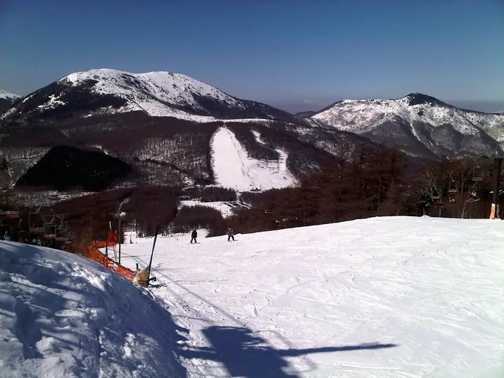
Mt. Yunomaru (North Peak) hiking routes
Hiking times are estimates calculated from the terrain.
Huts, campsites and lodging near Mt. Yunomaru (North Peak)
Campsites
- 湯の丸キャンプ場
Lodging
- 紅葉館
- 鹿沢リゾートホテル
- ロッヂ すばる
Mt. Yunomaru (North Peak) facts
- Elevation
- 2,099 m
- Location
- Ueda, Nagano / Tsumagoi, Gunma
36.437843, 138.401121 - National Park
- 上信越高原国立公園
- Website
- www.city.tomi.nagano.jp
- Trail Map
- www.qkamura.or.jp (PDF)
- Access Information
- db.go-nagano.net
- Wikipedia
- ja.wikipedia.org