
Mt. Yunomaru
湯ノ丸山
Ueda, Nagano / Tōmi-shi, Nagano / Tsumagoi, Gunma · Elevation 2,101 m
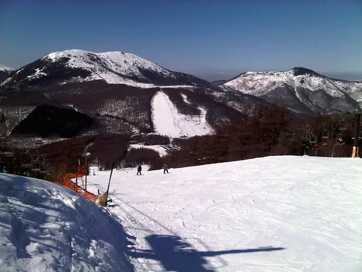
Mt. Yunomaru (2,101 m) is a peak of the Eboshi volcano group on the boundary of Tsumagoi Village in Gunma and Tomi and Ueda cities in Nagano, within Jōshin'etsu-Kōgen National Park. About 600,000 renge-tsutsuji azalea bushes carpet 174 hectares on its flanks—a colony so vast that it has been designated a National Natural Monument—and reaches peak bloom in mid- to late June, celebrated by the Yunomaru-Kōgen Azalea Festival. The Jizō Pass trailhead at around 1,750 m houses the Yunomaru-Kōgen Visitor Centre, and the three-hour return walk to the summit is a classic outing; loops with neighbouring Mt. Eboshi and traverses along the Jōshin border-ridge are also popular.
Mt. Yunomaru at a glance
- Weather: The most settled day in the next 7 days is Wed, November 4: clear, gusts up to 7 m/s. Sat, Nov 7: strong wind (gusts up to 16 m/s).
- Route: The shortest is Mount Yunomaru and Mount Eboshi Circuit from Jizō Pass: about 5 h 16 min, 9.2 km, about 660 m of climbing.
Mt. Yunomaru weather (hourly, 14 days)
Sunrise today 06:11, sunset 16:49
| Tue, 11/3 | Wed, 11/4 | Thu, 11/5 | Fri, 11/6 | Sat, 11/7 | Sun, 11/8 | Mon, 11/9 | Tue, 11/10 | Wed, 11/11 | Thu, 11/12 | Fri, 11/13 | Sat, 11/14 | Sun, 11/15 | Mon, 11/16 | Tue, 11/17 | |||||||||||||||||||||||||||||||||||||||||||||||||||||||||||||||||||||||
|---|---|---|---|---|---|---|---|---|---|---|---|---|---|---|---|---|---|---|---|---|---|---|---|---|---|---|---|---|---|---|---|---|---|---|---|---|---|---|---|---|---|---|---|---|---|---|---|---|---|---|---|---|---|---|---|---|---|---|---|---|---|---|---|---|---|---|---|---|---|---|---|---|---|---|---|---|---|---|---|---|---|---|---|---|---|
| Japan time | 21 | 23 | 1 | 3 | 5 | 7 | 9 | 11 | 13 | 15 | 17 | 19 | 21 | 0 | 3 | 6 | 9 | 12 | 15 | 18 | 21 | 0 | 3 | 6 | 9 | 12 | 15 | 18 | 21 | 0 | 3 | 6 | 9 | 12 | 15 | 18 | 21 | 0 | 3 | 6 | 9 | 12 | 15 | 18 | 21 | 0 | 3 | 6 | 9 | 12 | 15 | 21 | 3 | 9 | 15 | 21 | 3 | 9 | 15 | 21 | 3 | 9 | 15 | 21 | 3 | 9 | 15 | 21 | 3 | 9 | 15 | 21 | 3 | 9 | 15 | 21 | 3 | 9 | 15 | 21 | 3 | 9 | 15 | 21 | |
  |   |   | |  |   | | |  | | | |   | | | |   |   | | |   | | |   | | | | | | | | | | | | | | | | | | | | | | | | |   | | | | | | | |   |   | | | | | | | |   | | |  | | | | | | | | | | | | | | | | ||
| Temperature | °C | -3° | -3° | -3° | -3° | -3° | -1° | 3° | 6° | 7° | 6° | 2° | 1° | 1° | 2° | 2° | 3° | 5° | 10° | 10° | 6° | 6° | 5° | 4° | 4° | 8° | 9° | 9° | 3° | 1° | 0° | -2° | -3° | 1° | 2° | 0° | -4° | -5° | -5° | -6° | -6° | -1° | 2° | 1° | -4° | -4° | -3° | -2° | -1° | 2° | 7° | 4° | -1° | -2° | 0° | 2° | -2° | -5° | -4° | -3° | -5° | -6° | 0° | 3° | -5° | -2° | -1° | -2° | -7° | -6° | 2° | 6° | -2° | -1° | 4° | 7° | 2° | 4° | 7° | 4° | -4° | -6° | 0° | 3° | -4° |
| Precipitation | mm | 0.2 | 3.8 | 8 | 3.8 | 1.0 | 0.7 | 0.4 | 0.7 | 0.7 | 1.2 | 0.3 | 1.9 | 1.8 | 1.6 | 0.1 | 0.1 | 7 | 6 | 0.3 | 0.1 | ||||||||||||||||||||||||||||||||||||||||||||||||||||||||||||||||
| New snow | cm | <.1 | <.1 | 1.8 | 1.8 | 1.5 | <.1 | <.1 | <.1 | ||||||||||||||||||||||||||||||||||||||||||||||||||||||||||||||||||||||||||||
| Snow depth | cm | 0 | 0 | 0 | 0 | 0 | 0 | 0 | 0 | 0 | 0 | 0 | 0 | 0 | 0 | 0 | 0 | 0 | 0 | 0 | 0 | 0 | 0 | 0 | 0 | 0 | 0 | 0 | 0 | 0 | 0 | 0 | 0 | 0 | 0 | 0 | 0 | 0 | 0 | 0 | 0 | 0 | 0 | 0 | 0 | 0 | 0 | 0 | 0 | 0 | 0 | 0 | 0 | 0 | 0 | 0 | 0 | <1 | 2 | 3 | 2 | 2 | 2 | 1 | 1 | 1 | 1 | <1 | <1 | <1 | <1 | <1 | <1 | <1 | <1 | <1 | 0 | 0 | 0 | 0 | 0 | 0 | 0 | 0 | 0 |
| Wind | m/s | 1 | 0 | 0 | 0 | 0 | 0 | 1 | 2 | 2 | 2 | 2 | 3 | 2 | 2 | 1 | 1 | 1 | 1 | 1 | 1 | 1 | 1 | 2 | 1 | 3 | 4 | 3 | 2 | 3 | 3 | 2 | 3 | 4 | 5 | 4 | 2 | 2 | 2 | 2 | 2 | 2 | 2 | 2 | 0 | 0 | 1 | 0 | 0 | 0 | 2 | 1 | 1 | 1 | 1 | 2 | 1 | 4 | 5 | 4 | 2 | 1 | 1 | 1 | 0 | 1 | 3 | 3 | 2 | 1 | 1 | 1 | 0 | 0 | 2 | 4 | 1 | 2 | 2 | 5 | 3 | 2 | 1 | 1 | 0 |
| Wind gusts | m/s | 4 | 4 | 3 | 3 | 3 | 3 | 5 | 7 | 7 | 7 | 7 | 8 | 9 | 9 | 9 | 7 | 5 | 7 | 7 | 6 | 6 | 9 | 11 | 10 | 12 | 15 | 13 | 9 | 10 | 11 | 11 | 12 | 14 | 16 | 16 | 14 | 11 | 10 | 11 | 11 | 10 | 10 | 8 | 6 | 5 | 7 | 7 | 7 | 7 | 9 | 9 | 5 | 3 | 5 | 8 | 8 | 15 | 26 | 23 | 18 | 10 | 7 | 8 | 6 | 8 | 11 | 14 | 13 | 9 | 7 | 6 | 5 | 5 | 7 | 13 | 12 | 13 | 12 | 17 | 18 | 14 | 8 | 6 | 5 |
| Wind dir. | ↓ | ↓ | ↓ | ↓ | ↓ | ↓ | ↓ | ↓ | ↓ | ↓ | ↓ | ↓ | ↓ | ↓ | ↓ | ↓ | ↓ | ↓ | ↓ | ↓ | ↓ | ↓ | ↓ | ↓ | ↓ | ↓ | ↓ | ↓ | ↓ | ↓ | ↓ | ↓ | ↓ | ↓ | ↓ | ↓ | ↓ | ↓ | ↓ | ↓ | ↓ | ↓ | ↓ | ↓ | ↓ | ↓ | ↓ | ↓ | ↓ | ↓ | ↓ | ↓ | ↓ | ↓ | ↓ | ↓ | ↓ | ↓ | ↓ | ↓ | ↓ | ↓ | ↓ | ↓ | ↓ | ↓ | ↓ | ↓ | ↓ | ↓ | ↓ | ↓ | ↓ | ↓ | ↓ | ↓ | ↓ | ↓ | ↓ | ↓ | ↓ | ↓ | ↓ | ||
Mt. Yunomaru hiking routes
Hiking times are estimates calculated from the terrain.
Huts, campsites and lodging near Mt. Yunomaru
Campsites
- 湯の丸キャンプ場
Lodging
- 紅葉館
- 鹿沢リゾートホテル
- ロッヂ すばる
Lists that include Mt. Yunomaru
100 Famous Hot Spring Mountains · Kanto 100 Famous Mountains · Koshinetsu 100 Famous Mountains · Gunma 100 Famous Mountains · Elevations of 1003 Mountains of Japan · 1000 Mountains of Japan
Mt. Yunomaru facts
- Also known as
- 湯ノ丸山南峰
- Elevation
- 2,101 m
- Location
- Ueda, Nagano / Tōmi-shi, Nagano / Tsumagoi, Gunma
36.434745, 138.400891 - National Park
- 上信越高原国立公園
- Website
- tomikan.jp
- Trail Map
- tomikan.jp (PDF)
- Wikipedia
- ja.wikipedia.org