
Mt. Nyukasa
入笠山
Ina, Nagano / Fujimi, Nagano · Elevation 1,955 m
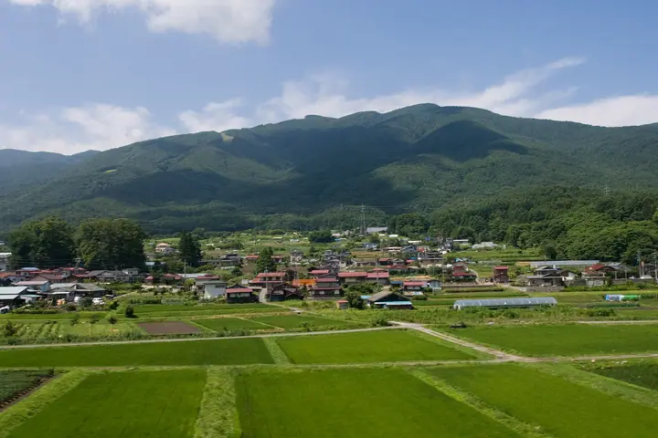
Nyūkasa-yama (1,955 m) stands at the northern tip of the Akaishi Range (Southern Alps), on the boundary of Fujimi Town and Ina City in southern Nagano Prefecture. It is included in the 300 Famous Mountains of Japan and the 100 Famous Mountains of Shinshū, and is celebrated as one of the country's broadest panoramic summits — looking out over Mount Fuji, the Yatsugatake range, and the Southern, Central and Northern Alps. Its high meadow, the Nyūkasa Marsh, hosts an estimated million lily-of-the-valley each June, and a gondola at Fujimi Panorama Resort takes hikers to within an hour's walk of the summit.
Mt. Nyukasa at a glance
- Weather: The most settled day in the next 7 days is Wed, November 4: clear, gusts up to 5 m/s.
- Route: The shortest is Mount Nyukasa Out-and-Back via Nyukasa Wetland from the Gondola Summit Station: about 2 h 10 min, 4.3 km, about 280 m of climbing.
Mt. Nyukasa weather (hourly, 14 days)
Sunrise today 06:11, sunset 16:51
| Tue, 11/3 | Wed, 11/4 | Thu, 11/5 | Fri, 11/6 | Sat, 11/7 | Sun, 11/8 | Mon, 11/9 | Tue, 11/10 | Wed, 11/11 | Thu, 11/12 | Fri, 11/13 | Sat, 11/14 | Sun, 11/15 | Mon, 11/16 | Tue, 11/17 | |||||||||||||||||||||||||||||||||||||||||||||||||||||||||||||||||||||||
|---|---|---|---|---|---|---|---|---|---|---|---|---|---|---|---|---|---|---|---|---|---|---|---|---|---|---|---|---|---|---|---|---|---|---|---|---|---|---|---|---|---|---|---|---|---|---|---|---|---|---|---|---|---|---|---|---|---|---|---|---|---|---|---|---|---|---|---|---|---|---|---|---|---|---|---|---|---|---|---|---|---|---|---|---|---|
| Japan time | 15 | 17 | 19 | 21 | 23 | 1 | 3 | 5 | 7 | 9 | 11 | 13 | 15 | 18 | 21 | 0 | 3 | 6 | 9 | 12 | 15 | 18 | 21 | 0 | 3 | 6 | 9 | 12 | 15 | 18 | 21 | 0 | 3 | 6 | 9 | 12 | 15 | 18 | 21 | 0 | 3 | 6 | 9 | 12 | 15 | 18 | 21 | 0 | 3 | 6 | 9 | 15 | 21 | 3 | 9 | 15 | 21 | 3 | 9 | 15 | 21 | 3 | 9 | 15 | 21 | 3 | 9 | 15 | 21 | 3 | 9 | 15 | 21 | 3 | 9 | 15 | 21 | 3 | 9 | 15 | 21 | 3 | 9 | 15 | |
 |  |   | | | | |   |   |   | | | |   | |   | | |   | |   |  | | | |   | | | | | | | | | | | | | | | | | | | | | | | | | | | | | | | | |   | |   |  | | | | | | | | | | | | | |   | | | | | | | | | ||
| Temperature | °C | 11° | 5° | 4° | 3° | 1° | 0° | -1° | -1° | 0° | 6° | 10° | 12° | 11° | 6° | 5° | 5° | 5° | 5° | 7° | 11° | 9° | 7° | 6° | 6° | 7° | 6° | 10° | 14° | 13° | 6° | 3° | 1° | 0° | -1° | 5° | 7° | 6° | 0° | -2° | -3° | -3° | -3° | 4° | 8° | 9° | 2° | 2° | 2° | 3° | 3° | 7° | 10° | 3° | 2° | 6° | 7° | 2° | 0° | 0° | 3° | -3° | -4° | 3° | 7° | -1° | -2° | 3° | 5° | -3° | -4° | 3° | 9° | 0° | -1° | 7° | 9° | 5° | 6° | 11° | 11° | 1° | -2° | 2° | 8° |
| Precipitation | mm | 2.9 | 9 | 4.2 | 0.2 | 1.3 | 0.2 | 0.2 | 0.3 | 11 | 14 | 0.1 | 0.5 | ||||||||||||||||||||||||||||||||||||||||||||||||||||||||||||||||||||||||
| New snow | cm | 0.2 | |||||||||||||||||||||||||||||||||||||||||||||||||||||||||||||||||||||||||||||||||||
| Snow depth | cm | 0 | 0 | 0 | 0 | 0 | 0 | 0 | 0 | 0 | 0 | 0 | 0 | 0 | 0 | 0 | 0 | 0 | 0 | 0 | 0 | 0 | 0 | 0 | 0 | 0 | 0 | 0 | 0 | 0 | 0 | 0 | 0 | 0 | 0 | 0 | 0 | 0 | 0 | 0 | 0 | 0 | 0 | 0 | 0 | 0 | 0 | 0 | 0 | 0 | 0 | 0 | 0 | 0 | 0 | 0 | 0 | 0 | 0 | 0 | 0 | 0 | 0 | 0 | 0 | 0 | 0 | 0 | 0 | 0 | 0 | 0 | 0 | 0 | 0 | 0 | 0 | 0 | 0 | 0 | 0 | 0 | 0 | 0 | 0 |
| Wind | m/s | 2 | 1 | 0 | 0 | 1 | 1 | 1 | 1 | 1 | 1 | 1 | 1 | 1 | 2 | 2 | 1 | 1 | 1 | 1 | 1 | 1 | 1 | 1 | 1 | 1 | 1 | 2 | 4 | 4 | 1 | 1 | 1 | 2 | 2 | 4 | 4 | 3 | 1 | 0 | 0 | 0 | 0 | 1 | 2 | 2 | 0 | 1 | 1 | 1 | 1 | 1 | 3 | 0 | 0 | 1 | 5 | 2 | 3 | 1 | 3 | 0 | 0 | 1 | 3 | 0 | 0 | 1 | 3 | 0 | 0 | 1 | 2 | 1 | 1 | 1 | 2 | 1 | 1 | 2 | 4 | 1 | 0 | 1 | 2 |
| Wind gusts | m/s | 8 | 8 | 4 | 3 | 3 | 4 | 3 | 3 | 3 | 4 | 5 | 5 | 5 | 7 | 7 | 8 | 7 | 6 | 4 | 6 | 7 | 6 | 6 | 6 | 7 | 8 | 8 | 13 | 14 | 12 | 7 | 7 | 7 | 9 | 12 | 15 | 14 | 11 | 5 | 4 | 4 | 4 | 5 | 7 | 7 | 6 | 4 | 6 | 6 | 5 | 6 | 12 | 10 | 3 | 6 | 15 | 14 | 12 | 13 | 14 | 11 | 3 | 6 | 13 | 9 | 4 | 6 | 9 | 9 | 3 | 4 | 9 | 8 | 6 | 7 | 14 | 9 | 13 | 9 | 14 | 13 | 5 | 5 | 8 |
| Wind dir. | ↓ | ↓ | ↓ | ↓ | ↓ | ↓ | ↓ | ↓ | ↓ | ↓ | ↓ | ↓ | ↓ | ↓ | ↓ | ↓ | ↓ | ↓ | ↓ | ↓ | ↓ | ↓ | ↓ | ↓ | ↓ | ↓ | ↓ | ↓ | ↓ | ↓ | ↓ | ↓ | ↓ | ↓ | ↓ | ↓ | ↓ | ↓ | ↓ | ↓ | ↓ | ↓ | ↓ | ↓ | ↓ | ↓ | ↓ | ↓ | ↓ | ↓ | ↓ | ↓ | ↓ | ↓ | ↓ | ↓ | ↓ | ↓ | ↓ | ↓ | ↓ | ↓ | ↓ | ↓ | ↓ | ↓ | ↓ | ↓ | ↓ | ↓ | ↓ | ↓ | ↓ | ↓ | ↓ | ↓ | ↓ | ↓ | ↓ | ↓ | ↓ | ↓ | ↓ | ↓ | |
Mt. Nyukasa hiking routes
Hiking times are estimates calculated from the terrain.
Huts, campsites and lodging near Mt. Nyukasa
Mountain huts
- マナスル山荘天文館 reservation required · sleeps 35
- ヒュッテ入笠 2026: open all year · reservation required
- Yamabiko-sō 2026: open April 25–November 15 · reservation required
Campsites
- 入笠JAハウス
- Nyukasa JA Camping Ground
Lodging
- ロッヂコスモス
Lists that include Mt. Nyukasa
Japan's 300 Famous Mountains · Koshinetsu 100 Famous Mountains · Shinshu 100 Famous Mountains · Elevations of 1003 Mountains of Japan · 1000 Mountains of Japan
Mt. Nyukasa facts
- Elevation
- 1,955 m
- Location
- Ina, Nagano / Fujimi, Nagano
35.896329, 138.171616 - Website
- www.town.fujimi.lg.jp
- Trail Map
- www.fujimipanorama.com (PDF)
- Access Information
- www.town.fujimi.lg.jp
- Wikipedia
- ja.wikipedia.org