
Mount Moriya
守屋山
Ina, Nagano · Elevation 1,650 m
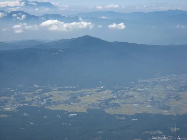
Mount Moriya is a 1,650 m peak rising at the convergence of Ina City's Takatō district, Suwa City, and Chino City in Nagano, an independent summit at the northern fringe of the Southern Alps. Long revered as the sacred mountain of Suwa Taisha, its summit looks out over Lake Suwa and circles around the Yatsugatake, Southern Alps, and Central Alps, with the Northern Alps showing on clear days. The classic route ascends from Tsuetsuki Pass on a path kept open by local volunteers, making it welcoming to beginners. Mizu-bashō and other wildflowers brighten the slopes, giving the mountain its place in Tanaka Sumie's Hana no Hyakumeizan, Shinshū Hyakumeizan, and Nagano's Meihō Hyakusen.
Mount Moriya at a glance
- Weather: The most settled day in the next 7 days is Thu, November 5: cloudy, gusts up to 4 m/s.
- Route: The shortest is Mount Moriya Circuit via Tsuetsuki Pass and the Tateishi Route: about 4 h 32 min, 7.9 km, about 640 m of climbing.
Mount Moriya weather (hourly, 14 days)
Sunrise today 06:11, sunset 16:51
| Tue, 11/3 | Wed, 11/4 | Thu, 11/5 | Fri, 11/6 | Sat, 11/7 | Sun, 11/8 | Mon, 11/9 | Tue, 11/10 | Wed, 11/11 | Thu, 11/12 | Fri, 11/13 | Sat, 11/14 | Sun, 11/15 | Mon, 11/16 | Tue, 11/17 | |||||||||||||||||||||||||||||||||||||||||||||||||||||||||||||||||||||||
|---|---|---|---|---|---|---|---|---|---|---|---|---|---|---|---|---|---|---|---|---|---|---|---|---|---|---|---|---|---|---|---|---|---|---|---|---|---|---|---|---|---|---|---|---|---|---|---|---|---|---|---|---|---|---|---|---|---|---|---|---|---|---|---|---|---|---|---|---|---|---|---|---|---|---|---|---|---|---|---|---|---|---|---|---|---|
| Japan time | 15 | 17 | 19 | 21 | 23 | 1 | 3 | 5 | 7 | 9 | 11 | 13 | 15 | 18 | 21 | 0 | 3 | 6 | 9 | 12 | 15 | 18 | 21 | 0 | 3 | 6 | 9 | 12 | 15 | 18 | 21 | 0 | 3 | 6 | 9 | 12 | 15 | 18 | 21 | 0 | 3 | 6 | 9 | 12 | 15 | 18 | 21 | 0 | 3 | 6 | 9 | 15 | 21 | 3 | 9 | 15 | 21 | 3 | 9 | 15 | 21 | 3 | 9 | 15 | 21 | 3 | 9 | 15 | 21 | 3 | 9 | 15 | 21 | 3 | 9 | 15 | 21 | 3 | 9 | 15 | 21 | 3 | 9 | 15 | |
  |   |  | | | | |   | | | | |   | |   |   | |   |   | |   |  | | |   | |  | | | | | | | | | | | | | | | | | | | | | | | | | | | | | | | | | | | | | |  | | | | | | | | | | |   | | | | | | | | | ||
| Temperature | °C | 11° | 5° | 3° | 2° | 0° | 0° | 0° | -1° | 0° | 6° | 10° | 12° | 12° | 7° | 6° | 5° | 5° | 5° | 7° | 10° | 10° | 7° | 6° | 5° | 6° | 5° | 11° | 15° | 14° | 7° | 3° | 1° | 0° | -2° | 5° | 7° | 6° | 0° | -3° | -3° | -4° | -5° | 4° | 9° | 8° | 2° | 2° | 2° | 3° | 3° | 7° | 10° | 2° | 1° | 6° | 8° | 2° | 0° | 2° | 4° | -3° | -5° | 3° | 8° | -2° | -3° | 4° | 5° | -2° | -5° | 2° | 10° | 0° | -1° | 7° | 9° | 5° | 5° | 10° | 12° | 3° | -1° | 2° | 9° |
| Precipitation | mm | 2.2 | 10 | 3.5 | 0.4 | 0.5 | 0.2 | 0.1 | 0.1 | 10 | 12 | 0.5 | 0.1 | ||||||||||||||||||||||||||||||||||||||||||||||||||||||||||||||||||||||||
| New snow | cm | ||||||||||||||||||||||||||||||||||||||||||||||||||||||||||||||||||||||||||||||||||||
| Snow depth | cm | 0 | 0 | 0 | 0 | 0 | 0 | 0 | 0 | 0 | 0 | 0 | 0 | 0 | 0 | 0 | 0 | 0 | 0 | 0 | 0 | 0 | 0 | 0 | 0 | 0 | 0 | 0 | 0 | 0 | 0 | 0 | 0 | 0 | 0 | 0 | 0 | 0 | 0 | 0 | 0 | 0 | 0 | 0 | 0 | 0 | 0 | 0 | 0 | 0 | 0 | 0 | 0 | 0 | 0 | 0 | 0 | 0 | 0 | 0 | 0 | 0 | 0 | 0 | 0 | 0 | 0 | 0 | 0 | 0 | 0 | 0 | 0 | 0 | 0 | 0 | 0 | 0 | 0 | 0 | 0 | 0 | 0 | 0 | 0 |
| Wind | m/s | 3 | 1 | 0 | 0 | 0 | 0 | 0 | 0 | 0 | 1 | 1 | 1 | 2 | 2 | 1 | 1 | 1 | 0 | 1 | 0 | 1 | 1 | 1 | 0 | 0 | 0 | 0 | 3 | 3 | 2 | 2 | 2 | 2 | 2 | 3 | 3 | 2 | 1 | 1 | 1 | 1 | 0 | 1 | 1 | 3 | 1 | 0 | 0 | 0 | 0 | 0 | 3 | 1 | 1 | 0 | 4 | 1 | 3 | 2 | 4 | 1 | 0 | 1 | 2 | 0 | 0 | 1 | 3 | 1 | 0 | 1 | 2 | 1 | 0 | 1 | 2 | 2 | 1 | 1 | 4 | 2 | 1 | 1 | 3 |
| Wind gusts | m/s | 7 | 7 | 4 | 2 | 2 | 2 | 2 | 2 | 2 | 4 | 4 | 5 | 6 | 6 | 5 | 4 | 4 | 4 | 3 | 4 | 4 | 4 | 4 | 3 | 4 | 4 | 4 | 9 | 10 | 9 | 5 | 5 | 5 | 6 | 9 | 10 | 10 | 8 | 5 | 4 | 3 | 3 | 4 | 5 | 8 | 8 | 3 | 3 | 3 | 3 | 3 | 9 | 9 | 4 | 4 | 11 | 10 | 9 | 9 | 11 | 10 | 3 | 4 | 9 | 6 | 3 | 4 | 9 | 9 | 3 | 3 | 6 | 6 | 3 | 4 | 12 | 7 | 7 | 6 | 12 | 10 | 6 | 4 | 8 |
| Wind dir. | ↓ | ↓ | ↓ | ↓ | ↓ | ↓ | ↓ | ↓ | ↓ | ↓ | ↓ | ↓ | ↓ | ↓ | ↓ | ↓ | ↓ | ↓ | ↓ | ↓ | ↓ | ↓ | ↓ | ↓ | ↓ | ↓ | ↓ | ↓ | ↓ | ↓ | ↓ | ↓ | ↓ | ↓ | ↓ | ↓ | ↓ | ↓ | ↓ | ↓ | ↓ | ↓ | ↓ | ↓ | ↓ | ↓ | ↓ | ↓ | ↓ | ↓ | ↓ | ↓ | ↓ | ↓ | ↓ | ↓ | ↓ | ↓ | ↓ | ↓ | ↓ | ↓ | ↓ | ↓ | ↓ | ↓ | ↓ | ↓ | ↓ | ↓ | ↓ | ↓ | ↓ | ↓ | ↓ | ↓ | ↓ | ↓ | ↓ | ↓ | ↓ | ↓ | ↓ | ||
Mount Moriya hiking routes
Hiking times are estimates calculated from the terrain.
Huts, campsites and lodging near Mount Moriya
Mountain huts
Lodging
- Tonya Aburaya Farmstay
Lists that include Mount Moriya
100 Famous Mountains of Flowers · Shinshu 100 Famous Mountains · Elevations of 1003 Mountains of Japan · 1000 Mountains of Japan
Mount Moriya facts
- Also known as
- 守屋山西峰
- Elevation
- 1,650 m
- Location
- Ina, Nagano
35.967556, 138.093397 - Website
- www.inacity.jp
- Wikipedia
- ja.wikipedia.org