
Moriyasan Nakadake
守屋山 中嶽
Ina, Nagano · Elevation 1,643 m
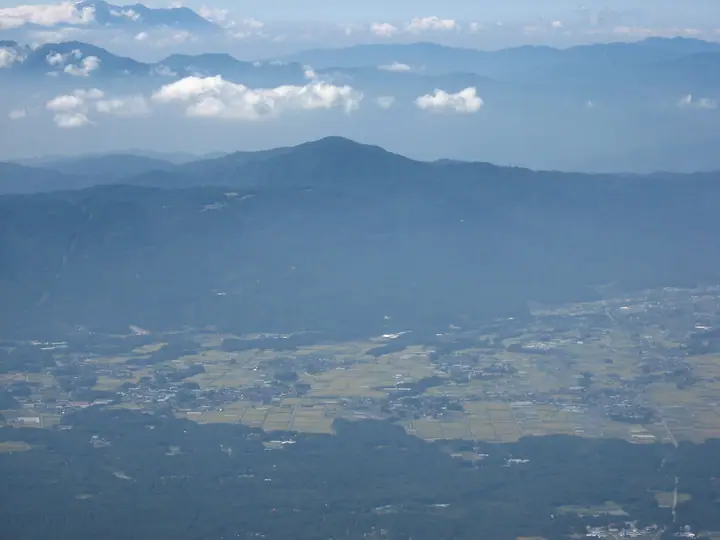
Moriyasan Nakadake is a 1,643 m point between the east and west summits of Mt. Moriya, which straddles Suwa and Ina in Nagano Prefecture. The mountain's trails are maintained by local residents, and the most common route is an out-and-back from the trailhead at Tsuetsuki Pass on National Route 152.
Moriyasan Nakadake at a glance
- Weather: The most settled day in the next 7 days is Thu, November 5: cloudy, gusts up to 4 m/s.
- Route: The shortest is Mount Moriya Circuit via Tsuetsuki Pass and the Tateishi Route: about 4 h 32 min, 7.9 km, about 640 m of climbing.
Moriyasan Nakadake weather (hourly, 14 days)
Sunrise today 06:11, sunset 16:51
| Tue, 11/3 | Wed, 11/4 | Thu, 11/5 | Fri, 11/6 | Sat, 11/7 | Sun, 11/8 | Mon, 11/9 | Tue, 11/10 | Wed, 11/11 | Thu, 11/12 | Fri, 11/13 | Sat, 11/14 | Sun, 11/15 | Mon, 11/16 | Tue, 11/17 | |||||||||||||||||||||||||||||||||||||||||||||||||||||||||||||||||||||||
|---|---|---|---|---|---|---|---|---|---|---|---|---|---|---|---|---|---|---|---|---|---|---|---|---|---|---|---|---|---|---|---|---|---|---|---|---|---|---|---|---|---|---|---|---|---|---|---|---|---|---|---|---|---|---|---|---|---|---|---|---|---|---|---|---|---|---|---|---|---|---|---|---|---|---|---|---|---|---|---|---|---|---|---|---|---|
| Japan time | 15 | 17 | 19 | 21 | 23 | 1 | 3 | 5 | 7 | 9 | 11 | 13 | 15 | 18 | 21 | 0 | 3 | 6 | 9 | 12 | 15 | 18 | 21 | 0 | 3 | 6 | 9 | 12 | 15 | 18 | 21 | 0 | 3 | 6 | 9 | 12 | 15 | 18 | 21 | 0 | 3 | 6 | 9 | 12 | 15 | 18 | 21 | 0 | 3 | 6 | 9 | 15 | 21 | 3 | 9 | 15 | 21 | 3 | 9 | 15 | 21 | 3 | 9 | 15 | 21 | 3 | 9 | 15 | 21 | 3 | 9 | 15 | 21 | 3 | 9 | 15 | 21 | 3 | 9 | 15 | 21 | 3 | 9 | 15 | |
  |   |  | | | | |   | | | | |   | |   |   | |   |   | |   |  | | |   | |  | | | | | | | | | | | | | | | | | | | | | | | | | | | | | | | | | | | | | |  | | | | | | | | | | |   | | | | | | | | | ||
| Temperature | °C | 11° | 5° | 3° | 2° | 1° | 0° | 0° | -1° | 1° | 6° | 10° | 13° | 12° | 7° | 6° | 5° | 5° | 5° | 7° | 10° | 10° | 7° | 6° | 5° | 6° | 5° | 11° | 15° | 14° | 7° | 3° | 2° | 0° | -2° | 5° | 7° | 6° | 0° | -3° | -3° | -4° | -4° | 4° | 9° | 8° | 2° | 2° | 2° | 3° | 3° | 7° | 10° | 2° | 1° | 6° | 8° | 2° | 0° | 2° | 4° | -3° | -5° | 3° | 8° | -2° | -3° | 4° | 5° | -2° | -5° | 2° | 10° | 0° | -1° | 7° | 9° | 5° | 5° | 10° | 12° | 3° | -1° | 2° | 9° |
| Precipitation | mm | 2.2 | 10 | 3.5 | 0.4 | 0.5 | 0.2 | 0.1 | 0.1 | 10 | 12 | 0.5 | 0.1 | ||||||||||||||||||||||||||||||||||||||||||||||||||||||||||||||||||||||||
| New snow | cm | ||||||||||||||||||||||||||||||||||||||||||||||||||||||||||||||||||||||||||||||||||||
| Snow depth | cm | 0 | 0 | 0 | 0 | 0 | 0 | 0 | 0 | 0 | 0 | 0 | 0 | 0 | 0 | 0 | 0 | 0 | 0 | 0 | 0 | 0 | 0 | 0 | 0 | 0 | 0 | 0 | 0 | 0 | 0 | 0 | 0 | 0 | 0 | 0 | 0 | 0 | 0 | 0 | 0 | 0 | 0 | 0 | 0 | 0 | 0 | 0 | 0 | 0 | 0 | 0 | 0 | 0 | 0 | 0 | 0 | 0 | 0 | 0 | 0 | 0 | 0 | 0 | 0 | 0 | 0 | 0 | 0 | 0 | 0 | 0 | 0 | 0 | 0 | 0 | 0 | 0 | 0 | 0 | 0 | 0 | 0 | 0 | 0 |
| Wind | m/s | 3 | 1 | 0 | 0 | 0 | 0 | 0 | 0 | 0 | 1 | 1 | 1 | 2 | 2 | 1 | 1 | 1 | 0 | 1 | 0 | 1 | 1 | 1 | 0 | 0 | 0 | 0 | 3 | 3 | 2 | 2 | 2 | 2 | 2 | 3 | 3 | 2 | 1 | 1 | 1 | 1 | 0 | 1 | 1 | 3 | 1 | 0 | 0 | 0 | 0 | 0 | 3 | 1 | 1 | 0 | 4 | 1 | 3 | 2 | 4 | 1 | 0 | 1 | 2 | 0 | 0 | 1 | 3 | 1 | 0 | 1 | 2 | 1 | 0 | 1 | 2 | 2 | 1 | 1 | 4 | 2 | 1 | 1 | 3 |
| Wind gusts | m/s | 7 | 7 | 4 | 2 | 2 | 2 | 2 | 2 | 2 | 4 | 4 | 5 | 6 | 6 | 5 | 4 | 4 | 4 | 3 | 4 | 4 | 4 | 4 | 3 | 4 | 4 | 4 | 9 | 10 | 9 | 5 | 5 | 5 | 6 | 9 | 10 | 10 | 8 | 5 | 4 | 3 | 3 | 4 | 5 | 8 | 8 | 3 | 3 | 3 | 3 | 3 | 9 | 9 | 4 | 4 | 11 | 10 | 9 | 9 | 11 | 10 | 3 | 4 | 9 | 6 | 3 | 4 | 9 | 9 | 3 | 3 | 6 | 6 | 3 | 4 | 12 | 7 | 7 | 6 | 12 | 10 | 6 | 4 | 8 |
| Wind dir. | ↓ | ↓ | ↓ | ↓ | ↓ | ↓ | ↓ | ↓ | ↓ | ↓ | ↓ | ↓ | ↓ | ↓ | ↓ | ↓ | ↓ | ↓ | ↓ | ↓ | ↓ | ↓ | ↓ | ↓ | ↓ | ↓ | ↓ | ↓ | ↓ | ↓ | ↓ | ↓ | ↓ | ↓ | ↓ | ↓ | ↓ | ↓ | ↓ | ↓ | ↓ | ↓ | ↓ | ↓ | ↓ | ↓ | ↓ | ↓ | ↓ | ↓ | ↓ | ↓ | ↓ | ↓ | ↓ | ↓ | ↓ | ↓ | ↓ | ↓ | ↓ | ↓ | ↓ | ↓ | ↓ | ↓ | ↓ | ↓ | ↓ | ↓ | ↓ | ↓ | ↓ | ↓ | ↓ | ↓ | ↓ | ↓ | ↓ | ↓ | ↓ | ↓ | ↓ | ||
Moriyasan Nakadake hiking routes
Hiking times are estimates calculated from the terrain.
Huts, campsites and lodging near Moriyasan Nakadake
Mountain huts
Campsites
- 千代田湖キャンプ場
Lodging
- Tonya Aburaya Farmstay
Moriyasan Nakadake facts
- Elevation
- 1,643 m
- Location
- Ina, Nagano
35.967370, 138.098182 - Website
- www.inacity.jp
- Wikipedia
- ja.wikipedia.org