
Mt. Mitake
御岳山
Ōme, Tokyo · Elevation 929 m
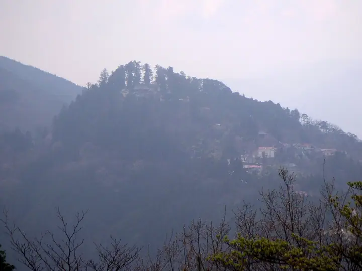
Mt. Mitake (929 m) is a sacred peak in Ōme, western Tokyo, within Chichibu-Tama-Kai National Park; the Musashi-Mitake Shrine just below the summit is said to date back more than two thousand years and remains an important Shugendō site today. The shrine enshrines the Ōguchi-no-Magami ("Ōinu-sama"), a Japanese-wolf deity protecting against theft and evil, and is one of the few major shrines that explicitly welcome dog companions. The Mitake Tozan Cable Car carries visitors up to the summit village, a traditional Oshi pilgrim-lodge district, with valley walks branching off through the Rock Garden, Ayahiro Falls, Nanayo Falls, and Nagao Plateau. The peak is one of the metropolitan area's most popular hikes and appears on lists from Japan's 100 Sacred Mountains and 100 Flower Mountains to the 100 Famous Mountains of Kantō.
Mt. Mitake at a glance
- Weather: The most settled day in the next 7 days is Wed, November 4: cloudy, gusts up to 4 m/s.
- Route: The shortest is Mount Mitake in Okutama, Musashi Mitake Shrine and Rock Garden Loop: about 2 h 42 min, 6.7 km, about 350 m of climbing.
Mt. Mitake weather (hourly, 14 days)
Sunrise today 06:07, sunset 16:47
| Tue, 11/3 | Wed, 11/4 | Thu, 11/5 | Fri, 11/6 | Sat, 11/7 | Sun, 11/8 | Mon, 11/9 | Tue, 11/10 | Wed, 11/11 | Thu, 11/12 | Fri, 11/13 | Sat, 11/14 | Sun, 11/15 | Mon, 11/16 | Tue, 11/17 | |||||||||||||||||||||||||||||||||||||||||||||||||||||||||||||||||||||||
|---|---|---|---|---|---|---|---|---|---|---|---|---|---|---|---|---|---|---|---|---|---|---|---|---|---|---|---|---|---|---|---|---|---|---|---|---|---|---|---|---|---|---|---|---|---|---|---|---|---|---|---|---|---|---|---|---|---|---|---|---|---|---|---|---|---|---|---|---|---|---|---|---|---|---|---|---|---|---|---|---|---|---|---|---|---|
| Japan time | 15 | 17 | 19 | 21 | 23 | 1 | 3 | 5 | 7 | 9 | 11 | 13 | 15 | 18 | 21 | 0 | 3 | 6 | 9 | 12 | 15 | 18 | 21 | 0 | 3 | 6 | 9 | 12 | 15 | 18 | 21 | 0 | 3 | 6 | 9 | 12 | 15 | 18 | 21 | 0 | 3 | 6 | 9 | 12 | 15 | 18 | 21 | 0 | 3 | 6 | 9 | 15 | 21 | 3 | 9 | 15 | 21 | 3 | 9 | 15 | 21 | 3 | 9 | 15 | 21 | 3 | 9 | 15 | 21 | 3 | 9 | 15 | 21 | 3 | 9 | 15 | 21 | 3 | 9 | 15 | 21 | 3 | 9 | 15 | |
  |   |   | | | | |   |   | | |   | | | | | | | |   | |   |   |  | | |  | | | | | | | | | | | | | | | | | | | | | | | | | | | | | | | | | |   |  | |   | | | | | | | | | | | | | | | |   | | | | | ||
| Temperature | °C | 12° | 11° | 10° | 9° | 9° | 8° | 8° | 8° | 8° | 8° | 9° | 9° | 8° | 8° | 8° | 8° | 8° | 9° | 12° | 17° | 13° | 11° | 10° | 9° | 8° | 8° | 15° | 18° | 16° | 12° | 9° | 8° | 7° | 6° | 11° | 12° | 10° | 6° | 4° | 4° | 3° | 2° | 9° | 11° | 10° | 8° | 7° | 6° | 5° | 5° | 6° | 8° | 6° | 4° | 6° | 7° | 4° | 2° | 9° | 10° | 1° | -1° | 7° | 7° | 6° | 2° | 11° | 11° | 1° | 1° | 5° | 7° | 2° | 2° | 8° | 10° | 9° | 8° | 14° | 17° | 7° | 6° | 4° | 6° |
| Precipitation | mm | 0.1 | 1.1 | 1.0 | 0.4 | 0.2 | 0.3 | 1.3 | 6 | 13 | 13 | 3.4 | 0.7 | 3.1 | 0.4 | 0.5 | 0.4 | 2.7 | 13 | 0.5 | |||||||||||||||||||||||||||||||||||||||||||||||||||||||||||||||||
| New snow | cm | ||||||||||||||||||||||||||||||||||||||||||||||||||||||||||||||||||||||||||||||||||||
| Snow depth | cm | 0 | 0 | 0 | 0 | 0 | 0 | 0 | 0 | 0 | 0 | 0 | 0 | 0 | 0 | 0 | 0 | 0 | 0 | 0 | 0 | 0 | 0 | 0 | 0 | 0 | 0 | 0 | 0 | 0 | 0 | 0 | 0 | 0 | 0 | 0 | 0 | 0 | 0 | 0 | 0 | 0 | 0 | 0 | 0 | 0 | 0 | 0 | 0 | 0 | 0 | 0 | 0 | 0 | 0 | 0 | 0 | 0 | 0 | 0 | 0 | 0 | 0 | 0 | 0 | 0 | 0 | 0 | 0 | 0 | 0 | 0 | 0 | 0 | 0 | 0 | 0 | 0 | 0 | 0 | 0 | 0 | 0 | 0 | 0 |
| Wind | m/s | 2 | 0 | 0 | 0 | 0 | 0 | 0 | 0 | 1 | 1 | 1 | 1 | 0 | 1 | 1 | 1 | 3 | 2 | 2 | 2 | 2 | 1 | 0 | 0 | 1 | 1 | 0 | 3 | 2 | 1 | 1 | 1 | 0 | 0 | 2 | 3 | 3 | 1 | 1 | 1 | 1 | 1 | 1 | 3 | 2 | 0 | 1 | 0 | 1 | 1 | 1 | 2 | 1 | 2 | 1 | 2 | 1 | 2 | 5 | 4 | 2 | 1 | 1 | 2 | 1 | 1 | 0 | 4 | 1 | 0 | 1 | 2 | 1 | 0 | 1 | 1 | 0 | 1 | 0 | 4 | 2 | 1 | 1 | 2 |
| Wind gusts | m/s | 5 | 5 | 1 | 1 | 1 | 2 | 2 | 1 | 3 | 4 | 4 | 4 | 4 | 2 | 3 | 4 | 6 | 6 | 7 | 7 | 6 | 5 | 2 | 2 | 2 | 3 | 3 | 8 | 8 | 5 | 4 | 4 | 3 | 2 | 5 | 8 | 9 | 7 | 3 | 3 | 3 | 4 | 4 | 9 | 9 | 5 | 2 | 3 | 2 | 2 | 4 | 7 | 5 | 4 | 5 | 7 | 6 | 4 | 13 | 18 | 10 | 6 | 5 | 9 | 5 | 3 | 5 | 11 | 9 | 3 | 5 | 7 | 6 | 2 | 4 | 7 | 4 | 4 | 4 | 11 | 15 | 5 | 4 | 7 |
| Wind dir. | ↓ | ↓ | ↓ | ↓ | ↓ | ↓ | ↓ | ↓ | ↓ | ↓ | ↓ | ↓ | ↓ | ↓ | ↓ | ↓ | ↓ | ↓ | ↓ | ↓ | ↓ | ↓ | ↓ | ↓ | ↓ | ↓ | ↓ | ↓ | ↓ | ↓ | ↓ | ↓ | ↓ | ↓ | ↓ | ↓ | ↓ | ↓ | ↓ | ↓ | ↓ | ↓ | ↓ | ↓ | ↓ | ↓ | ↓ | ↓ | ↓ | ↓ | ↓ | ↓ | ↓ | ↓ | ↓ | ↓ | ↓ | ↓ | ↓ | ↓ | ↓ | ↓ | ↓ | ↓ | ↓ | ↓ | ↓ | ↓ | ↓ | ↓ | ↓ | ↓ | ↓ | ↓ | ↓ | ↓ | ↓ | ↓ | ↓ | ↓ | ↓ | ↓ | ↓ | ↓ | |
Mt. Mitake hiking routes
- Mount Mitake in Okutama, Musashi Mitake Shrine and Rock Garden Loop 6.7 km · Ascent 353 m Mount Mitake (Station), 御岳平駅 (Aerialway station), 大展望台駅 (Aerialway station)
- Mount Mitake–Mount Hinode to Tsurutsuru Onsen Hiking Course 7.0 km · Ascent 258 m Mount Mitake (Station), 御岳平駅 (Aerialway station), 大展望台駅 (Aerialway station) → つるつる温泉 (Bus stop), 生涯青春の湯;つるつる温泉, つるつる温泉駐車場 第三, つるつる温泉駐車場 第二 (parking)
- Mount Mitake, Okunoin Peak and Mount Nabewari Circuit from Takimoto Station 10.6 km · Ascent 816 m Takimoto (Station), 滝本駅 (Aerialway station), ケーブル下バス停 (Bus stop), ケーブル下 (Bus stop), Times
- Mount Odake, Mount Nabewari and Okunoin Peak Loop from Mount Mitake 10.4 km · Ascent 935 m Mount Mitake (Station), 御岳平駅 (Aerialway station), 大展望台駅 (Aerialway station)
- Mount Odake and Mount Nokogiri Traverse from Mitake to Okutama 12.1 km · Ascent 875 m Mount Mitake (Station), 御岳平駅 (Aerialway station), 大展望台駅 (Aerialway station) → Okutama Station (Bus stop), Oku-Tama (Station), 南一丁目 (Bus stop), 下栃久保 (Bus stop), Times
- Okutama–Mitake Traverse via Nokogiriyama and Odakesan 12.2 km · Ascent 1,464 m Okutama Station (Bus stop), Oku-Tama (Station), 南一丁目 (Bus stop), 下栃久保 (Bus stop), Times → Mount Mitake (Station), 御岳平駅 (Aerialway station), 大展望台駅 (Aerialway station)
- Mount Mitake and Mount Odake Out-and-Back from Mitake Station 22.5 km · Ascent 1,529 m 御嶽駅 (Station), Mitake (Station), Mitake Station (Bus stop), 御岳駅バス停 (Bus stop)
Hiking times are estimates calculated from the terrain.
Huts, campsites and lodging near Mt. Mitake
Mountain huts
- Shinonome-sanso
Campsites
- 大岳鍾乳洞 大岳キャンプ場
- アメリカキャンプ村
- Kawai Campsite
- 奥多摩福音の家
- 鳩ノ巣バンガロー
Lodging
- Komadori Sanso
- Machiya
- Kuraya
- Sankoso
- Machikubota
Lists that include Mt. Mitake
100 Famous Mountains of Flowers · New 100 Famous Flower Mountains · 100 Low Mountains of Japan · Illustrated Collection of Japan's Famous Mountains · Kanto 100 Famous Mountains · 100 Mountains of Tama
Mt. Mitake facts
- Elevation
- 929 m
- Location
- Ōme, Tokyo
35.782815, 139.149485 - National Park
- 秩父多摩甲斐国立公園
- Website
- www.omekanko.gr.jp
- Trail Map
- www.omekanko.gr.jp (PDF)
- Access Information
- www.mitaketozan.co.jp
- Wikipedia
- en.wikipedia.org