
Mount Sogaku
惣岳山
Ōme, Tokyo · Elevation 756 m
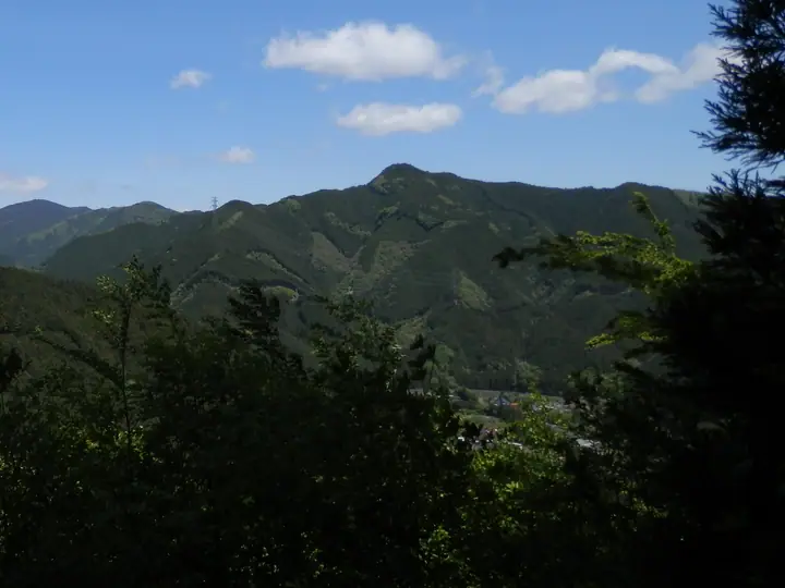
Mount Sogaku is a 756 m peak in Ome City, Tokyo, forming with Mount Takamizu and Mount Iwatakeishi the classic introductory Okutama traverse known as the Takamizu Sanzan. A loop that climbs from JR Gunbatake Station over Takamizu and Iwatakeishi to this summit and descends to Mitake Station has been a popular hiking route since before the war. Just below the summit stands the inner sanctuary of Aoi Shrine, marking the mountain's long history as a sacred site, and the peak is selected for the Tama 100, Tokyo 100 Famous Mountains and other lists.
Mount Sogaku at a glance
- Weather: The most settled day in the next 7 days is Wed, November 4: cloudy, gusts up to 5 m/s.
- Route: The shortest is Takamizu Three Mountains Traverse from Ikusabata to Mitake: about 5 h 5 min, 9.8 km, about 780 m of climbing.
Mount Sogaku weather (hourly, 14 days)
Sunrise today 06:07, sunset 16:47
| Tue, 11/3 | Wed, 11/4 | Thu, 11/5 | Fri, 11/6 | Sat, 11/7 | Sun, 11/8 | Mon, 11/9 | Tue, 11/10 | Wed, 11/11 | Thu, 11/12 | Fri, 11/13 | Sat, 11/14 | Sun, 11/15 | Mon, 11/16 | Tue, 11/17 | |||||||||||||||||||||||||||||||||||||||||||||||||||||||||||||||||||||||
|---|---|---|---|---|---|---|---|---|---|---|---|---|---|---|---|---|---|---|---|---|---|---|---|---|---|---|---|---|---|---|---|---|---|---|---|---|---|---|---|---|---|---|---|---|---|---|---|---|---|---|---|---|---|---|---|---|---|---|---|---|---|---|---|---|---|---|---|---|---|---|---|---|---|---|---|---|---|---|---|---|---|---|---|---|---|
| Japan time | 15 | 17 | 19 | 21 | 23 | 1 | 3 | 5 | 7 | 9 | 11 | 13 | 15 | 18 | 21 | 0 | 3 | 6 | 9 | 12 | 15 | 18 | 21 | 0 | 3 | 6 | 9 | 12 | 15 | 18 | 21 | 0 | 3 | 6 | 9 | 12 | 15 | 18 | 21 | 0 | 3 | 6 | 9 | 12 | 15 | 18 | 21 | 0 | 3 | 6 | 9 | 15 | 21 | 3 | 9 | 15 | 21 | 3 | 9 | 15 | 21 | 3 | 9 | 15 | 21 | 3 | 9 | 15 | 21 | 3 | 9 | 15 | 21 | 3 | 9 | 15 | 21 | 3 | 9 | 15 | 21 | 3 | 9 | 15 | |
  |   |   | | | | | |   | | | | | | | | | | |   |   |   |   |  | | |  |   |   | | | | | | | | | | | | | | | | | |   | | | | | | | | | | | | | |   |  | | | | | | | | | | | | | | | |   | | | | | | | ||
| Temperature | °C | 12° | 10° | 10° | 9° | 9° | 8° | 8° | 8° | 8° | 9° | 10° | 9° | 9° | 8° | 8° | 8° | 8° | 9° | 12° | 17° | 14° | 11° | 11° | 10° | 10° | 11° | 16° | 19° | 17° | 13° | 11° | 9° | 7° | 6° | 11° | 12° | 10° | 6° | 4° | 3° | 3° | 2° | 9° | 11° | 10° | 6° | 7° | 6° | 5° | 5° | 7° | 9° | 6° | 5° | 6° | 8° | 5° | 1° | 8° | 9° | 2° | 1° | 8° | 8° | 6° | 3° | 11° | 10° | 1° | 1° | 6° | 8° | 3° | 3° | 9° | 10° | 9° | 9° | 15° | 16° | 8° | 5° | 5° | 7° |
| Precipitation | mm | 0.2 | 0.4 | 0.9 | 0.5 | 0.9 | 0.2 | 0.2 | 0.3 | 1.0 | 6 | 14 | 13 | 3.6 | 0.5 | 1.4 | 0.2 | 0.1 | 0.3 | 0.9 | 0.3 | 3.1 | 15 | ||||||||||||||||||||||||||||||||||||||||||||||||||||||||||||||
| New snow | cm | ||||||||||||||||||||||||||||||||||||||||||||||||||||||||||||||||||||||||||||||||||||
| Snow depth | cm | 0 | 0 | 0 | 0 | 0 | 0 | 0 | 0 | 0 | 0 | 0 | 0 | 0 | 0 | 0 | 0 | 0 | 0 | 0 | 0 | 0 | 0 | 0 | 0 | 0 | 0 | 0 | 0 | 0 | 0 | 0 | 0 | 0 | 0 | 0 | 0 | 0 | 0 | 0 | 0 | 0 | 0 | 0 | 0 | 0 | 0 | 0 | 0 | 0 | 0 | 0 | 0 | 0 | 0 | 0 | 0 | 0 | 0 | 0 | 0 | 0 | 0 | 0 | 0 | 0 | 0 | 0 | 0 | 0 | 0 | 0 | 0 | 0 | 0 | 0 | 0 | 0 | 0 | 0 | 0 | 0 | 0 | 0 | 0 |
| Wind | m/s | 2 | 1 | 0 | 1 | 0 | 0 | 0 | 0 | 1 | 1 | 1 | 1 | 1 | 1 | 1 | 2 | 3 | 3 | 3 | 2 | 2 | 1 | 0 | 0 | 0 | 0 | 1 | 2 | 1 | 1 | 2 | 2 | 1 | 1 | 1 | 3 | 3 | 1 | 1 | 1 | 2 | 2 | 1 | 2 | 2 | 1 | 1 | 0 | 1 | 0 | 1 | 2 | 1 | 2 | 2 | 3 | 1 | 1 | 8 | 6 | 2 | 1 | 1 | 1 | 1 | 1 | 3 | 6 | 2 | 0 | 1 | 2 | 0 | 0 | 1 | 1 | 0 | 0 | 0 | 6 | 4 | 1 | 1 | 2 |
| Wind gusts | m/s | 5 | 4 | 2 | 2 | 2 | 2 | 2 | 2 | 2 | 3 | 4 | 5 | 5 | 3 | 3 | 4 | 6 | 6 | 7 | 8 | 6 | 4 | 2 | 2 | 2 | 2 | 4 | 6 | 6 | 4 | 5 | 5 | 5 | 3 | 5 | 9 | 9 | 8 | 4 | 4 | 5 | 5 | 5 | 6 | 7 | 5 | 3 | 3 | 3 | 3 | 4 | 7 | 5 | 5 | 5 | 8 | 7 | 4 | 21 | 22 | 15 | 6 | 4 | 8 | 4 | 3 | 8 | 16 | 14 | 5 | 5 | 7 | 6 | 2 | 4 | 6 | 5 | 6 | 4 | 15 | 17 | 11 | 4 | 7 |
| Wind dir. | ↓ | ↓ | ↓ | ↓ | ↓ | ↓ | ↓ | ↓ | ↓ | ↓ | ↓ | ↓ | ↓ | ↓ | ↓ | ↓ | ↓ | ↓ | ↓ | ↓ | ↓ | ↓ | ↓ | ↓ | ↓ | ↓ | ↓ | ↓ | ↓ | ↓ | ↓ | ↓ | ↓ | ↓ | ↓ | ↓ | ↓ | ↓ | ↓ | ↓ | ↓ | ↓ | ↓ | ↓ | ↓ | ↓ | ↓ | ↓ | ↓ | ↓ | ↓ | ↓ | ↓ | ↓ | ↓ | ↓ | ↓ | ↓ | ↓ | ↓ | ↓ | ↓ | ↓ | ↓ | ↓ | ↓ | ↓ | ↓ | ↓ | ↓ | ↓ | ↓ | ↓ | ↓ | ↓ | ↓ | ↓ | ↓ | ↓ | ↓ | ↓ | ↓ | ↓ | ↓ | |
Mount Sogaku hiking routes
- Takamizu Three Mountains Traverse from Ikusabata to Mitake 9.8 km · Ascent 779 m 軍畑駅 (Station), Ikusabata (Station), 軍畑駅入口 (Bus stop) → 御嶽駅 (Station), Mitake (Station), Mitake Station (Bus stop), 御岳駅バス停 (Bus stop)
- Mount Bono, Mount Iwatakeishi and Mount Sogaku Traverse to Mitake Station 13.8 km · Ascent 1,261 m Nolla Naguri (Bus stop), RVパーク狩太23, さわらびの湯 第三駐車場 (parking) → 御嶽駅 (Station), Mitake (Station), Mitake Station (Bus stop), 御岳駅バス停 (Bus stop)
Hiking times are estimates calculated from the terrain.
Huts, campsites and lodging near Mount Sogaku
Mountain huts
- Shinonome-sanso
Campsites
- Kawai Campsite
- 奥多摩福音の家
- 煉瓦堂朱とんぼ
- 清東園キャンプ場
- NAKACHAYA
Lodging
- 民宿 おかべ
- 松乃温泉 水香園
- ぎん鈴旅館
- A-yard
- 髙名荘
Lists that include Mount Sogaku
Mount Sogaku facts
- Elevation
- 756 m
- Location
- Ōme, Tokyo
35.819166, 139.177766 - Website
- www.omekanko.gr.jp
- Trail Map
- www.omekanko.gr.jp
- Wikipedia
- ja.wikipedia.org