
Mt. Gozen
御前山
Okutama, Tokyo · Elevation 1,405 m
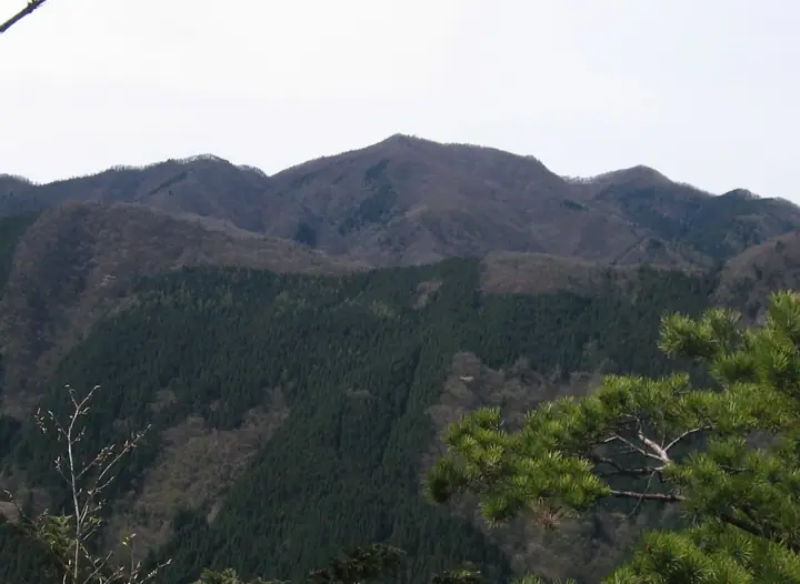
Mt. Gozen (1,405 m) rises in Okutama Town in western Tokyo as one of the Okutama Three Mountains, within Chichibu-Tama-Kai National Park. Standing alongside Mt. Mitō and Mt. Ōdake, it is famed for sweeping ridge views over Lake Okutama and especially for the masses of katakuri (dogtooth violet) that carpet the slopes just below the summit in spring—earning it a place on Sumie Tanaka's "100 Flower Mountains." Routes climb from Sakaibashi and Okōchi Pass on the lakeshore or traverse the ridge from Mt. Ōdake, typically passing the Gozenyama emergency hut. It is counted among the 100 Famous Mountains of Kantō and Japan's 100 Low Mountains.
Mt. Gozen at a glance
- Weather: The most settled day in the next 7 days is Mon, November 9: clear, gusts up to 7 m/s.
- Route: The shortest is Mount Gozen Traverse from Lake Okutama to Sakaibashi: about 5 h 55 min, 11.4 km, about 960 m of climbing.
Mt. Gozen weather (hourly, 14 days)
Sunrise today 06:07, sunset 16:48
| Tue, 11/3 | Wed, 11/4 | Thu, 11/5 | Fri, 11/6 | Sat, 11/7 | Sun, 11/8 | Mon, 11/9 | Tue, 11/10 | Wed, 11/11 | Thu, 11/12 | Fri, 11/13 | Sat, 11/14 | Sun, 11/15 | Mon, 11/16 | Tue, 11/17 | |||||||||||||||||||||||||||||||||||||||||||||||||||||||||||||||||||||||
|---|---|---|---|---|---|---|---|---|---|---|---|---|---|---|---|---|---|---|---|---|---|---|---|---|---|---|---|---|---|---|---|---|---|---|---|---|---|---|---|---|---|---|---|---|---|---|---|---|---|---|---|---|---|---|---|---|---|---|---|---|---|---|---|---|---|---|---|---|---|---|---|---|---|---|---|---|---|---|---|---|---|---|---|---|---|
| Japan time | 15 | 17 | 19 | 21 | 23 | 1 | 3 | 5 | 7 | 9 | 11 | 13 | 15 | 18 | 21 | 0 | 3 | 6 | 9 | 12 | 15 | 18 | 21 | 0 | 3 | 6 | 9 | 12 | 15 | 18 | 21 | 0 | 3 | 6 | 9 | 12 | 15 | 18 | 21 | 0 | 3 | 6 | 9 | 12 | 15 | 18 | 21 | 0 | 3 | 6 | 9 | 15 | 21 | 3 | 9 | 15 | 21 | 3 | 9 | 15 | 21 | 3 | 9 | 15 | 21 | 3 | 9 | 15 | 21 | 3 | 9 | 15 | 21 | 3 | 9 | 15 | 21 | 3 | 9 | 15 | 21 | 3 | 9 | 15 | |
  |   | | | | |   | |   | | | | | | | | | | |   |   |   | |   |  | |  | | | | |   | | | | |   | | | | | | | | | |   | | | | | | | | | | | | | |   |  | | | | | | | | | | | | | | | | | |   | | | | | ||
| Temperature | °C | 7° | 6° | 6° | 5° | 5° | 5° | 5° | 4° | 4° | 5° | 6° | 6° | 5° | 4° | 5° | 5° | 5° | 6° | 8° | 14° | 10° | 8° | 6° | 6° | 5° | 5° | 13° | 16° | 13° | 8° | 6° | 5° | 4° | 3° | 8° | 10° | 7° | 3° | 1° | 1° | 0° | -1° | 7° | 8° | 6° | 3° | 3° | 2° | 2° | 2° | 3° | 5° | 2° | 1° | 2° | 4° | 1° | -1° | 4° | 6° | -3° | -3° | 4° | 4° | 2° | -2° | 7° | 9° | -2° | -1° | 3° | 4° | -1° | -2° | 7° | 8° | 6° | 5° | 11° | 14° | 3° | 3° | 1° | 3° |
| Precipitation | mm | 0.6 | 0.4 | 1.1 | 0.9 | 0.2 | 0.2 | 0.2 | 0.2 | 0.2 | 1.2 | 7 | 14 | 12 | 3.8 | 1.6 | 1.4 | 0.1 | 0.2 | 0.5 | 0.5 | 0.1 | 0.2 | 0.1 | 3.5 | 14 | 1.0 | ||||||||||||||||||||||||||||||||||||||||||||||||||||||||||
| New snow | cm | ||||||||||||||||||||||||||||||||||||||||||||||||||||||||||||||||||||||||||||||||||||
| Snow depth | cm | 0 | 0 | 0 | 0 | 0 | 0 | 0 | 0 | 0 | 0 | 0 | 0 | 0 | 0 | 0 | 0 | 0 | 0 | 0 | 0 | 0 | 0 | 0 | 0 | 0 | 0 | 0 | 0 | 0 | 0 | 0 | 0 | 0 | 0 | 0 | 0 | 0 | 0 | 0 | 0 | 0 | 0 | 0 | 0 | 0 | 0 | 0 | 0 | 0 | 0 | 0 | 0 | 0 | 0 | 0 | 0 | 0 | 0 | 0 | 0 | 0 | 0 | 0 | 0 | 0 | 0 | 0 | 0 | 0 | 0 | 0 | 0 | 0 | 0 | 0 | 0 | 0 | 0 | 0 | 0 | 0 | 0 | 0 | 0 |
| Wind | m/s | 2 | 0 | 0 | 1 | 1 | 1 | 1 | 1 | 1 | 1 | 2 | 2 | 1 | 1 | 1 | 1 | 2 | 2 | 2 | 1 | 2 | 1 | 0 | 1 | 1 | 1 | 1 | 3 | 2 | 2 | 2 | 1 | 1 | 1 | 1 | 1 | 3 | 0 | 1 | 1 | 1 | 1 | 1 | 3 | 2 | 0 | 1 | 0 | 0 | 1 | 1 | 2 | 1 | 2 | 2 | 2 | 1 | 2 | 5 | 4 | 2 | 1 | 1 | 3 | 1 | 1 | 1 | 1 | 1 | 0 | 1 | 2 | 0 | 1 | 1 | 1 | 0 | 1 | 1 | 2 | 3 | 1 | 1 | 2 |
| Wind gusts | m/s | 5 | 5 | 2 | 2 | 2 | 2 | 3 | 2 | 3 | 4 | 5 | 6 | 6 | 4 | 3 | 5 | 5 | 6 | 6 | 7 | 5 | 5 | 3 | 3 | 4 | 4 | 4 | 8 | 8 | 6 | 4 | 5 | 4 | 3 | 5 | 7 | 9 | 9 | 4 | 4 | 3 | 4 | 4 | 9 | 9 | 6 | 3 | 3 | 2 | 2 | 4 | 7 | 6 | 5 | 5 | 7 | 6 | 6 | 15 | 19 | 11 | 6 | 4 | 9 | 8 | 4 | 6 | 11 | 5 | 3 | 5 | 7 | 6 | 3 | 5 | 9 | 4 | 6 | 6 | 7 | 17 | 7 | 5 | 6 |
| Wind dir. | ↓ | ↓ | ↓ | ↓ | ↓ | ↓ | ↓ | ↓ | ↓ | ↓ | ↓ | ↓ | ↓ | ↓ | ↓ | ↓ | ↓ | ↓ | ↓ | ↓ | ↓ | ↓ | ↓ | ↓ | ↓ | ↓ | ↓ | ↓ | ↓ | ↓ | ↓ | ↓ | ↓ | ↓ | ↓ | ↓ | ↓ | ↓ | ↓ | ↓ | ↓ | ↓ | ↓ | ↓ | ↓ | ↓ | ↓ | ↓ | ↓ | ↓ | ↓ | ↓ | ↓ | ↓ | ↓ | ↓ | ↓ | ↓ | ↓ | ↓ | ↓ | ↓ | ↓ | ↓ | ↓ | ↓ | ↓ | ↓ | ↓ | ↓ | ↓ | ↓ | ↓ | ↓ | ↓ | ↓ | ↓ | ↓ | ↓ | ↓ | ↓ | ↓ | ↓ | ||
Mt. Gozen hiking routes
- Mount Gozen Traverse from Lake Okutama to Sakaibashi 11.4 km · Ascent 959 m 奥多摩湖バス停 (Bus stop), Okutamako (Bus stop), 水根バス停 (Bus stop), 水根 (Bus stop) (parking) → 境橋バス停 (Bus stop), 境橋 (Bus stop)
- Gozensan from Lake Okutama to Okutama Station 12.0 km · Ascent 1,286 m 奥多摩湖バス停 (Bus stop), Okutamako (Bus stop), 水根バス停 (Bus stop), 水根 (Bus stop) (parking) → Times, Oku-Tama (Station), Okutama Station (Bus stop), 下栃久保 (Bus stop)
Hiking times are estimates calculated from the terrain.
Huts, campsites and lodging near Mt. Gozen
Mountain huts
Campsites
- 境渓谷キャンプ場
- Hikawa Campsite
- 水根沢キャンプ場
- アメリカキャンプ村
Lodging
- 栃寄森の家
- 小河内荘
- 古民家風張
- 民宿 あたみ荘
- 氷川郷 麻葉の湯 三河屋
Lists that include Mt. Gozen
100 Famous Mountains of Flowers · 100 Low Mountains of Japan · Kanto 100 Famous Mountains · 100 Mountains of Tama · 3 Mountains of Okutama · 1000 Mountains of Japan
Mt. Gozen facts
- Elevation
- 1,405 m
- Location
- Okutama, Tokyo
35.770128, 139.080573 - National Park
- 秩父多摩甲斐国立公園
- Website
- www.okutama.gr.jp
- Wikipedia
- ja.wikipedia.org