
Mt. Kitaizumigatake
北泉ヶ岳
Taiwa, Miyagi · Elevation 1,253 m
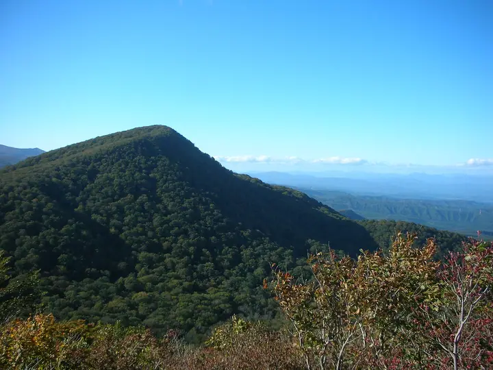
Kitaizumigatake (1,253.1 m) is the foremost peak of the Funagata Range on the boundary between Taiwa Town in Kuroka District and Izumi Ward, Sendai City, Miyagi Prefecture. Lying at the southern edge of Funagata-Renpo Prefectural Natural Park, it stands 78 m higher than the neighbouring and more popular Izumigatake (1,172 m) and is most often climbed as a traverse from the city-run Izumidake Nature Friendship Hall along the Suijin route.
Mt. Kitaizumigatake at a glance
- Weather: The most settled day in the next 7 days is Wed, November 4: clear, gusts up to 9 m/s. Fri, Nov 6, Sat, Nov 7, Sun, Nov 8: strong wind (gusts up to 25 m/s).
- Route: The shortest is Mount Izumigatake and Kita-Izumigatake Loop: about 6 h 5 min, 10.3 km, about 880 m of climbing.
Mt. Kitaizumigatake weather (hourly, 14 days)
Sunrise today 06:05, sunset 16:37
| Tue, 11/3 | Wed, 11/4 | Thu, 11/5 | Fri, 11/6 | Sat, 11/7 | Sun, 11/8 | Mon, 11/9 | Tue, 11/10 | Wed, 11/11 | Thu, 11/12 | Fri, 11/13 | Sat, 11/14 | Sun, 11/15 | Mon, 11/16 | Tue, 11/17 | |||||||||||||||||||||||||||||||||||||||||||||||||||||||||||||||||||||||
|---|---|---|---|---|---|---|---|---|---|---|---|---|---|---|---|---|---|---|---|---|---|---|---|---|---|---|---|---|---|---|---|---|---|---|---|---|---|---|---|---|---|---|---|---|---|---|---|---|---|---|---|---|---|---|---|---|---|---|---|---|---|---|---|---|---|---|---|---|---|---|---|---|---|---|---|---|---|---|---|---|---|---|---|---|---|
| Japan time | 15 | 17 | 19 | 21 | 23 | 1 | 3 | 5 | 7 | 9 | 11 | 13 | 15 | 18 | 21 | 0 | 3 | 6 | 9 | 12 | 15 | 18 | 21 | 0 | 3 | 6 | 9 | 12 | 15 | 18 | 21 | 0 | 3 | 6 | 9 | 12 | 15 | 18 | 21 | 0 | 3 | 6 | 9 | 12 | 15 | 18 | 21 | 0 | 3 | 6 | 9 | 15 | 21 | 3 | 9 | 15 | 21 | 3 | 9 | 15 | 21 | 3 | 9 | 15 | 21 | 3 | 9 | 15 | 21 | 3 | 9 | 15 | 21 | 3 | 9 | 15 | 21 | 3 | 9 | 15 | 21 | 3 | 9 | 15 | |
 |  | | | | | |   |   | | |   | | | |   |   | |   | | | | |   | | | |   | | | | | | |   | | |   |   | | | | | |   | | | | | | | | | | | |   | | | |   | | | | | | |   | | | | |  | | | | | | | | | | | | ||
| Temperature | °C | 6° | 3° | 1° | 1° | 1° | 0° | 0° | 1° | 3° | 7° | 9° | 10° | 9° | 4° | 5° | 6° | 6° | 7° | 8° | 8° | 9° | 8° | 8° | 8° | 7° | 7° | 11° | 12° | 12° | 7° | 4° | 2° | 1° | 0° | 0° | 1° | -1° | -1° | -2° | -1° | -1° | -1° | 1° | 2° | 2° | 0° | -1° | -1° | 0° | -1° | 2° | 2° | -1° | -2° | 2° | 3° | 1° | 1° | 1° | 4° | 0° | 0° | 3° | 3° | 1° | 2° | 2° | 1° | -1° | -2° | 3° | 5° | -1° | 0° | 7° | 9° | 6° | 5° | 8° | 5° | -2° | -2° | 1° | 3° |
| Precipitation | mm | 0.7 | 6 | 9 | 2.5 | 2.1 | 0.4 | 0.2 | 1.2 | 0.9 | 0.7 | 0.6 | 1.0 | 1.3 | 2.1 | 1.9 | 1.6 | 2.0 | 0.8 | 1.0 | 0.6 | 0.4 | 0.3 | 0.4 | 0.3 | 0.1 | 0.1 | 0.2 | 2.2 | 2.0 | 0.3 | 0.5 | 1.2 | 0.9 | 0.1 | 1.1 | 6 | 0.6 | 2.3 | 1.5 | |||||||||||||||||||||||||||||||||||||||||||||
| New snow | cm | 0.6 | 0.7 | 1.1 | 0.4 | 0.7 | 0.2 | <.1 | 0.3 | 0.3 | <.1 | ||||||||||||||||||||||||||||||||||||||||||||||||||||||||||||||||||||||||||
| Snow depth | cm | 0 | 0 | 0 | 0 | 0 | 0 | 0 | 0 | 0 | 0 | 0 | 0 | 0 | 0 | 0 | 0 | 0 | 0 | 0 | 0 | 0 | 0 | 0 | 0 | 0 | 0 | 0 | 0 | 0 | 0 | 0 | 0 | 0 | 0 | 0 | <1 | <1 | <1 | 1 | <1 | <1 | <1 | <1 | 0 | 0 | 0 | 0 | 0 | 0 | 0 | 0 | 0 | 0 | 0 | 0 | 0 | 0 | <1 | 0 | 0 | 0 | 0 | 0 | 0 | 0 | 0 | 0 | 0 | 0 | 0 | 0 | 0 | 0 | 0 | 0 | 0 | 0 | 0 | 0 | 0 | 0 | 0 | 0 | 0 |
| Wind | m/s | 5 | 3 | 3 | 3 | 3 | 2 | 2 | 2 | 3 | 3 | 2 | 2 | 1 | 2 | 3 | 3 | 3 | 2 | 1 | 2 | 1 | 0 | 0 | 2 | 2 | 2 | 3 | 6 | 7 | 6 | 6 | 7 | 6 | 6 | 5 | 7 | 6 | 6 | 6 | 7 | 7 | 7 | 7 | 9 | 8 | 5 | 3 | 3 | 3 | 2 | 3 | 4 | 3 | 2 | 1 | 5 | 3 | 4 | 5 | 6 | 4 | 3 | 3 | 3 | 2 | 2 | 5 | 8 | 5 | 3 | 3 | 1 | 0 | 1 | 1 | 1 | 1 | 1 | 3 | 6 | 8 | 6 | 4 | 3 |
| Wind gusts | m/s | 17 | 14 | 10 | 10 | 10 | 9 | 8 | 8 | 8 | 9 | 9 | 8 | 5 | 7 | 9 | 10 | 11 | 9 | 7 | 6 | 6 | 4 | 3 | 7 | 8 | 8 | 11 | 18 | 21 | 19 | 18 | 20 | 18 | 18 | 18 | 22 | 22 | 20 | 19 | 20 | 21 | 22 | 21 | 24 | 25 | 21 | 15 | 10 | 10 | 9 | 9 | 12 | 11 | 8 | 7 | 12 | 12 | 12 | 14 | 21 | 16 | 11 | 11 | 10 | 9 | 8 | 15 | 21 | 20 | 14 | 10 | 8 | 6 | 5 | 5 | 6 | 8 | 6 | 9 | 17 | 25 | 22 | 16 | 11 |
| Wind dir. | ↓ | ↓ | ↓ | ↓ | ↓ | ↓ | ↓ | ↓ | ↓ | ↓ | ↓ | ↓ | ↓ | ↓ | ↓ | ↓ | ↓ | ↓ | ↓ | ↓ | ↓ | ↓ | ↓ | ↓ | ↓ | ↓ | ↓ | ↓ | ↓ | ↓ | ↓ | ↓ | ↓ | ↓ | ↓ | ↓ | ↓ | ↓ | ↓ | ↓ | ↓ | ↓ | ↓ | ↓ | ↓ | ↓ | ↓ | ↓ | ↓ | ↓ | ↓ | ↓ | ↓ | ↓ | ↓ | ↓ | ↓ | ↓ | ↓ | ↓ | ↓ | ↓ | ↓ | ↓ | ↓ | ↓ | ↓ | ↓ | ↓ | ↓ | ↓ | ↓ | ↓ | ↓ | ↓ | ↓ | ↓ | ↓ | ↓ | ↓ | ↓ | ↓ | ↓ | ↓ | |
Mt. Kitaizumigatake hiking routes
Hiking times are estimates calculated from the terrain.
Huts, campsites and lodging near Mt. Kitaizumigatake
Campsites
- 学校キャンプ場
- 市民キャンプ場
- IZUMI PEAK BASE
Lodging
- オーエンス泉岳自然ふれあい館
Mt. Kitaizumigatake facts
- Elevation
- 1,253 m
- Location
- Taiwa, Miyagi
38.422167, 140.697312 - Website
- www.city.sendai.jp
- Trail Map
- www.shizenfureaikan.jp (PDF)
- Access Information
- www.shizenfureaikan.jp
- Wikipedia
- ja.wikipedia.org