
Mount Funagata
船形山
Kami, Miyagi · Elevation 1,500 m
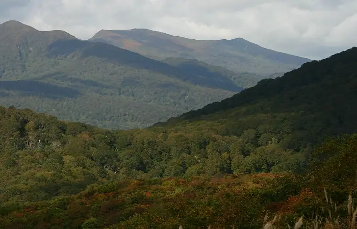
Mount Funagata is a 1,500.34 m stratovolcano on the Yamagata–Miyagi border, the principal summit of the Funagata Range within the Ōu Mountains; the Yamagata side calls it Mount Goshō. The summit straddles Kami, Shikama, and Taiwa towns in Miyagi and Obanazawa and Higashine cities in Yamagata. The Yamagata side falls within the Goshō-san Prefectural Natural Park (designated 1951) and the Miyagi side within the Funagata Range Prefectural Natural Park (designated 1962). It is included in the Nihon Nihyaku Meizan, the Yamagata Hyakumeizan, and the Tōhoku Hyakumeizan. From the summit refuge, multiple trails radiate—the Masuzawa course from Hatagasaka campground in Taiwa, the Yūhizawa course from Kami, and the Obanazawa and Kannonji courses from the Yamagata side via Kurofushi-kōgen. The practical climbing season runs from mid-June through October, and the range is known for its old-growth beech forests and alpine flora.
Mount Funagata at a glance
- Weather: The most settled day in the next 7 days is Wed, November 4: clear, gusts up to 9 m/s. Fri, Nov 6, Sat, Nov 7, Sun, Nov 8: strong wind (gusts up to 25 m/s).
- Route: The shortest is Mount Funagata–Jagatake Circuit via the Masuzawa Course from Hatasaka: about 9 h 2 min, 15.4 km, about 1,100 m of climbing.
Mount Funagata weather (hourly, 14 days)
Sunrise today 06:05, sunset 16:37
| Tue, 11/3 | Wed, 11/4 | Thu, 11/5 | Fri, 11/6 | Sat, 11/7 | Sun, 11/8 | Mon, 11/9 | Tue, 11/10 | Wed, 11/11 | Thu, 11/12 | Fri, 11/13 | Sat, 11/14 | Sun, 11/15 | Mon, 11/16 | Tue, 11/17 | |||||||||||||||||||||||||||||||||||||||||||||||||||||||||||||||||||||||
|---|---|---|---|---|---|---|---|---|---|---|---|---|---|---|---|---|---|---|---|---|---|---|---|---|---|---|---|---|---|---|---|---|---|---|---|---|---|---|---|---|---|---|---|---|---|---|---|---|---|---|---|---|---|---|---|---|---|---|---|---|---|---|---|---|---|---|---|---|---|---|---|---|---|---|---|---|---|---|---|---|---|---|---|---|---|
| Japan time | 15 | 17 | 19 | 21 | 23 | 1 | 3 | 5 | 7 | 9 | 11 | 13 | 15 | 18 | 21 | 0 | 3 | 6 | 9 | 12 | 15 | 18 | 21 | 0 | 3 | 6 | 9 | 12 | 15 | 18 | 21 | 0 | 3 | 6 | 9 | 12 | 15 | 18 | 21 | 0 | 3 | 6 | 9 | 12 | 15 | 18 | 21 | 0 | 3 | 6 | 9 | 15 | 21 | 3 | 9 | 15 | 21 | 3 | 9 | 15 | 21 | 3 | 9 | 15 | 21 | 3 | 9 | 15 | 21 | 3 | 9 | 15 | 21 | 3 | 9 | 15 | 21 | 3 | 9 | 15 | 21 | 3 | 9 | 15 | |
 |  | | | | | |   |   | | |   | | | |   |   | |   | | | | |   | | | |   | | | | | | |   | | |   |   | | | | | |   | | | | | | | | | | | |   | | | |   | | | | | | |   | | | | |  | | | | | | | | | | | | ||
| Temperature | °C | 5° | 2° | 0° | 0° | -1° | -2° | -1° | -1° | 2° | 5° | 7° | 8° | 8° | 2° | 3° | 4° | 4° | 5° | 6° | 7° | 7° | 7° | 7° | 6° | 6° | 5° | 10° | 11° | 10° | 5° | 3° | 0° | -1° | -2° | -2° | -1° | -2° | -3° | -3° | -3° | -3° | -2° | -1° | 1° | 0° | -1° | -2° | -2° | -2° | -3° | 1° | 1° | -3° | -4° | 0° | 1° | 0° | -1° | -1° | 3° | -2° | -2° | 1° | 2° | -1° | 0° | 0° | 0° | -2° | -3° | 1° | 4° | -2° | -2° | 6° | 8° | 4° | 3° | 6° | 3° | -3° | -3° | -1° | 2° |
| Precipitation | mm | 0.7 | 6 | 9 | 2.5 | 2.1 | 0.4 | 0.2 | 1.2 | 0.9 | 0.7 | 0.6 | 1.0 | 1.3 | 2.1 | 1.9 | 1.6 | 2.0 | 0.8 | 1.0 | 0.6 | 0.4 | 0.3 | 0.4 | 0.3 | 0.1 | 0.1 | 0.2 | 2.2 | 2.0 | 0.3 | 0.5 | 1.2 | 0.9 | 0.1 | 1.1 | 6 | 0.6 | 2.3 | 1.5 | |||||||||||||||||||||||||||||||||||||||||||||
| New snow | cm | 0.6 | 0.7 | 1.1 | 0.4 | 0.7 | 0.2 | <.1 | 0.3 | 0.3 | <.1 | ||||||||||||||||||||||||||||||||||||||||||||||||||||||||||||||||||||||||||
| Snow depth | cm | 0 | 0 | 0 | 0 | 0 | 0 | 0 | 0 | 0 | 0 | 0 | 0 | 0 | 0 | 0 | 0 | 0 | 0 | 0 | 0 | 0 | 0 | 0 | 0 | 0 | 0 | 0 | 0 | 0 | 0 | 0 | 0 | 0 | 0 | 0 | <1 | <1 | <1 | 1 | <1 | <1 | <1 | <1 | 0 | 0 | 0 | 0 | 0 | 0 | 0 | 0 | 0 | 0 | 0 | 0 | 0 | 0 | <1 | 0 | 0 | 0 | 0 | 0 | 0 | 0 | 0 | 0 | 0 | 0 | 0 | 0 | 0 | 0 | 0 | 0 | 0 | 0 | 0 | 0 | 0 | 0 | 0 | 0 | 0 |
| Wind | m/s | 5 | 3 | 3 | 3 | 3 | 2 | 2 | 2 | 3 | 3 | 2 | 2 | 1 | 2 | 3 | 3 | 3 | 2 | 1 | 2 | 1 | 0 | 0 | 2 | 2 | 2 | 3 | 6 | 7 | 6 | 6 | 7 | 6 | 6 | 5 | 7 | 6 | 6 | 6 | 7 | 7 | 7 | 7 | 9 | 8 | 5 | 3 | 3 | 3 | 2 | 3 | 4 | 3 | 2 | 1 | 5 | 3 | 4 | 5 | 6 | 4 | 3 | 3 | 3 | 2 | 2 | 5 | 8 | 5 | 3 | 3 | 1 | 0 | 1 | 1 | 1 | 1 | 1 | 3 | 6 | 8 | 6 | 4 | 3 |
| Wind gusts | m/s | 17 | 14 | 10 | 10 | 10 | 9 | 8 | 8 | 8 | 9 | 9 | 8 | 5 | 7 | 9 | 10 | 11 | 9 | 7 | 6 | 6 | 4 | 3 | 7 | 8 | 8 | 11 | 18 | 21 | 19 | 18 | 20 | 18 | 18 | 18 | 22 | 22 | 20 | 19 | 20 | 21 | 22 | 21 | 24 | 25 | 21 | 15 | 10 | 10 | 9 | 9 | 12 | 11 | 8 | 7 | 12 | 12 | 12 | 14 | 21 | 16 | 11 | 11 | 10 | 9 | 8 | 15 | 21 | 20 | 14 | 10 | 8 | 6 | 5 | 5 | 6 | 8 | 6 | 9 | 17 | 25 | 22 | 16 | 11 |
| Wind dir. | ↓ | ↓ | ↓ | ↓ | ↓ | ↓ | ↓ | ↓ | ↓ | ↓ | ↓ | ↓ | ↓ | ↓ | ↓ | ↓ | ↓ | ↓ | ↓ | ↓ | ↓ | ↓ | ↓ | ↓ | ↓ | ↓ | ↓ | ↓ | ↓ | ↓ | ↓ | ↓ | ↓ | ↓ | ↓ | ↓ | ↓ | ↓ | ↓ | ↓ | ↓ | ↓ | ↓ | ↓ | ↓ | ↓ | ↓ | ↓ | ↓ | ↓ | ↓ | ↓ | ↓ | ↓ | ↓ | ↓ | ↓ | ↓ | ↓ | ↓ | ↓ | ↓ | ↓ | ↓ | ↓ | ↓ | ↓ | ↓ | ↓ | ↓ | ↓ | ↓ | ↓ | ↓ | ↓ | ↓ | ↓ | ↓ | ↓ | ↓ | ↓ | ↓ | ↓ | ↓ | |
Mount Funagata hiking routes
Hiking times are estimates calculated from the terrain.
Huts, campsites and lodging near Mount Funagata
Mountain huts
Campsites
- 大滝キャンプ場
Lists that include Mount Funagata
Japan 200 Famous Mountains · Japan's 300 Famous Mountains · 100 Famous Hot Spring Mountains · Tohoku 100 Famous Mountains · Yamagata 100 Famous Mountains · Elevations of 1003 Mountains of Japan · 1000 Mountains of Japan
Mount Funagata facts
- Also known as
- 御所山
- Elevation
- 1,500 m
- Location
- Kami, Miyagi
38.455454, 140.619861 - Website
- yamagatayama.com
- Trail Map
- www.town.taiwa.miyagi.jp (PDF)
- Access Information
- www.town.taiwa.miyagi.jp
- Wikipedia
- ja.wikipedia.org