
Mt. Karamatsuoyama
唐松尾山
Chichibu, Saitama · Elevation 2,109 m
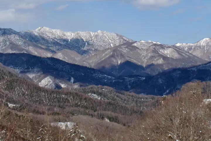
Mt. Karamatsuoyama is a 2,109.2 m peak on the main ridge of the Okuchichibu Mountains, straddling the border between Chichibu City in Saitama Prefecture and Kōshū City in Yamanashi Prefecture, and is the highest point in the entire Tama River watershed. Its name derives from the larch (karamatsu) plantations that once covered its slopes; from here the ridge extends north to Mt. Hiryū-san and Mt. Kumotori-yama, and west to Mt. Kasatori-yama and Mt. Kobushigatake. The peak lies within Chichibu-Tama-Kai National Park; the standard traverse loops from the Sakubadaira trailhead via Shōgen-tōge (where Shōgen-goya hut sits) and on to Mt. Kasatori-yama, and the summit appears on numerous lists including the Kantō Hyakuzan, Kai Hyakusan and the catalogue of Japan 2,000 m peaks.
Mt. Karamatsuoyama at a glance
- Weather: The most settled day in the next 7 days is Sun, November 8: clear, gusts up to 6 m/s.
Mt. Karamatsuoyama weather (hourly, 14 days)
Sunrise today 06:08, sunset 16:48
| Tue, 11/3 | Wed, 11/4 | Thu, 11/5 | Fri, 11/6 | Sat, 11/7 | Sun, 11/8 | Mon, 11/9 | Tue, 11/10 | Wed, 11/11 | Thu, 11/12 | Fri, 11/13 | Sat, 11/14 | Sun, 11/15 | Mon, 11/16 | Tue, 11/17 | |||||||||||||||||||||||||||||||||||||||||||||||||||||||||||||||||||||||
|---|---|---|---|---|---|---|---|---|---|---|---|---|---|---|---|---|---|---|---|---|---|---|---|---|---|---|---|---|---|---|---|---|---|---|---|---|---|---|---|---|---|---|---|---|---|---|---|---|---|---|---|---|---|---|---|---|---|---|---|---|---|---|---|---|---|---|---|---|---|---|---|---|---|---|---|---|---|---|---|---|---|---|---|---|---|
| Japan time | 15 | 17 | 19 | 21 | 23 | 1 | 3 | 5 | 7 | 9 | 11 | 13 | 15 | 18 | 21 | 0 | 3 | 6 | 9 | 12 | 15 | 18 | 21 | 0 | 3 | 6 | 9 | 12 | 15 | 18 | 21 | 0 | 3 | 6 | 9 | 12 | 15 | 18 | 21 | 0 | 3 | 6 | 9 | 12 | 15 | 18 | 21 | 0 | 3 | 6 | 9 | 15 | 21 | 3 | 9 | 15 | 21 | 3 | 9 | 15 | 21 | 3 | 9 | 15 | 21 | 3 | 9 | 15 | 21 | 3 | 9 | 15 | 21 | 3 | 9 | 15 | 21 | 3 | 9 | 15 | 21 | 3 | 9 | 15 | |
  |   | | | | |   | |   | | | | | | | | | | |   | | |   |  | | |  | | |   | | | | | | | |   | | | | | | |   | | | | | | | | |   |   |   | | | | |   |  | | | | | | | | | | | | | | | |   | |   | | | | | ||
| Temperature | °C | 4° | 3° | 2° | 2° | 2° | 2° | 1° | 1° | 1° | 2° | 5° | 5° | 4° | 2° | 2° | 2° | 2° | 3° | 6° | 11° | 8° | 5° | 4° | 3° | 3° | 3° | 9° | 13° | 12° | 5° | 2° | 0° | -2° | -3° | 4° | 6° | 5° | -1° | -3° | -3° | -3° | -3° | 4° | 7° | 4° | -1° | 0° | 0° | -1° | 0° | 3° | 2° | -1° | -3° | -2° | 2° | -1° | -5° | -1° | 0° | -7° | -5° | 2° | 3° | -2° | -5° | 3° | 4° | -4° | -4° | 3° | 4° | -3° | -4° | 4° | 5° | 3° | 3° | 9° | 9° | -1° | 1° | 1° | 2° |
| Precipitation | mm | 1.4 | 0.4 | 0.4 | 1.5 | 1.7 | 1.4 | 0.2 | 1.4 | 0.3 | 6 | 12 | 11 | 1.1 | 1.4 | 0.5 | 0.1 | 1.2 | 2.2 | 4.7 | 1.2 | 0.1 | 0.1 | 9 | 14 | 0.1 | 0.3 | ||||||||||||||||||||||||||||||||||||||||||||||||||||||||||
| New snow | cm | 1.7 | 0.6 | ||||||||||||||||||||||||||||||||||||||||||||||||||||||||||||||||||||||||||||||||||
| Snow depth | cm | 0 | 0 | 0 | 0 | 0 | 0 | 0 | 0 | 0 | 0 | 0 | 0 | 0 | 0 | 0 | 0 | 0 | 0 | 0 | 0 | 0 | 0 | 0 | 0 | 0 | 0 | 0 | 0 | 0 | 0 | 0 | 0 | 0 | 0 | 0 | 0 | 0 | 0 | 0 | 0 | 0 | 0 | 0 | 0 | 0 | 0 | 0 | 0 | 0 | 0 | 0 | 0 | 0 | 1 | 1 | <1 | 0 | 0 | 0 | 0 | 0 | 0 | 0 | 0 | 0 | 0 | 0 | 0 | 0 | 0 | 0 | 0 | 0 | 0 | 0 | 0 | 0 | 0 | 0 | 0 | 0 | 0 | 0 | 0 |
| Wind | m/s | 1 | 1 | 0 | 1 | 0 | 0 | 1 | 1 | 1 | 0 | 1 | 2 | 1 | 1 | 1 | 1 | 1 | 1 | 2 | 1 | 2 | 1 | 1 | 1 | 1 | 1 | 1 | 1 | 0 | 1 | 1 | 0 | 1 | 1 | 1 | 3 | 1 | 0 | 1 | 1 | 0 | 1 | 0 | 1 | 1 | 0 | 1 | 1 | 1 | 1 | 1 | 1 | 1 | 0 | 0 | 2 | 1 | 1 | 6 | 4 | 1 | 1 | 1 | 1 | 1 | 1 | 3 | 1 | 1 | 1 | 1 | 1 | 1 | 1 | 2 | 2 | 2 | 3 | 1 | 3 | 2 | 1 | 1 | 1 |
| Wind gusts | m/s | 5 | 4 | 3 | 3 | 3 | 3 | 3 | 4 | 4 | 4 | 5 | 6 | 6 | 6 | 6 | 6 | 6 | 8 | 6 | 6 | 7 | 8 | 6 | 6 | 6 | 6 | 6 | 7 | 7 | 5 | 5 | 5 | 7 | 7 | 8 | 12 | 11 | 7 | 5 | 6 | 6 | 5 | 5 | 6 | 6 | 5 | 6 | 7 | 6 | 6 | 6 | 6 | 5 | 4 | 5 | 9 | 8 | 8 | 21 | 23 | 15 | 6 | 6 | 8 | 6 | 5 | 10 | 12 | 6 | 4 | 4 | 6 | 6 | 6 | 9 | 13 | 10 | 12 | 12 | 10 | 14 | 7 | 5 | 6 |
| Wind dir. | ↓ | ↓ | ↓ | ↓ | ↓ | ↓ | ↓ | ↓ | ↓ | ↓ | ↓ | ↓ | ↓ | ↓ | ↓ | ↓ | ↓ | ↓ | ↓ | ↓ | ↓ | ↓ | ↓ | ↓ | ↓ | ↓ | ↓ | ↓ | ↓ | ↓ | ↓ | ↓ | ↓ | ↓ | ↓ | ↓ | ↓ | ↓ | ↓ | ↓ | ↓ | ↓ | ↓ | ↓ | ↓ | ↓ | ↓ | ↓ | ↓ | ↓ | ↓ | ↓ | ↓ | ↓ | ↓ | ↓ | ↓ | ↓ | ↓ | ↓ | ↓ | ↓ | ↓ | ↓ | ↓ | ↓ | ↓ | ↓ | ↓ | ↓ | ↓ | ↓ | ↓ | ↓ | ↓ | ↓ | ↓ | ↓ | ↓ | ↓ | ↓ | ↓ | ↓ | ↓ | |
Huts, campsites and lodging near Mt. Karamatsuoyama
Mountain huts
Campsites
- 笠取小屋 テント場
- 一の瀬高原キャンプ場
Lodging
- 民宿みはらし
Lists that include Mt. Karamatsuoyama
Elevations of 1003 Mountains of Japan · 1000 Mountains of Japan
Mt. Karamatsuoyama facts
- Elevation
- 2,109 m
- Location
- Chichibu, Saitama
35.867687, 138.845397 - National Park
- 秩父多摩甲斐国立公園
- Trail Map
- www.env.go.jp (PDF)
- Wikipedia
- ja.wikipedia.org