
Mount Kumotori
雲取山
Okutama, Tokyo · Elevation 2,017 m
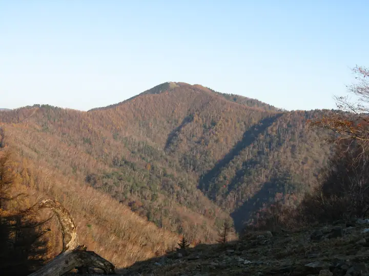
Mount Kumotori is a 2,017 m peak at the meeting point of Tokyo, Saitama, and Yamanashi, the highest summit in Tokyo Metropolis. Within Chichibu-Tama-Kai National Park, its north face preserves a subalpine old-growth forest of Hondo spruce and Veitch's silver fir. Listed in the Hyakumeizan, the 100 Mountains of Flowers, the 100 First-Class Triangulation Mountains, and as Tokyo's highest peak, it offers seasonal interest from spring rhododendrons to summer alpine flowers and winter rime ice. The standard climb is the Kamozawa route via the Kumotori-sansō hut, while longer options follow the Ishi-One ridge from Okutama Station or descend from the Mitsumine Shrine on the Saitama side.
Mount Kumotori at a glance
- Weather: The most settled day in the next 7 days is Fri, November 6: clear, gusts up to 6 m/s.
- Route: The shortest is Mount Kumotori Return from Mitsumine Shrine via the Mitsumine Route: about 12 h 11 min, 19.2 km, about 1,760 m of climbing.
Mount Kumotori weather (hourly, 14 days)
Sunrise today 06:08, sunset 16:48
| Tue, 11/3 | Wed, 11/4 | Thu, 11/5 | Fri, 11/6 | Sat, 11/7 | Sun, 11/8 | Mon, 11/9 | Tue, 11/10 | Wed, 11/11 | Thu, 11/12 | Fri, 11/13 | Sat, 11/14 | Sun, 11/15 | Mon, 11/16 | Tue, 11/17 | |||||||||||||||||||||||||||||||||||||||||||||||||||||||||||||||||||||||
|---|---|---|---|---|---|---|---|---|---|---|---|---|---|---|---|---|---|---|---|---|---|---|---|---|---|---|---|---|---|---|---|---|---|---|---|---|---|---|---|---|---|---|---|---|---|---|---|---|---|---|---|---|---|---|---|---|---|---|---|---|---|---|---|---|---|---|---|---|---|---|---|---|---|---|---|---|---|---|---|---|---|---|---|---|---|
| Japan time | 15 | 17 | 19 | 21 | 23 | 1 | 3 | 5 | 7 | 9 | 11 | 13 | 15 | 18 | 21 | 0 | 3 | 6 | 9 | 12 | 15 | 18 | 21 | 0 | 3 | 6 | 9 | 12 | 15 | 18 | 21 | 0 | 3 | 6 | 9 | 12 | 15 | 18 | 21 | 0 | 3 | 6 | 9 | 12 | 15 | 18 | 21 | 0 | 3 | 6 | 9 | 15 | 21 | 3 | 9 | 15 | 21 | 3 | 9 | 15 | 21 | 3 | 9 | 15 | 21 | 3 | 9 | 15 | 21 | 3 | 9 | 15 | 21 | 3 | 9 | 15 | 21 | 3 | 9 | 15 | 21 | 3 | 9 | 15 | |
  |   | | | | | |   |   | | | | | | | | | | |   | | | |  | | |  | |   |   |   | | | | | | | | | | | | | |   | |   | | | | | | |   | | | | | | |   |  | | | | | | | | | | | | | | | |   | | | | | | | ||
| Temperature | °C | 4° | 3° | 3° | 3° | 3° | 2° | 2° | 2° | 2° | 3° | 5° | 4° | 4° | 2° | 2° | 3° | 3° | 4° | 6° | 11° | 8° | 6° | 4° | 4° | 3° | 3° | 10° | 15° | 12° | 7° | 4° | 2° | 0° | 1° | 6° | 8° | 6° | 0° | -1° | -1° | -2° | -3° | 4° | 7° | 4° | 0° | 1° | 0° | 0° | 0° | 3° | 3° | 0° | -1° | -1° | 3° | -1° | -5° | 1° | 1° | -5° | -4° | 2° | 3° | 0° | -5° | 4° | 5° | -4° | -4° | 2° | 4° | -2° | -4° | 5° | 7° | 4° | 4° | 10° | 10° | 0° | 1° | 0° | 2° |
| Precipitation | mm | 1.1 | 0.2 | 0.4 | 1.5 | 1.7 | 1.5 | 0.2 | 0.1 | 1.1 | 0.6 | 7 | 13 | 13 | 1.5 | 1.2 | 0.6 | 0.4 | 0.7 | 0.3 | 1.2 | 2.5 | 0.7 | 0.2 | 0.1 | 6 | 15 | 0.3 | |||||||||||||||||||||||||||||||||||||||||||||||||||||||||
| New snow | cm | <.1 | <.1 | ||||||||||||||||||||||||||||||||||||||||||||||||||||||||||||||||||||||||||||||||||
| Snow depth | cm | 0 | 0 | 0 | 0 | 0 | 0 | 0 | 0 | 0 | 0 | 0 | 0 | 0 | 0 | 0 | 0 | 0 | 0 | 0 | 0 | 0 | 0 | 0 | 0 | 0 | 0 | 0 | 0 | 0 | 0 | 0 | 0 | 0 | 0 | 0 | 0 | 0 | 0 | 0 | 0 | 0 | 0 | 0 | 0 | 0 | 0 | 0 | 0 | 0 | 0 | 0 | 0 | 0 | <1 | <1 | <1 | 0 | 0 | 0 | 0 | 0 | 0 | 0 | 0 | 0 | 0 | 0 | 0 | 0 | 0 | 0 | 0 | 0 | 0 | 0 | 0 | 0 | 0 | 0 | 0 | 0 | 0 | 0 | 0 |
| Wind | m/s | 1 | 1 | 1 | 1 | 1 | 1 | 1 | 1 | 1 | 1 | 1 | 2 | 2 | 1 | 1 | 1 | 1 | 1 | 2 | 1 | 2 | 1 | 1 | 0 | 1 | 0 | 0 | 1 | 1 | 0 | 1 | 1 | 0 | 0 | 1 | 1 | 2 | 0 | 0 | 0 | 0 | 0 | 0 | 1 | 2 | 1 | 1 | 1 | 0 | 0 | 1 | 2 | 1 | 1 | 1 | 2 | 1 | 1 | 6 | 4 | 1 | 0 | 1 | 2 | 1 | 1 | 3 | 2 | 0 | 0 | 1 | 1 | 1 | 1 | 1 | 1 | 1 | 1 | 0 | 4 | 3 | 0 | 1 | 2 |
| Wind gusts | m/s | 6 | 4 | 2 | 3 | 3 | 3 | 3 | 4 | 4 | 4 | 5 | 7 | 7 | 6 | 6 | 5 | 5 | 6 | 6 | 7 | 6 | 7 | 4 | 4 | 4 | 4 | 4 | 5 | 6 | 5 | 4 | 4 | 4 | 4 | 5 | 7 | 8 | 7 | 4 | 3 | 4 | 4 | 4 | 6 | 7 | 6 | 5 | 5 | 5 | 4 | 4 | 7 | 5 | 5 | 5 | 8 | 8 | 6 | 21 | 23 | 15 | 5 | 5 | 8 | 7 | 4 | 10 | 14 | 8 | 3 | 4 | 7 | 5 | 4 | 6 | 11 | 7 | 9 | 9 | 11 | 16 | 8 | 4 | 7 |
| Wind dir. | ↓ | ↓ | ↓ | ↓ | ↓ | ↓ | ↓ | ↓ | ↓ | ↓ | ↓ | ↓ | ↓ | ↓ | ↓ | ↓ | ↓ | ↓ | ↓ | ↓ | ↓ | ↓ | ↓ | ↓ | ↓ | ↓ | ↓ | ↓ | ↓ | ↓ | ↓ | ↓ | ↓ | ↓ | ↓ | ↓ | ↓ | ↓ | ↓ | ↓ | ↓ | ↓ | ↓ | ↓ | ↓ | ↓ | ↓ | ↓ | ↓ | ↓ | ↓ | ↓ | ↓ | ↓ | ↓ | ↓ | ↓ | ↓ | ↓ | ↓ | ↓ | ↓ | ↓ | ↓ | ↓ | ↓ | ↓ | ↓ | ↓ | ↓ | ↓ | ↓ | ↓ | ↓ | ↓ | ↓ | ↓ | ↓ | ↓ | ↓ | ↓ | ↓ | ↓ | ↓ | |
Mount Kumotori hiking routes
- Mount Kumotori Return from Mitsumine Shrine via the Mitsumine Route 19.2 km · Ascent 1,759 m 三峯神社 (Bus stop), 三峰山駐車場 (parking)
- Mount Kumotori from Kamosawa Out-and-Back 23.3 km · Ascent 1,677 m 鴨沢バス停 (Bus stop), Kamosawa (Bus stop), Kosodegawa (Bus stop), 小袖川バス停 (Bus stop) (parking)
Hiking times are estimates calculated from the terrain.
Huts, campsites and lodging near Mount Kumotori
Mountain huts
- Kumotori emergency lodge unstaffed
- Kumotori-Sanso Lodge 2026: open all year · reservation required
- Okutama-Koya Lodge (Closed)
- Shiraiwa Hut (Ruined)
- Sanjo no yu hut with hot springs reservation required
Campsites
- 雲取山荘テント場
- 五十人平野営場
- 七ツ石小屋 テント場
Lists that include Mount Kumotori
100 Famous Japanese Mountains · Japan 200 Famous Mountains · Japan's 300 Famous Mountains · 100 Famous Mountains of Flowers · New 100 Famous Flower Mountains · 100 Famous Mountains with First-order Triangulation Points · New Japan 100 Famous Mountains · Highest Peaks by Prefecture · 100 Famous Hot Spring Mountains · Kanto 100 Famous Mountains · Yamanashi 100 Famous Mountains · 100 Mountains of Tama · 50 Mountains of Saitama Prefecture · Elevations of 1003 Mountains of Japan · 1000 Mountains of Japan
Mount Kumotori facts
- Elevation
- 2,017 m
- Location
- Okutama, Tokyo
35.855535, 138.943931 - National Park
- 秩父多摩甲斐国立公園
- Website
- www.town.okutama.tokyo.jp
- Trail Map
- www.pref.yamanashi.jp (PDF)
- Access Information
- www.kankyo1.metro.tokyo.lg.jp
- Wikipedia
- ja.wikipedia.org