
Mount Nanatsuishi
七ツ石山
Tabayama, Yamanashi / Okutama, Tokyo · Elevation 1,757 m
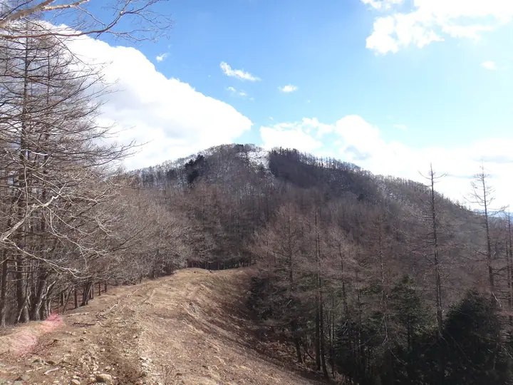
Mount Nanatsuishi (1,757 m) lies on the boundary between Tabayama Village in Yamanashi and Okutama Town in Tokyo, on the Ishione Ridge that runs south from Mount Kumotori within Chichibu-Tama-Kai National Park. The summit takes its name from seven great boulders said to be the petrified retainers of the warrior Taira no Masakado, venerated at the Nanatsuishi Shrine—rebuilt in 2018 and guarded by carved wolves. The trail from Kamosawa over Nanatsuishi is one of the principal approaches to Mount Kumotori, Tokyo's highest peak.
Mount Nanatsuishi at a glance
- Weather: The most settled day in the next 7 days is Fri, November 6: clear, gusts up to 6 m/s.
- Route: The shortest is Mount Nanatsuishi Out-and-Back from Kamosawa: about 7 h 57 min, 12.9 km, about 1,090 m of climbing.
Mount Nanatsuishi weather (hourly, 14 days)
Sunrise today 06:08, sunset 16:48
| Tue, 11/3 | Wed, 11/4 | Thu, 11/5 | Fri, 11/6 | Sat, 11/7 | Sun, 11/8 | Mon, 11/9 | Tue, 11/10 | Wed, 11/11 | Thu, 11/12 | Fri, 11/13 | Sat, 11/14 | Sun, 11/15 | Mon, 11/16 | Tue, 11/17 | |||||||||||||||||||||||||||||||||||||||||||||||||||||||||||||||||||||||
|---|---|---|---|---|---|---|---|---|---|---|---|---|---|---|---|---|---|---|---|---|---|---|---|---|---|---|---|---|---|---|---|---|---|---|---|---|---|---|---|---|---|---|---|---|---|---|---|---|---|---|---|---|---|---|---|---|---|---|---|---|---|---|---|---|---|---|---|---|---|---|---|---|---|---|---|---|---|---|---|---|---|---|---|---|---|
| Japan time | 15 | 17 | 19 | 21 | 23 | 1 | 3 | 5 | 7 | 9 | 11 | 13 | 15 | 18 | 21 | 0 | 3 | 6 | 9 | 12 | 15 | 18 | 21 | 0 | 3 | 6 | 9 | 12 | 15 | 18 | 21 | 0 | 3 | 6 | 9 | 12 | 15 | 18 | 21 | 0 | 3 | 6 | 9 | 12 | 15 | 18 | 21 | 0 | 3 | 6 | 9 | 15 | 21 | 3 | 9 | 15 | 21 | 3 | 9 | 15 | 21 | 3 | 9 | 15 | 21 | 3 | 9 | 15 | 21 | 3 | 9 | 15 | 21 | 3 | 9 | 15 | 21 | 3 | 9 | 15 | 21 | 3 | 9 | 15 | |
  |   | | | | | |   |   | | | | | | | | | | |   | | | |  | | |  | |   |   |   | | | | | | | | | | | | | |   | |   | | | | | | |   | | | | | | |   |  | | | | | | | | | | | | | | | |   | | | | | | | ||
| Temperature | °C | 6° | 5° | 5° | 5° | 4° | 4° | 4° | 4° | 4° | 5° | 7° | 6° | 6° | 4° | 4° | 4° | 5° | 5° | 7° | 13° | 10° | 7° | 6° | 5° | 5° | 5° | 12° | 16° | 14° | 8° | 5° | 4° | 2° | 2° | 8° | 10° | 8° | 2° | 1° | 1° | 0° | -1° | 6° | 9° | 5° | 2° | 3° | 2° | 1° | 2° | 4° | 4° | 2° | 0° | 1° | 4° | 1° | -3° | 3° | 3° | -4° | -2° | 4° | 5° | 1° | -3° | 6° | 7° | -2° | -2° | 4° | 5° | -1° | -3° | 6° | 8° | 5° | 5° | 12° | 12° | 2° | 2° | 2° | 3° |
| Precipitation | mm | 1.1 | 0.2 | 0.4 | 1.5 | 1.7 | 1.5 | 0.2 | 0.1 | 1.1 | 0.6 | 7 | 13 | 13 | 1.5 | 1.2 | 0.6 | 0.4 | 0.7 | 0.3 | 1.2 | 2.5 | 0.7 | 0.2 | 0.1 | 6 | 15 | 0.3 | |||||||||||||||||||||||||||||||||||||||||||||||||||||||||
| New snow | cm | <.1 | <.1 | ||||||||||||||||||||||||||||||||||||||||||||||||||||||||||||||||||||||||||||||||||
| Snow depth | cm | 0 | 0 | 0 | 0 | 0 | 0 | 0 | 0 | 0 | 0 | 0 | 0 | 0 | 0 | 0 | 0 | 0 | 0 | 0 | 0 | 0 | 0 | 0 | 0 | 0 | 0 | 0 | 0 | 0 | 0 | 0 | 0 | 0 | 0 | 0 | 0 | 0 | 0 | 0 | 0 | 0 | 0 | 0 | 0 | 0 | 0 | 0 | 0 | 0 | 0 | 0 | 0 | 0 | <1 | <1 | <1 | 0 | 0 | 0 | 0 | 0 | 0 | 0 | 0 | 0 | 0 | 0 | 0 | 0 | 0 | 0 | 0 | 0 | 0 | 0 | 0 | 0 | 0 | 0 | 0 | 0 | 0 | 0 | 0 |
| Wind | m/s | 1 | 1 | 1 | 1 | 1 | 1 | 1 | 1 | 1 | 1 | 1 | 2 | 2 | 1 | 1 | 1 | 1 | 1 | 2 | 1 | 2 | 1 | 1 | 0 | 1 | 0 | 0 | 1 | 1 | 0 | 1 | 1 | 0 | 0 | 1 | 1 | 2 | 0 | 0 | 0 | 0 | 0 | 0 | 1 | 2 | 1 | 1 | 1 | 0 | 0 | 1 | 2 | 1 | 1 | 1 | 2 | 1 | 1 | 6 | 4 | 1 | 0 | 1 | 2 | 1 | 1 | 3 | 2 | 0 | 0 | 1 | 1 | 1 | 1 | 1 | 1 | 1 | 1 | 0 | 4 | 3 | 0 | 1 | 2 |
| Wind gusts | m/s | 6 | 4 | 2 | 3 | 3 | 3 | 3 | 4 | 4 | 4 | 5 | 7 | 7 | 6 | 6 | 5 | 5 | 6 | 6 | 7 | 6 | 7 | 4 | 4 | 4 | 4 | 4 | 5 | 6 | 5 | 4 | 4 | 4 | 4 | 5 | 7 | 8 | 7 | 4 | 3 | 4 | 4 | 4 | 6 | 7 | 6 | 5 | 5 | 5 | 4 | 4 | 7 | 5 | 5 | 5 | 8 | 8 | 6 | 21 | 23 | 15 | 5 | 5 | 8 | 7 | 4 | 10 | 14 | 8 | 3 | 4 | 7 | 5 | 4 | 6 | 11 | 7 | 9 | 9 | 11 | 16 | 8 | 4 | 7 |
| Wind dir. | ↓ | ↓ | ↓ | ↓ | ↓ | ↓ | ↓ | ↓ | ↓ | ↓ | ↓ | ↓ | ↓ | ↓ | ↓ | ↓ | ↓ | ↓ | ↓ | ↓ | ↓ | ↓ | ↓ | ↓ | ↓ | ↓ | ↓ | ↓ | ↓ | ↓ | ↓ | ↓ | ↓ | ↓ | ↓ | ↓ | ↓ | ↓ | ↓ | ↓ | ↓ | ↓ | ↓ | ↓ | ↓ | ↓ | ↓ | ↓ | ↓ | ↓ | ↓ | ↓ | ↓ | ↓ | ↓ | ↓ | ↓ | ↓ | ↓ | ↓ | ↓ | ↓ | ↓ | ↓ | ↓ | ↓ | ↓ | ↓ | ↓ | ↓ | ↓ | ↓ | ↓ | ↓ | ↓ | ↓ | ↓ | ↓ | ↓ | ↓ | ↓ | ↓ | ↓ | ↓ | |
Mount Nanatsuishi hiking routes
Hiking times are estimates calculated from the terrain.
Huts, campsites and lodging near Mount Nanatsuishi
Mountain huts
- Nanatsuishi-Koya Lodge 2026: open all year · reservation required · sleeps 10
- Okutama-Koya Lodge (Closed)
- Kumotori emergency lodge unstaffed
- Takanosu Hut (non staffed) unstaffed
- Kumotori-Sanso Lodge 2026: open all year · reservation required
Campsites
- 七ツ石小屋 テント場
- 五十人平野営場
- 雲取山荘テント場
Lodging
- 雲取お祭り山荘
Lists that include Mount Nanatsuishi
Mount Nanatsuishi facts
- Elevation
- 1,757 m
- Location
- Tabayama, Yamanashi / Okutama, Tokyo
35.829753, 138.961810 - National Park
- 秩父多摩甲斐国立公園
- Website
- tabayama.info
- Access Information
- tabayama.info
- Wikipedia
- ja.wikipedia.org