
Mount Shiraiwa
白岩山
Chichibu, Saitama · Elevation 1,921 m
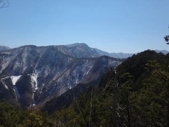
Shiraiwayama is a 1,921 m mountain in Chichibu, Saitama Prefecture, within Chichibu-Tama-Kai National Park. It is a main summit on the ridge from Mitsumine Shrine to Kumotoriyama — Mae-Shiraiwayama, Shiraiwayama, Kumotoriyama — on a route of about 10 km and 6 hours usually broken by a night at the Kumotori Sanso hut; winter passage from December to March is discouraged because of ice.
Mount Shiraiwa at a glance
- Weather: The most settled day in the next 7 days is Fri, November 6: clear, gusts up to 6 m/s.
- Route: The shortest is Mount Kumotori Return from Mitsumine Shrine via the Mitsumine Route: about 12 h 11 min, 19.2 km, about 1,760 m of climbing.
Mount Shiraiwa weather (hourly, 14 days)
Sunrise today 06:08, sunset 16:48
| Tue, 11/3 | Wed, 11/4 | Thu, 11/5 | Fri, 11/6 | Sat, 11/7 | Sun, 11/8 | Mon, 11/9 | Tue, 11/10 | Wed, 11/11 | Thu, 11/12 | Fri, 11/13 | Sat, 11/14 | Sun, 11/15 | Mon, 11/16 | Tue, 11/17 | |||||||||||||||||||||||||||||||||||||||||||||||||||||||||||||||||||||||
|---|---|---|---|---|---|---|---|---|---|---|---|---|---|---|---|---|---|---|---|---|---|---|---|---|---|---|---|---|---|---|---|---|---|---|---|---|---|---|---|---|---|---|---|---|---|---|---|---|---|---|---|---|---|---|---|---|---|---|---|---|---|---|---|---|---|---|---|---|---|---|---|---|---|---|---|---|---|---|---|---|---|---|---|---|---|
| Japan time | 15 | 17 | 19 | 21 | 23 | 1 | 3 | 5 | 7 | 9 | 11 | 13 | 15 | 18 | 21 | 0 | 3 | 6 | 9 | 12 | 15 | 18 | 21 | 0 | 3 | 6 | 9 | 12 | 15 | 18 | 21 | 0 | 3 | 6 | 9 | 12 | 15 | 18 | 21 | 0 | 3 | 6 | 9 | 12 | 15 | 18 | 21 | 0 | 3 | 6 | 9 | 15 | 21 | 3 | 9 | 15 | 21 | 3 | 9 | 15 | 21 | 3 | 9 | 15 | 21 | 3 | 9 | 15 | 21 | 3 | 9 | 15 | 21 | 3 | 9 | 15 | 21 | 3 | 9 | 15 | 21 | 3 | 9 | 15 | |
  |   | | | | | |   |   | | | | | | | | | | |   | | | |  | | |  | |   |   |   | | | | | | | | | | | | | |   | |   | | | | | | |   | | | | | | |   |  | | | | | | | | | | | | | | | |   | | | | | | | ||
| Temperature | °C | 5° | 4° | 4° | 4° | 3° | 3° | 3° | 3° | 3° | 4° | 6° | 5° | 5° | 3° | 3° | 3° | 3° | 4° | 6° | 12° | 9° | 6° | 5° | 4° | 4° | 4° | 11° | 15° | 13° | 7° | 4° | 2° | 1° | 1° | 6° | 9° | 7° | 1° | 0° | -1° | -2° | -2° | 5° | 8° | 4° | 0° | 2° | 1° | 0° | 1° | 3° | 3° | 0° | -1° | 0° | 3° | 0° | -4° | 1° | 2° | -5° | -3° | 2° | 4° | 0° | -4° | 5° | 6° | -3° | -3° | 3° | 4° | -2° | -4° | 5° | 7° | 4° | 4° | 11° | 11° | 1° | 1° | 1° | 2° |
| Precipitation | mm | 1.1 | 0.2 | 0.4 | 1.5 | 1.7 | 1.5 | 0.2 | 0.1 | 1.1 | 0.6 | 7 | 13 | 13 | 1.5 | 1.2 | 0.6 | 0.4 | 0.7 | 0.3 | 1.2 | 2.5 | 0.7 | 0.2 | 0.1 | 6 | 15 | 0.3 | |||||||||||||||||||||||||||||||||||||||||||||||||||||||||
| New snow | cm | <.1 | <.1 | ||||||||||||||||||||||||||||||||||||||||||||||||||||||||||||||||||||||||||||||||||
| Snow depth | cm | 0 | 0 | 0 | 0 | 0 | 0 | 0 | 0 | 0 | 0 | 0 | 0 | 0 | 0 | 0 | 0 | 0 | 0 | 0 | 0 | 0 | 0 | 0 | 0 | 0 | 0 | 0 | 0 | 0 | 0 | 0 | 0 | 0 | 0 | 0 | 0 | 0 | 0 | 0 | 0 | 0 | 0 | 0 | 0 | 0 | 0 | 0 | 0 | 0 | 0 | 0 | 0 | 0 | <1 | <1 | <1 | 0 | 0 | 0 | 0 | 0 | 0 | 0 | 0 | 0 | 0 | 0 | 0 | 0 | 0 | 0 | 0 | 0 | 0 | 0 | 0 | 0 | 0 | 0 | 0 | 0 | 0 | 0 | 0 |
| Wind | m/s | 1 | 1 | 1 | 1 | 1 | 1 | 1 | 1 | 1 | 1 | 1 | 2 | 2 | 1 | 1 | 1 | 1 | 1 | 2 | 1 | 2 | 1 | 1 | 0 | 1 | 0 | 0 | 1 | 1 | 0 | 1 | 1 | 0 | 0 | 1 | 1 | 2 | 0 | 0 | 0 | 0 | 0 | 0 | 1 | 2 | 1 | 1 | 1 | 0 | 0 | 1 | 2 | 1 | 1 | 1 | 2 | 1 | 1 | 6 | 4 | 1 | 0 | 1 | 2 | 1 | 1 | 3 | 2 | 0 | 0 | 1 | 1 | 1 | 1 | 1 | 1 | 1 | 1 | 0 | 4 | 3 | 0 | 1 | 2 |
| Wind gusts | m/s | 6 | 4 | 2 | 3 | 3 | 3 | 3 | 4 | 4 | 4 | 5 | 7 | 7 | 6 | 6 | 5 | 5 | 6 | 6 | 7 | 6 | 7 | 4 | 4 | 4 | 4 | 4 | 5 | 6 | 5 | 4 | 4 | 4 | 4 | 5 | 7 | 8 | 7 | 4 | 3 | 4 | 4 | 4 | 6 | 7 | 6 | 5 | 5 | 5 | 4 | 4 | 7 | 5 | 5 | 5 | 8 | 8 | 6 | 21 | 23 | 15 | 5 | 5 | 8 | 7 | 4 | 10 | 14 | 8 | 3 | 4 | 7 | 5 | 4 | 6 | 11 | 7 | 9 | 9 | 11 | 16 | 8 | 4 | 7 |
| Wind dir. | ↓ | ↓ | ↓ | ↓ | ↓ | ↓ | ↓ | ↓ | ↓ | ↓ | ↓ | ↓ | ↓ | ↓ | ↓ | ↓ | ↓ | ↓ | ↓ | ↓ | ↓ | ↓ | ↓ | ↓ | ↓ | ↓ | ↓ | ↓ | ↓ | ↓ | ↓ | ↓ | ↓ | ↓ | ↓ | ↓ | ↓ | ↓ | ↓ | ↓ | ↓ | ↓ | ↓ | ↓ | ↓ | ↓ | ↓ | ↓ | ↓ | ↓ | ↓ | ↓ | ↓ | ↓ | ↓ | ↓ | ↓ | ↓ | ↓ | ↓ | ↓ | ↓ | ↓ | ↓ | ↓ | ↓ | ↓ | ↓ | ↓ | ↓ | ↓ | ↓ | ↓ | ↓ | ↓ | ↓ | ↓ | ↓ | ↓ | ↓ | ↓ | ↓ | ↓ | ↓ | |
Mount Shiraiwa hiking routes
Hiking times are estimates calculated from the terrain.
Huts, campsites and lodging near Mount Shiraiwa
Mountain huts
- Shiraiwa Hut (Ruined)
- Kumotori-Sanso Lodge 2026: open all year · reservation required
- Kumotori emergency lodge unstaffed
- Okutama-Koya Lodge (Closed)
Campsites
- 雲取山荘テント場
- 五十人平野営場
Mount Shiraiwa facts
- Elevation
- 1,921 m
- Location
- Chichibu, Saitama
35.878849, 138.952251 - National Park
- 秩父多摩甲斐国立公園
- Website
- www.chichibuji.gr.jp
- Wikipedia
- ja.wikipedia.org