
Mount Kumotori
雲取山
โอกูตามะ, โตเกียว · ความสูง 2,017 ม.
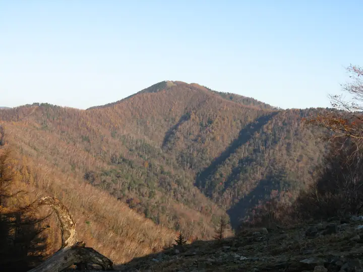
Mount Kumotori is a 2,017 m peak at the meeting point of Tokyo, Saitama, and Yamanashi, the highest summit in Tokyo Metropolis. Within Chichibu-Tama-Kai National Park, its north face preserves a subalpine old-growth forest of Hondo spruce and Veitch's silver fir. Listed in the Hyakumeizan, the 100 Mountains of Flowers, the 100 First-Class Triangulation Mountains, and as Tokyo's highest peak, it offers seasonal interest from spring rhododendrons to summer alpine flowers and winter rime ice. The standard climb is the Kamozawa route via the Kumotori-sansō hut, while longer options follow the Ishi-One ridge from Okutama Station or descend from the Mitsumine Shrine on the Saitama side.
สรุป Mount Kumotori
- อากาศ: วันที่อากาศคงที่ที่สุดใน 7 วันข้างหน้าคือ ศุกร์ 6 พฤศจิกายน: ท้องฟ้าแจ่มใส ลมกระโชกสูงสุด 6 ม./วินาที
- เส้นทาง: เส้นทางที่สั้นที่สุดคือ Mount Kumotori Return from Mitsumine Shrine via the Mitsumine Route: ประมาณ 12 ชม. 11 นาที 19.2 km ขึ้นประมาณ 1,760 m
อากาศ Mount Kumotori (รายชั่วโมง 2 สัปดาห์)
วันนี้พระอาทิตย์ขึ้น 06:08 ตก 16:48
| อังคาร 3/11 | พุธ 4/11 | พฤหัส 5/11 | ศุกร์ 6/11 | เสาร์ 7/11 | อาทิตย์ 8/11 | จันทร์ 9/11 | อังคาร 10/11 | พุธ 11/11 | พฤหัส 12/11 | ศุกร์ 13/11 | เสาร์ 14/11 | อาทิตย์ 15/11 | จันทร์ 16/11 | อังคาร 17/11 | |||||||||||||||||||||||||||||||||||||||||||||||||||||||||||||||||||||||
|---|---|---|---|---|---|---|---|---|---|---|---|---|---|---|---|---|---|---|---|---|---|---|---|---|---|---|---|---|---|---|---|---|---|---|---|---|---|---|---|---|---|---|---|---|---|---|---|---|---|---|---|---|---|---|---|---|---|---|---|---|---|---|---|---|---|---|---|---|---|---|---|---|---|---|---|---|---|---|---|---|---|---|---|---|---|
| เวลาญี่ปุ่น | 15 | 17 | 19 | 21 | 23 | 1 | 3 | 5 | 7 | 9 | 11 | 13 | 15 | 18 | 21 | 0 | 3 | 6 | 9 | 12 | 15 | 18 | 21 | 0 | 3 | 6 | 9 | 12 | 15 | 18 | 21 | 0 | 3 | 6 | 9 | 12 | 15 | 18 | 21 | 0 | 3 | 6 | 9 | 12 | 15 | 18 | 21 | 0 | 3 | 6 | 9 | 15 | 21 | 3 | 9 | 15 | 21 | 3 | 9 | 15 | 21 | 3 | 9 | 15 | 21 | 3 | 9 | 15 | 21 | 3 | 9 | 15 | 21 | 3 | 9 | 15 | 21 | 3 | 9 | 15 | 21 | 3 | 9 | 15 | |
  |   | | | | | |   |   | | | | | | | | | | |   | | | |  | | |  | |   |   |   | | | | | | | | | | | | | |   | |   | | | | | | |   | | | | | | |   |  | | | | | | | | | | | | | | | |   | | | | | | | ||
| อุณหภูมิ | °C | 4° | 3° | 3° | 3° | 3° | 2° | 2° | 2° | 2° | 3° | 5° | 4° | 4° | 2° | 2° | 3° | 3° | 4° | 6° | 11° | 8° | 6° | 4° | 4° | 3° | 3° | 10° | 15° | 12° | 7° | 4° | 2° | 0° | 1° | 6° | 8° | 6° | 0° | -1° | -1° | -2° | -3° | 4° | 7° | 4° | 0° | 1° | 0° | 0° | 0° | 3° | 3° | 0° | -1° | -1° | 3° | -1° | -5° | 1° | 1° | -5° | -4° | 2° | 3° | 0° | -5° | 4° | 5° | -4° | -4° | 2° | 4° | -2° | -4° | 5° | 7° | 4° | 4° | 10° | 10° | 0° | 1° | 0° | 2° |
| ฝนและหิมะ | mm | 1.1 | 0.2 | 0.4 | 1.5 | 1.7 | 1.5 | 0.2 | 0.1 | 1.1 | 0.6 | 7 | 13 | 13 | 1.5 | 1.2 | 0.6 | 0.4 | 0.7 | 0.3 | 1.2 | 2.5 | 0.7 | 0.2 | 0.1 | 6 | 15 | 0.3 | |||||||||||||||||||||||||||||||||||||||||||||||||||||||||
| หิมะตก | cm | <.1 | <.1 | ||||||||||||||||||||||||||||||||||||||||||||||||||||||||||||||||||||||||||||||||||
| หิมะสะสม | cm | 0 | 0 | 0 | 0 | 0 | 0 | 0 | 0 | 0 | 0 | 0 | 0 | 0 | 0 | 0 | 0 | 0 | 0 | 0 | 0 | 0 | 0 | 0 | 0 | 0 | 0 | 0 | 0 | 0 | 0 | 0 | 0 | 0 | 0 | 0 | 0 | 0 | 0 | 0 | 0 | 0 | 0 | 0 | 0 | 0 | 0 | 0 | 0 | 0 | 0 | 0 | 0 | 0 | <1 | <1 | <1 | 0 | 0 | 0 | 0 | 0 | 0 | 0 | 0 | 0 | 0 | 0 | 0 | 0 | 0 | 0 | 0 | 0 | 0 | 0 | 0 | 0 | 0 | 0 | 0 | 0 | 0 | 0 | 0 |
| ลม | m/s | 1 | 1 | 1 | 1 | 1 | 1 | 1 | 1 | 1 | 1 | 1 | 2 | 2 | 1 | 1 | 1 | 1 | 1 | 2 | 1 | 2 | 1 | 1 | 0 | 1 | 0 | 0 | 1 | 1 | 0 | 1 | 1 | 0 | 0 | 1 | 1 | 2 | 0 | 0 | 0 | 0 | 0 | 0 | 1 | 2 | 1 | 1 | 1 | 0 | 0 | 1 | 2 | 1 | 1 | 1 | 2 | 1 | 1 | 6 | 4 | 1 | 0 | 1 | 2 | 1 | 1 | 3 | 2 | 0 | 0 | 1 | 1 | 1 | 1 | 1 | 1 | 1 | 1 | 0 | 4 | 3 | 0 | 1 | 2 |
| ลมกระโชก | m/s | 6 | 4 | 2 | 3 | 3 | 3 | 3 | 4 | 4 | 4 | 5 | 7 | 7 | 6 | 6 | 5 | 5 | 6 | 6 | 7 | 6 | 7 | 4 | 4 | 4 | 4 | 4 | 5 | 6 | 5 | 4 | 4 | 4 | 4 | 5 | 7 | 8 | 7 | 4 | 3 | 4 | 4 | 4 | 6 | 7 | 6 | 5 | 5 | 5 | 4 | 4 | 7 | 5 | 5 | 5 | 8 | 8 | 6 | 21 | 23 | 15 | 5 | 5 | 8 | 7 | 4 | 10 | 14 | 8 | 3 | 4 | 7 | 5 | 4 | 6 | 11 | 7 | 9 | 9 | 11 | 16 | 8 | 4 | 7 |
| ทิศทางลม | ↓ | ↓ | ↓ | ↓ | ↓ | ↓ | ↓ | ↓ | ↓ | ↓ | ↓ | ↓ | ↓ | ↓ | ↓ | ↓ | ↓ | ↓ | ↓ | ↓ | ↓ | ↓ | ↓ | ↓ | ↓ | ↓ | ↓ | ↓ | ↓ | ↓ | ↓ | ↓ | ↓ | ↓ | ↓ | ↓ | ↓ | ↓ | ↓ | ↓ | ↓ | ↓ | ↓ | ↓ | ↓ | ↓ | ↓ | ↓ | ↓ | ↓ | ↓ | ↓ | ↓ | ↓ | ↓ | ↓ | ↓ | ↓ | ↓ | ↓ | ↓ | ↓ | ↓ | ↓ | ↓ | ↓ | ↓ | ↓ | ↓ | ↓ | ↓ | ↓ | ↓ | ↓ | ↓ | ↓ | ↓ | ↓ | ↓ | ↓ | ↓ | ↓ | ↓ | ↓ | |
เส้นทางเดินป่า Mount Kumotori
- Mount Kumotori Return from Mitsumine Shrine via the Mitsumine Route 19.2 km · ความสูงสะสมขาขึ้น 1,759 m 三峯神社 (ป้ายรถประจำทาง), 三峰山駐車場 (มีที่จอดรถ)
- Mount Kumotori from Kamosawa Out-and-Back 23.3 km · ความสูงสะสมขาขึ้น 1,677 m 鴨沢バス停 (ป้ายรถประจำทาง), Kamosawa (ป้ายรถประจำทาง), Kosodegawa (ป้ายรถประจำทาง), 小袖川バス停 (ป้ายรถประจำทาง) (มีที่จอดรถ)
เวลาเดินเป็นค่าประมาณที่คำนวณจากภูมิประเทศ
กระท่อม ที่ตั้งแคมป์ และที่พักใกล้ Mount Kumotori
กระท่อมบนภูเขา
- Kumotori emergency lodge ไม่มีผู้ดูแล
- Kumotori-Sanso Lodge ปี 2026 เปิดตลอดปี · ต้องจองล่วงหน้า
- Okutama-Koya Lodge (Closed)
- Shiraiwa Hut (Ruined)
- Sanjo no yu hut with hot springs ต้องจองล่วงหน้า
ที่ตั้งแคมป์
- 雲取山荘テント場
- 五十人平野営場
- 七ツ石小屋 テント場
รายชื่อที่มี Mount Kumotori
100 ภูเขาที่มีชื่อเสียงของญี่ปุ่น · 200 ภูเขาที่มีชื่อเสียงของญี่ปุ่น · 300 ภูเขาที่มีชื่อเสียงของญี่ปุ่น · 100 ภูเขาที่มีชื่อเสียงด้านดอกไม้ · 100 ภูเขาที่มีชื่อเสียงด้านดอกไม้ฉบับใหม่ · 100 ภูเขาที่มีชื่อเสียงซึ่งมีหมุดสามเหลี่ยมชั้นหนึ่ง · 100 ภูเขาที่มีชื่อเสียงของญี่ปุ่นชุดใหม่ · ยอดเขาสูงที่สุดแยกตามจังหวัด · 100 ภูเขาที่มีชื่อเสียงด้านน้ำพุร้อน · 100 ภูเขาที่มีชื่อเสียงของคันโต · 100 ภูเขาที่มีชื่อเสียงของยามานาชิ · ภูเขา 100 แห่งของทามะ · ภูเขา 50 แห่งในจังหวัดไซตามะ · ระดับความสูงของภูเขา 1003 แห่งในญี่ปุ่น · ภูเขา 1000 แห่งของญี่ปุ่น
ข้อมูลพื้นฐาน Mount Kumotori
- ความสูง
- 2,017 ม.
- ที่ตั้ง
- โอกูตามะ, โตเกียว
35.855535, 138.943931 - อุทยานแห่งชาติ
- 秩父多摩甲斐国立公園
- เว็บไซต์
- www.town.okutama.tokyo.jp
- แผนที่เส้นทางเดินเขา
- www.pref.yamanashi.jp (PDF)
- ข้อมูลการเดินทาง
- www.kankyo1.metro.tokyo.lg.jp
- วิกิพีเดีย
- ja.wikipedia.org