
Mt. Itoseyama
糸瀬山
Okuwa, Nagano · Elevation 1,867 m
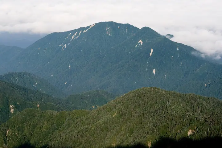
Mt. Itoseyama is an 1,867-meter peak in Ōkuwa Village, Kiso District, Nagano Prefecture, lying on a southwestern ridge of the main Central Alps spine, rising like a folding screen east of the Kiso River. Together with Mt. Nagiso and Mt. Kazakoshi it is counted as one of the Kiso Three Mountains. Just below the summit stands Noroshi-iwa, a large granite tower scalable via ladder and chains that affords expansive views of Mt. Ontake, Mt. Norikura, and the Northern, Central, and Southern Alps. The trail from Ōkuwa Village reaches the summit in about three hours and is well-marked by local volunteers.
Mt. Itoseyama at a glance
- Weather: The most settled day in the next 7 days is Sun, November 8: clear, gusts up to 8 m/s.
- Route: The shortest is Okuwa Mount Itose, the Kiso Folding Screen, Return along the Old Bird-lodge Ridge to Noroshi Rock: about 5 h 34 min, 7.8 km, about 1,000 m of climbing.
Mt. Itoseyama weather (hourly, 14 days)
Sunrise today 06:12, sunset 16:53
| Tue, 11/3 | Wed, 11/4 | Thu, 11/5 | Fri, 11/6 | Sat, 11/7 | Sun, 11/8 | Mon, 11/9 | Tue, 11/10 | Wed, 11/11 | Thu, 11/12 | Fri, 11/13 | Sat, 11/14 | Sun, 11/15 | Mon, 11/16 | Tue, 11/17 | |||||||||||||||||||||||||||||||||||||||||||||||||||||||||||||||||||||||
|---|---|---|---|---|---|---|---|---|---|---|---|---|---|---|---|---|---|---|---|---|---|---|---|---|---|---|---|---|---|---|---|---|---|---|---|---|---|---|---|---|---|---|---|---|---|---|---|---|---|---|---|---|---|---|---|---|---|---|---|---|---|---|---|---|---|---|---|---|---|---|---|---|---|---|---|---|---|---|---|---|---|---|---|---|---|
| Japan time | 15 | 17 | 19 | 21 | 23 | 1 | 3 | 5 | 7 | 9 | 11 | 13 | 15 | 18 | 21 | 0 | 3 | 6 | 9 | 12 | 15 | 18 | 21 | 0 | 3 | 6 | 9 | 12 | 15 | 18 | 21 | 0 | 3 | 6 | 9 | 12 | 15 | 18 | 21 | 0 | 3 | 6 | 9 | 12 | 15 | 18 | 21 | 0 | 3 | 6 | 9 | 15 | 21 | 3 | 9 | 15 | 21 | 3 | 9 | 15 | 21 | 3 | 9 | 15 | 21 | 3 | 9 | 15 | 21 | 3 | 9 | 15 | 21 | 3 | 9 | 15 | 21 | 3 | 9 | 15 | 21 | 3 | 9 | 15 | |
 |   |  | | | | | |   | | |   |   |   | |   | | |   | |   | |   | | | | | | | | | | | | | | |  | | | | | | | | | | | | | | | | | | | |   |   | |   |  | | | | | | | | | | | | | | | | | | | | | | | ||
| Temperature | °C | 10° | 5° | 2° | 1° | 1° | 1° | 0° | 0° | 0° | 7° | 10° | 12° | 11° | 6° | 5° | 5° | 4° | 4° | 7° | 9° | 10° | 6° | 5° | 5° | 7° | 6° | 8° | 11° | 9° | 3° | 1° | 1° | 1° | -1° | 2° | 3° | 2° | -3° | -5° | -5° | -5° | -5° | 4° | 9° | 7° | 1° | 1° | 1° | 1° | 2° | 5° | 7° | -1° | -3° | 4° | 4° | 0° | -3° | -2° | 3° | -5° | -6° | 3° | 4° | -3° | -2° | 2° | 5° | -4° | -5° | 3° | 5° | 0° | 1° | 6° | 7° | 5° | 5° | 8° | 8° | -2° | -1° | 4° | 5° |
| Precipitation | mm | 4.2 | 15 | 2.3 | 0.8 | 0.2 | 0.4 | 0.6 | 0.2 | 0.2 | 0.8 | 0.4 | 0.1 | 0.2 | 20 | 15 | 0.5 | 0.6 | |||||||||||||||||||||||||||||||||||||||||||||||||||||||||||||||||||
| New snow | cm | <.1 | <.1 | ||||||||||||||||||||||||||||||||||||||||||||||||||||||||||||||||||||||||||||||||||
| Snow depth | cm | 0 | 0 | 0 | 0 | 0 | 0 | 0 | 0 | 0 | 0 | 0 | 0 | 0 | 0 | 0 | 0 | 0 | 0 | 0 | 0 | 0 | 0 | 0 | 0 | 0 | 0 | 0 | 0 | 0 | 0 | 0 | 0 | 0 | 0 | 0 | 0 | 0 | 0 | 0 | 0 | 0 | 0 | 0 | 0 | 0 | 0 | 0 | 0 | 0 | 0 | 0 | 0 | 0 | 0 | 0 | 0 | 0 | 0 | 0 | 0 | 0 | 0 | 0 | 0 | 0 | 0 | 0 | 0 | 0 | 0 | 0 | 0 | 0 | 0 | 0 | 0 | 0 | 0 | 0 | 0 | 0 | 0 | 0 | 0 |
| Wind | m/s | 2 | 1 | 0 | 1 | 1 | 1 | 0 | 1 | 1 | 1 | 1 | 2 | 2 | 1 | 1 | 2 | 2 | 1 | 1 | 0 | 1 | 1 | 1 | 1 | 2 | 1 | 1 | 2 | 2 | 1 | 1 | 1 | 1 | 1 | 2 | 2 | 2 | 1 | 1 | 0 | 0 | 0 | 0 | 2 | 1 | 1 | 2 | 2 | 1 | 1 | 2 | 1 | 1 | 1 | 2 | 3 | 2 | 1 | 3 | 2 | 1 | 1 | 2 | 2 | 0 | 0 | 2 | 1 | 1 | 1 | 1 | 2 | 1 | 1 | 3 | 2 | 2 | 1 | 2 | 3 | 1 | 1 | 1 | 2 |
| Wind gusts | m/s | 8 | 7 | 4 | 4 | 5 | 5 | 5 | 5 | 5 | 5 | 7 | 11 | 10 | 8 | 7 | 12 | 14 | 12 | 8 | 7 | 11 | 10 | 8 | 9 | 12 | 12 | 8 | 10 | 12 | 11 | 9 | 9 | 10 | 10 | 11 | 12 | 12 | 11 | 9 | 9 | 8 | 7 | 7 | 8 | 8 | 6 | 9 | 10 | 10 | 10 | 10 | 10 | 6 | 7 | 11 | 16 | 12 | 15 | 19 | 18 | 12 | 6 | 10 | 12 | 8 | 5 | 12 | 12 | 9 | 5 | 5 | 8 | 7 | 8 | 12 | 15 | 18 | 16 | 12 | 13 | 13 | 8 | 5 | 10 |
| Wind dir. | ↓ | ↓ | ↓ | ↓ | ↓ | ↓ | ↓ | ↓ | ↓ | ↓ | ↓ | ↓ | ↓ | ↓ | ↓ | ↓ | ↓ | ↓ | ↓ | ↓ | ↓ | ↓ | ↓ | ↓ | ↓ | ↓ | ↓ | ↓ | ↓ | ↓ | ↓ | ↓ | ↓ | ↓ | ↓ | ↓ | ↓ | ↓ | ↓ | ↓ | ↓ | ↓ | ↓ | ↓ | ↓ | ↓ | ↓ | ↓ | ↓ | ↓ | ↓ | ↓ | ↓ | ↓ | ↓ | ↓ | ↓ | ↓ | ↓ | ↓ | ↓ | ↓ | ↓ | ↓ | ↓ | ↓ | ↓ | ↓ | ↓ | ↓ | ↓ | ↓ | ↓ | ↓ | ↓ | ↓ | ↓ | ↓ | ↓ | ↓ | ↓ | ↓ | ↓ | ↓ | |
Mt. Itoseyama hiking routes
Hiking times are estimates calculated from the terrain.
Huts, campsites and lodging near Mt. Itoseyama
Mountain huts
- 避難小屋
Mt. Itoseyama facts
- Elevation
- 1,867 m
- Location
- Okuwa, Nagano
35.708294, 137.733831 - Website
- www.vill.okuwa.lg.jp
- Access Information
- www.vill.okuwa.lg.jp (PDF)
- Wikipedia
- ja.wikipedia.org