
Mt. Itoseyama
糸瀬山
โอกูวะ, นากาโนะ · ความสูง 1,867 ม.
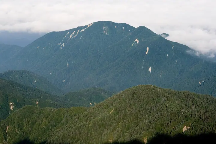
Mt. Itoseyama is an 1,867-meter peak in Ōkuwa Village, Kiso District, Nagano Prefecture, lying on a southwestern ridge of the main Central Alps spine, rising like a folding screen east of the Kiso River. Together with Mt. Nagiso and Mt. Kazakoshi it is counted as one of the Kiso Three Mountains. Just below the summit stands Noroshi-iwa, a large granite tower scalable via ladder and chains that affords expansive views of Mt. Ontake, Mt. Norikura, and the Northern, Central, and Southern Alps. The trail from Ōkuwa Village reaches the summit in about three hours and is well-marked by local volunteers.
สรุป Mt. Itoseyama
- อากาศ: วันที่อากาศคงที่ที่สุดใน 7 วันข้างหน้าคือ อาทิตย์ 8 พฤศจิกายน: ท้องฟ้าแจ่มใส ลมกระโชกสูงสุด 8 ม./วินาที
- เส้นทาง: เส้นทางที่สั้นที่สุดคือ Okuwa Mount Itose, the Kiso Folding Screen, Return along the Old Bird-lodge Ridge to Noroshi Rock: ประมาณ 5 ชม. 34 นาที 7.8 km ขึ้นประมาณ 1,000 m
อากาศ Mt. Itoseyama (รายชั่วโมง 2 สัปดาห์)
วันนี้พระอาทิตย์ขึ้น 06:12 ตก 16:53
| อังคาร 3/11 | พุธ 4/11 | พฤหัส 5/11 | ศุกร์ 6/11 | เสาร์ 7/11 | อาทิตย์ 8/11 | จันทร์ 9/11 | อังคาร 10/11 | พุธ 11/11 | พฤหัส 12/11 | ศุกร์ 13/11 | เสาร์ 14/11 | อาทิตย์ 15/11 | จันทร์ 16/11 | อังคาร 17/11 | |||||||||||||||||||||||||||||||||||||||||||||||||||||||||||||||||||||||
|---|---|---|---|---|---|---|---|---|---|---|---|---|---|---|---|---|---|---|---|---|---|---|---|---|---|---|---|---|---|---|---|---|---|---|---|---|---|---|---|---|---|---|---|---|---|---|---|---|---|---|---|---|---|---|---|---|---|---|---|---|---|---|---|---|---|---|---|---|---|---|---|---|---|---|---|---|---|---|---|---|---|---|---|---|---|
| เวลาญี่ปุ่น | 15 | 17 | 19 | 21 | 23 | 1 | 3 | 5 | 7 | 9 | 11 | 13 | 15 | 18 | 21 | 0 | 3 | 6 | 9 | 12 | 15 | 18 | 21 | 0 | 3 | 6 | 9 | 12 | 15 | 18 | 21 | 0 | 3 | 6 | 9 | 12 | 15 | 18 | 21 | 0 | 3 | 6 | 9 | 12 | 15 | 18 | 21 | 0 | 3 | 6 | 9 | 15 | 21 | 3 | 9 | 15 | 21 | 3 | 9 | 15 | 21 | 3 | 9 | 15 | 21 | 3 | 9 | 15 | 21 | 3 | 9 | 15 | 21 | 3 | 9 | 15 | 21 | 3 | 9 | 15 | 21 | 3 | 9 | 15 | |
 |   |  | | | | | |   | | |   |   |   | |   | | |   | |   | |   | | | | | | | | | | | | | | |  | | | | | | | | | | | | | | | | | | | |   |   | |   |  | | | | | | | | | | | | | | | | | | | | | | | ||
| อุณหภูมิ | °C | 10° | 5° | 2° | 1° | 1° | 1° | 0° | 0° | 0° | 7° | 10° | 12° | 11° | 6° | 5° | 5° | 4° | 4° | 7° | 9° | 10° | 6° | 5° | 5° | 7° | 6° | 8° | 11° | 9° | 3° | 1° | 1° | 1° | -1° | 2° | 3° | 2° | -3° | -5° | -5° | -5° | -5° | 4° | 9° | 7° | 1° | 1° | 1° | 1° | 2° | 5° | 7° | -1° | -3° | 4° | 4° | 0° | -3° | -2° | 3° | -5° | -6° | 3° | 4° | -3° | -2° | 2° | 5° | -4° | -5° | 3° | 5° | 0° | 1° | 6° | 7° | 5° | 5° | 8° | 8° | -2° | -1° | 4° | 5° |
| ฝนและหิมะ | mm | 4.2 | 15 | 2.3 | 0.8 | 0.2 | 0.4 | 0.6 | 0.2 | 0.2 | 0.8 | 0.4 | 0.1 | 0.2 | 20 | 15 | 0.5 | 0.6 | |||||||||||||||||||||||||||||||||||||||||||||||||||||||||||||||||||
| หิมะตก | cm | <.1 | <.1 | ||||||||||||||||||||||||||||||||||||||||||||||||||||||||||||||||||||||||||||||||||
| หิมะสะสม | cm | 0 | 0 | 0 | 0 | 0 | 0 | 0 | 0 | 0 | 0 | 0 | 0 | 0 | 0 | 0 | 0 | 0 | 0 | 0 | 0 | 0 | 0 | 0 | 0 | 0 | 0 | 0 | 0 | 0 | 0 | 0 | 0 | 0 | 0 | 0 | 0 | 0 | 0 | 0 | 0 | 0 | 0 | 0 | 0 | 0 | 0 | 0 | 0 | 0 | 0 | 0 | 0 | 0 | 0 | 0 | 0 | 0 | 0 | 0 | 0 | 0 | 0 | 0 | 0 | 0 | 0 | 0 | 0 | 0 | 0 | 0 | 0 | 0 | 0 | 0 | 0 | 0 | 0 | 0 | 0 | 0 | 0 | 0 | 0 |
| ลม | m/s | 2 | 1 | 0 | 1 | 1 | 1 | 0 | 1 | 1 | 1 | 1 | 2 | 2 | 1 | 1 | 2 | 2 | 1 | 1 | 0 | 1 | 1 | 1 | 1 | 2 | 1 | 1 | 2 | 2 | 1 | 1 | 1 | 1 | 1 | 2 | 2 | 2 | 1 | 1 | 0 | 0 | 0 | 0 | 2 | 1 | 1 | 2 | 2 | 1 | 1 | 2 | 1 | 1 | 1 | 2 | 3 | 2 | 1 | 3 | 2 | 1 | 1 | 2 | 2 | 0 | 0 | 2 | 1 | 1 | 1 | 1 | 2 | 1 | 1 | 3 | 2 | 2 | 1 | 2 | 3 | 1 | 1 | 1 | 2 |
| ลมกระโชก | m/s | 8 | 7 | 4 | 4 | 5 | 5 | 5 | 5 | 5 | 5 | 7 | 11 | 10 | 8 | 7 | 12 | 14 | 12 | 8 | 7 | 11 | 10 | 8 | 9 | 12 | 12 | 8 | 10 | 12 | 11 | 9 | 9 | 10 | 10 | 11 | 12 | 12 | 11 | 9 | 9 | 8 | 7 | 7 | 8 | 8 | 6 | 9 | 10 | 10 | 10 | 10 | 10 | 6 | 7 | 11 | 16 | 12 | 15 | 19 | 18 | 12 | 6 | 10 | 12 | 8 | 5 | 12 | 12 | 9 | 5 | 5 | 8 | 7 | 8 | 12 | 15 | 18 | 16 | 12 | 13 | 13 | 8 | 5 | 10 |
| ทิศทางลม | ↓ | ↓ | ↓ | ↓ | ↓ | ↓ | ↓ | ↓ | ↓ | ↓ | ↓ | ↓ | ↓ | ↓ | ↓ | ↓ | ↓ | ↓ | ↓ | ↓ | ↓ | ↓ | ↓ | ↓ | ↓ | ↓ | ↓ | ↓ | ↓ | ↓ | ↓ | ↓ | ↓ | ↓ | ↓ | ↓ | ↓ | ↓ | ↓ | ↓ | ↓ | ↓ | ↓ | ↓ | ↓ | ↓ | ↓ | ↓ | ↓ | ↓ | ↓ | ↓ | ↓ | ↓ | ↓ | ↓ | ↓ | ↓ | ↓ | ↓ | ↓ | ↓ | ↓ | ↓ | ↓ | ↓ | ↓ | ↓ | ↓ | ↓ | ↓ | ↓ | ↓ | ↓ | ↓ | ↓ | ↓ | ↓ | ↓ | ↓ | ↓ | ↓ | ↓ | ↓ | |
เส้นทางเดินป่า Mt. Itoseyama
เวลาเดินเป็นค่าประมาณที่คำนวณจากภูมิประเทศ
กระท่อม ที่ตั้งแคมป์ และที่พักใกล้ Mt. Itoseyama
กระท่อมบนภูเขา
- 避難小屋
ข้อมูลพื้นฐาน Mt. Itoseyama
- ความสูง
- 1,867 ม.
- ที่ตั้ง
- โอกูวะ, นากาโนะ
35.708294, 137.733831 - เว็บไซต์
- www.vill.okuwa.lg.jp
- ข้อมูลการเดินทาง
- www.vill.okuwa.lg.jp (PDF)
- วิกิพีเดีย
- ja.wikipedia.org