
Mt. Inugatake
犬ヶ岳
Itoigawa, Niigata / Asahi, Toyama · Elevation 1,593 m
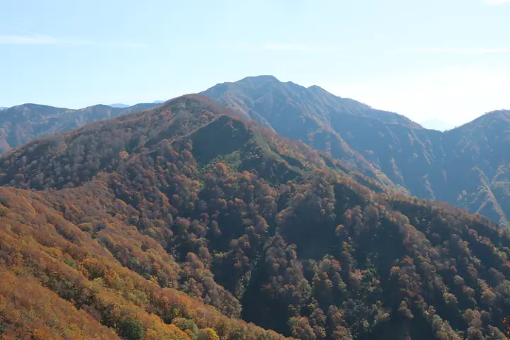
Mt. Inugatake is a 1,593 m peak on the boundary between Itoigawa City (Niigata) and Asahi Town (Toyama), at the northernmost end of the Hida (Northern Alps) Range. It serves as a key waypoint on the Tsugami Shindō, the long-distance traverse trail that links the Oyashirazu coast on the Japan Sea (sea level) over Mt. Shiratori (1,286.9 m) and Inugatake to Asahidake (2,418 m); the unmanned Tsugami Sansō hut sits on the north side of the summit. Opened in 1971 after six years of trail-cutting by the Sawagani Mountaineering Club, it is rated a top-advanced route with no escape options. The peak appears in the Echigo, Etchu, Shin-Etchu, and Toyama Hundred Mountain lists, the Niigata 100 Mountains, the Niigata and Toyama Prefecture mountains guidebooks, the Japan 1000 Mountains, and the Japan 1003 Mountain Elevations list.
Mt. Inugatake at a glance
- Weather: The most settled day in the next 7 days is Wed, November 4: clear, gusts up to 10 m/s. Fri, Nov 6: strong wind (gusts up to 21 m/s).
Mt. Inugatake weather (hourly, 14 days)
Sunrise today 06:14, sunset 16:51
| Tue, 11/3 | Wed, 11/4 | Thu, 11/5 | Fri, 11/6 | Sat, 11/7 | Sun, 11/8 | Mon, 11/9 | Tue, 11/10 | Wed, 11/11 | Thu, 11/12 | Fri, 11/13 | Sat, 11/14 | Sun, 11/15 | Mon, 11/16 | Tue, 11/17 | |||||||||||||||||||||||||||||||||||||||||||||||||||||||||||||||||||||||
|---|---|---|---|---|---|---|---|---|---|---|---|---|---|---|---|---|---|---|---|---|---|---|---|---|---|---|---|---|---|---|---|---|---|---|---|---|---|---|---|---|---|---|---|---|---|---|---|---|---|---|---|---|---|---|---|---|---|---|---|---|---|---|---|---|---|---|---|---|---|---|---|---|---|---|---|---|---|---|---|---|---|---|---|---|---|
| Japan time | 15 | 17 | 19 | 21 | 23 | 1 | 3 | 5 | 7 | 9 | 11 | 13 | 15 | 18 | 21 | 0 | 3 | 6 | 9 | 12 | 15 | 18 | 21 | 0 | 3 | 6 | 9 | 12 | 15 | 18 | 21 | 0 | 3 | 6 | 9 | 12 | 15 | 18 | 21 | 0 | 3 | 6 | 9 | 12 | 15 | 18 | 21 | 0 | 3 | 6 | 9 | 15 | 21 | 3 | 9 | 15 | 21 | 3 | 9 | 15 | 21 | 3 | 9 | 15 | 21 | 3 | 9 | 15 | 21 | 3 | 9 | 15 | 21 | 3 | 9 | 15 | 21 | 3 | 9 | 15 | 21 | 3 | 9 | 15 | |
  |   | |   | | | |  |  | | | | | | |   |   | |   |   |   | |   | | | | |   | | | | | | | | | | | | | | | |   | | | | | | | | | | | | | |   |   | | | | | | | | | | | | | |  | | | | |   | | | | | | | ||
| Temperature | °C | 6° | 3° | 1° | -1° | -1° | -1° | -2° | -2° | 0° | 6° | 8° | 9° | 8° | 5° | 6° | 6° | 5° | 6° | 7° | 11° | 11° | 8° | 7° | 7° | 7° | 7° | 8° | 11° | 7° | 5° | 3° | 1° | 0° | 0° | -1° | 0° | 0° | -2° | -2° | -2° | -3° | -3° | 2° | 3° | 3° | 1° | 0° | 0° | 0° | 0° | 3° | 2° | 0° | -3° | 5° | 7° | 2° | -3° | 0° | 0° | -1° | -2° | 3° | 4° | -3° | 0° | 1° | 2° | -1° | -6° | 3° | 5° | -2° | -2° | 8° | 8° | 4° | 5° | 6° | 3° | 0° | -1° | 1° | 2° |
| Precipitation | mm | 7 | 7 | 3.8 | 2.1 | 1.4 | 0.1 | 1.9 | 3.8 | 0.7 | 1.0 | 1.1 | 1.9 | 1.6 | 2.5 | 2.4 | 2.8 | 5.0 | 4.0 | 4.4 | 2.3 | 1.2 | 0.8 | 0.4 | 0.3 | 0.2 | 1.2 | 1.2 | 1.4 | 0.8 | 3.6 | 13 | 9 | 7 | 6 | 1.0 | 2.2 | 17 | 6 | 0.3 | 0.3 | 8 | 2.3 | 18 | 27 | 12 | 1.6 | ||||||||||||||||||||||||||||||||||||||
| New snow | cm | 1.1 | 0.8 | ||||||||||||||||||||||||||||||||||||||||||||||||||||||||||||||||||||||||||||||||||
| Snow depth | cm | 0 | 0 | 0 | 0 | 0 | 0 | 0 | 0 | 0 | 0 | 0 | 0 | 0 | 0 | 0 | 0 | 0 | 0 | 0 | 0 | 0 | 0 | 0 | 0 | 0 | 0 | 0 | 0 | 0 | 0 | 0 | 0 | 0 | 0 | 0 | 0 | 0 | 0 | 0 | 0 | 0 | 0 | 0 | 0 | 0 | 0 | 0 | 0 | 0 | 0 | 0 | 0 | 0 | 0 | 0 | 0 | 0 | <1 | <1 | 0 | 0 | 0 | 0 | 0 | 0 | 0 | 0 | 0 | 0 | 0 | 0 | 0 | 0 | 0 | 0 | 0 | 0 | 0 | 0 | 0 | 0 | 0 | 0 | 0 |
| Wind | m/s | 2 | 1 | 1 | 1 | 2 | 2 | 2 | 2 | 2 | 3 | 4 | 4 | 3 | 1 | 3 | 3 | 2 | 1 | 1 | 1 | 1 | 1 | 1 | 1 | 2 | 4 | 5 | 8 | 6 | 6 | 6 | 5 | 6 | 5 | 5 | 5 | 5 | 4 | 3 | 3 | 3 | 3 | 1 | 3 | 1 | 2 | 1 | 1 | 2 | 1 | 1 | 3 | 2 | 1 | 2 | 2 | 5 | 9 | 4 | 2 | 2 | 2 | 1 | 4 | 2 | 3 | 3 | 2 | 2 | 2 | 1 | 1 | 1 | 1 | 1 | 1 | 3 | 2 | 3 | 5 | 3 | 2 | 2 | 2 |
| Wind gusts | m/s | 7 | 6 | 3 | 4 | 5 | 5 | 5 | 5 | 5 | 8 | 10 | 10 | 10 | 8 | 7 | 7 | 6 | 6 | 5 | 5 | 5 | 5 | 5 | 4 | 6 | 11 | 16 | 19 | 21 | 18 | 17 | 16 | 16 | 17 | 14 | 15 | 14 | 13 | 10 | 9 | 9 | 8 | 7 | 8 | 8 | 5 | 5 | 4 | 4 | 5 | 5 | 7 | 8 | 5 | 5 | 8 | 17 | 25 | 24 | 14 | 7 | 5 | 6 | 11 | 10 | 12 | 9 | 7 | 6 | 6 | 6 | 6 | 5 | 6 | 6 | 5 | 9 | 10 | 12 | 14 | 13 | 7 | 6 | 8 |
| Wind dir. | ↓ | ↓ | ↓ | ↓ | ↓ | ↓ | ↓ | ↓ | ↓ | ↓ | ↓ | ↓ | ↓ | ↓ | ↓ | ↓ | ↓ | ↓ | ↓ | ↓ | ↓ | ↓ | ↓ | ↓ | ↓ | ↓ | ↓ | ↓ | ↓ | ↓ | ↓ | ↓ | ↓ | ↓ | ↓ | ↓ | ↓ | ↓ | ↓ | ↓ | ↓ | ↓ | ↓ | ↓ | ↓ | ↓ | ↓ | ↓ | ↓ | ↓ | ↓ | ↓ | ↓ | ↓ | ↓ | ↓ | ↓ | ↓ | ↓ | ↓ | ↓ | ↓ | ↓ | ↓ | ↓ | ↓ | ↓ | ↓ | ↓ | ↓ | ↓ | ↓ | ↓ | ↓ | ↓ | ↓ | ↓ | ↓ | ↓ | ↓ | ↓ | ↓ | ↓ | ↓ | |
Huts, campsites and lodging near Mt. Inugatake
Mountain huts
Lists that include Mt. Inugatake
100 Mountains of Toyama · Niigata 100 Famous Mountains · Elevations of 1003 Mountains of Japan · 1000 Mountains of Japan
Mt. Inugatake facts
- Elevation
- 1,593 m
- Location
- Itoigawa, Niigata / Asahi, Toyama
36.906885, 137.715603 - Website
- www.itoigawa-kanko.net
- Trail Map
- www.itoigawa-kanko.net (PDF)
- Wikipedia
- ja.wikipedia.org