
Mount Akita-Komagatake
秋田駒ヶ岳
Semboku, Akita · Elevation 1,485 m
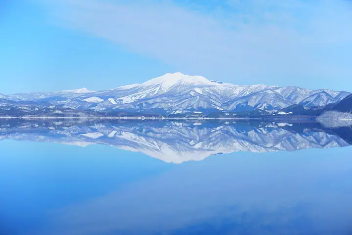
Mount Akita-Komagatake is an active volcano with northern and southern calderas around its summit area. Alpine flowers, including primroses, avens and komakusa, bloom from early summer through summer, followed by autumn foliage. Buses from Arupa Komakusa provide access to the eighth-station trailhead, and a traverse continues toward Nyutosan.
Mount Akita-Komagatake at a glance
- Weather: The most settled day in the next 7 days is Wed, November 4: clear, gusts up to 11 m/s. Fri, Nov 6, Sat, Nov 7, Sun, Nov 8: strong wind (gusts up to 25 m/s).
- Route: The shortest is Akita-Komagatake from the Eighth Station around Yokodake, Oyakesuna and Moomin Valley: about 4 h 43 min, 8.2 km, about 540 m of climbing.
Mount Akita-Komagatake weather (hourly, 14 days)
Sunrise today 06:07, sunset 16:34
| Tue, 11/3 | Wed, 11/4 | Thu, 11/5 | Fri, 11/6 | Sat, 11/7 | Sun, 11/8 | Mon, 11/9 | Tue, 11/10 | Wed, 11/11 | Thu, 11/12 | Fri, 11/13 | Sat, 11/14 | Sun, 11/15 | Mon, 11/16 | Tue, 11/17 | |||||||||||||||||||||||||||||||||||||||||||||||||||||||||||||||||||||||
|---|---|---|---|---|---|---|---|---|---|---|---|---|---|---|---|---|---|---|---|---|---|---|---|---|---|---|---|---|---|---|---|---|---|---|---|---|---|---|---|---|---|---|---|---|---|---|---|---|---|---|---|---|---|---|---|---|---|---|---|---|---|---|---|---|---|---|---|---|---|---|---|---|---|---|---|---|---|---|---|---|---|---|---|---|---|
| Japan time | 15 | 17 | 19 | 21 | 23 | 1 | 3 | 5 | 7 | 9 | 11 | 13 | 15 | 18 | 21 | 0 | 3 | 6 | 9 | 12 | 15 | 18 | 21 | 0 | 3 | 6 | 9 | 12 | 15 | 18 | 21 | 0 | 3 | 6 | 9 | 12 | 15 | 18 | 21 | 0 | 3 | 6 | 9 | 12 | 15 | 18 | 21 | 0 | 3 | 6 | 9 | 15 | 21 | 3 | 9 | 15 | 21 | 3 | 9 | 15 | 21 | 3 | 9 | 15 | 21 | 3 | 9 | 15 | 21 | 3 | 9 | 15 | 21 | 3 | 9 | 15 | 21 | 3 | 9 | 15 | 21 | 3 | 9 | 15 | |
  |  |   | | |   | |   |   |  | | | | | | | |   |   | | | | | | | | | | | | | |   | |   |   |   |   | | |   |   |   | | | | | |   | | | | | | | | | |   | | | | | | | | | | | | | | |  | | | | | | |   | | | | ||
| Temperature | °C | 2° | -1° | -2° | -2° | -3° | -3° | -2° | -2° | -1° | 3° | 5° | 6° | 5° | 0° | 0° | -1° | 0° | 2° | 3° | 5° | 5° | 4° | 4° | 4° | 4° | 4° | 5° | 6° | 5° | 2° | -1° | -3° | -4° | -5° | -4° | -3° | -3° | -4° | -5° | -4° | -4° | -4° | -2° | -2° | -2° | -4° | -4° | -4° | -4° | -5° | -2° | -2° | -5° | -7° | -3° | 1° | -3° | -2° | -2° | -2° | -5° | -6° | -2° | 0° | -3° | -3° | -3° | -3° | -6° | -7° | -2° | 1° | -5° | -5° | 2° | 4° | 0° | 1° | 3° | -1° | -6° | -7° | -3° | -1° |
| Precipitation | mm | 0.4 | 0.5 | 3.8 | 4.6 | 1.2 | 0.4 | 0.6 | 2.2 | 1.5 | 0.6 | 1.6 | 2.4 | 3.6 | 0.8 | 1.6 | 1.1 | 1.3 | 1.4 | 1.6 | 1.3 | 1.9 | 0.9 | 0.1 | 0.2 | 0.1 | 0.1 | 1.0 | 7 | 4.8 | 0.6 | 0.2 | 0.1 | 4.3 | 1.0 | 3.7 | 2.0 | 1.6 | 1.9 | ||||||||||||||||||||||||||||||||||||||||||||||
| New snow | cm | 0.5 | 0.9 | 1.4 | 1.2 | 1.7 | 0.8 | 0.1 | <.1 | <.1 | <.1 | <.1 | <.1 | 0.6 | 1.5 | 0.9 | <.1 | 0.3 | |||||||||||||||||||||||||||||||||||||||||||||||||||||||||||||||||||
| Snow depth | cm | 0 | 0 | 0 | 0 | 0 | 0 | 0 | 0 | 0 | 0 | 0 | 0 | 0 | 0 | 0 | 0 | 0 | 0 | 0 | 0 | 0 | 0 | 0 | 0 | 0 | 0 | 0 | 0 | 0 | 0 | 0 | 0 | 0 | <1 | <1 | 2 | 2 | 2 | 2 | 2 | 2 | 2 | 1 | 1 | 1 | 1 | 1 | 1 | <1 | <1 | <1 | <1 | <1 | <1 | <1 | <1 | <1 | <1 | 1 | <1 | <1 | <1 | <1 | <1 | <1 | 0 | 0 | 0 | 0 | 0 | 0 | 0 | 0 | 0 | 0 | 0 | 0 | 0 | 0 | 0 | 0 | 0 | 0 | 0 |
| Wind | m/s | 6 | 4 | 3 | 2 | 1 | 1 | 2 | 1 | 1 | 3 | 4 | 3 | 2 | 1 | 1 | 2 | 3 | 2 | 2 | 2 | 2 | 1 | 1 | 0 | 0 | 1 | 2 | 6 | 5 | 6 | 6 | 5 | 4 | 6 | 5 | 8 | 7 | 6 | 6 | 5 | 6 | 6 | 8 | 9 | 8 | 4 | 3 | 3 | 3 | 1 | 4 | 4 | 1 | 1 | 1 | 4 | 5 | 0 | 2 | 3 | 1 | 1 | 1 | 4 | 0 | 1 | 5 | 5 | 2 | 1 | 2 | 2 | 0 | 1 | 0 | 1 | 1 | 1 | 1 | 4 | 4 | 2 | 3 | 3 |
| Wind gusts | m/s | 17 | 16 | 11 | 10 | 8 | 8 | 9 | 9 | 8 | 10 | 11 | 11 | 10 | 6 | 4 | 6 | 7 | 7 | 7 | 7 | 6 | 5 | 5 | 4 | 5 | 6 | 7 | 19 | 19 | 17 | 18 | 18 | 16 | 18 | 21 | 25 | 25 | 23 | 19 | 19 | 19 | 19 | 22 | 25 | 25 | 21 | 14 | 12 | 11 | 11 | 11 | 11 | 10 | 6 | 5 | 10 | 17 | 15 | 9 | 12 | 9 | 6 | 7 | 12 | 11 | 5 | 13 | 15 | 14 | 8 | 6 | 10 | 7 | 3 | 3 | 6 | 5 | 5 | 5 | 13 | 15 | 13 | 9 | 10 |
| Wind dir. | ↓ | ↓ | ↓ | ↓ | ↓ | ↓ | ↓ | ↓ | ↓ | ↓ | ↓ | ↓ | ↓ | ↓ | ↓ | ↓ | ↓ | ↓ | ↓ | ↓ | ↓ | ↓ | ↓ | ↓ | ↓ | ↓ | ↓ | ↓ | ↓ | ↓ | ↓ | ↓ | ↓ | ↓ | ↓ | ↓ | ↓ | ↓ | ↓ | ↓ | ↓ | ↓ | ↓ | ↓ | ↓ | ↓ | ↓ | ↓ | ↓ | ↓ | ↓ | ↓ | ↓ | ↓ | ↓ | ↓ | ↓ | ↓ | ↓ | ↓ | ↓ | ↓ | ↓ | ↓ | ↓ | ↓ | ↓ | ↓ | ↓ | ↓ | ↓ | ↓ | ↓ | ↓ | ↓ | ↓ | ↓ | ↓ | ↓ | ↓ | ↓ | ↓ | ↓ | ↓ | |
Mount Akita-Komagatake live cameras
Mount Akita-Komagatake hiking routes
- Akita-Komagatake from the Eighth Station around Yokodake, Oyakesuna and Moomin Valley 8.2 km · Ascent 536 m 秋田駒ヶ岳八合目登山口, 8th Stage Komadatake (Bus stop) (parking)
- Mount Akita-Komagatake Hiking Trail 8.4 km · Ascent 640 m 秋田駒ヶ岳八合目登山口, 8th Stage Komadatake (Bus stop) (parking)
- Mount Akita-Komagatake Loop from Kunimi Onsen 11.9 km · Ascent 995 m 秋田駒ヶ岳登山口駐車場
Hiking times are estimates calculated from the terrain.
Huts, campsites and lodging near Mount Akita-Komagatake
Mountain huts
Campsites
- 休暇村乳頭温泉郷キャンプ場
Lodging
- ヒュッテ ビルケ
- ペンション白い星
- どんぐり山荘
- ロッヂ ヨーデル
- 駒ヶ岳温泉
Mount Akita-Komagatake facts
- Elevation
- 1,485 m
- Location
- Semboku, Akita
39.753067, 140.795680 - Volcano
- Active volcano (秋田駒ヶ岳)
- Website
- akikoma.jp
- Trail Map
- akikoma.jp
- Access Information
- akikoma.jp
- Wikipedia
- ja.wikipedia.org