
Ushigadake
牛ヶ岳
Minamiuonuma, Niigata / Minakami, Gunma · Elevation 1,962 m
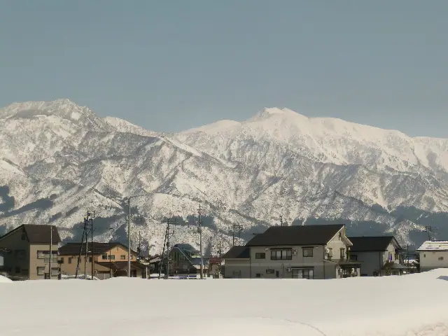
Ushigadake (1,962 m) is a peak in the Mikuni Mountains on the border of Minakami (Gunma) and Minamiuonuma (Niigata), forming the eastern shoulder of Mt. Makihata, one of Japan's 100 Famous Mountains. It lies within the Echigo-Sanzan Tadami Quasi-National Park and is typically reached by a short ridge walk east from the Makihata summit. The ridge is known for day lily (nikkō-kisuge) colonies and small alpine ponds (chitō).
Ushigadake at a glance
- Weather: The most settled day in the next 7 days is Wed, November 4: clear, gusts up to 8 m/s. Sat, Nov 7: strong wind (gusts up to 18 m/s).
- Route: The shortest is Mount Makihata and Mount Ushigatake Out-and-Back via the Ido Ridge Course: about 8 h 47 min, 13.3 km, about 1,450 m of climbing.
Ushigadake weather (hourly, 14 days)
Sunrise today 06:09, sunset 16:46
| Tue, 11/3 | Wed, 11/4 | Thu, 11/5 | Fri, 11/6 | Sat, 11/7 | Sun, 11/8 | Mon, 11/9 | Tue, 11/10 | Wed, 11/11 | Thu, 11/12 | Fri, 11/13 | Sat, 11/14 | Sun, 11/15 | Mon, 11/16 | Tue, 11/17 | |||||||||||||||||||||||||||||||||||||||||||||||||||||||||||||||||||||||
|---|---|---|---|---|---|---|---|---|---|---|---|---|---|---|---|---|---|---|---|---|---|---|---|---|---|---|---|---|---|---|---|---|---|---|---|---|---|---|---|---|---|---|---|---|---|---|---|---|---|---|---|---|---|---|---|---|---|---|---|---|---|---|---|---|---|---|---|---|---|---|---|---|---|---|---|---|---|---|---|---|---|---|---|---|---|
| Japan time | 15 | 17 | 19 | 21 | 23 | 1 | 3 | 5 | 7 | 9 | 11 | 13 | 15 | 18 | 21 | 0 | 3 | 6 | 9 | 12 | 15 | 18 | 21 | 0 | 3 | 6 | 9 | 12 | 15 | 18 | 21 | 0 | 3 | 6 | 9 | 12 | 15 | 18 | 21 | 0 | 3 | 6 | 9 | 12 | 15 | 18 | 21 | 0 | 3 | 6 | 9 | 15 | 21 | 3 | 9 | 15 | 21 | 3 | 9 | 15 | 21 | 3 | 9 | 15 | 21 | 3 | 9 | 15 | 21 | 3 | 9 | 15 | 21 | 3 | 9 | 15 | 21 | 3 | 9 | 15 | 21 | 3 | 9 | 15 | |
  |   | |   | | | | |  | | | |   |   | |   | | |   | | | | | | | | | | | | | | |   |   | | | | | |   | |   | | | | | | | | |   | |   |   | | | | | | | | | |   | | | | |   | | |  | | | | | | | | | | | | ||
| Temperature | °C | 1° | 0° | -2° | -4° | -5° | -4° | -4° | -3° | -2° | 3° | 6° | 8° | 7° | 2° | 1° | 1° | 2° | 2° | 4° | 9° | 9° | 5° | 5° | 4° | 3° | 4° | 5° | 5° | 6° | 3° | 1° | -1° | -2° | -4° | -4° | -4° | -4° | -5° | -5° | -5° | -5° | -5° | -3° | -2° | -3° | -4° | -5° | -5° | -5° | -5° | -1° | -1° | -4° | -4° | 1° | 1° | -2° | -5° | -4° | -4° | -4° | -4° | -2° | -2° | -7° | -3° | -4° | -3° | -5° | -6° | -1° | 2° | -7° | -6° | 4° | 4° | -1° | 2° | 3° | 1° | -4° | -6° | -4° | -1° |
| Precipitation | mm | 0.4 | 0.2 | 10 | 6 | 0.5 | 1.6 | 0.6 | 0.5 | 2.1 | 0.6 | 1.9 | 2.8 | 3.6 | 2.0 | 1.9 | 3.4 | 3.5 | 3.2 | 1.9 | 1.4 | 1.4 | 0.4 | 0.4 | 0.4 | 0.4 | 0.2 | 0.1 | 0.6 | 0.5 | 0.1 | 0.2 | 0.1 | 7 | 6 | 10 | 4.0 | 1.6 | 0.1 | 0.2 | 13 | 4.6 | 1.4 | 0.1 | 4.9 | 4.4 | 0.7 | 15 | 15 | 2.9 | |||||||||||||||||||||||||||||||||||
| New snow | cm | 0.2 | 2.3 | 2.4 | 2.3 | 1.3 | 0.9 | 0.9 | 0.3 | 0.2 | 0.3 | 0.3 | <.1 | <.1 | 0.4 | 0.3 | 4.6 | 4.3 | 4.9 | 1.0 | 0.5 | 7.0 | 3.1 | 0.8 | <.1 | 1.2 | 1.6 | ||||||||||||||||||||||||||||||||||||||||||||||||||||||||||
| Snow depth | cm | 0 | 0 | 0 | 0 | 0 | 0 | 0 | 0 | 0 | 0 | 0 | 0 | 0 | 0 | 0 | 0 | 0 | 0 | 0 | 0 | 0 | 0 | 0 | 0 | 0 | 0 | 0 | 0 | 0 | 0 | 0 | 0 | 0 | <1 | 2 | 2 | 4 | 4 | 5 | 5 | 5 | 5 | 5 | 5 | 5 | 5 | 4 | 5 | 5 | 5 | 5 | 2 | 2 | 2 | 2 | <1 | <1 | 3 | 6 | 7 | 7 | 7 | 7 | 5 | 4 | 4 | 9 | 10 | 10 | 10 | 10 | 7 | 7 | 7 | 7 | 4 | 3 | 2 | <1 | 0 | <1 | 1 | 1 | 1 |
| Wind | m/s | 2 | 1 | 1 | 1 | 1 | 1 | 0 | 0 | 0 | 1 | 1 | 1 | 2 | 4 | 5 | 4 | 2 | 2 | 2 | 0 | 0 | 2 | 0 | 0 | 0 | 1 | 2 | 3 | 3 | 3 | 3 | 3 | 4 | 4 | 5 | 5 | 4 | 4 | 4 | 4 | 4 | 3 | 3 | 3 | 2 | 1 | 1 | 1 | 1 | 1 | 0 | 2 | 1 | 1 | 2 | 4 | 2 | 2 | 6 | 5 | 3 | 1 | 1 | 1 | 1 | 1 | 2 | 5 | 3 | 1 | 1 | 1 | 2 | 1 | 1 | 1 | 3 | 3 | 0 | 5 | 5 | 2 | 1 | 1 |
| Wind gusts | m/s | 8 | 7 | 5 | 4 | 3 | 3 | 3 | 3 | 2 | 3 | 4 | 6 | 8 | 14 | 17 | 18 | 14 | 10 | 8 | 6 | 4 | 5 | 5 | 3 | 3 | 5 | 10 | 11 | 10 | 10 | 12 | 13 | 14 | 15 | 16 | 18 | 16 | 16 | 15 | 14 | 14 | 13 | 10 | 10 | 11 | 8 | 4 | 4 | 4 | 4 | 4 | 7 | 6 | 3 | 8 | 13 | 14 | 10 | 24 | 24 | 18 | 10 | 5 | 5 | 5 | 7 | 8 | 15 | 15 | 10 | 4 | 6 | 6 | 6 | 6 | 7 | 10 | 12 | 9 | 17 | 18 | 16 | 7 | 5 |
| Wind dir. | ↓ | ↓ | ↓ | ↓ | ↓ | ↓ | ↓ | ↓ | ↓ | ↓ | ↓ | ↓ | ↓ | ↓ | ↓ | ↓ | ↓ | ↓ | ↓ | ↓ | ↓ | ↓ | ↓ | ↓ | ↓ | ↓ | ↓ | ↓ | ↓ | ↓ | ↓ | ↓ | ↓ | ↓ | ↓ | ↓ | ↓ | ↓ | ↓ | ↓ | ↓ | ↓ | ↓ | ↓ | ↓ | ↓ | ↓ | ↓ | ↓ | ↓ | ↓ | ↓ | ↓ | ↓ | ↓ | ↓ | ↓ | ↓ | ↓ | ↓ | ↓ | ↓ | ↓ | ↓ | ↓ | ↓ | ↓ | ↓ | ↓ | ↓ | ↓ | ↓ | ↓ | ↓ | ↓ | ↓ | ↓ | ↓ | ↓ | ↓ | ↓ | ↓ | ↓ | ↓ | |
Ushigadake hiking routes
Hiking times are estimates calculated from the terrain.
Huts, campsites and lodging near Ushigadake
Mountain huts
Campsites
- 巻機山麓キャンプ場
Ushigadake facts
- Elevation
- 1,962 m
- Location
- Minamiuonuma, Niigata / Minakami, Gunma
36.982149, 138.969911 - National Park
- 越後三山只見国定公園
- Website
- m-uonuma.jp
- Wikipedia
- ja.wikipedia.org