
Mt. Torokawa
瀞川山
Kami, Hyogo · Elevation 1,039 m
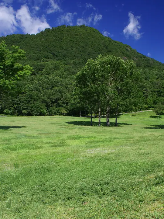
Torokawayama is a 1,039.2 m peak in Muraoka, Kami Town, Mikata District, Hyogo, sitting in the heart of Hyōnosen-Ushiroyama-Nagisan Quasi-National Park. Its slopes connect to the rolling Torokawa-daira and Uwano highlands, where the Uwano Kōgen Outdoor Education Centre and the Ki-no-Dendō hall serve as the main trailheads on the gently graded climbs. From the summit, hikers look out over Hachibuseyama and the Hachikita ski area to Hyōnosen, the prefecture's highest peak, and east to the 1,000 m Tajima skyline of Sobudake and Myōkensan. It is included in the Furusato Hyogo 100.
Mt. Torokawa at a glance
- Weather: The most settled day in the next 7 days is Wed, November 4: clear, gusts up to 8 m/s. Fri, Nov 6, Sat, Nov 7: strong wind (gusts up to 17 m/s).
Mt. Torokawa weather (hourly, 14 days)
Sunrise today 06:25, sunset 17:06
| Tue, 11/3 | Wed, 11/4 | Thu, 11/5 | Fri, 11/6 | Sat, 11/7 | Sun, 11/8 | Mon, 11/9 | Tue, 11/10 | Wed, 11/11 | Thu, 11/12 | Fri, 11/13 | Sat, 11/14 | Sun, 11/15 | Mon, 11/16 | Tue, 11/17 | |||||||||||||||||||||||||||||||||||||||||||||||||||||||||||||||||||||||
|---|---|---|---|---|---|---|---|---|---|---|---|---|---|---|---|---|---|---|---|---|---|---|---|---|---|---|---|---|---|---|---|---|---|---|---|---|---|---|---|---|---|---|---|---|---|---|---|---|---|---|---|---|---|---|---|---|---|---|---|---|---|---|---|---|---|---|---|---|---|---|---|---|---|---|---|---|---|---|---|---|---|---|---|---|---|
| Japan time | 15 | 17 | 19 | 21 | 23 | 1 | 3 | 5 | 7 | 9 | 11 | 13 | 15 | 18 | 21 | 0 | 3 | 6 | 9 | 12 | 15 | 18 | 21 | 0 | 3 | 6 | 9 | 12 | 15 | 18 | 21 | 0 | 3 | 6 | 9 | 12 | 15 | 18 | 21 | 0 | 3 | 6 | 9 | 12 | 15 | 18 | 21 | 0 | 3 | 6 | 9 | 15 | 21 | 3 | 9 | 15 | 21 | 3 | 9 | 15 | 21 | 3 | 9 | 15 | 21 | 3 | 9 | 15 | 21 | 3 | 9 | 15 | 21 | 3 | 9 | 15 | 21 | 3 | 9 | 15 | 21 | 3 | 9 | 15 | |
  | |   |   |   | | |   |   |  | |   | | | |   | | |   |   | | | | | | |   | | | | | | | | | | | | | | | | | | | | | | | | | |   | | | | | | | | | | | | | | | | | | | | | | | | | | | | | | | | ||
| Temperature | °C | 9° | 6° | 6° | 5° | 5° | 5° | 5° | 5° | 5° | 7° | 10° | 11° | 11° | 6° | 7° | 9° | 8° | 9° | 10° | 15° | 12° | 10° | 10° | 9° | 9° | 8° | 8° | 11° | 8° | 6° | 4° | 3° | 3° | 2° | 4° | 5° | 4° | 2° | 3° | 2° | 3° | 2° | 6° | 8° | 6° | 4° | 4° | 4° | 4° | 3° | 5° | 6° | 3° | 3° | 6° | 6° | 2° | 0° | 2° | 3° | 2° | 2° | 5° | 7° | 2° | 3° | 3° | 4° | 1° | 1° | 6° | 11° | 1° | 3° | 9° | 9° | 10° | 9° | 8° | 5° | 2° | 0° | 3° | 4° |
| Precipitation | mm | 0.6 | 0.5 | 0.2 | 0.2 | 0.1 | 2.9 | 0.2 | 0.7 | 2.1 | 1.6 | 9 | 1.6 | 0.6 | 0.8 | 1.4 | 1.1 | 0.5 | 0.4 | 0.5 | 0.3 | 0.1 | 0.6 | 0.8 | 0.5 | 0.5 | 0.3 | 1.5 | 4.2 | 1.5 | 0.2 | 2.3 | 2.2 | 2.5 | 1.2 | 1.7 | 0.5 | 1.6 | 5 | 0.4 | 0.8 | 9 | 3.7 | 6 | 11 | 7 | 0.3 | 0.2 | 0.3 | ||||||||||||||||||||||||||||||||||||
| New snow | cm | ||||||||||||||||||||||||||||||||||||||||||||||||||||||||||||||||||||||||||||||||||||
| Snow depth | cm | 0 | 0 | 0 | 0 | 0 | 0 | 0 | 0 | 0 | 0 | 0 | 0 | 0 | 0 | 0 | 0 | 0 | 0 | 0 | 0 | 0 | 0 | 0 | 0 | 0 | 0 | 0 | 0 | 0 | 0 | 0 | 0 | 0 | 0 | 0 | 0 | 0 | 0 | 0 | 0 | 0 | 0 | 0 | 0 | 0 | 0 | 0 | 0 | 0 | 0 | 0 | 0 | 0 | 0 | 0 | 0 | 0 | 0 | 0 | 0 | 0 | 0 | 0 | 0 | 0 | 0 | 0 | 0 | 0 | 0 | 0 | 0 | 0 | 0 | 0 | 0 | 0 | 0 | 0 | 0 | 0 | 0 | 0 | 0 |
| Wind | m/s | 2 | 1 | 1 | 0 | 0 | 1 | 1 | 1 | 1 | 3 | 2 | 3 | 3 | 1 | 2 | 2 | 0 | 0 | 0 | 0 | 1 | 3 | 2 | 3 | 3 | 5 | 4 | 6 | 5 | 4 | 5 | 5 | 5 | 5 | 6 | 6 | 5 | 3 | 2 | 2 | 1 | 2 | 3 | 4 | 3 | 0 | 1 | 1 | 2 | 2 | 2 | 3 | 1 | 0 | 3 | 5 | 5 | 7 | 4 | 4 | 2 | 1 | 1 | 3 | 2 | 2 | 4 | 4 | 2 | 1 | 2 | 1 | 1 | 2 | 3 | 5 | 4 | 3 | 3 | 4 | 4 | 2 | 3 | 2 |
| Wind gusts | m/s | 7 | 6 | 3 | 3 | 2 | 3 | 4 | 4 | 4 | 7 | 8 | 8 | 8 | 8 | 6 | 7 | 7 | 5 | 4 | 4 | 6 | 6 | 7 | 9 | 9 | 13 | 13 | 17 | 17 | 14 | 14 | 15 | 14 | 14 | 16 | 17 | 16 | 14 | 8 | 7 | 6 | 6 | 9 | 10 | 10 | 7 | 3 | 4 | 5 | 6 | 7 | 10 | 10 | 4 | 9 | 15 | 16 | 20 | 18 | 13 | 10 | 5 | 5 | 9 | 9 | 8 | 10 | 12 | 11 | 5 | 6 | 6 | 5 | 5 | 8 | 14 | 17 | 13 | 10 | 11 | 12 | 9 | 7 | 7 |
| Wind dir. | ↓ | ↓ | ↓ | ↓ | ↓ | ↓ | ↓ | ↓ | ↓ | ↓ | ↓ | ↓ | ↓ | ↓ | ↓ | ↓ | ↓ | ↓ | ↓ | ↓ | ↓ | ↓ | ↓ | ↓ | ↓ | ↓ | ↓ | ↓ | ↓ | ↓ | ↓ | ↓ | ↓ | ↓ | ↓ | ↓ | ↓ | ↓ | ↓ | ↓ | ↓ | ↓ | ↓ | ↓ | ↓ | ↓ | ↓ | ↓ | ↓ | ↓ | ↓ | ↓ | ↓ | ↓ | ↓ | ↓ | ↓ | ↓ | ↓ | ↓ | ↓ | ↓ | ↓ | ↓ | ↓ | ↓ | ↓ | ↓ | ↓ | ↓ | ↓ | ↓ | ↓ | ↓ | ↓ | ↓ | ↓ | ↓ | ↓ | ↓ | ↓ | ↓ | ↓ | ↓ | |
Huts, campsites and lodging near Mt. Torokawa
Campsites
- 奥但馬・南部高原キャンプ場・コテージ村
- Yoshitaki Camping Sites
Lodging
- 藤乃
- Suminoya Guesthouse
- 尼崎市立美方高原自然の家「とちのき村」
- ホテルプラトーこのはな
- Auberge Hanagori
Lists that include Mt. Torokawa
Mt. Torokawa facts
- Elevation
- 1,039 m
- Location
- Kami, Hyogo
35.418778, 134.556180 - National Park
- 氷ノ山後山那岐山国定公園
- Website
- www.kami-tourism.com
- Trail Map
- www.kami-tourism.com (PDF)
- Wikipedia
- ja.wikipedia.org