
Mt. Torageyama
虎毛山
Yuzawa, Akita · Elevation 1,432 m
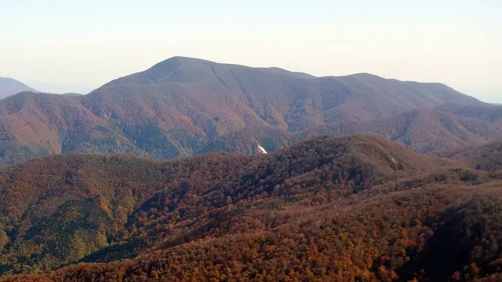
Mt. Torageyama is a 1,432-meter peak in Yuzawa City, Akita Prefecture, lying in the northwestern part of Kurikoma Quasi-National Park near the three-prefecture meeting point of Akita, Miyagi, and Yamagata. Its name ("tiger-fur mountain") refers to the tiger-stripe pattern that streams etch down its slopes. A roughly three-hectare highland wetland on the summit ridge holds tarns that mirror Mt. Kurikoma, with mass blooms of Geum pentapetalum after snowmelt and gold-toned autumn grasses. The Yuzawa-side round-trip route takes about 7 hours with 963 m of cumulative elevation gain, but is currently closed with no reopening date following damage from heavy rain in August 2018. The mountain is included in the Tōhoku Hyakumeizan and Nishimaru Shin'ya Nihon Hyakuzan lists.
Mt. Torageyama at a glance
- Weather: The most settled day in the next 7 days is Mon, November 9: cloudy, gusts up to 11 m/s. Fri, Nov 6, Sat, Nov 7, Sun, Nov 8: strong wind (gusts up to 24 m/s).
Mt. Torageyama weather (hourly, 14 days)
Sunrise today 06:06, sunset 16:36
| Tue, 11/3 | Wed, 11/4 | Thu, 11/5 | Fri, 11/6 | Sat, 11/7 | Sun, 11/8 | Mon, 11/9 | Tue, 11/10 | Wed, 11/11 | Thu, 11/12 | Fri, 11/13 | Sat, 11/14 | Sun, 11/15 | Mon, 11/16 | Tue, 11/17 | |||||||||||||||||||||||||||||||||||||||||||||||||||||||||||||||||||||||
|---|---|---|---|---|---|---|---|---|---|---|---|---|---|---|---|---|---|---|---|---|---|---|---|---|---|---|---|---|---|---|---|---|---|---|---|---|---|---|---|---|---|---|---|---|---|---|---|---|---|---|---|---|---|---|---|---|---|---|---|---|---|---|---|---|---|---|---|---|---|---|---|---|---|---|---|---|---|---|---|---|---|---|---|---|---|
| Japan time | 15 | 17 | 19 | 21 | 23 | 1 | 3 | 5 | 7 | 9 | 11 | 13 | 15 | 18 | 21 | 0 | 3 | 6 | 9 | 12 | 15 | 18 | 21 | 0 | 3 | 6 | 9 | 12 | 15 | 18 | 21 | 0 | 3 | 6 | 9 | 12 | 15 | 18 | 21 | 0 | 3 | 6 | 9 | 12 | 15 | 18 | 21 | 0 | 3 | 6 | 9 | 15 | 21 | 3 | 9 | 15 | 21 | 3 | 9 | 15 | 21 | 3 | 9 | 15 | 21 | 3 | 9 | 15 | 21 | 3 | 9 | 15 | 21 | 3 | 9 | 15 | 21 | 3 | 9 | 15 | 21 | 3 | 9 | 15 | |
  |   | | |  | | | | | |   |   |   | | |   |   | | | | |   | | | | | | | | | | |   | |   | |   |   | | | | |   | |   | | | | |   | | |   | |  | | | |   | |   | | | | | | | | | | | |  | | | | | | | | | | | | ||
| Temperature | °C | 3° | 0° | -1° | -1° | -3° | -2° | -1° | 0° | 1° | 4° | 5° | 6° | 5° | 1° | 2° | 2° | 3° | 4° | 4° | 6° | 6° | 6° | 6° | 6° | 5° | 6° | 7° | 8° | 6° | 3° | 0° | -2° | -3° | -4° | -4° | -3° | -4° | -5° | -5° | -4° | -4° | -4° | -2° | -1° | -2° | -3° | -4° | -4° | -4° | -5° | -1° | -2° | -4° | -6° | -1° | 0° | -2° | -2° | -3° | -1° | -5° | -4° | -1° | 0° | -3° | -2° | -3° | -2° | -5° | -5° | -1° | 1° | -5° | -4° | 4° | 7° | 1° | 2° | 4° | 0° | -5° | -5° | -3° | -1° |
| Precipitation | mm | 0.2 | 0.3 | 0.1 | 2.7 | 5 | 4.1 | 1.6 | 0.2 | 1.8 | 0.8 | 0.8 | 3.8 | 2.7 | 0.6 | 2.0 | 1.6 | 3.7 | 2.9 | 3.0 | 2.1 | 2.6 | 1.6 | 1.4 | 1.0 | 0.7 | 0.7 | 0.5 | 0.2 | 0.2 | 0.1 | 0.5 | 7 | 2.2 | 0.7 | 1.1 | 0.1 | 5 | 1.8 | 0.2 | 0.2 | 1.3 | 4.8 | 1.7 | 4.9 | 5.0 | 0.4 | ||||||||||||||||||||||||||||||||||||||
| New snow | cm | 0.7 | 2.2 | 2.0 | 2.5 | 1.5 | 1.4 | 1.0 | 0.6 | 0.6 | 0.4 | 0.1 | 0.1 | <.1 | <.1 | <.1 | 1.1 | <.1 | 0.4 | <.1 | 0.2 | 1.3 | 0.4 | ||||||||||||||||||||||||||||||||||||||||||||||||||||||||||||||
| Snow depth | cm | 0 | 0 | 0 | 0 | 0 | 0 | 0 | 0 | 0 | 0 | 0 | 0 | 0 | 0 | 0 | 0 | 0 | 0 | 0 | 0 | 0 | 0 | 0 | 0 | 0 | 0 | 0 | 0 | 0 | 0 | 0 | 0 | <1 | 2 | 2 | 3 | 4 | 4 | 5 | 5 | 5 | 5 | 5 | 4 | 4 | 3 | 3 | 3 | 3 | 3 | 3 | 2 | 2 | 2 | 2 | <1 | <1 | <1 | <1 | <1 | <1 | <1 | 0 | 0 | 0 | 0 | <1 | 0 | 0 | 0 | 0 | 0 | 0 | 0 | 0 | 0 | 0 | 0 | 0 | 0 | <1 | <1 | <1 | <1 |
| Wind | m/s | 5 | 4 | 3 | 3 | 2 | 2 | 3 | 3 | 3 | 4 | 4 | 3 | 2 | 3 | 4 | 5 | 5 | 4 | 3 | 2 | 2 | 2 | 2 | 1 | 2 | 1 | 3 | 7 | 7 | 6 | 6 | 5 | 5 | 5 | 4 | 6 | 6 | 6 | 6 | 6 | 7 | 7 | 9 | 9 | 8 | 5 | 4 | 4 | 4 | 2 | 4 | 4 | 2 | 1 | 1 | 6 | 5 | 3 | 5 | 5 | 2 | 2 | 3 | 4 | 1 | 2 | 5 | 8 | 5 | 3 | 3 | 2 | 0 | 1 | 1 | 1 | 2 | 3 | 2 | 6 | 8 | 5 | 4 | 3 |
| Wind gusts | m/s | 17 | 14 | 10 | 9 | 9 | 7 | 9 | 10 | 11 | 11 | 12 | 10 | 8 | 6 | 11 | 14 | 14 | 13 | 12 | 7 | 7 | 7 | 7 | 7 | 7 | 7 | 10 | 20 | 21 | 18 | 17 | 16 | 14 | 14 | 17 | 22 | 22 | 20 | 18 | 18 | 18 | 20 | 22 | 24 | 23 | 20 | 14 | 11 | 11 | 10 | 11 | 11 | 10 | 6 | 5 | 15 | 18 | 14 | 14 | 16 | 14 | 7 | 10 | 11 | 11 | 7 | 14 | 20 | 19 | 13 | 9 | 9 | 7 | 4 | 4 | 7 | 7 | 8 | 8 | 17 | 23 | 22 | 14 | 10 |
| Wind dir. | ↓ | ↓ | ↓ | ↓ | ↓ | ↓ | ↓ | ↓ | ↓ | ↓ | ↓ | ↓ | ↓ | ↓ | ↓ | ↓ | ↓ | ↓ | ↓ | ↓ | ↓ | ↓ | ↓ | ↓ | ↓ | ↓ | ↓ | ↓ | ↓ | ↓ | ↓ | ↓ | ↓ | ↓ | ↓ | ↓ | ↓ | ↓ | ↓ | ↓ | ↓ | ↓ | ↓ | ↓ | ↓ | ↓ | ↓ | ↓ | ↓ | ↓ | ↓ | ↓ | ↓ | ↓ | ↓ | ↓ | ↓ | ↓ | ↓ | ↓ | ↓ | ↓ | ↓ | ↓ | ↓ | ↓ | ↓ | ↓ | ↓ | ↓ | ↓ | ↓ | ↓ | ↓ | ↓ | ↓ | ↓ | ↓ | ↓ | ↓ | ↓ | ↓ | ↓ | ↓ | |
Huts, campsites and lodging near Mt. Torageyama
Mountain huts
Lists that include Mt. Torageyama
Tohoku 100 Famous Mountains · Elevations of 1003 Mountains of Japan · 1000 Mountains of Japan
Mt. Torageyama facts
- Elevation
- 1,432 m
- Location
- Yuzawa, Akita
38.904601, 140.618815 - Website
- www.city-yuzawa.jp
- Wikipedia
- ja.wikipedia.org