
Mount Kamuro
神室山
Yuzawa, Akita · Elevation 1,365 m
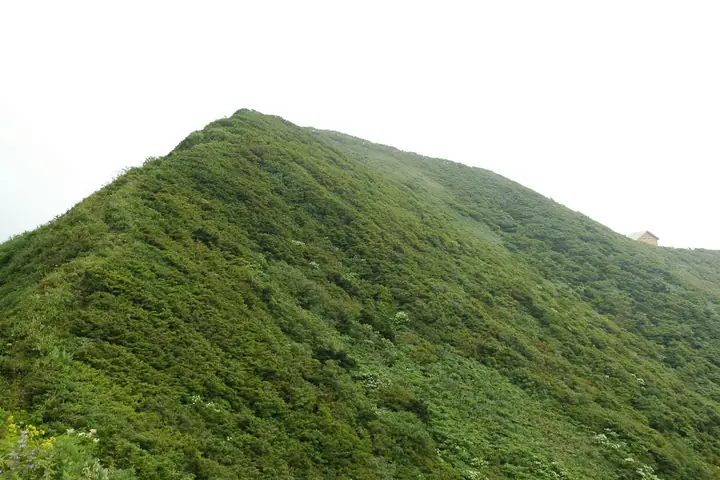
Mount Kamuro is a 1,365 m peak on the Yamagata–Akita prefectural border, the principal summit of the Kamuro Range; the top sits where Kaneyama, Mogami (Yamagata) and Yuzawa City (Akita) meet, within the Kurikoma Quasi-National Park. Listed in the Nihon Nihyaku Meizan, the Yamagata Hyakumeizan, the Tōhoku Hyakumeizan, and the Onsen Hyakumeizan, the range is known as the "mini Alps of Michinoku" for its 25 km of narrow, alpine-style ridge. Historically venerated alongside Mount Chōkai as a major centre of mountain ascetic practice, the peak takes its name from that Shugendō tradition. Three trails—the Ariya, Kabu-zawa, and Nishi-no-mata-zawa courses—climb from the Yamagata side to the summit, where an emergency shelter with toilet and water source stands. The climbing season generally runs from June through October.
Mount Kamuro at a glance
- Weather: The most settled day in the next 7 days is Wed, November 4: cloudy, gusts up to 8 m/s. Fri, Nov 6, Sat, Nov 7, Sun, Nov 8: strong wind (gusts up to 20 m/s).
Mount Kamuro weather (hourly, 14 days)
Sunrise today 06:06, sunset 16:37
| Tue, 11/3 | Wed, 11/4 | Thu, 11/5 | Fri, 11/6 | Sat, 11/7 | Sun, 11/8 | Mon, 11/9 | Tue, 11/10 | Wed, 11/11 | Thu, 11/12 | Fri, 11/13 | Sat, 11/14 | Sun, 11/15 | Mon, 11/16 | Tue, 11/17 | |||||||||||||||||||||||||||||||||||||||||||||||||||||||||||||||||||||||
|---|---|---|---|---|---|---|---|---|---|---|---|---|---|---|---|---|---|---|---|---|---|---|---|---|---|---|---|---|---|---|---|---|---|---|---|---|---|---|---|---|---|---|---|---|---|---|---|---|---|---|---|---|---|---|---|---|---|---|---|---|---|---|---|---|---|---|---|---|---|---|---|---|---|---|---|---|---|---|---|---|---|---|---|---|---|
| Japan time | 15 | 17 | 19 | 21 | 23 | 1 | 3 | 5 | 7 | 9 | 11 | 13 | 15 | 18 | 21 | 0 | 3 | 6 | 9 | 12 | 15 | 18 | 21 | 0 | 3 | 6 | 9 | 12 | 15 | 18 | 21 | 0 | 3 | 6 | 9 | 12 | 15 | 18 | 21 | 0 | 3 | 6 | 9 | 12 | 15 | 18 | 21 | 0 | 3 | 6 | 9 | 15 | 21 | 3 | 9 | 15 | 21 | 3 | 9 | 15 | 21 | 3 | 9 | 15 | 21 | 3 | 9 | 15 | 21 | 3 | 9 | 15 | 21 | 3 | 9 | 15 | 21 | 3 | 9 | 15 | 21 | 3 | 9 | 15 | |
  |   | | |  | | | |   | |   | |   | | | |   | | | | |   |   | | | | |   | | | | | |   |   |   | |   | | | | | | |   | | | | |   | | | |   |  | | | | | | | | | | | | | |   | | | |  | | | | | | | |   | | | | ||
| Temperature | °C | 4° | 1° | -1° | -1° | -1° | -1° | -1° | -1° | 0° | 4° | 6° | 7° | 7° | 1° | 2° | 4° | 5° | 4° | 5° | 7° | 7° | 6° | 6° | 6° | 6° | 6° | 7° | 8° | 6° | 4° | 1° | -1° | -2° | -3° | -3° | -2° | -2° | -3° | -4° | -3° | -3° | -3° | -1° | 1° | -1° | -2° | -4° | -4° | -3° | -4° | 0° | -1° | -4° | -6° | -1° | 2° | -1° | -2° | -2° | 0° | -4° | -2° | 0° | 1° | -2° | -1° | -2° | -1° | -3° | -4° | 0° | 3° | -4° | -4° | 4° | 7° | 2° | 2° | 4° | 1° | -4° | -4° | -2° | 0° |
| Precipitation | mm | 0.2 | 0.1 | 0.3 | 0.3 | 2.0 | 4.3 | 2.9 | 0.9 | 0.1 | 1.8 | 1.1 | 2.0 | 5 | 3.3 | 0.8 | 1.9 | 1.1 | 2.3 | 1.8 | 2.3 | 2.2 | 2.8 | 1.6 | 1.0 | 1.1 | 1.1 | 1.0 | 0.9 | 0.4 | 0.2 | 0.7 | 7 | 2.5 | 0.6 | 0.5 | 0.2 | 8 | 1.9 | 0.1 | 0.2 | 1.9 | 4.5 | 2.0 | 3.4 | 2.8 | 0.2 | ||||||||||||||||||||||||||||||||||||||
| New snow | cm | 0.3 | 0.9 | 1.5 | 0.9 | 0.5 | 0.6 | 0.3 | 0.2 | 0.1 | <.1 | <.1 | 0.4 | <.1 | <.1 | 0.1 | |||||||||||||||||||||||||||||||||||||||||||||||||||||||||||||||||||||
| Snow depth | cm | 0 | 0 | 0 | 0 | 0 | 0 | 0 | 0 | 0 | 0 | 0 | 0 | 0 | 0 | 0 | 0 | 0 | 0 | 0 | 0 | 0 | 0 | 0 | 0 | 0 | 0 | 0 | 0 | 0 | 0 | 0 | 0 | 0 | 0 | <1 | 1 | 1 | 1 | 1 | 1 | 1 | <1 | <1 | <1 | <1 | <1 | <1 | <1 | <1 | <1 | <1 | 0 | 0 | 0 | 0 | 0 | 0 | 0 | 0 | 0 | 0 | 0 | 0 | 0 | 0 | 0 | 0 | 0 | 0 | 0 | 0 | 0 | 0 | 0 | 0 | 0 | 0 | 0 | 0 | 0 | 0 | 0 | 0 | 0 |
| Wind | m/s | 4 | 2 | 2 | 1 | 0 | 1 | 2 | 1 | 2 | 2 | 2 | 2 | 1 | 1 | 3 | 5 | 5 | 4 | 2 | 2 | 1 | 1 | 2 | 2 | 1 | 2 | 3 | 6 | 6 | 4 | 5 | 4 | 3 | 3 | 4 | 4 | 6 | 5 | 4 | 5 | 5 | 4 | 7 | 8 | 6 | 3 | 2 | 2 | 2 | 1 | 3 | 3 | 1 | 1 | 1 | 5 | 5 | 5 | 2 | 5 | 1 | 1 | 2 | 4 | 2 | 1 | 5 | 5 | 3 | 1 | 1 | 1 | 1 | 1 | 2 | 2 | 3 | 1 | 0 | 5 | 4 | 3 | 2 | 2 |
| Wind gusts | m/s | 12 | 11 | 6 | 5 | 5 | 5 | 6 | 7 | 7 | 7 | 8 | 7 | 6 | 4 | 8 | 13 | 13 | 13 | 11 | 6 | 6 | 4 | 5 | 7 | 7 | 7 | 10 | 18 | 19 | 16 | 12 | 12 | 10 | 13 | 15 | 19 | 20 | 18 | 16 | 15 | 14 | 13 | 17 | 20 | 20 | 16 | 8 | 7 | 7 | 6 | 8 | 9 | 8 | 4 | 4 | 13 | 19 | 16 | 12 | 14 | 13 | 5 | 6 | 11 | 10 | 7 | 12 | 15 | 14 | 8 | 5 | 8 | 4 | 4 | 6 | 8 | 9 | 9 | 4 | 15 | 15 | 12 | 8 | 7 |
| Wind dir. | ↓ | ↓ | ↓ | ↓ | ↓ | ↓ | ↓ | ↓ | ↓ | ↓ | ↓ | ↓ | ↓ | ↓ | ↓ | ↓ | ↓ | ↓ | ↓ | ↓ | ↓ | ↓ | ↓ | ↓ | ↓ | ↓ | ↓ | ↓ | ↓ | ↓ | ↓ | ↓ | ↓ | ↓ | ↓ | ↓ | ↓ | ↓ | ↓ | ↓ | ↓ | ↓ | ↓ | ↓ | ↓ | ↓ | ↓ | ↓ | ↓ | ↓ | ↓ | ↓ | ↓ | ↓ | ↓ | ↓ | ↓ | ↓ | ↓ | ↓ | ↓ | ↓ | ↓ | ↓ | ↓ | ↓ | ↓ | ↓ | ↓ | ↓ | ↓ | ↓ | ↓ | ↓ | ↓ | ↓ | ↓ | ↓ | ↓ | ↓ | ↓ | ↓ | ↓ | ↓ | |
Huts, campsites and lodging near Mount Kamuro
Mountain huts
Lists that include Mount Kamuro
Japan 200 Famous Mountains · Japan's 300 Famous Mountains · 100 Famous Hot Spring Mountains · Tohoku 100 Famous Mountains · Yamagata 100 Famous Mountains · Elevations of 1003 Mountains of Japan · 1000 Mountains of Japan
Mount Kamuro facts
- Elevation
- 1,365 m
- Location
- Yuzawa, Akita
38.902251, 140.492300 - National Park
- 栗駒国定公園
- Website
- yamagatayama.com
- Wikipedia
- ja.wikipedia.org