
Mt. Saruga
猿ヶ山
Nanto, Toyama · Elevation 1,448 m
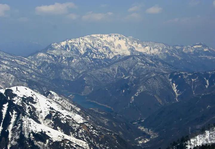
Mt. Saruga is a 1,448 m peak in the southwestern part of Nanto City, Toyama Prefecture, close to the Ishikawa border and counted among the headwaters of the Oyabe River. A second-class triangulation point marks the summit, and the shapely profile of the mountain can be seen from both the Tonami Plain and central Kanazawa. It is featured in numerous regional lists, including the Toyama 100 Mountains (selected by the Toyama Mountaineering Federation), the Toyama Mountain Guide, the New Etchū 100 Mountains, the Etchū 100 Mountains, the Hokuriku 100 Mountains, and the Japan 1000 Mountains. Two trails reach the summit — from Kose hamlet and via Bunao Pass and Mt. Hakamagoshi — and the latter is part of Toyama Prefecture's mountain-grading system.
Mt. Saruga at a glance
- Weather: The most settled day in the next 7 days is Sun, November 8: clear, gusts up to 9 m/s. Fri, Nov 6: strong wind (gusts up to 15 m/s).
Mt. Saruga weather (hourly, 14 days)
Sunrise today 06:17, sunset 16:56
| Tue, 11/3 | Wed, 11/4 | Thu, 11/5 | Fri, 11/6 | Sat, 11/7 | Sun, 11/8 | Mon, 11/9 | Tue, 11/10 | Wed, 11/11 | Thu, 11/12 | Fri, 11/13 | Sat, 11/14 | Sun, 11/15 | Mon, 11/16 | Tue, 11/17 | |||||||||||||||||||||||||||||||||||||||||||||||||||||||||||||||||||||||
|---|---|---|---|---|---|---|---|---|---|---|---|---|---|---|---|---|---|---|---|---|---|---|---|---|---|---|---|---|---|---|---|---|---|---|---|---|---|---|---|---|---|---|---|---|---|---|---|---|---|---|---|---|---|---|---|---|---|---|---|---|---|---|---|---|---|---|---|---|---|---|---|---|---|---|---|---|---|---|---|---|---|---|---|---|---|
| Japan time | 15 | 17 | 19 | 21 | 23 | 1 | 3 | 5 | 7 | 9 | 11 | 13 | 15 | 18 | 21 | 0 | 3 | 6 | 9 | 12 | 15 | 18 | 21 | 0 | 3 | 6 | 9 | 12 | 15 | 18 | 21 | 0 | 3 | 6 | 9 | 12 | 15 | 18 | 21 | 0 | 3 | 6 | 9 | 12 | 15 | 18 | 21 | 0 | 3 | 6 | 9 | 15 | 21 | 3 | 9 | 15 | 21 | 3 | 9 | 15 | 21 | 3 | 9 | 15 | 21 | 3 | 9 | 15 | 21 | 3 | 9 | 15 | 21 | 3 | 9 | 15 | 21 | 3 | 9 | 15 | 21 | 3 | 9 | 15 | |
  |   | |  | | | | | |  | | |   |   |   |   | | |   |   | |   | | | | | | | | | | | | | | |   | | | | | | | | | | | | | |   | | |   | | | |   |   | | | | | | | | | |  | | | | | | | | | | | | | | | | ||
| Temperature | °C | 7° | 3° | 1° | 1° | 1° | 1° | 1° | 0° | 0° | 5° | 8° | 8° | 7° | 4° | 5° | 5° | 4° | 4° | 5° | 11° | 12° | 8° | 7° | 6° | 5° | 7° | 7° | 10° | 6° | 3° | 2° | 1° | -1° | -1° | -1° | 0° | -1° | -1° | -1° | -2° | -2° | -2° | 1° | 4° | 3° | 1° | 0° | 0° | 0° | 0° | 4° | 2° | 1° | -1° | 5° | 7° | 1° | -2° | -2° | 2° | -2° | -4° | 2° | 3° | 0° | 1° | 1° | 3° | -2° | -3° | 4° | 6° | -1° | 2° | 8° | 6° | 6° | 8° | 5° | 2° | 0° | -2° | 1° | 2° |
| Precipitation | mm | 0.7 | 5 | 3.7 | 3.8 | 0.3 | 0.4 | 1.8 | 11 | 1.4 | 1.0 | 0.6 | 2.1 | 0.7 | 1.6 | 3.0 | 1.6 | 2.1 | 3.0 | 2.3 | 1.6 | 1.1 | 0.4 | 0.2 | 0.5 | 0.2 | 2.3 | 0.9 | 8 | 9 | 2.7 | 1.3 | 0.9 | 6 | 0.3 | 1.4 | 4.6 | 1.8 | 10 | 8 | 1.5 | 0.1 | |||||||||||||||||||||||||||||||||||||||||||
| New snow | cm | 0.4 | 0.4 | ||||||||||||||||||||||||||||||||||||||||||||||||||||||||||||||||||||||||||||||||||
| Snow depth | cm | 0 | 0 | 0 | 0 | 0 | 0 | 0 | 0 | 0 | 0 | 0 | 0 | 0 | 0 | 0 | 0 | 0 | 0 | 0 | 0 | 0 | 0 | 0 | 0 | 0 | 0 | 0 | 0 | 0 | 0 | 0 | 0 | 0 | 0 | 0 | 0 | 0 | 0 | 0 | 0 | 0 | 0 | 0 | 0 | 0 | 0 | 0 | 0 | 0 | 0 | 0 | 0 | 0 | 0 | 0 | 0 | 0 | 0 | <1 | 0 | 0 | 0 | 0 | 0 | 0 | 0 | 0 | 0 | 0 | 0 | 0 | 0 | 0 | 0 | 0 | 0 | 0 | 0 | 0 | 0 | 0 | 0 | 0 | 0 |
| Wind | m/s | 3 | 1 | 1 | 1 | 1 | 1 | 1 | 2 | 2 | 3 | 4 | 4 | 3 | 1 | 0 | 2 | 2 | 1 | 1 | 0 | 2 | 0 | 0 | 1 | 1 | 3 | 4 | 6 | 5 | 4 | 2 | 4 | 3 | 3 | 2 | 3 | 2 | 0 | 1 | 1 | 1 | 1 | 2 | 4 | 3 | 2 | 2 | 2 | 1 | 1 | 2 | 4 | 3 | 2 | 1 | 5 | 5 | 5 | 0 | 4 | 1 | 1 | 1 | 2 | 3 | 1 | 3 | 3 | 1 | 2 | 1 | 1 | 3 | 4 | 4 | 3 | 4 | 4 | 2 | 5 | 3 | 3 | 4 | 3 |
| Wind gusts | m/s | 8 | 8 | 3 | 2 | 2 | 2 | 3 | 4 | 5 | 9 | 10 | 9 | 9 | 6 | 4 | 5 | 6 | 5 | 3 | 4 | 7 | 6 | 2 | 3 | 6 | 9 | 11 | 14 | 15 | 12 | 11 | 10 | 10 | 9 | 8 | 10 | 10 | 6 | 3 | 4 | 2 | 3 | 6 | 9 | 9 | 8 | 5 | 5 | 4 | 3 | 5 | 8 | 9 | 8 | 6 | 14 | 14 | 15 | 13 | 12 | 10 | 3 | 4 | 8 | 6 | 8 | 8 | 9 | 8 | 4 | 6 | 7 | 7 | 9 | 10 | 10 | 12 | 13 | 10 | 11 | 11 | 7 | 9 | 10 |
| Wind dir. | ↓ | ↓ | ↓ | ↓ | ↓ | ↓ | ↓ | ↓ | ↓ | ↓ | ↓ | ↓ | ↓ | ↓ | ↓ | ↓ | ↓ | ↓ | ↓ | ↓ | ↓ | ↓ | ↓ | ↓ | ↓ | ↓ | ↓ | ↓ | ↓ | ↓ | ↓ | ↓ | ↓ | ↓ | ↓ | ↓ | ↓ | ↓ | ↓ | ↓ | ↓ | ↓ | ↓ | ↓ | ↓ | ↓ | ↓ | ↓ | ↓ | ↓ | ↓ | ↓ | ↓ | ↓ | ↓ | ↓ | ↓ | ↓ | ↓ | ↓ | ↓ | ↓ | ↓ | ↓ | ↓ | ↓ | ↓ | ↓ | ↓ | ↓ | ↓ | ↓ | ↓ | ↓ | ↓ | ↓ | ↓ | ↓ | ↓ | ↓ | ↓ | ↓ | ↓ | ↓ | |
Lists that include Mt. Saruga
100 Mountains of Hokuriku · 100 Mountains of Toyama · 1000 Mountains of Japan
Mt. Saruga facts
- Elevation
- 1,448 m
- Location
- Nanto, Toyama
36.404152, 136.843391 - Website
- www.pref.toyama.jp
- Trail Map
- www.pref.toyama.jp (PDF)
- Wikipedia
- ja.wikipedia.org