
Mt. Minago
皆子山
Kyoto, Kyoto / Otsu, Shiga · Elevation 971 m
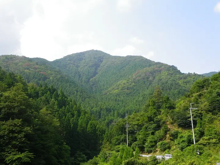
Minagoyama is a 971 m peak straddling the border of Sakyō Ward in Kyoto City and Katsuragawa in Ōtsu City, Shiga, and at 971 m it is the highest point in Kyoto Prefecture. It rises on the Hanaori Fault at the eastern edge of the Tanba Highlands, facing the Hira Mountains across the Katsura River, and the surrounding ridges are protected as part of Kyoto Tanba Kōgen Quasi-National Park. Its broad sasa-grass summit gives an open view back across the Hira Range, with three regular approaches: the Ashio-dani gorge from the north (one of Tanba's most celebrated valleys), the eastern ridge, and the Tera-dani route from the south.
Mt. Minago at a glance
- Weather: The most settled day in the next 7 days is Wed, November 4: clear, gusts up to 10 m/s. Sat, Nov 7: strong wind (gusts up to 18 m/s).
- Route: The shortest is Mount Minago from Taira Trailhead: about 4 h 4 min, 6.6 km, about 610 m of climbing.
Mt. Minago weather (hourly, 14 days)
Sunrise today 06:19, sunset 17:02
| Tue, 11/3 | Wed, 11/4 | Thu, 11/5 | Fri, 11/6 | Sat, 11/7 | Sun, 11/8 | Mon, 11/9 | Tue, 11/10 | Wed, 11/11 | Thu, 11/12 | Fri, 11/13 | Sat, 11/14 | Sun, 11/15 | Mon, 11/16 | Tue, 11/17 | |||||||||||||||||||||||||||||||||||||||||||||||||||||||||||||||||||||||
|---|---|---|---|---|---|---|---|---|---|---|---|---|---|---|---|---|---|---|---|---|---|---|---|---|---|---|---|---|---|---|---|---|---|---|---|---|---|---|---|---|---|---|---|---|---|---|---|---|---|---|---|---|---|---|---|---|---|---|---|---|---|---|---|---|---|---|---|---|---|---|---|---|---|---|---|---|---|---|---|---|---|---|---|---|---|
| Japan time | 15 | 17 | 19 | 21 | 23 | 1 | 3 | 5 | 7 | 9 | 11 | 13 | 15 | 18 | 21 | 0 | 3 | 6 | 9 | 12 | 15 | 18 | 21 | 0 | 3 | 6 | 9 | 12 | 15 | 18 | 21 | 0 | 3 | 6 | 9 | 12 | 15 | 18 | 21 | 0 | 3 | 6 | 9 | 12 | 15 | 18 | 21 | 0 | 3 | 6 | 9 | 15 | 21 | 3 | 9 | 15 | 21 | 3 | 9 | 15 | 21 | 3 | 9 | 15 | 21 | 3 | 9 | 15 | 21 | 3 | 9 | 15 | 21 | 3 | 9 | 15 | 21 | 3 | 9 | 15 | 21 | 3 | 9 | 15 | |
 |   |   | | | | | | | | | |   |   | |   | |   |   | | | | | | | |   | | | | | | | | | | | | | | | |   | | |   | | | | | |   | | | | |   | | | | | | | | | | | | |  | | | | | | | | | | | | | | | ||
| Temperature | °C | 12° | 9° | 8° | 7° | 7° | 6° | 6° | 6° | 6° | 10° | 14° | 15° | 14° | 12° | 11° | 10° | 10° | 10° | 12° | 15° | 15° | 13° | 12° | 11° | 12° | 11° | 12° | 15° | 13° | 9° | 7° | 6° | 5° | 4° | 6° | 6° | 5° | 4° | 3° | 4° | 4° | 5° | 6° | 8° | 8° | 6° | 6° | 5° | 5° | 5° | 9° | 9° | 4° | 4° | 8° | 10° | 5° | 3° | 6° | 6° | 5° | 2° | 7° | 9° | 4° | 5° | 6° | 7° | 5° | 2° | 8° | 11° | 6° | 6° | 9° | 10° | 10° | 11° | 11° | 8° | 4° | 4° | 5° | 8° |
| Precipitation | mm | 3.4 | 5 | 5 | 1.7 | 0.5 | 2.4 | 0.3 | 0.3 | 0.2 | 0.4 | 0.4 | 1.3 | 1.4 | 0.9 | 0.3 | 0.8 | 0.1 | 0.2 | 0.4 | 0.3 | 0.5 | 4.6 | 0.4 | 0.2 | 3.2 | 2.4 | 1.0 | 3.6 | 3.2 | |||||||||||||||||||||||||||||||||||||||||||||||||||||||
| New snow | cm | ||||||||||||||||||||||||||||||||||||||||||||||||||||||||||||||||||||||||||||||||||||
| Snow depth | cm | 0 | 0 | 0 | 0 | 0 | 0 | 0 | 0 | 0 | 0 | 0 | 0 | 0 | 0 | 0 | 0 | 0 | 0 | 0 | 0 | 0 | 0 | 0 | 0 | 0 | 0 | 0 | 0 | 0 | 0 | 0 | 0 | 0 | 0 | 0 | 0 | 0 | 0 | 0 | 0 | 0 | 0 | 0 | 0 | 0 | 0 | 0 | 0 | 0 | 0 | 0 | 0 | 0 | 0 | 0 | 0 | 0 | 0 | 0 | 0 | 0 | 0 | 0 | 0 | 0 | 0 | 0 | 0 | 0 | 0 | 0 | 0 | 0 | 0 | 0 | 0 | 0 | 0 | 0 | 0 | 0 | 0 | 0 | 0 |
| Wind | m/s | 4 | 3 | 3 | 3 | 3 | 3 | 3 | 3 | 3 | 3 | 2 | 1 | 2 | 2 | 3 | 2 | 3 | 1 | 0 | 1 | 1 | 1 | 1 | 2 | 2 | 3 | 5 | 5 | 5 | 4 | 4 | 5 | 5 | 6 | 5 | 7 | 5 | 4 | 3 | 3 | 3 | 3 | 3 | 5 | 4 | 2 | 2 | 1 | 1 | 1 | 3 | 4 | 1 | 2 | 3 | 5 | 4 | 7 | 7 | 7 | 4 | 2 | 3 | 3 | 1 | 3 | 5 | 7 | 4 | 3 | 1 | 3 | 1 | 1 | 3 | 3 | 2 | 2 | 4 | 6 | 6 | 4 | 5 | 3 |
| Wind gusts | m/s | 11 | 11 | 10 | 9 | 9 | 8 | 9 | 10 | 10 | 9 | 9 | 7 | 7 | 6 | 9 | 9 | 9 | 8 | 4 | 4 | 4 | 3 | 4 | 7 | 10 | 10 | 14 | 14 | 15 | 15 | 13 | 14 | 15 | 16 | 17 | 18 | 18 | 15 | 12 | 10 | 10 | 10 | 10 | 13 | 13 | 11 | 7 | 6 | 5 | 5 | 9 | 12 | 10 | 5 | 9 | 13 | 14 | 19 | 21 | 20 | 19 | 11 | 8 | 8 | 8 | 10 | 13 | 18 | 17 | 12 | 9 | 8 | 8 | 5 | 9 | 10 | 9 | 11 | 13 | 19 | 18 | 16 | 13 | 12 |
| Wind dir. | ↓ | ↓ | ↓ | ↓ | ↓ | ↓ | ↓ | ↓ | ↓ | ↓ | ↓ | ↓ | ↓ | ↓ | ↓ | ↓ | ↓ | ↓ | ↓ | ↓ | ↓ | ↓ | ↓ | ↓ | ↓ | ↓ | ↓ | ↓ | ↓ | ↓ | ↓ | ↓ | ↓ | ↓ | ↓ | ↓ | ↓ | ↓ | ↓ | ↓ | ↓ | ↓ | ↓ | ↓ | ↓ | ↓ | ↓ | ↓ | ↓ | ↓ | ↓ | ↓ | ↓ | ↓ | ↓ | ↓ | ↓ | ↓ | ↓ | ↓ | ↓ | ↓ | ↓ | ↓ | ↓ | ↓ | ↓ | ↓ | ↓ | ↓ | ↓ | ↓ | ↓ | ↓ | ↓ | ↓ | ↓ | ↓ | ↓ | ↓ | ↓ | ↓ | ↓ | ↓ | |
Mt. Minago hiking routes
Hiking times are estimates calculated from the terrain.
Lists that include Mt. Minago
Highest Peaks by Prefecture · Kansai 100 Famous Mountains · Kinki 100 Famous Mountains · Elevations of 1003 Mountains of Japan
Mt. Minago facts
- Elevation
- 971 m
- Location
- Kyoto, Kyoto / Otsu, Shiga
35.202161, 135.835170 - National Park
- 京都丹波高原国定公園
- Website
- www.pref.kyoto.jp
- Wikipedia
- ja.wikipedia.org