
Mt. Hōrai
蓬莱山
Otsu, Shiga · Elevation 1,174 m
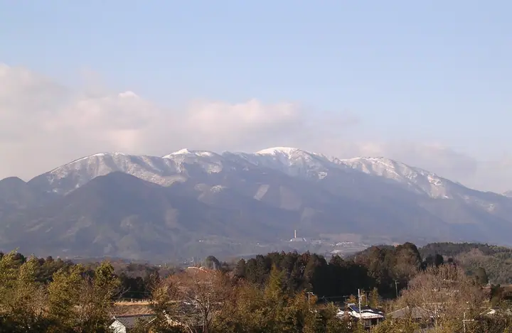
Hōraisan is a 1,174 m peak in the central Hira Range, rising over the western shore of Lake Biwa in Ōtsu City, Shiga Prefecture. The second-highest summit of the Hira chain after Bunagatake, it commands one of Kansai's finest panoramas of the lake and is crowned by the Hira-daijin Okumiya Shrine, marking its long history as a Shugendō sacred peak. The Biwako Valley resort — a summit ropeway and observation-terrace complex — occupies the western slope, making the high ridge unusually accessible. The mountain lies within Lake Biwa Quasi-National Park and is listed in the Japanese 300 Famous Mountains and the Kansai 100.
Mt. Hōrai at a glance
- Weather: The most settled day in the next 7 days is Wed, November 4: clear, gusts up to 10 m/s. Sat, Nov 7: strong wind (gusts up to 18 m/s).
- Route: The shortest is Horai Station to Kojoro Pass, Mount Horai, Mount Uchimi, and Shiga Station Traverse: about 6 h 14 min, 12.7 km, about 1,140 m of climbing.
Mt. Hōrai weather (hourly, 14 days)
Sunrise today 06:19, sunset 17:01
| Tue, 11/3 | Wed, 11/4 | Thu, 11/5 | Fri, 11/6 | Sat, 11/7 | Sun, 11/8 | Mon, 11/9 | Tue, 11/10 | Wed, 11/11 | Thu, 11/12 | Fri, 11/13 | Sat, 11/14 | Sun, 11/15 | Mon, 11/16 | Tue, 11/17 | |||||||||||||||||||||||||||||||||||||||||||||||||||||||||||||||||||||||
|---|---|---|---|---|---|---|---|---|---|---|---|---|---|---|---|---|---|---|---|---|---|---|---|---|---|---|---|---|---|---|---|---|---|---|---|---|---|---|---|---|---|---|---|---|---|---|---|---|---|---|---|---|---|---|---|---|---|---|---|---|---|---|---|---|---|---|---|---|---|---|---|---|---|---|---|---|---|---|---|---|---|---|---|---|---|
| Japan time | 15 | 17 | 19 | 21 | 23 | 1 | 3 | 5 | 7 | 9 | 11 | 13 | 15 | 18 | 21 | 0 | 3 | 6 | 9 | 12 | 15 | 18 | 21 | 0 | 3 | 6 | 9 | 12 | 15 | 18 | 21 | 0 | 3 | 6 | 9 | 12 | 15 | 18 | 21 | 0 | 3 | 6 | 9 | 12 | 15 | 18 | 21 | 0 | 3 | 6 | 9 | 15 | 21 | 3 | 9 | 15 | 21 | 3 | 9 | 15 | 21 | 3 | 9 | 15 | 21 | 3 | 9 | 15 | 21 | 3 | 9 | 15 | 21 | 3 | 9 | 15 | 21 | 3 | 9 | 15 | 21 | 3 | 9 | 15 | |
 |   |   | | | | | | | | | |   |   | |   | |   |   | | | | | | | |   | | | | | | | | | | | | | | | |   | | |   | | | | | |   | | | | |   | | | | | | | | | | | | |  | | | | | | | | | | | | | | | ||
| Temperature | °C | 10° | 8° | 6° | 6° | 6° | 5° | 5° | 4° | 5° | 9° | 12° | 14° | 13° | 10° | 10° | 9° | 9° | 9° | 10° | 14° | 14° | 11° | 10° | 10° | 10° | 9° | 10° | 14° | 12° | 7° | 6° | 4° | 4° | 3° | 5° | 5° | 4° | 2° | 2° | 2° | 3° | 4° | 5° | 6° | 6° | 5° | 4° | 4° | 4° | 4° | 7° | 7° | 3° | 3° | 7° | 9° | 4° | 2° | 5° | 5° | 3° | 1° | 6° | 8° | 3° | 4° | 5° | 5° | 4° | 1° | 7° | 10° | 4° | 5° | 8° | 9° | 8° | 9° | 10° | 7° | 3° | 3° | 4° | 7° |
| Precipitation | mm | 3.4 | 5 | 5 | 1.7 | 0.5 | 2.4 | 0.3 | 0.3 | 0.2 | 0.4 | 0.4 | 1.3 | 1.4 | 0.9 | 0.3 | 0.8 | 0.1 | 0.2 | 0.4 | 0.3 | 0.5 | 4.6 | 0.4 | 0.2 | 3.2 | 2.4 | 1.0 | 3.6 | 3.2 | |||||||||||||||||||||||||||||||||||||||||||||||||||||||
| New snow | cm | ||||||||||||||||||||||||||||||||||||||||||||||||||||||||||||||||||||||||||||||||||||
| Snow depth | cm | 0 | 0 | 0 | 0 | 0 | 0 | 0 | 0 | 0 | 0 | 0 | 0 | 0 | 0 | 0 | 0 | 0 | 0 | 0 | 0 | 0 | 0 | 0 | 0 | 0 | 0 | 0 | 0 | 0 | 0 | 0 | 0 | 0 | 0 | 0 | 0 | 0 | 0 | 0 | 0 | 0 | 0 | 0 | 0 | 0 | 0 | 0 | 0 | 0 | 0 | 0 | 0 | 0 | 0 | 0 | 0 | 0 | 0 | 0 | 0 | 0 | 0 | 0 | 0 | 0 | 0 | 0 | 0 | 0 | 0 | 0 | 0 | 0 | 0 | 0 | 0 | 0 | 0 | 0 | 0 | 0 | 0 | 0 | 0 |
| Wind | m/s | 4 | 3 | 3 | 3 | 3 | 3 | 3 | 3 | 3 | 3 | 2 | 1 | 2 | 2 | 3 | 2 | 3 | 1 | 0 | 1 | 1 | 1 | 1 | 2 | 2 | 3 | 5 | 5 | 5 | 4 | 4 | 5 | 5 | 6 | 5 | 7 | 5 | 4 | 3 | 3 | 3 | 3 | 3 | 5 | 4 | 2 | 2 | 1 | 1 | 1 | 3 | 4 | 1 | 2 | 3 | 5 | 4 | 7 | 7 | 7 | 4 | 2 | 3 | 3 | 1 | 3 | 5 | 7 | 4 | 3 | 1 | 3 | 1 | 1 | 3 | 3 | 2 | 2 | 4 | 6 | 6 | 4 | 5 | 3 |
| Wind gusts | m/s | 11 | 11 | 10 | 9 | 9 | 8 | 9 | 10 | 10 | 9 | 9 | 7 | 7 | 6 | 9 | 9 | 9 | 8 | 4 | 4 | 4 | 3 | 4 | 7 | 10 | 10 | 14 | 14 | 15 | 15 | 13 | 14 | 15 | 16 | 17 | 18 | 18 | 15 | 12 | 10 | 10 | 10 | 10 | 13 | 13 | 11 | 7 | 6 | 5 | 5 | 9 | 12 | 10 | 5 | 9 | 13 | 14 | 19 | 21 | 20 | 19 | 11 | 8 | 8 | 8 | 10 | 13 | 18 | 17 | 12 | 9 | 8 | 8 | 5 | 9 | 10 | 9 | 11 | 13 | 19 | 18 | 16 | 13 | 12 |
| Wind dir. | ↓ | ↓ | ↓ | ↓ | ↓ | ↓ | ↓ | ↓ | ↓ | ↓ | ↓ | ↓ | ↓ | ↓ | ↓ | ↓ | ↓ | ↓ | ↓ | ↓ | ↓ | ↓ | ↓ | ↓ | ↓ | ↓ | ↓ | ↓ | ↓ | ↓ | ↓ | ↓ | ↓ | ↓ | ↓ | ↓ | ↓ | ↓ | ↓ | ↓ | ↓ | ↓ | ↓ | ↓ | ↓ | ↓ | ↓ | ↓ | ↓ | ↓ | ↓ | ↓ | ↓ | ↓ | ↓ | ↓ | ↓ | ↓ | ↓ | ↓ | ↓ | ↓ | ↓ | ↓ | ↓ | ↓ | ↓ | ↓ | ↓ | ↓ | ↓ | ↓ | ↓ | ↓ | ↓ | ↓ | ↓ | ↓ | ↓ | ↓ | ↓ | ↓ | ↓ | ↓ | |
Mt. Hōrai hiking routes
- Horai Station to Kojoro Pass, Mount Horai, Mount Uchimi, and Shiga Station Traverse 12.7 km · Ascent 1,143 m 蓬莱駅 (Station), Hōrai (Station) → 志賀駅 (Station), Shiga (Station)
- Mount Gongen, Mount Hokke and Mount Horai Return from Ryozenzan Trailhead 11.0 km · Ascent 939 m 霊仙山権現山登山口駐車場
Hiking times are estimates calculated from the terrain.
Huts, campsites and lodging near Mt. Hōrai
Campsites
- 大津市立葛川森林キャンプ村
Lists that include Mt. Hōrai
Japan's 300 Famous Mountains · Kansai 100 Famous Mountains · Omi 100 Mountains · Hirahiei Trail · Elevations of 1003 Mountains of Japan
Mt. Hōrai facts
- Elevation
- 1,174 m
- Location
- Otsu, Shiga
35.209507, 135.885735 - National Park
- 琵琶湖国定公園
- Website
- otsu.or.jp
- Trail Map
- hirahiei.com
- Access Information
- www.biwako-valley.com
- Wikipedia
- ja.wikipedia.org