
Mount Sukai
皇海山
Numata, Gunma / Nikkō-shi, Tochigi · Elevation 2,144 m
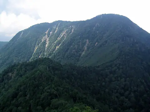
Mount Sukai is the highest peak of the Ashio range at 2,144 m, on the border of Nikkō City in Tochigi and Numata City in Gunma within Nikkō National Park. It is one of the Hyakumeizan and was historically reached by the short Fudōzawa route from the Kuriharagawa forest road on the Gunma side, but that road has been closed since the 2019 typhoon. The classic route from Ginzan-daira on the Tochigi side via Kōshinzan and Nokogiriyama is now the primary line, with the unstaffed Kōshin-sansō shelter available free of charge year-round as a base. The mountain retains a remote, deep-mountain character and is known for its quiet trails through fresh greenery and autumn color.
Mount Sukai at a glance
- Weather: The most settled day in the next 7 days is Wed, November 4: clear, gusts up to 8 m/s. Sat, Nov 7: strong wind (gusts up to 23 m/s).
- Route: The shortest is Mount Sukai Classic Circuit via Kōshin and Nokogiri: about 14 h 35 min, 25.7 km, about 2,340 m of climbing.
Mount Sukai weather (hourly, 14 days)
Sunrise today 06:07, sunset 16:45
| Tue, 11/3 | Wed, 11/4 | Thu, 11/5 | Fri, 11/6 | Sat, 11/7 | Sun, 11/8 | Mon, 11/9 | Tue, 11/10 | Wed, 11/11 | Thu, 11/12 | Fri, 11/13 | Sat, 11/14 | Sun, 11/15 | Mon, 11/16 | Tue, 11/17 | |||||||||||||||||||||||||||||||||||||||||||||||||||||||||||||||||||||||
|---|---|---|---|---|---|---|---|---|---|---|---|---|---|---|---|---|---|---|---|---|---|---|---|---|---|---|---|---|---|---|---|---|---|---|---|---|---|---|---|---|---|---|---|---|---|---|---|---|---|---|---|---|---|---|---|---|---|---|---|---|---|---|---|---|---|---|---|---|---|---|---|---|---|---|---|---|---|---|---|---|---|---|---|---|---|
| Japan time | 15 | 17 | 19 | 21 | 23 | 1 | 3 | 5 | 7 | 9 | 11 | 13 | 15 | 18 | 21 | 0 | 3 | 6 | 9 | 12 | 15 | 18 | 21 | 0 | 3 | 6 | 9 | 12 | 15 | 18 | 21 | 0 | 3 | 6 | 9 | 12 | 15 | 18 | 21 | 0 | 3 | 6 | 9 | 12 | 15 | 18 | 21 | 0 | 3 | 6 | 9 | 15 | 21 | 3 | 9 | 15 | 21 | 3 | 9 | 15 | 21 | 3 | 9 | 15 | 21 | 3 | 9 | 15 | 21 | 3 | 9 | 15 | 21 | 3 | 9 | 15 | 21 | 3 | 9 | 15 | 21 | 3 | 9 | 15 | |
 |   | | |   | | | | |   | | |   |   |   | | | |   |   |   | | |  | | | | | | | | | | | | | | | | | | | | | | | | | | | | | | | | | | |   |   |   | | | |  | | | | | | | | | | | | |   | | | | | | | ||
| Temperature | °C | 4° | 0° | -2° | -2° | -2° | -3° | -3° | -4° | -1° | 4° | 6° | 7° | 4° | 1° | 0° | 1° | 2° | 3° | 6° | 9° | 8° | 4° | 3° | 2° | 3° | 2° | 8° | 10° | 9° | 3° | 2° | 0° | -2° | -3° | -2° | -1° | -2° | -5° | -5° | -5° | -6° | -6° | -1° | 3° | 2° | -3° | -5° | -3° | -3° | -3° | 0° | 2° | -2° | -3° | -1° | 0° | -3° | -3° | -3° | -2° | -4° | -6° | 0° | 2° | -3° | -4° | 0° | -2° | -5° | -7° | 0° | 2° | -5° | -4° | 4° | 5° | 2° | 3° | 9° | 4° | -3° | -6° | 0° | 1° |
| Precipitation | mm | 0.5 | 1.2 | 8 | 9 | 1.6 | 0.1 | 0.1 | 0.1 | 0.6 | 0.2 | 0.2 | 1.2 | 1.7 | 0.1 | 0.2 | 4.1 | 8 | 0.3 | ||||||||||||||||||||||||||||||||||||||||||||||||||||||||||||||||||
| New snow | cm | 1.0 | 1.3 | <.1 | |||||||||||||||||||||||||||||||||||||||||||||||||||||||||||||||||||||||||||||||||
| Snow depth | cm | 0 | 0 | 0 | 0 | 0 | 0 | 0 | 0 | 0 | 0 | 0 | 0 | 0 | 0 | 0 | 0 | 0 | 0 | 0 | 0 | 0 | 0 | 0 | 0 | 0 | 0 | 0 | 0 | 0 | 0 | 0 | 0 | 0 | 0 | 0 | 0 | 0 | 0 | 0 | 0 | 0 | 0 | 0 | 0 | 0 | 0 | 0 | 0 | 0 | 0 | 0 | 0 | 0 | 0 | 0 | 0 | 0 | 0 | <1 | <1 | <1 | <1 | <1 | 0 | 0 | 0 | 0 | 0 | 0 | 0 | 0 | 0 | 0 | 0 | 0 | 0 | 0 | 0 | 0 | 0 | 0 | 0 | 0 | 0 |
| Wind | m/s | 2 | 1 | 0 | 0 | 1 | 1 | 1 | 1 | 0 | 1 | 1 | 2 | 2 | 1 | 1 | 1 | 1 | 2 | 2 | 0 | 1 | 0 | 1 | 1 | 1 | 1 | 3 | 3 | 2 | 2 | 2 | 4 | 5 | 5 | 6 | 7 | 7 | 5 | 5 | 4 | 4 | 3 | 3 | 3 | 1 | 0 | 1 | 0 | 1 | 1 | 1 | 1 | 0 | 0 | 1 | 2 | 0 | 3 | 7 | 7 | 2 | 2 | 1 | 2 | 1 | 1 | 3 | 5 | 2 | 3 | 1 | 1 | 1 | 1 | 1 | 1 | 1 | 1 | 1 | 6 | 5 | 2 | 1 | 1 |
| Wind gusts | m/s | 9 | 7 | 4 | 4 | 4 | 4 | 4 | 4 | 4 | 4 | 6 | 8 | 8 | 6 | 5 | 6 | 6 | 9 | 8 | 5 | 5 | 5 | 4 | 5 | 5 | 5 | 11 | 11 | 11 | 8 | 9 | 14 | 16 | 18 | 19 | 23 | 22 | 21 | 17 | 16 | 15 | 14 | 12 | 11 | 10 | 6 | 6 | 6 | 6 | 6 | 6 | 7 | 5 | 3 | 4 | 7 | 8 | 9 | 25 | 26 | 23 | 9 | 7 | 9 | 7 | 6 | 11 | 17 | 15 | 9 | 8 | 6 | 6 | 4 | 5 | 8 | 6 | 8 | 8 | 21 | 20 | 18 | 7 | 7 |
| Wind dir. | ↓ | ↓ | ↓ | ↓ | ↓ | ↓ | ↓ | ↓ | ↓ | ↓ | ↓ | ↓ | ↓ | ↓ | ↓ | ↓ | ↓ | ↓ | ↓ | ↓ | ↓ | ↓ | ↓ | ↓ | ↓ | ↓ | ↓ | ↓ | ↓ | ↓ | ↓ | ↓ | ↓ | ↓ | ↓ | ↓ | ↓ | ↓ | ↓ | ↓ | ↓ | ↓ | ↓ | ↓ | ↓ | ↓ | ↓ | ↓ | ↓ | ↓ | ↓ | ↓ | ↓ | ↓ | ↓ | ↓ | ↓ | ↓ | ↓ | ↓ | ↓ | ↓ | ↓ | ↓ | ↓ | ↓ | ↓ | ↓ | ↓ | ↓ | ↓ | ↓ | ↓ | ↓ | ↓ | ↓ | ↓ | ↓ | ↓ | ↓ | ↓ | ↓ | ↓ | ↓ | |
Mount Sukai hiking routes
Hiking times are estimates calculated from the terrain.
Huts, campsites and lodging near Mount Sukai
Mountain huts
Lists that include Mount Sukai
100 Famous Japanese Mountains · Japan 200 Famous Mountains · Japan's 300 Famous Mountains · Kanto 100 Famous Mountains · Gunma 100 Famous Mountains · Tochigi 100 Famous Mountains · Elevations of 1003 Mountains of Japan · 1000 Mountains of Japan
Mount Sukai facts
- Also known as
- 笄山
- Elevation
- 2,144 m
- Location
- Numata, Gunma / Nikkō-shi, Tochigi
36.689866, 139.336987 - National Park
- 日光国立公園
- Website
- www.nikko-kankou.org
- Wikipedia
- ja.wikipedia.org