
Mount Ito
以東岳
Tsuruoka, Yamagata / 村上市, Yamagata · Elevation 1,771 m
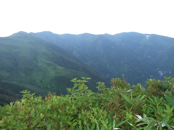
Mount Itō is a 1,771.4 m peak at the northern end of the Asahi Mountains, with the summit straddling Tsuruoka City in Yamagata Prefecture and Murakami City in Niigata Prefecture, within Bandai-Asahi National Park. It serves as the northern starting or finishing point for traversing the Asahi Mountains. On its slopes lies Lake Ōtori (963 m elevation, 0.4 km²), Yamagata's largest natural lake, ringed by old-growth beech forest; from the lakeshore Ōtori Hut (Takitarō Sansō) two routes—the Direct Ascent and the Otsubo-mine course—climb to the summit. The Itō-dake emergency shelter just below the top was rebuilt in 2017. The practical climbing season runs from late June to mid-October.
Mount Ito at a glance
- Weather: The most settled day in the next 7 days is Mon, November 9: cloudy, gusts up to 8 m/s. Fri, Nov 6, Sat, Nov 7, Sun, Nov 8: strong wind (gusts up to 27 m/s).
Mount Ito weather (hourly, 14 days)
Sunrise today 06:08, sunset 16:40
| Tue, 11/3 | Wed, 11/4 | Thu, 11/5 | Fri, 11/6 | Sat, 11/7 | Sun, 11/8 | Mon, 11/9 | Tue, 11/10 | Wed, 11/11 | Thu, 11/12 | Fri, 11/13 | Sat, 11/14 | Sun, 11/15 | Mon, 11/16 | Tue, 11/17 | |||||||||||||||||||||||||||||||||||||||||||||||||||||||||||||||||||||||
|---|---|---|---|---|---|---|---|---|---|---|---|---|---|---|---|---|---|---|---|---|---|---|---|---|---|---|---|---|---|---|---|---|---|---|---|---|---|---|---|---|---|---|---|---|---|---|---|---|---|---|---|---|---|---|---|---|---|---|---|---|---|---|---|---|---|---|---|---|---|---|---|---|---|---|---|---|---|---|---|---|---|---|---|---|---|
| Japan time | 15 | 17 | 19 | 21 | 23 | 1 | 3 | 5 | 7 | 9 | 11 | 13 | 15 | 18 | 21 | 0 | 3 | 6 | 9 | 12 | 15 | 18 | 21 | 0 | 3 | 6 | 9 | 12 | 15 | 18 | 21 | 0 | 3 | 6 | 9 | 12 | 15 | 18 | 21 | 0 | 3 | 6 | 9 | 12 | 15 | 18 | 21 | 0 | 3 | 6 | 9 | 15 | 21 | 3 | 9 | 15 | 21 | 3 | 9 | 15 | 21 | 3 | 9 | 15 | 21 | 3 | 9 | 15 | 21 | 3 | 9 | 15 | 21 | 3 | 9 | 15 | 21 | 3 | 9 | 15 | 21 | 3 | 9 | 15 | |
  |   | | |  | | | |   | | | | | | |   |   | |   | |   |   | | | | | | | | | |   | | |   |   |   |   | | | | | | | | | | | | |   | | | |  | | | |   | | | | | | | | | | | | | |  | | | | | | | | | | | | ||
| Temperature | °C | 2° | -1° | -2° | -2° | -2° | -2° | -2° | -2° | -1° | 3° | 5° | 6° | 6° | 1° | 1° | 2° | 2° | 3° | 4° | 5° | 7° | 5° | 5° | 5° | 5° | 5° | 6° | 6° | 4° | 2° | 0° | -2° | -3° | -4° | -4° | -3° | -4° | -4° | -5° | -5° | -5° | -4° | -4° | -2° | -3° | -4° | -5° | -5° | -4° | -6° | -2° | -3° | -5° | -7° | -2° | 1° | -3° | -4° | -3° | -2° | -3° | -4° | -2° | -2° | -2° | -2° | -2° | -3° | -4° | -4° | -1° | 2° | -3° | -1° | 5° | 6° | 2° | 3° | 4° | 0° | -5° | -5° | -3° | -2° |
| Precipitation | mm | 0.5 | 8 | 5 | 3.5 | 0.3 | 0.4 | 1.4 | 0.2 | 1.2 | 4.7 | 3.0 | 2.8 | 6 | 4.5 | 6 | 6 | 5 | 2.9 | 2.6 | 1.7 | 2.3 | 2.6 | 2.2 | 2.4 | 1.3 | 1.2 | 0.8 | 0.4 | 1.0 | 0.3 | 0.3 | 0.3 | 0.1 | 4.0 | 15 | 3.7 | 0.7 | 2.1 | 0.6 | 0.8 | 2.1 | 0.8 | 7 | 2.9 | 0.5 | 0.3 | 2.9 | 7 | 4.4 | 8 | 4.0 | 0.5 | 0.2 | |||||||||||||||||||||||||||||||
| New snow | cm | <.1 | 1.9 | 3.0 | 2.2 | 2.4 | 1.5 | 2.2 | 2.4 | 2.1 | 2.1 | 1.2 | 1.0 | 0.5 | 0.2 | 0.5 | 0.3 | 0.3 | <.1 | 0.9 | 7.6 | 3.7 | 0.3 | 0.1 | 0.3 | 0.7 | 0.4 | 0.1 | |||||||||||||||||||||||||||||||||||||||||||||||||||||||||
| Snow depth | cm | 0 | 0 | 0 | 0 | 0 | 0 | 0 | 0 | 0 | 0 | 0 | 0 | 0 | 0 | 0 | 0 | 0 | 0 | 0 | 0 | 0 | 0 | 0 | 0 | 0 | 0 | 0 | 0 | 0 | 0 | 0 | 0 | 1 | 3 | 3 | 4 | 4 | 6 | 7 | 8 | 9 | 9 | 9 | 9 | 8 | 8 | 8 | 7 | 7 | 8 | 7 | 6 | 6 | 6 | 6 | 4 | 4 | 9 | 10 | 7 | 6 | 5 | 4 | 3 | 2 | 2 | 1 | <1 | <1 | <1 | <1 | <1 | <1 | <1 | <1 | <1 | 0 | 0 | 0 | 0 | <1 | <1 | <1 | 0 |
| Wind | m/s | 5 | 3 | 2 | 2 | 2 | 1 | 1 | 1 | 1 | 2 | 2 | 1 | 2 | 3 | 3 | 3 | 3 | 2 | 2 | 3 | 3 | 2 | 3 | 2 | 2 | 3 | 5 | 7 | 6 | 5 | 6 | 5 | 5 | 5 | 7 | 8 | 7 | 7 | 6 | 6 | 6 | 6 | 7 | 8 | 6 | 4 | 3 | 2 | 2 | 0 | 1 | 2 | 0 | 0 | 1 | 4 | 3 | 2 | 3 | 5 | 3 | 2 | 3 | 3 | 2 | 3 | 6 | 6 | 4 | 3 | 3 | 2 | 1 | 2 | 2 | 2 | 2 | 2 | 2 | 7 | 7 | 5 | 3 | 2 |
| Wind gusts | m/s | 16 | 13 | 8 | 8 | 7 | 7 | 6 | 6 | 6 | 8 | 8 | 7 | 6 | 9 | 10 | 10 | 10 | 10 | 7 | 8 | 10 | 7 | 8 | 9 | 9 | 11 | 16 | 21 | 21 | 17 | 18 | 16 | 16 | 19 | 22 | 25 | 27 | 24 | 21 | 20 | 19 | 18 | 20 | 21 | 22 | 17 | 12 | 9 | 9 | 8 | 5 | 8 | 7 | 5 | 5 | 12 | 15 | 12 | 11 | 16 | 15 | 10 | 9 | 11 | 10 | 12 | 15 | 17 | 16 | 11 | 9 | 9 | 5 | 7 | 8 | 10 | 9 | 10 | 10 | 19 | 21 | 18 | 13 | 8 |
| Wind dir. | ↓ | ↓ | ↓ | ↓ | ↓ | ↓ | ↓ | ↓ | ↓ | ↓ | ↓ | ↓ | ↓ | ↓ | ↓ | ↓ | ↓ | ↓ | ↓ | ↓ | ↓ | ↓ | ↓ | ↓ | ↓ | ↓ | ↓ | ↓ | ↓ | ↓ | ↓ | ↓ | ↓ | ↓ | ↓ | ↓ | ↓ | ↓ | ↓ | ↓ | ↓ | ↓ | ↓ | ↓ | ↓ | ↓ | ↓ | ↓ | ↓ | ↓ | ↓ | ↓ | ↓ | ↓ | ↓ | ↓ | ↓ | ↓ | ↓ | ↓ | ↓ | ↓ | ↓ | ↓ | ↓ | ↓ | ↓ | ↓ | ↓ | ↓ | ↓ | ↓ | ↓ | ↓ | ↓ | ↓ | ↓ | ↓ | ↓ | ↓ | ↓ | ↓ | ↓ | ↓ | |
Huts, campsites and lodging near Mount Ito
Mountain huts
Lists that include Mount Ito
Japan 200 Famous Mountains · Japan's 300 Famous Mountains · 100 Famous Mountains with First-order Triangulation Points · Tohoku 100 Famous Mountains · Yamagata 100 Famous Mountains · Niigata 100 Famous Mountains · Elevations of 1003 Mountains of Japan · 1000 Mountains of Japan
Mount Ito facts
- Also known as
- Itodake
- Elevation
- 1,771 m
- Location
- Tsuruoka, Yamagata / 村上市, Yamagata
38.342977, 139.849058 - National Park
- 磐梯朝日国立公園
- Website
- yamagatayama.com
- Trail Map
- www.city.tsuruoka.lg.jp (PDF)
- Access Information
- www.city.tsuruoka.lg.jp
- Wikipedia
- ja.wikipedia.org